Signs Tagged With Summit
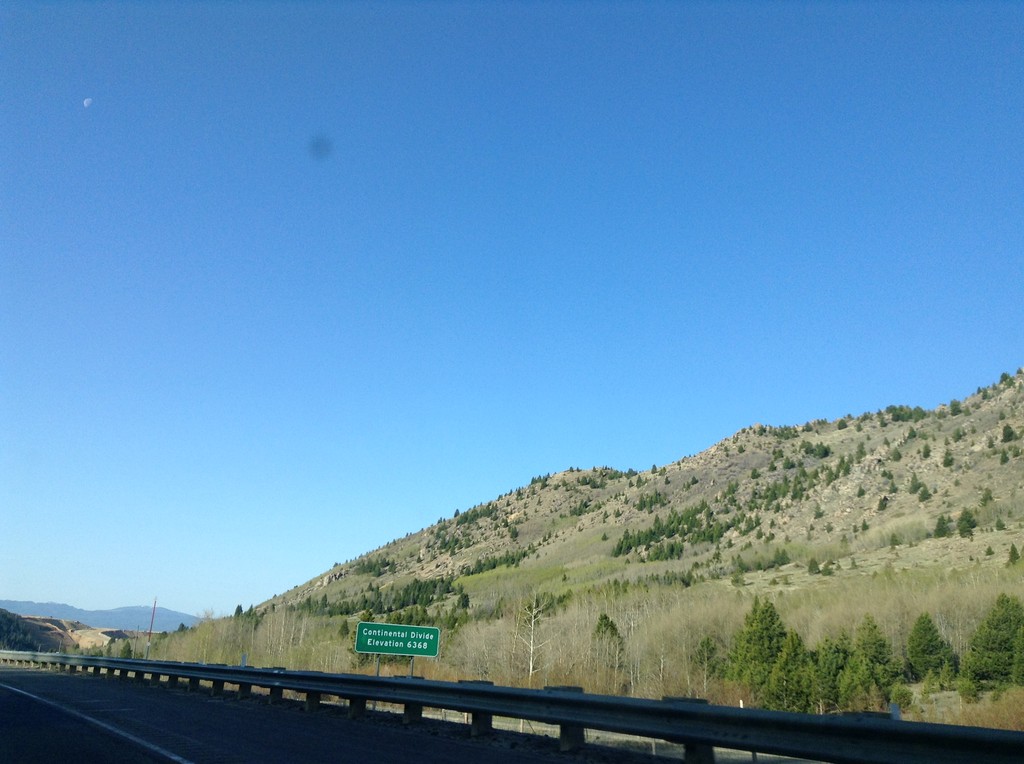
I-15 South - Elk Park Pass
I-15 south at Elk Park Pass (Continental Divide). Elevation 6368 Feet. This is also the county boundary between Silver Bow and Jefferson County.
Taken 05-10-2015
 Woodville
Jefferson County
Montana
United States
Woodville
Jefferson County
Montana
United States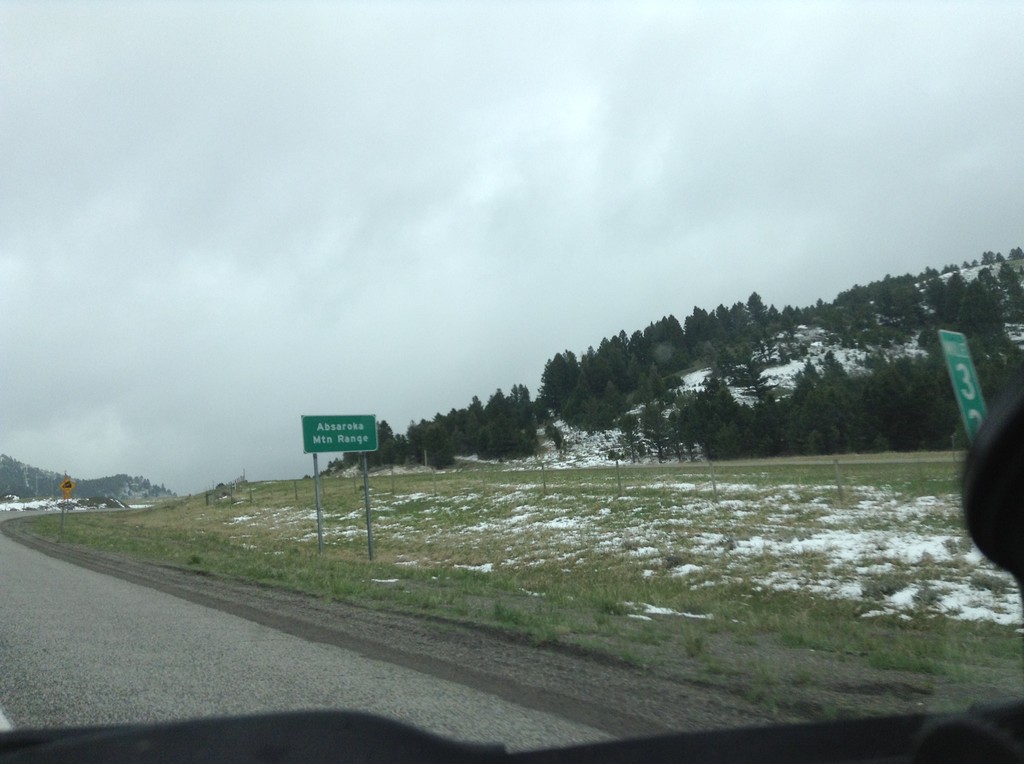
I-90 East - Bozeman Pass
I-90 east at Bozeman Pass. Bozeman Pass is part of the Absaroka Mountain Range. These type of signs are common across Montana, giving name to the many mountain ranges in the state.
Taken 05-08-2015

 Muir
Park County
Montana
United States
Muir
Park County
Montana
United States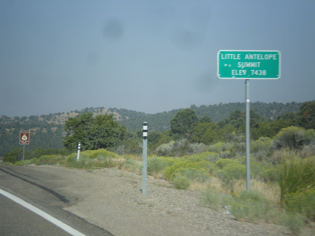
US-50 West - Little Antelope Summit
US-50 west at Little Antelope Summit - Elevation 7,438 Feet. Little Antelope Summit is in the Pine Range.
Taken 08-31-2014
 White Pine County
Nevada
United States
White Pine County
Nevada
United States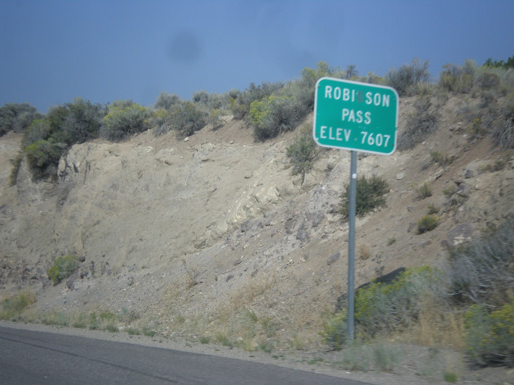
US-50 West - Robinson Summit
US-50 west at Robinson Pass - Elevation 7,607 Feet. Robinson Pass is in the Egan Range.
Taken 08-31-2014
Ely
White Pine County
Nevada
United States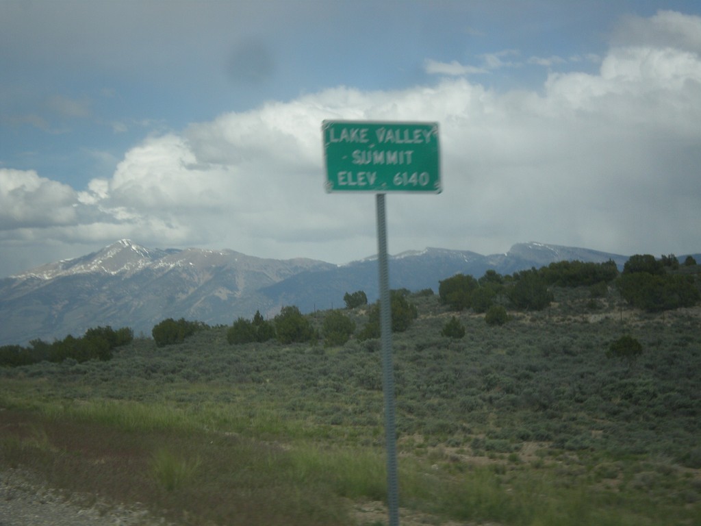
US-93 North - Lake Valley Summit
Lake Valley Summit - Elevation 6,140 Feet on US-93 north. Wheeler Peak is the mountain in the background. Wheeler Peak is the second highest mountain in Nevada and is located in Great Basin National Park.
Taken 05-21-2014
 Ely
White Pine County
Nevada
United States
Ely
White Pine County
Nevada
United States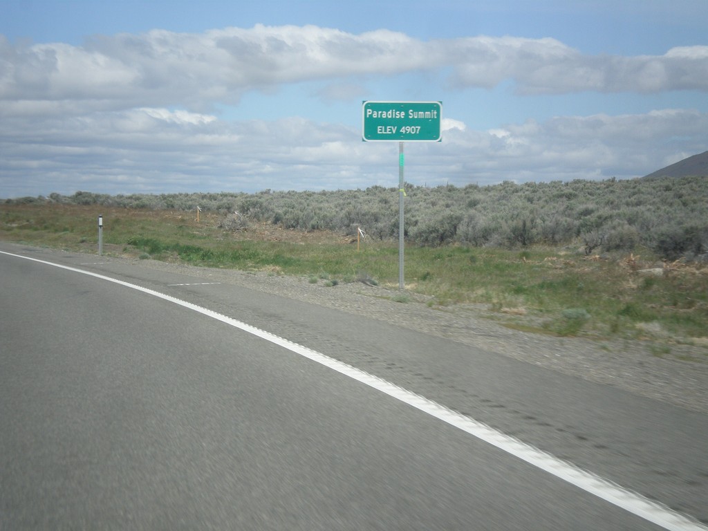
US-95 North - Paradise Summit
Paradise Summit - Elevation 4907 Feet on US-95 North.
Taken 05-06-2014
 Winnemucca
Humboldt County
Nevada
United States
Winnemucca
Humboldt County
Nevada
United States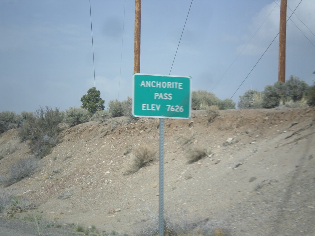
NV-359 North - Anchorite Pass
Anchorite Pass - Elevation 7,626 Feet on NV-359 North.
Taken 05-05-2014
 Mina
Mineral County
Nevada
United States
Mina
Mineral County
Nevada
United States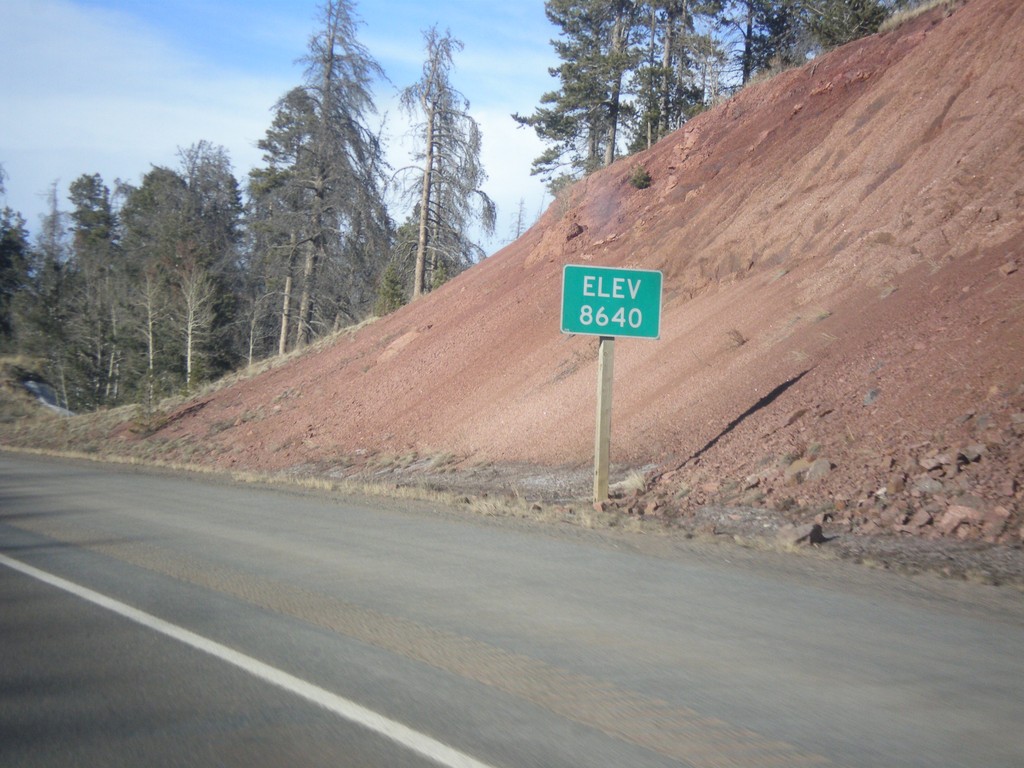
I-80 West - Elevation 8640
I-80 west - Elevation 8640. This is the highest point on all of I-80. The summit lies between Cheyenne and Laramie in the Sherman Mountains.
Taken 03-30-2014

 Laramie
Albany County
Wyoming
United States
Laramie
Albany County
Wyoming
United States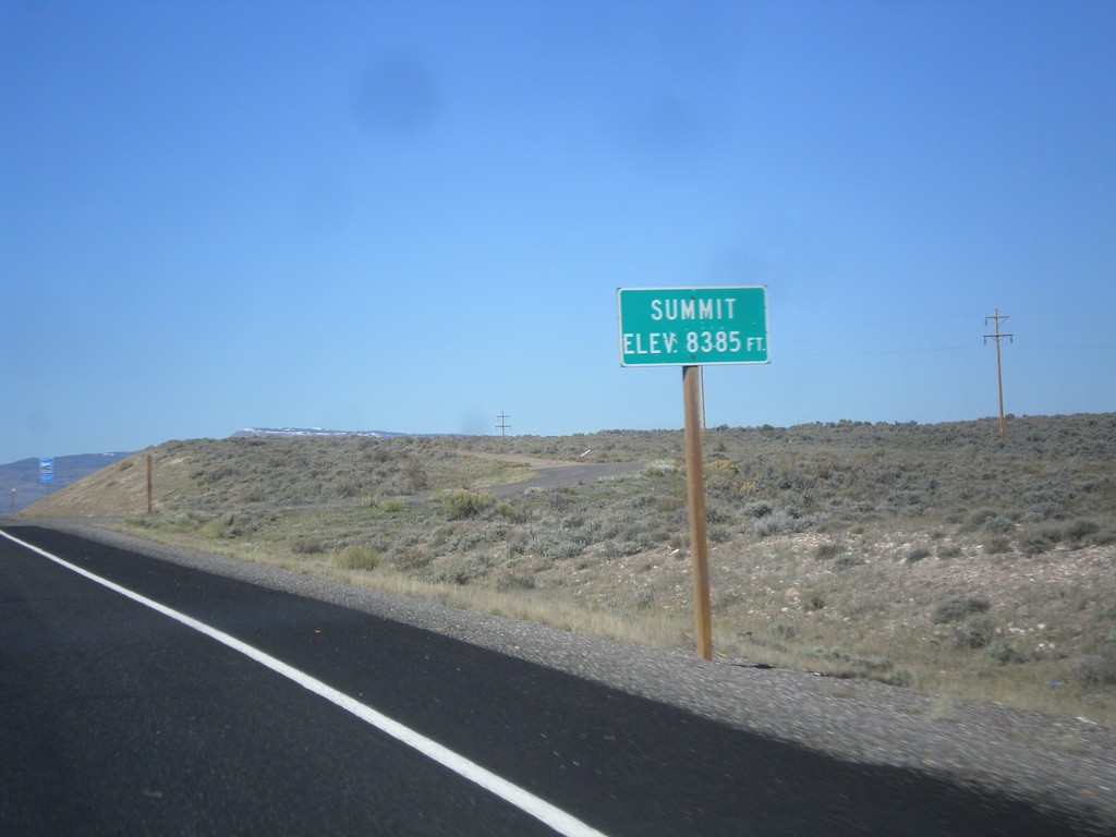
UT-24 West - Summit
Summit 8,385 Feet on UT-24 west. This is the summit of the Awapa Plateau.
Taken 10-18-2013
Koosharem Wayne County Utah United States
NV-431 East - Mount Rose Summit
NV-431 East at Mount Rose Summit - Elevation 8900 Feet. Mount Rose Summit is one of the few Sierra Nevada passes in Nevada, and is the highest pass open year round in the Sierra Nevada.
Taken 07-28-2012
 Reno
Washoe County
Nevada
United States
Reno
Washoe County
Nevada
United States