Signs Tagged With Summit
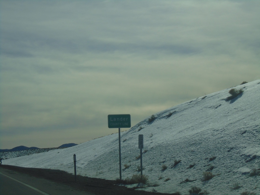
US-50 East - Lander County
Lander County Line on US-50 west at New Pass Summit.
Taken 01-15-2022
 Fallon
Lander County
Nevada
United States
Fallon
Lander County
Nevada
United States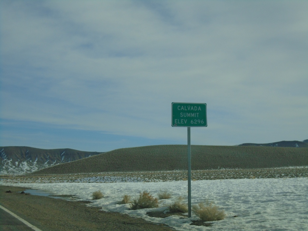
NV-361 North - Calvada Summit
Calvada Summit - Elevation 6296 Feet on NV-361 North. Calvada Summit is in the Gabbs Valley Range.
Taken 01-15-2022
 Luning
Mineral County
Nevada
United States
Luning
Mineral County
Nevada
United States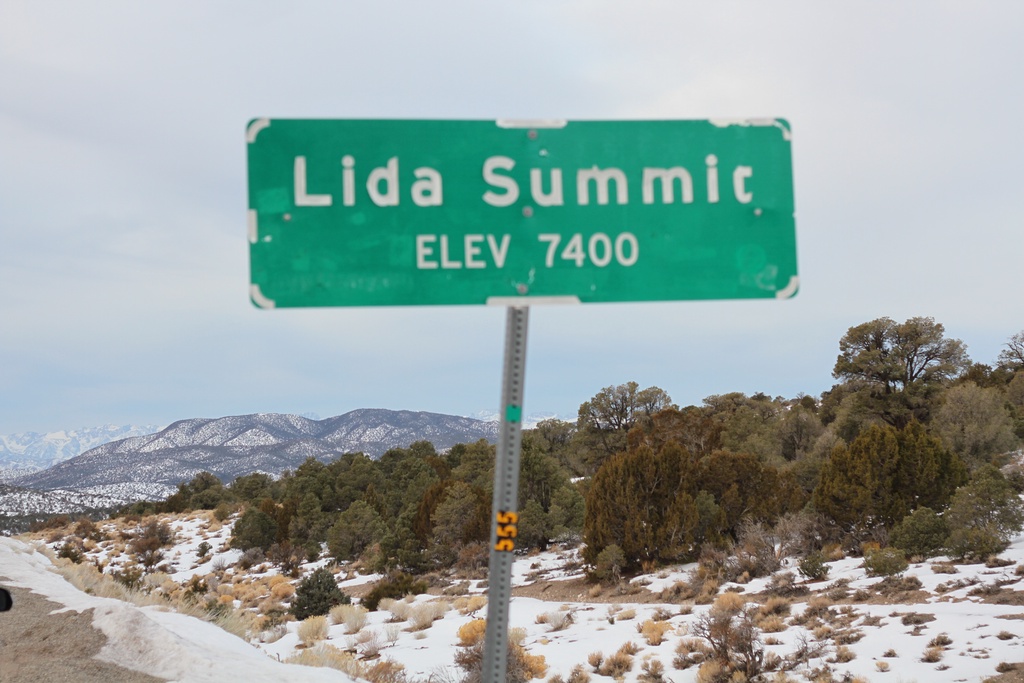
NV-266 West - Lida Summit
Lida Summit - Elevation 7400 Feet on NV-266 West. Lida Summit is located in the Palmetto Mountains.
Taken 01-15-2022
 Goldfield
Esmeralda County
Nevada
United States
Goldfield
Esmeralda County
Nevada
United States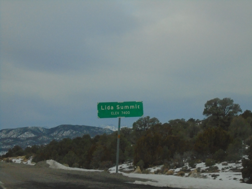
NV-266 West - Lida Summit
Lida Summit - Elevation 7400 Feet on NV-266 West. Lida Summit is located in the Palmetto Mountains.
Taken 01-15-2022
Goldfield
Esmeralda County
Nevada
United States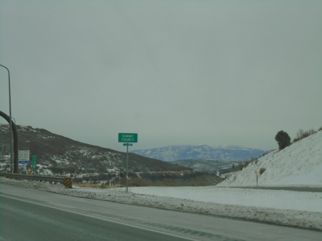
I-80 East - Summit County
Entering Summit County on I-80 East at Parleys Summit - 7120 Feet. This is the highest point along I-80 in the state of Utah.
Taken 12-30-2020
 Park City
Summit County
Utah
United States
Park City
Summit County
Utah
United States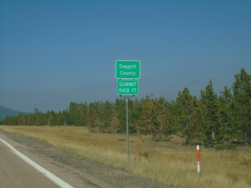
US-191 North - Daggett County
Entering Daggett County on US-191 North. Summit at Elevation 8428 Feet. Daggett County is the least populated county in Utah
Taken 10-03-2020
 Vernal
Daggett County
Utah
United States
Vernal
Daggett County
Utah
United States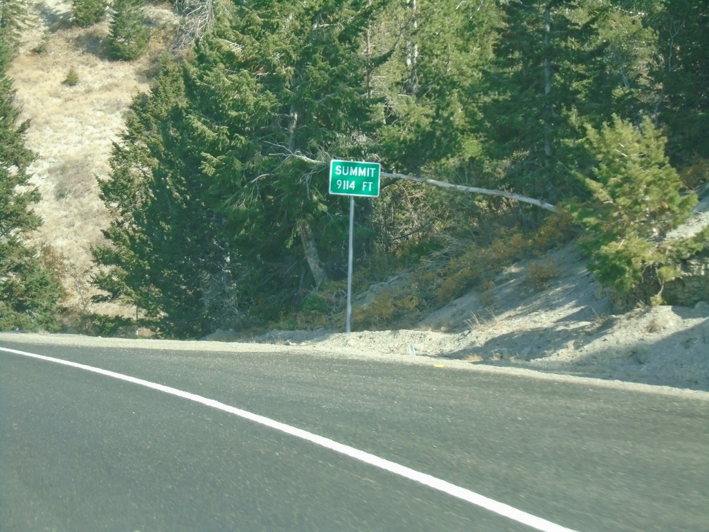
US-191 North - Elevation 9114 Feet
US-191 North - Elevation 9114 Feet. This is the summit of the divide between the Price River basin and the Duchesne River basin.
Taken 10-03-2020
Duchesne
Duchesne County
Utah
United States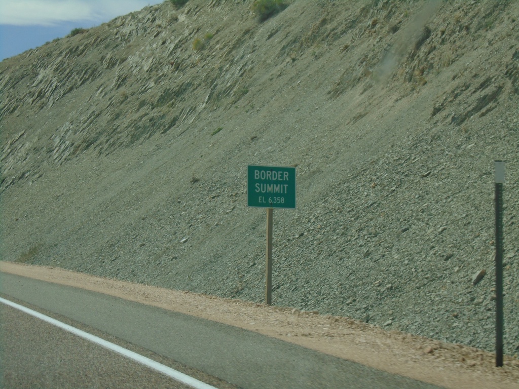
US-30 East - Border Summit
US-30 east at Border Summit - Elevation 6358 Feet.
Taken 08-13-2020
 Montpelier
Bear Lake County
Idaho
United States
Montpelier
Bear Lake County
Idaho
United States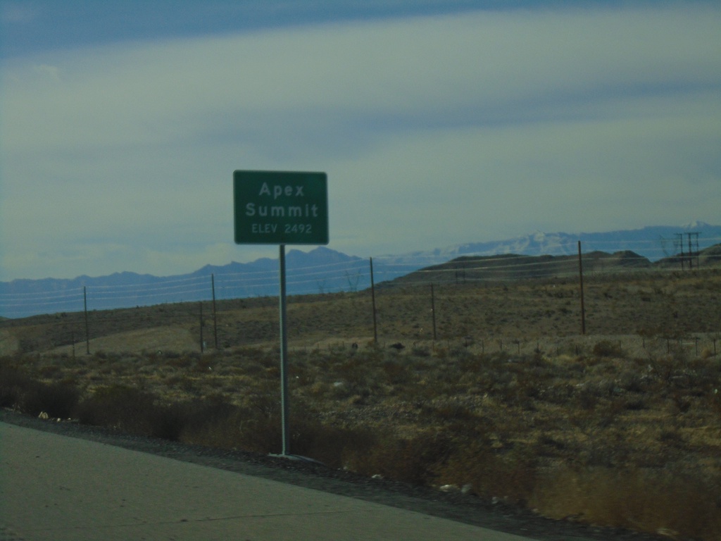
I-15 South - Apex Summit
I-15 south at Apex Summit - Elevation 2492 Feet.
Taken 11-26-2019

 Nellis Air Force Base
Clark County
Nevada
United States
Nellis Air Force Base
Clark County
Nevada
United States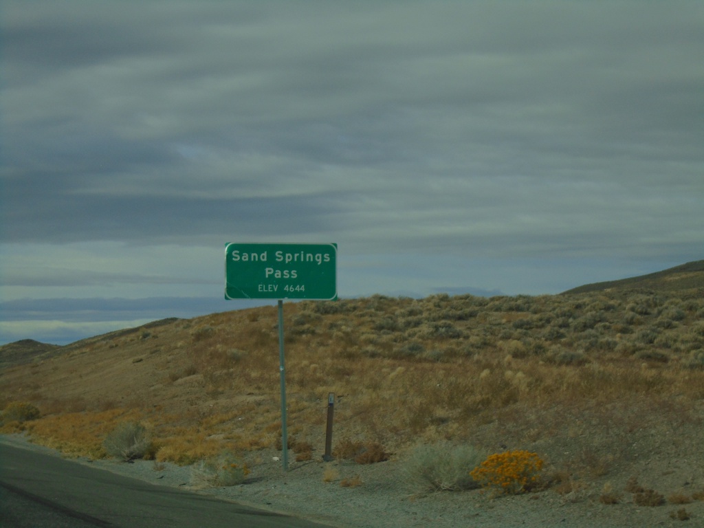
US-50 West - Sand Springs Pass
Sand Springs Pass on US-50 west. Elevation 4644 Feet.
Taken 10-19-2019
Fallon
Churchill County
Nevada
United States