Signs Tagged With Shield
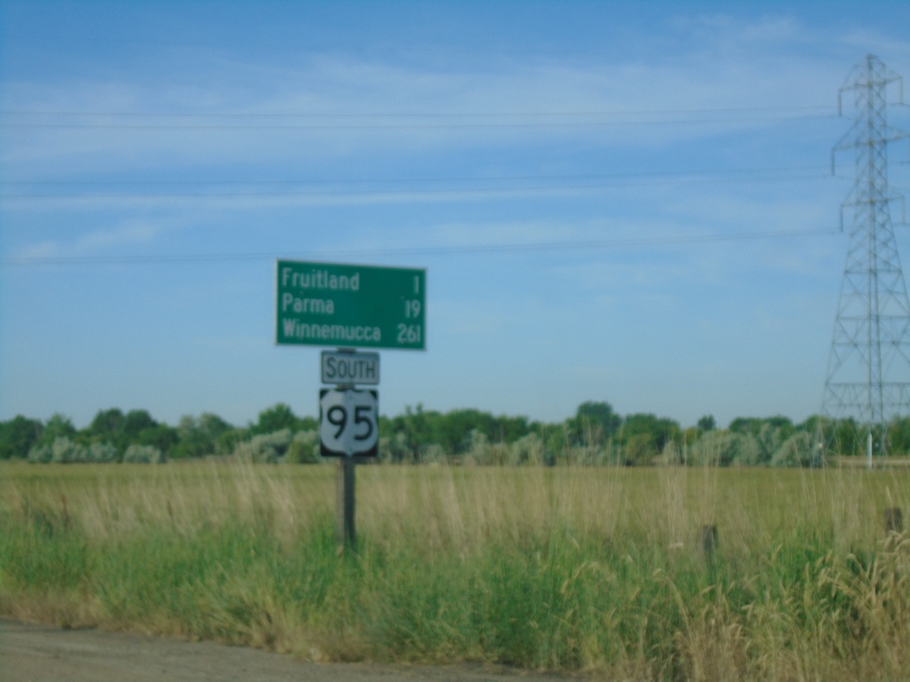
US-95 South - Distance Marker
Distance marker on US-95 south. Distance to Fruitland, Parma, and Winnemucca (Nevada).
Taken 06-19-2020
 Payette
 County
Idaho
United States
Payette
Payette County
Idaho
United States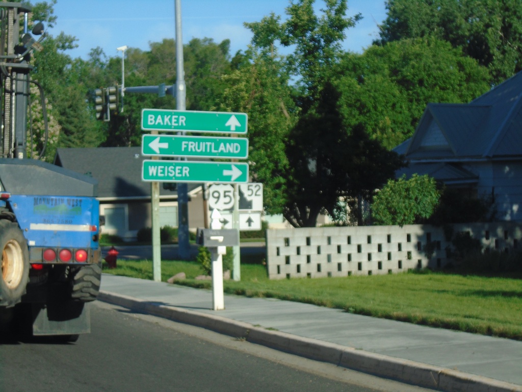
ID-52 West at US-95
ID-52 west at US-95 in Payette. Turn right for US-95 north to Weiser; left for US-95 south to Fruitland. Continue west on ID-52 for Baker (City, Oregon). The ID-52 shield is the new style of Idaho state highway shield.
Taken 06-19-2020
 Payette
 County
Idaho
United States
Payette
Payette County
Idaho
United States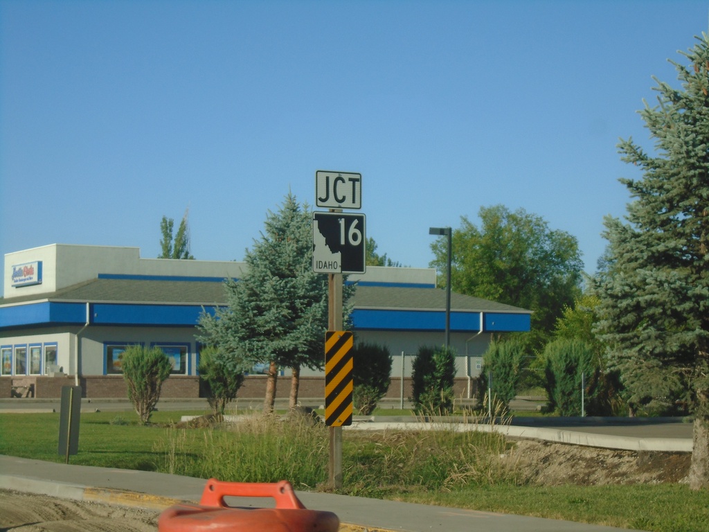
ID-52 West Approaching ID-16
ID-52 West approaching ID-16 in Emmett.
Taken 06-19-2020
 Emmett
Gem County
Idaho
United States
Emmett
Gem County
Idaho
United States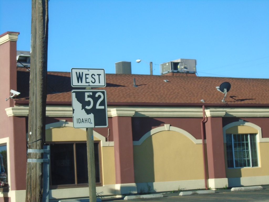
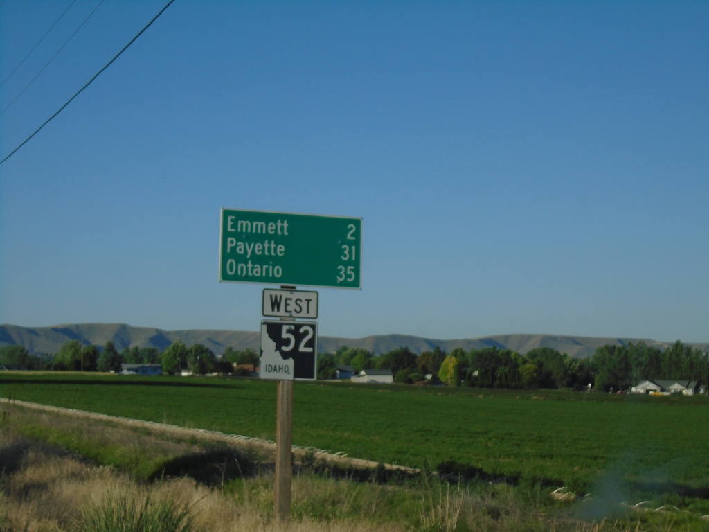
ID-52 West - Distance Marker
Distance marker on ID-52 west. Distance to Emmett, Payette, and Ontario.
Taken 06-19-2020
Emmett
Gem County
Idaho
United States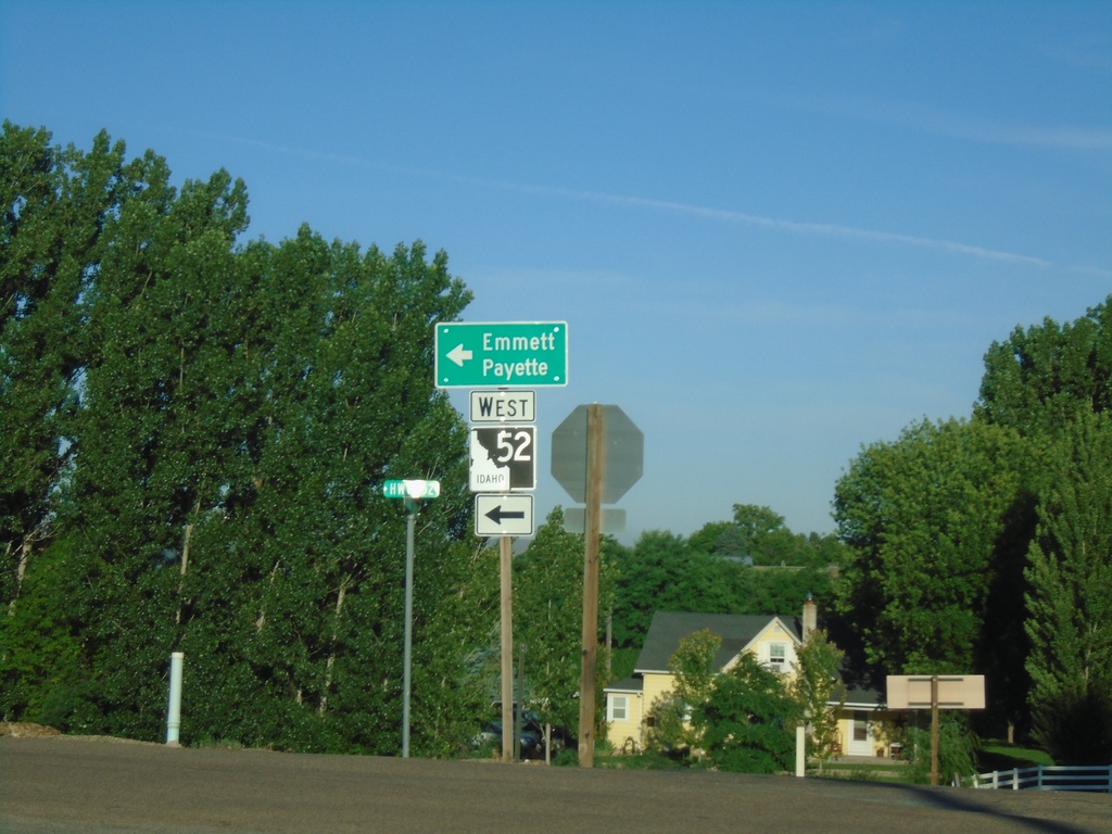
ID-52 West at Van Deusen Road
ID-52 West (Black Canyon Highway) at Van Deusen Road junction. Turn left to continue west on ID-52 to Emmett and Payette.
Taken 06-19-2020
Emmett
Gem County
Idaho
United States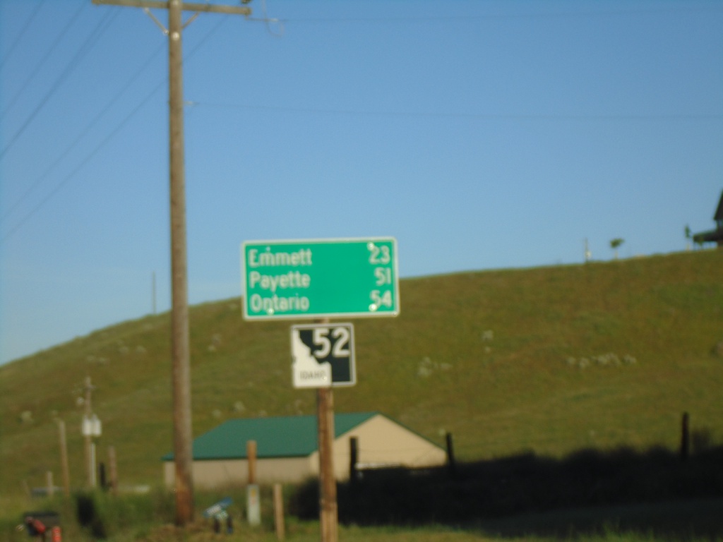
ID-52 West - Distance Marker
Distance marker on ID-52 west. Distance to Emmett, Payette, and Ontario.
Taken 06-19-2020
Horseshoe Bend
Boise County
Idaho
United States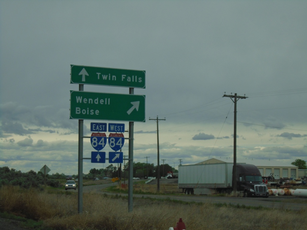
End ID-25 West at I-84
End ID-25 West at I-84 in Jerome. Use I-84 west to Wendell and Boise; use I-84 east to Twin Falls.
Taken 05-22-2020

 Jerome
 County
Idaho
United States
Jerome
Jerome County
Idaho
United States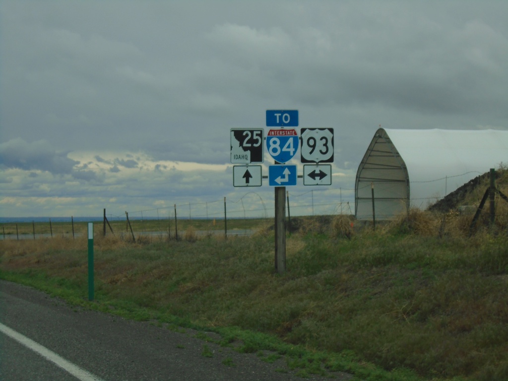
ID-25 West at US-93
ID-25 West at US-93 in Jerome County. Use US-93 South or ID-25 West for I-84.
Taken 05-22-2020
 Jerome
 County
Idaho
United States
Jerome
Jerome County
Idaho
United States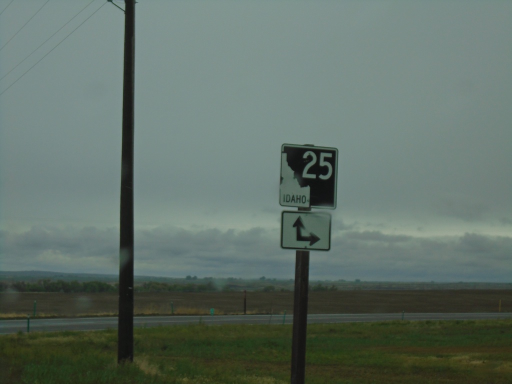
End ID-50 East at ID-25
End ID-50 East at ID-25 in Jerome County.
Taken 05-22-2020
 Eden
Jerome County
Idaho
United States
Eden
Jerome County
Idaho
United States