Signs Tagged With Shield
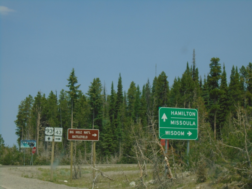
US-93 North at MT-43 - Lost Trail Pass
US-93 north at MT-43 East at the top of Lost Trail Pass, on the Idaho-Montana State Line. Turn right on MT-43 for Wisdom and the Big Hole National Battlefield. Continue north on US-93 for Hamilton and Missoula. The welcome to Montana sign is in the background.
Taken 07-02-2021

 Sula
Ravalli County
Montana
United States
Sula
Ravalli County
Montana
United States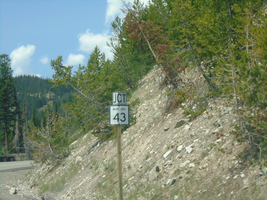
US-93 North Approaching MT-43 Junction
US-93 North approaching MT-43 Junction. The MT-43/US-93 intersection is at the top of Lost Trail Pass on the stateline with Idaho and Montana.
Taken 07-02-2021
Gibbonsville
Lemhi County
Idaho
United States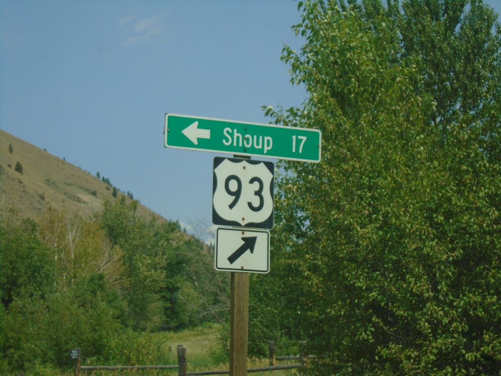
US-93 North - Shoup Jct.
US-93 north at Salmon River Road Jct. to Shoup. The Salmon River heads west here.
Taken 07-02-2021
North Fork
Lemhi County
Idaho
United States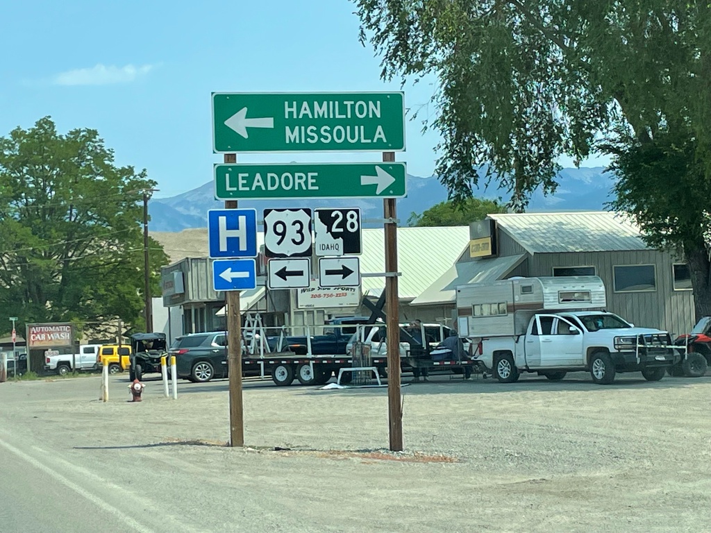
US-93 North at ID-28
US-93 North at ID-28 south to Leadore. Turn left to continue north on US-93 to Hamilton (MT) and Missoula (MT).
Taken 07-02-2021
 Salmon
Lemhi County
Idaho
United States
Salmon
Lemhi County
Idaho
United States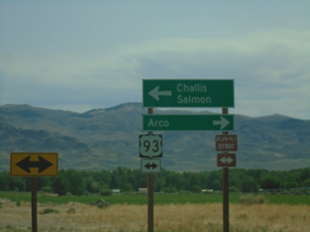
End ID-75 North at US-93
End ID-75 at US-93. Turn left for US-93 north to Challis and Salmon. Turn right for US-93 south to Arco. US-93 north is part of the Salmon River Scenic Byway; US-93 south is part of the Peaks to Craters Scenic Byway.
Taken 07-02-2021
 Challis
Custer County
Idaho
United States
Challis
Custer County
Idaho
United States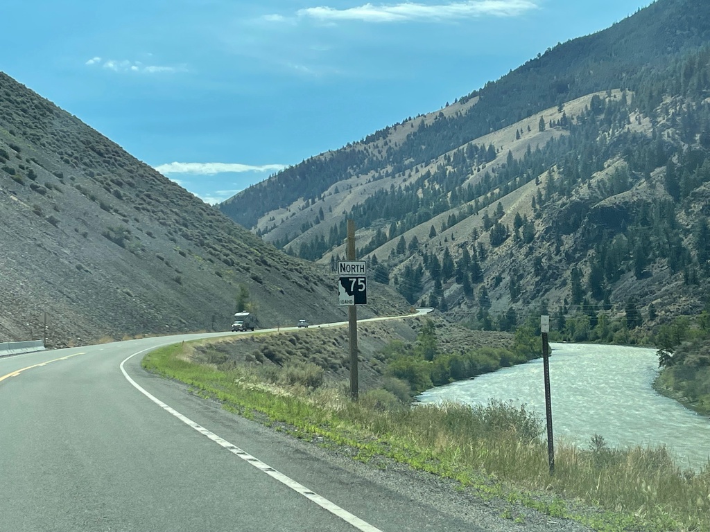
ID-75 North - Custer County
ID-75 north, just north of Clayton. The Salmon River is in the background.
Taken 07-02-2021
Clayton
Custer County
Idaho
United States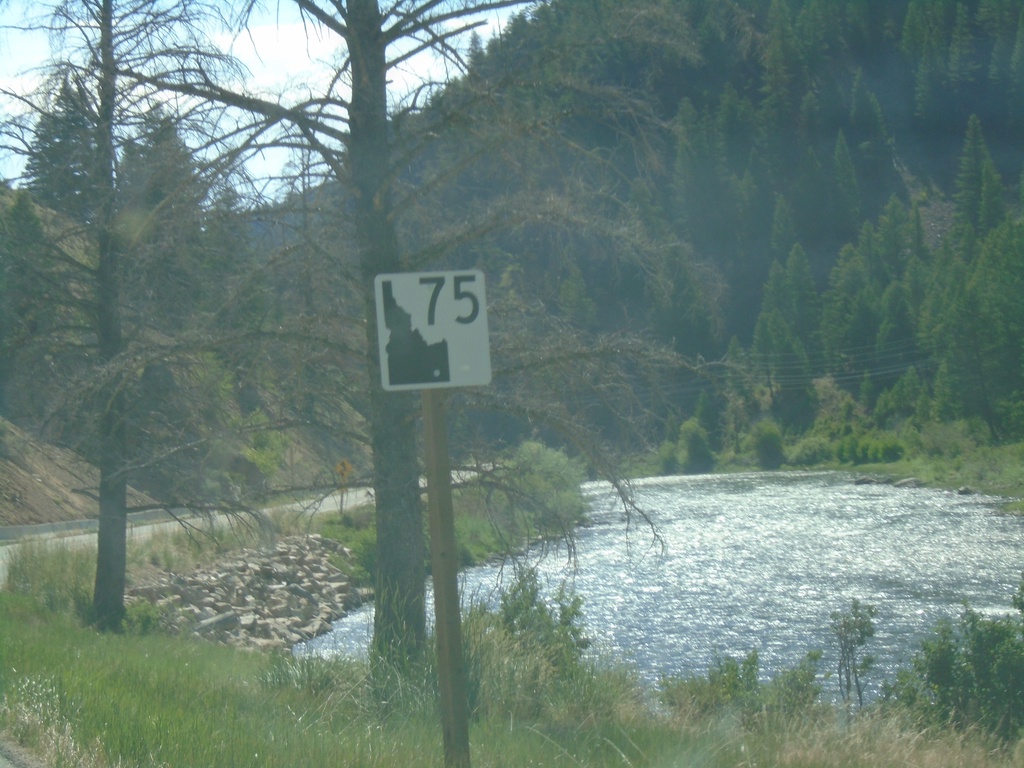
ID-75 North - Custer County
ID-75 North in Custer County. The Salmon River is in the background of the picture. There are quite a few of the new style state highway shields on ID-75 northbound between Stanley and Challis.
Taken 07-02-2021
Stanley
Custer County
Idaho
United States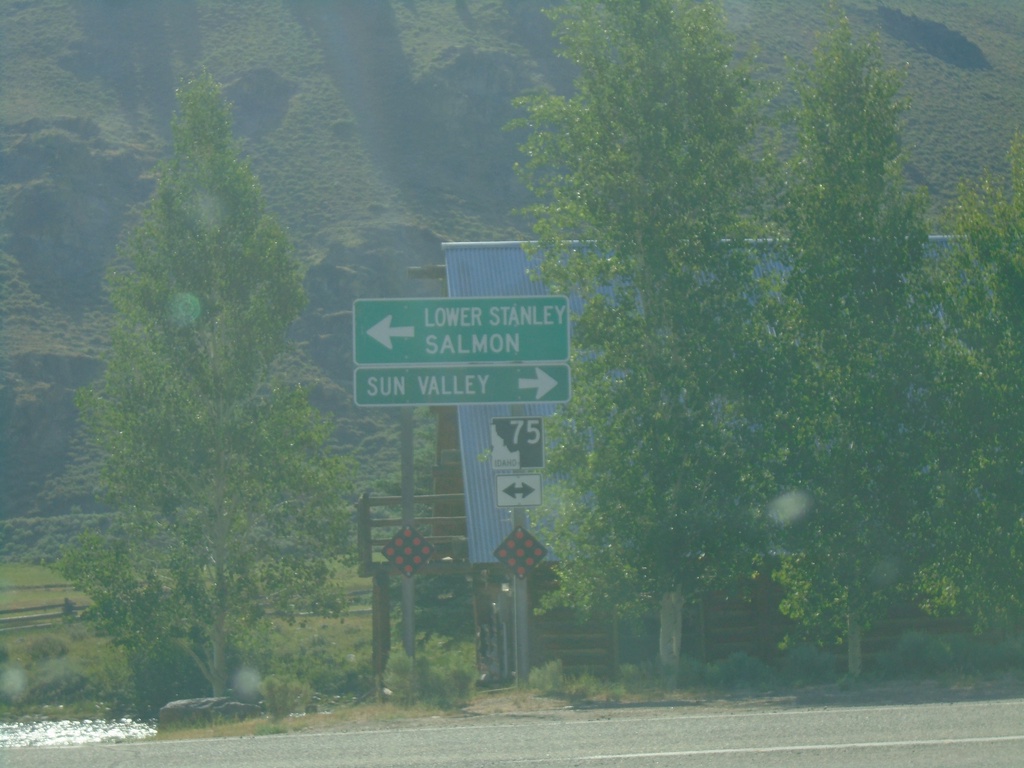
End ID-21 East at ID-75
End ID-21 East at ID-75. Use ID-75 south for Sun Valley. Use ID-75 north for Lower Stanley and Salmon.
Taken 07-02-2021
 Stanley
Custer County
Idaho
United States
Stanley
Custer County
Idaho
United States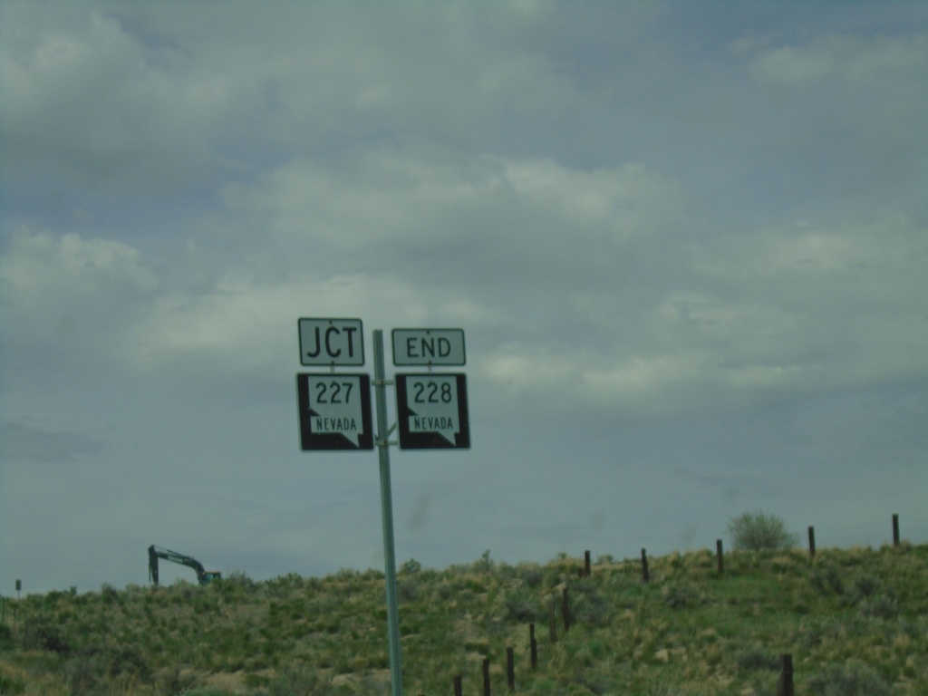
End NV-228 North At NV-227
End NV-228 North At NV-227 in Spring Creek.
Taken 05-29-2021

 Spring Creek
Elko County
Nevada
United States
Spring Creek
Elko County
Nevada
United States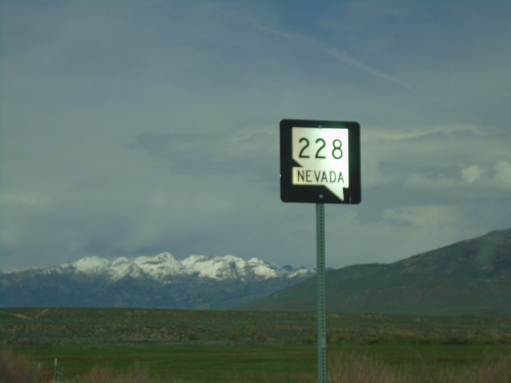
Begin NV-228 Northbound
Begin NV-228 Northbound in Jiggs
Taken 05-29-2021
Jiggs
Elko County
Nevada
United States