Signs Tagged With Shield
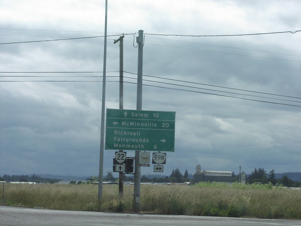
OR-22 East at OR-99W
OR-22 east at OR-99W. Use OR-99W south to Rickreall Fairgrounds, and Monmouth. Use OR-99W north to McMinnville. Continue east on OR-22 to Salem. This intersection has been replaced with a full interchange.
Taken 06-01-2001

 Rickreall
Polk County
Oregon
United States
Rickreall
Polk County
Oregon
United States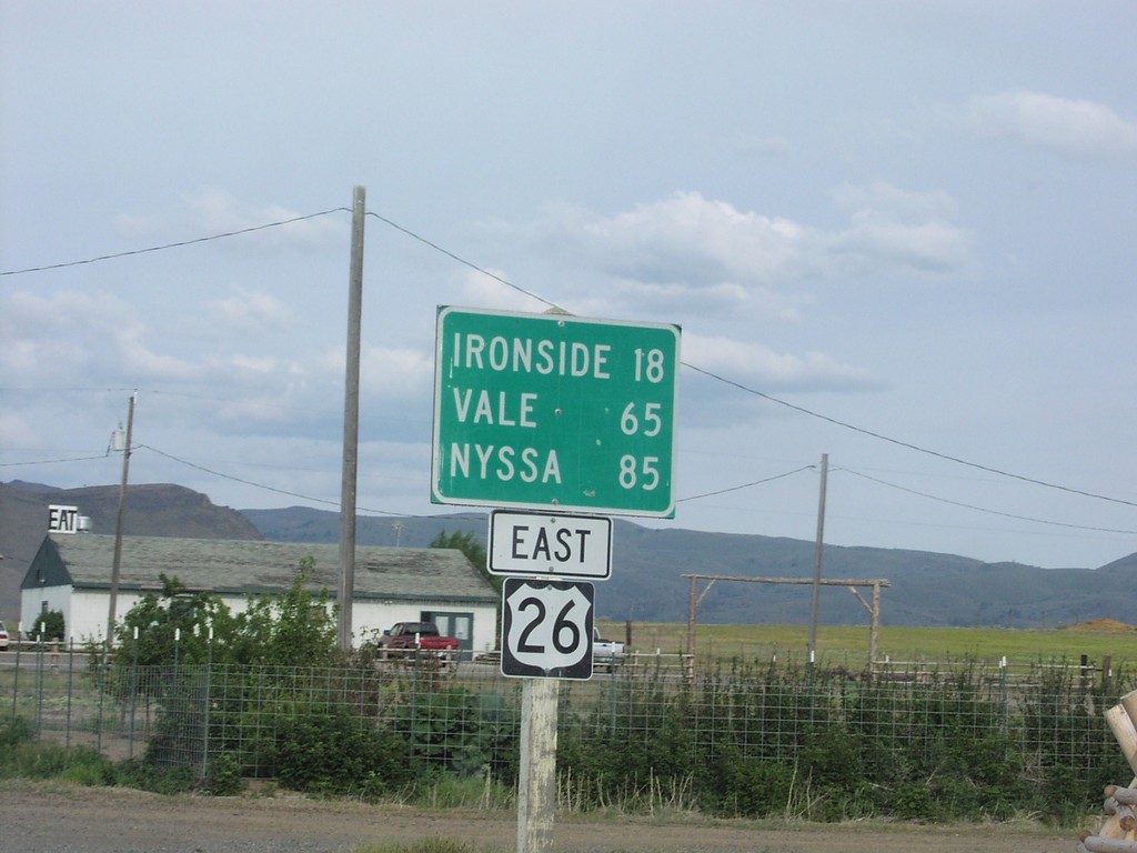
US-26 East - Distance Marker
Distance marker on US-26 east. Distance to Ironside, Vale, and Nyssa.
Taken 06-01-2001
 Unity
Baker County
Oregon
United States
Unity
Baker County
Oregon
United States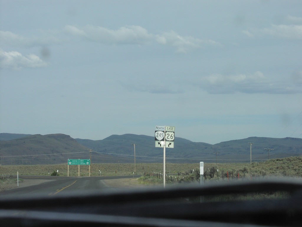
US-26 East Approaching OR-245
US-26 east approaching OR-245 north in Baker County.
Taken 06-01-2001
 Unity
Baker County
Oregon
United States
Unity
Baker County
Oregon
United States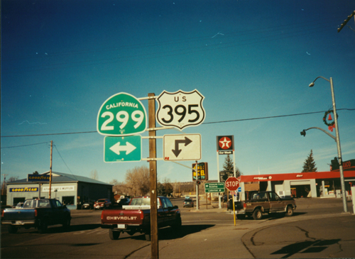
US-395 North at CA-299
CA-299 Junction on US-395 North
Taken 12-01-2000

 Alturas
Modoc County
California
United States
Alturas
Modoc County
California
United States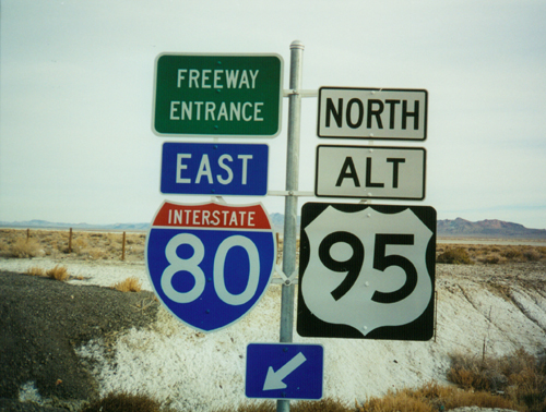
I-80 East/Alt. US-95 North Onramp - Exit 78
I-80/US-95 ALT freeway entrance at Exit 78 - Jessup
Taken 11-01-2000

 Churchill County
Nevada
United States
Churchill County
Nevada
United States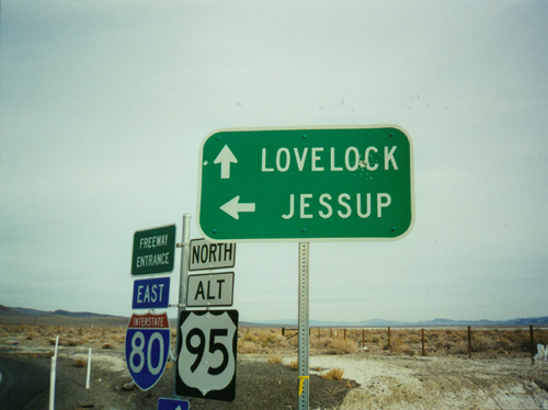
I-80 East/Alt. US-95 North Onramp - Exit 78
I-80 east onramp to Lovelock at Exit 78 - Jessup.
Taken 11-01-2000
Churchill County
Nevada
United States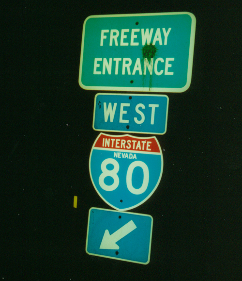
I-80 West Onramp at Exit 158
I-80 freeway entrance at Cosgrave. I-80 has the word "Nevada" above the route number. Most of Nevada’s interstate markers contain the state name.
Taken 11-01-2000
 Winnemucca
Pershing County
Nevada
United States
Winnemucca
Pershing County
Nevada
United States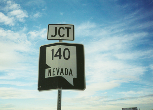
US-95 North at NV-140 West
Junction NV-140 on US-95 North
Taken 11-01-2000
 Humboldt County
Nevada
United States
Humboldt County
Nevada
United States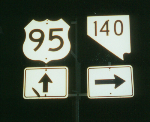
US-95 South at NV-140
US-95 south at NV-140. This Nevada state route shield does not contain the word "Nevada."
Taken 11-01-2000
Humboldt County
Nevada
United States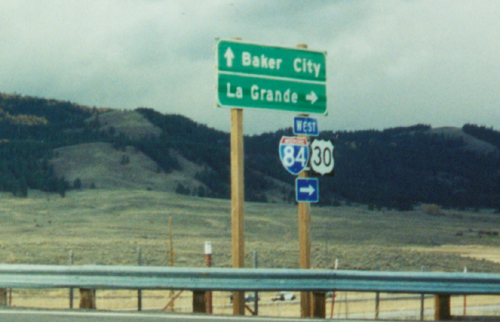
I-84/US-30 Exit 283 Onramp
I-84/US-30 freeway entrance to Baker City/LaGrande. Taken at the Exit 283 - Wolf Creek Lane onramp. The Blue Mountains are in the background.
Taken 10-01-2000

 North Powder
Union County
Oregon
United States
North Powder
Union County
Oregon
United States