Signs Tagged With Shield
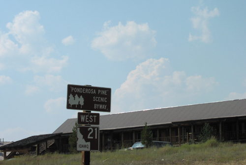
ID-21 West - Ponderosa Pine Scenic Byway
Ponderosa Pine Scenic Byway on ID-21 west. The Ponderosa Pine Scenic Byway starts here in Stanley and follows ID-21 west to Boise.
Taken 08-01-2001
 Stanley
Custer County
Idaho
United States
Stanley
Custer County
Idaho
United States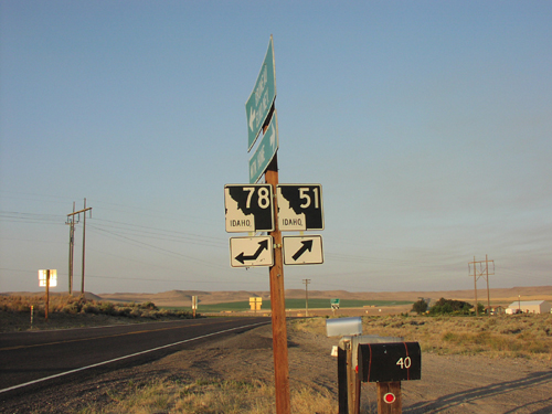
ID-51 South at ID-78
ID-51 south at ID-78. ID-78 joins ID-51 south for a few miles.
Taken 08-01-2001

 Mountain Home
Owyhee County
Idaho
United States
Mountain Home
Owyhee County
Idaho
United States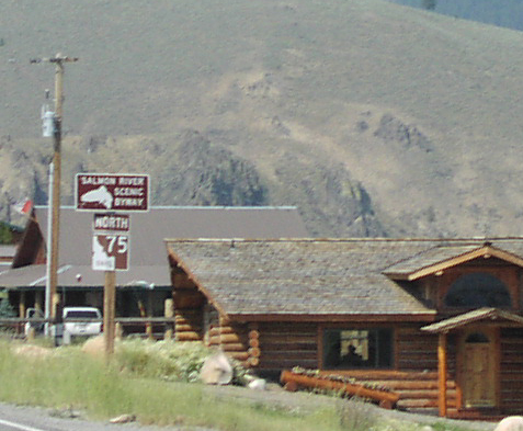
ID-75 North - Salmon River Scenic Byway
Salmon River Scenic Byway on ID-75 north. The Salmon River Scenic Byway starts here in Stanley and follows ID-75 north to Challis. Then the byway follows US-93 north to the Montana line.
Taken 08-01-2001
 Stanley
Custer County
Idaho
United States
Stanley
Custer County
Idaho
United States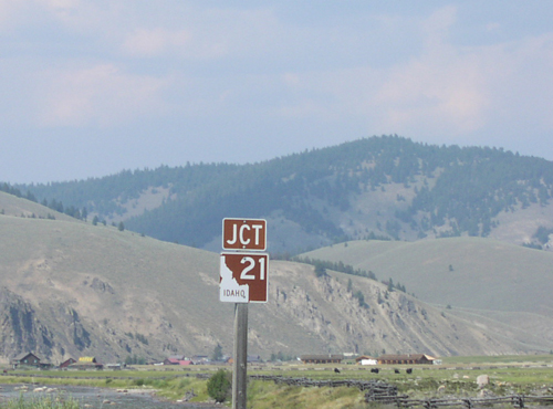
ID-75 North Approaching ID-21
Approaching ID-21 Junction on ID-75 North in Stanley.
Taken 08-01-2001
Stanley
Custer County
Idaho
United States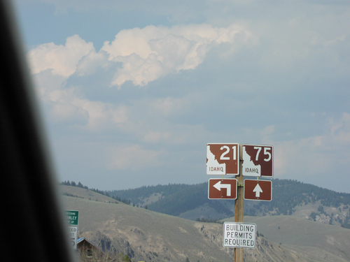
ID-75 North at ID-21 South
ID-21 Junction on ID-75 North in Stanley.
Taken 08-01-2001
Stanley
Custer County
Idaho
United States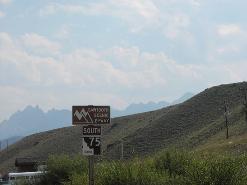
ID-75 South - Sawtooth Scenic Byway
Sawtooth Scenic Byway on ID-75 south. The Sawtooth Scenic Byway starts here in Stanley and follows ID-75 south to Shoshone. The peaks of the Sawtooth Range are in the background.
Taken 08-01-2001
Stanley
Custer County
Idaho
United States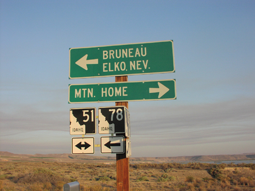
ID-78 West at ID-51
ID-78 west at ID-51. Use ID-51 north for Mountain Home. Use ID-51 South/ID-78 West for Bruneau and Elko, Nevada. C.J. Strike Reservoir is in the background.
Taken 08-01-2001
Bruneau
Owyhee County
Idaho
United States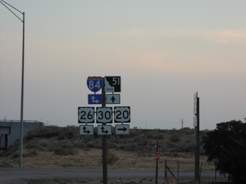
US-20 West at I-84
US-20 East at ID-51/I-84 Junction
Taken 08-01-2001


 Mountain Home
Elmore County
Idaho
United States
Mountain Home
Elmore County
Idaho
United States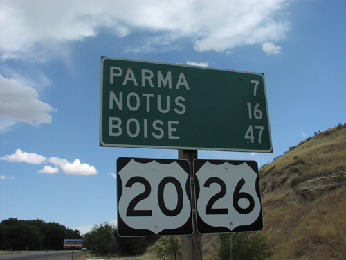
Distance Marker on US-20/US-26 East
Distance Marker To Notus/Parma/Boise on US-20/US-26 East, ID-OR Border
Taken 07-01-2001
Parma
Canyon County
Idaho
United States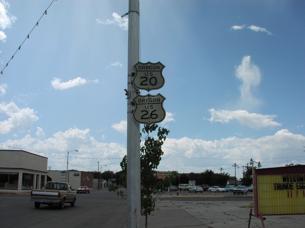
Historic Oregon US-20/US-26 Shields
Historic Oregon US-20/US-26 shields in downtown Nyssa. This photo was taken in 2001, and were replaced with newer shields sometime in the early 2000’s.
Taken 07-01-2001
Nyssa
Malheur County
Oregon
United States