Signs Tagged With Shield
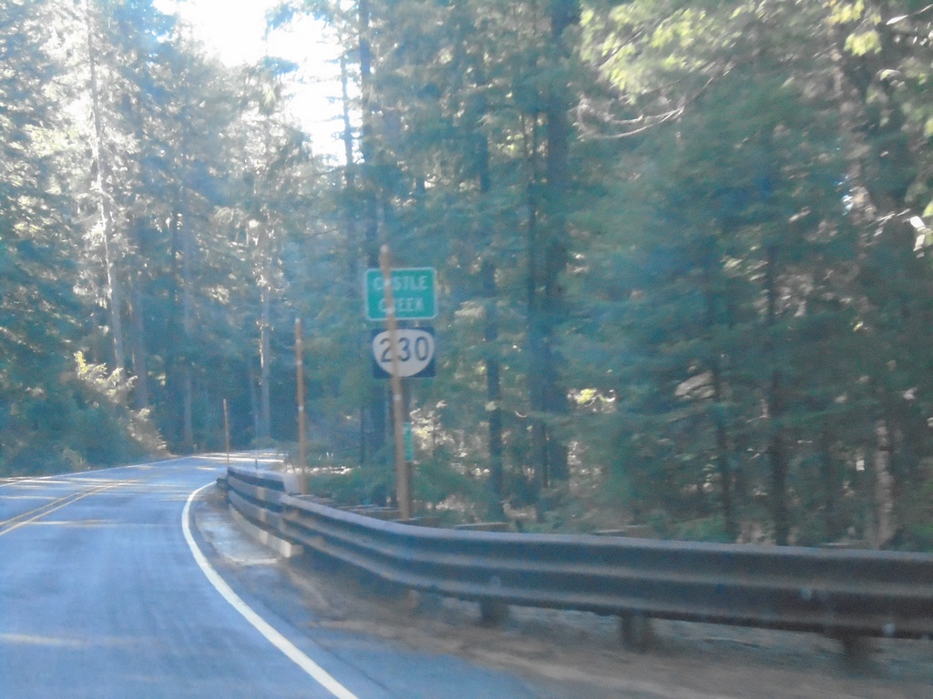
OR-230 West - Castle Creek
OR-230 west crossing Castle Creek.
Taken 11-20-2021
 Prospect
Jackson County
Oregon
United States
Prospect
Jackson County
Oregon
United States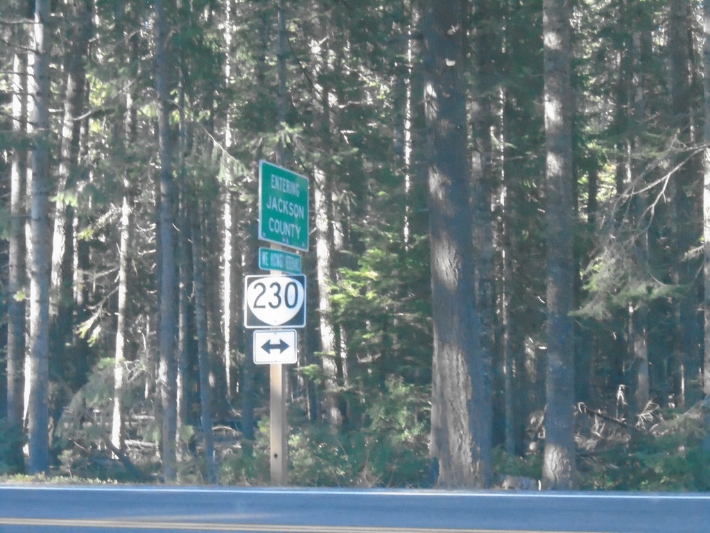
End Forest Road 6530 at OR-230
End Forest Road 6530 at OR-230 at the Jackson/Douglas County Line.
Taken 11-20-2021
Prospect
Jackson County
Oregon
United States
OR-230 West - Douglas County
OR-230 west in Douglas County. Taken just west of Diamond Lake.
Taken 11-20-2021
Crescent
Douglas County
Oregon
United States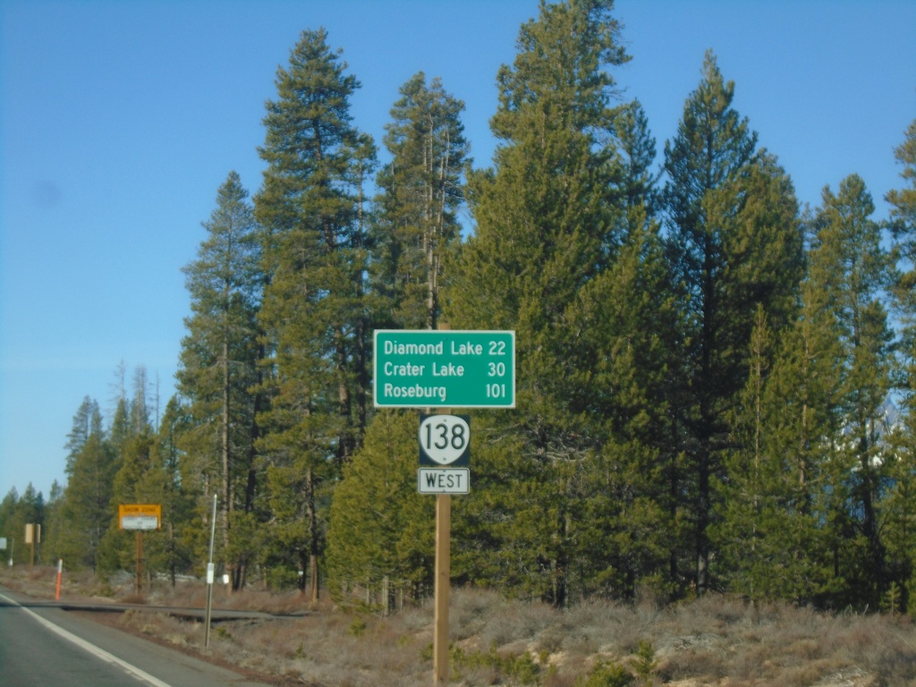
Distance Marker on OR-138 West
Distance marker on OR-138 west to Diamond Lake, Crater Lake, and Roseburg. Taken just west of Diamond Lake Junction.
Taken 11-20-2021
 Chemult
Klamath County
Oregon
United States
Chemult
Klamath County
Oregon
United States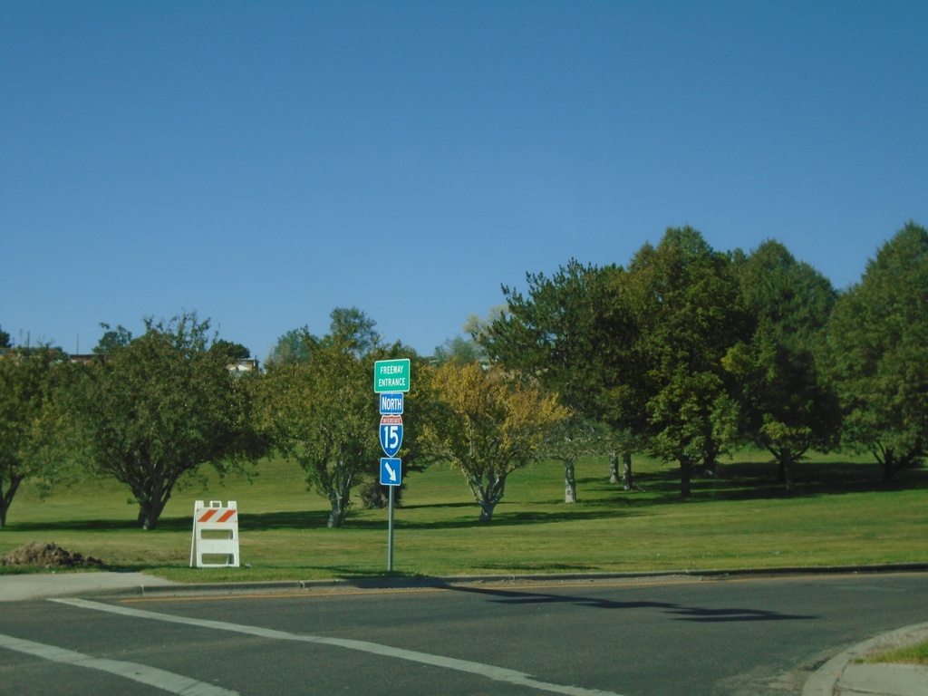
Pocatello Creek Road at I-15 North
Pocatello Creek Road at I-15 North. This type of sign assembly with the Freeway Entrance sign mounted on the shield is not very common in Idaho.
Taken 09-25-2021

 Pocatello
Bannock County
Idaho
United States
Pocatello
Bannock County
Idaho
United States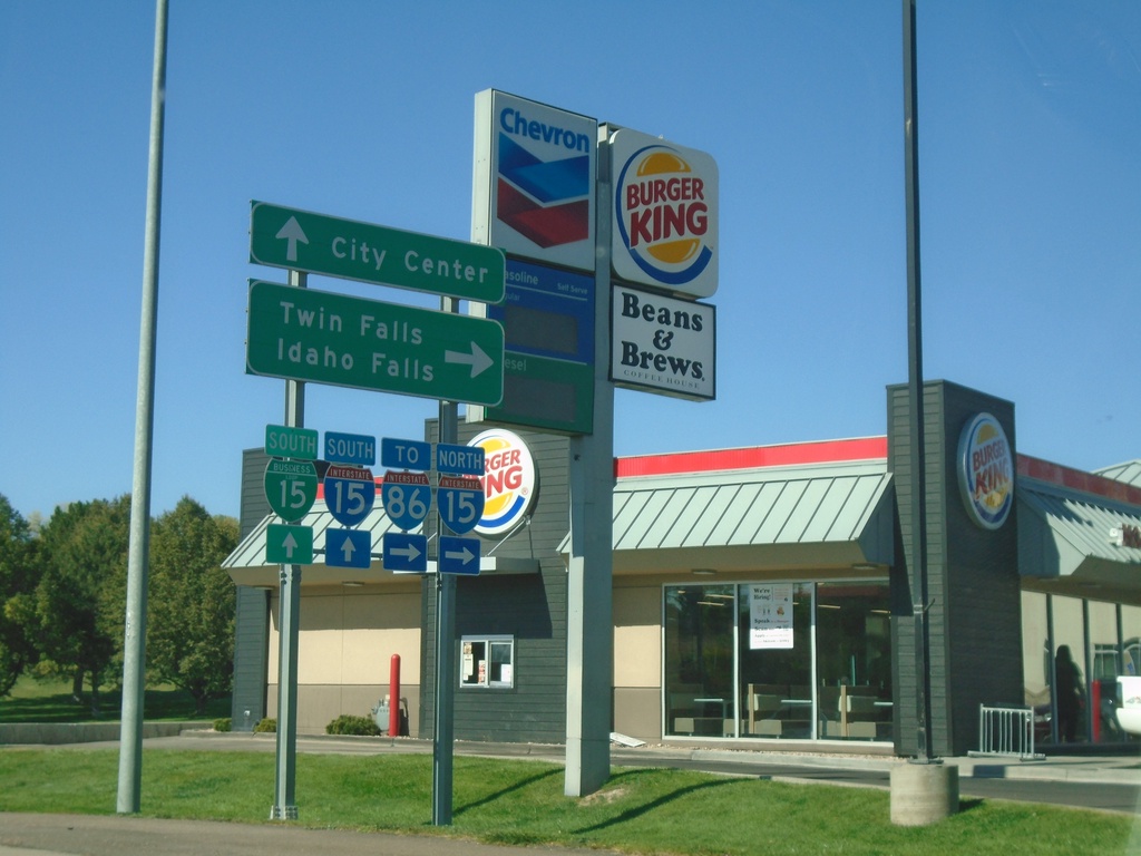
Pocatello Creek Road West at I-15
Pocatello Creek Road west at I-15. Use I-15 North for I-86, Twin Falls and Idaho Falls. Continue straight on Pocatello Creek Road for I-15 South and BL-15 to City Center.
Taken 09-25-2021
 Pocatello
Bannock County
Idaho
United States
Pocatello
Bannock County
Idaho
United States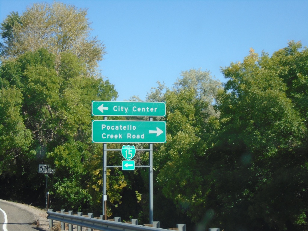
I-15 North Exit 71 Offramp
I-15 North Exit 71 Offramp at BL-15/Pocatello Creek Road. Turn right for Pocatello Creek Road; left for I-15 and City Center.
Taken 09-25-2021
Pocatello
Bannock County
Idaho
United States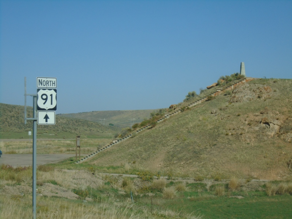
US-91 North at Oxford Highway
US-91 North at Oxford Highway in Bannock County. The intersection is located at Red Rock Pass which was the site of an ancient dam on prehistoric Lake Bonneville. The erosion of this dam created the catastrophic Bonneville Floods which affected much of the Snake River plain of Idaho.
Taken 09-25-2021
 Downey
Bannock County
Idaho
United States
Downey
Bannock County
Idaho
United States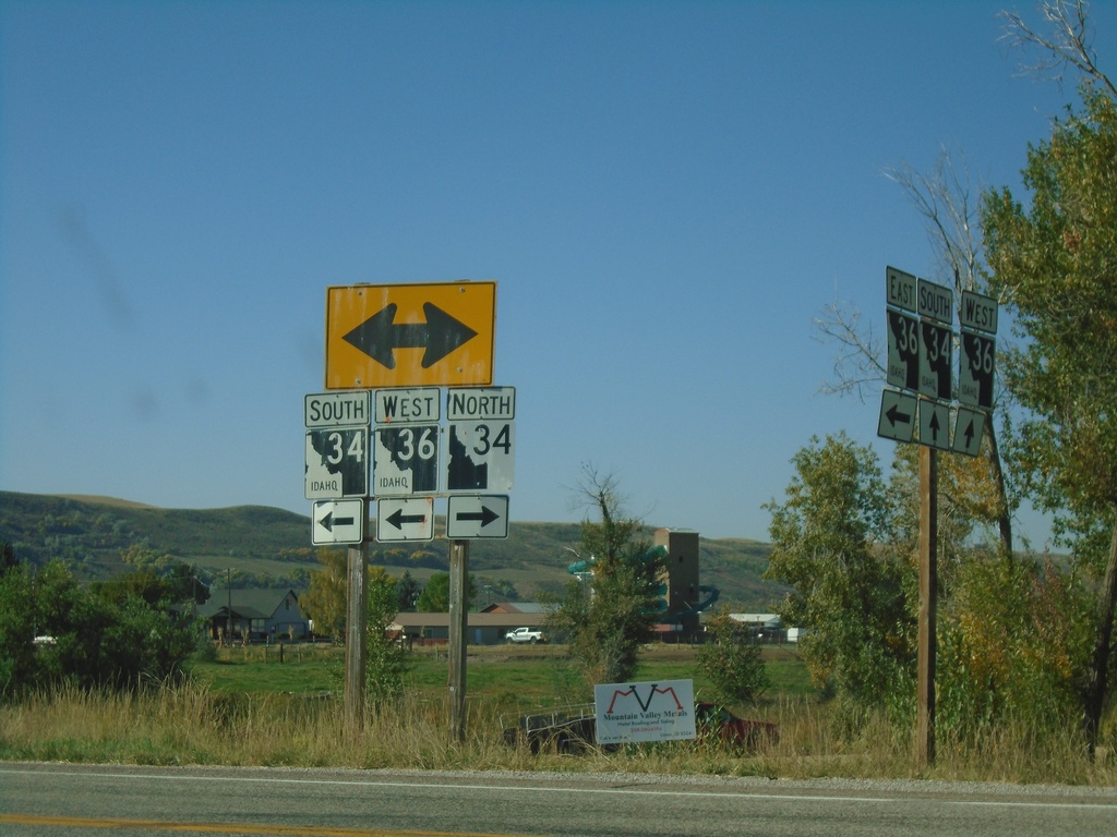
ID-36 West at ID-34 - Franklin County
ID-36 West at ID-34 in Franklin County. Turn right for ID-34 North; turn left for ID-34 South/ID-36 West. Notice the the old and new varieties of Idaho state highway markers (ID-34 North - New, ID-34 South/ID-36 West - Old).
Taken 09-25-2021

 Preston
Franklin County
Idaho
United States
Preston
Franklin County
Idaho
United States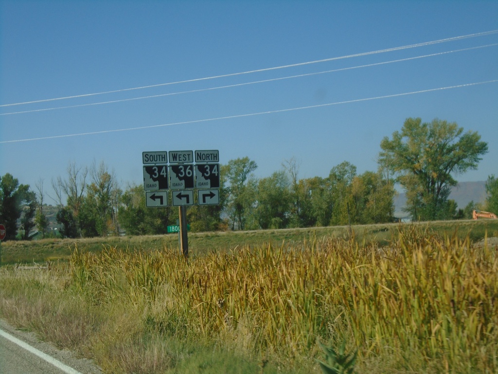
ID-36 West Approaching ID-34
ID-36 West approaching ID-34 in Franklin County. ID-36 West joins ID-34 south to Preston.
Taken 09-25-2021
Preston
Franklin County
Idaho
United States