Signs Tagged With Shield
End NM-597 at US-160
End NM-597 south at US-160.
Taken 10-18-2008

 Teec Nos Pos
San Juan County
New Mexico
United States
Teec Nos Pos
San Juan County
New Mexico
United States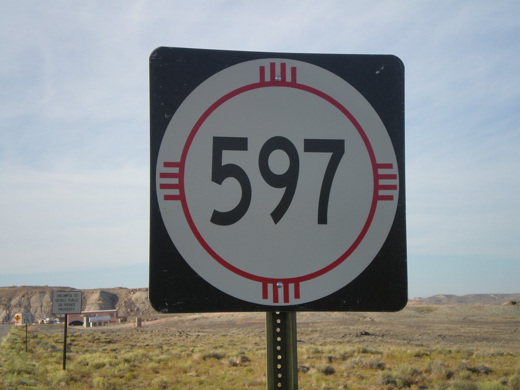
NM-597 - Four Corners Access Road
NM-597 at Four Corners
Taken 10-18-2008
Teec Nos Pos
San Juan County
New Mexico
United States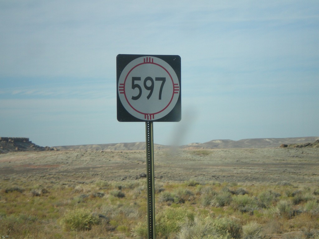
NM-597 - Four Corners
NM-597 just north of US-160. NM-597 is a short state route connecting US-160 with the Four Corners monument.
Taken 10-18-2008
Teec Nos Pos
San Juan County
New Mexico
United States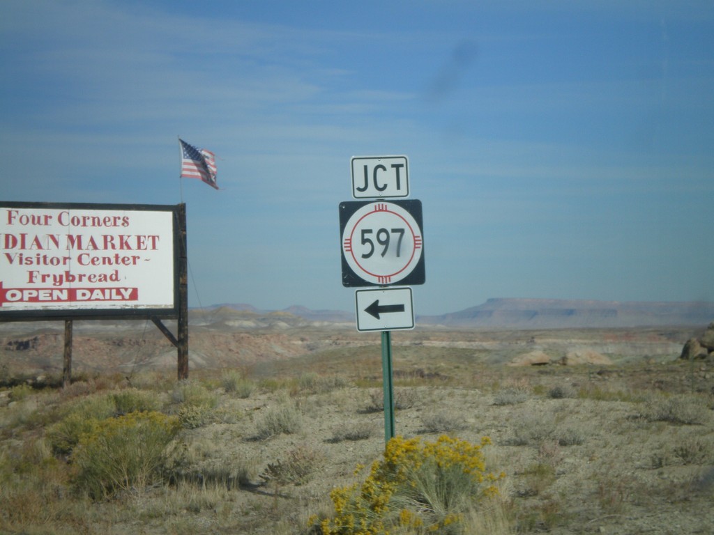
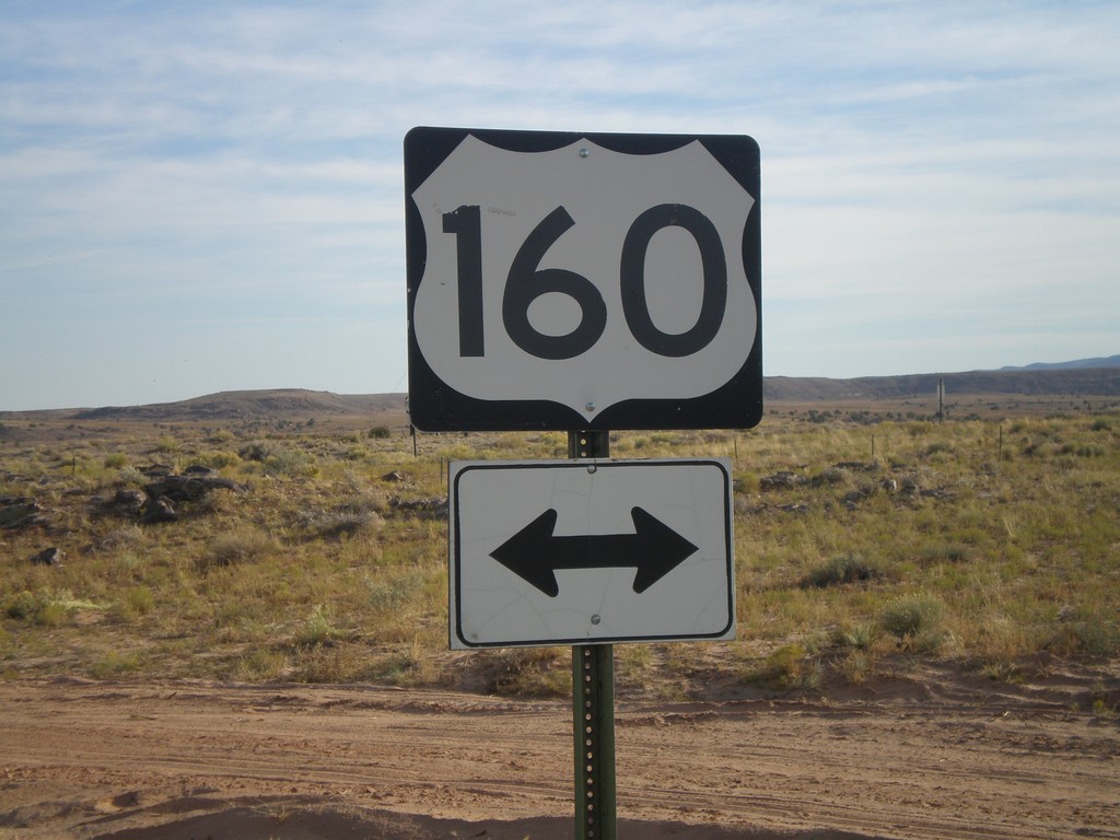
US-160 East at NM-597
US-160 east approaching NM-597 at Four Corners.
Taken 10-18-2008
Teec Nos Pos
San Juan County
New Mexico
United States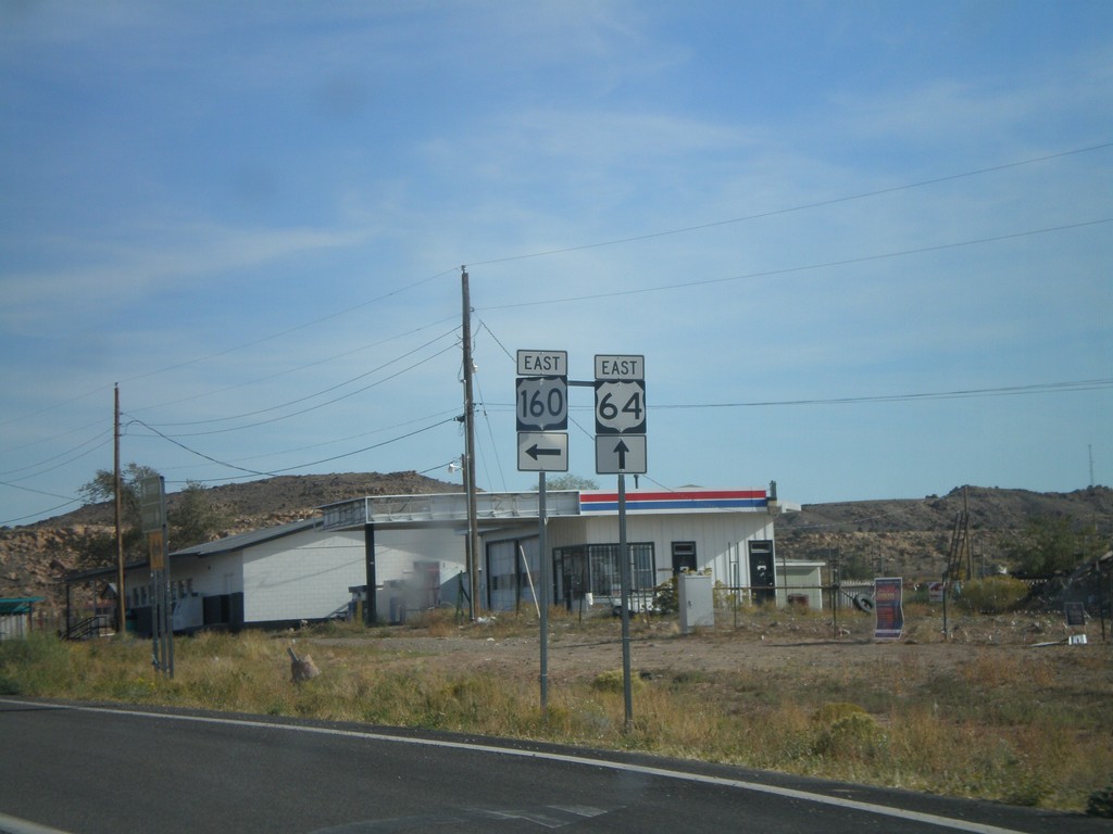
US-160 East at US-64
US-160 east at US-64 east. US-64 east begins here.
Taken 10-18-2008
 Teec Nos Pos
Apache County
Arizona
United States
Teec Nos Pos
Apache County
Arizona
United States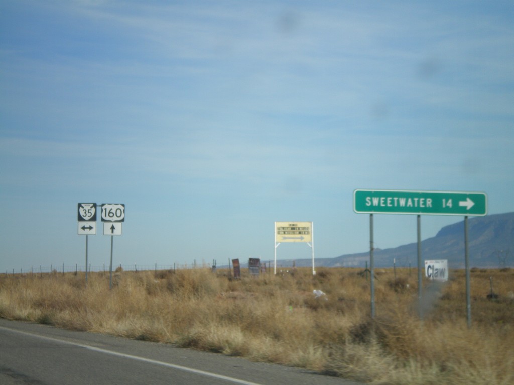
US-160 East at BIA-35
US-160 east at BIA-35. Sweetwater is 14 miles to the south on BIA-35.
Taken 10-18-2008
 Red Mesa
Apache County
Arizona
United States
Red Mesa
Apache County
Arizona
United States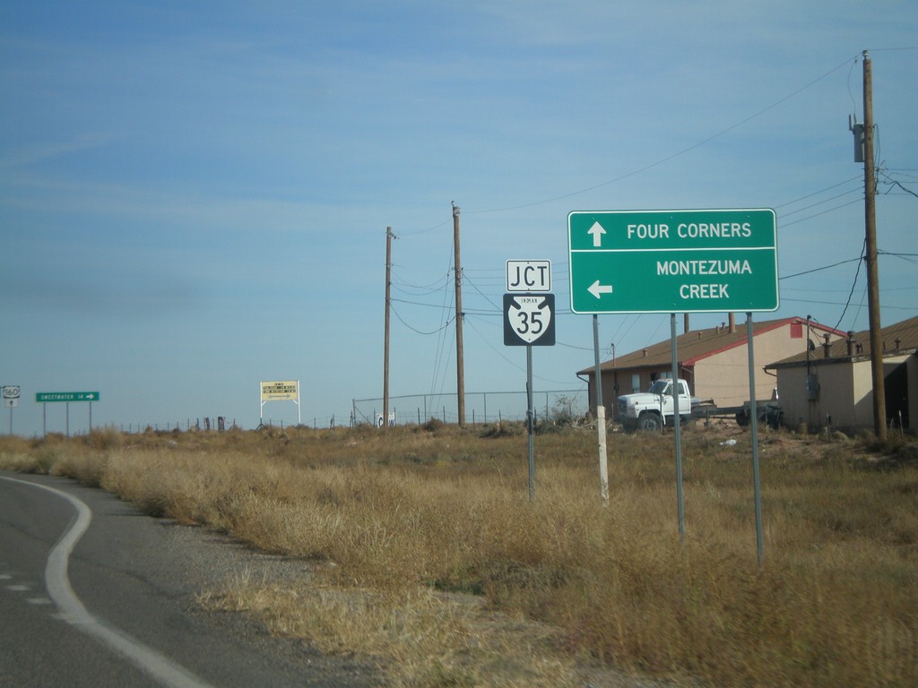
US-160 East at BIA-35
US-160 east approaching BIA-35 north to Montezuma Creek. Continue on US-160 east to Four Corners.
Taken 10-18-2008
Red Mesa
Apache County
Arizona
United States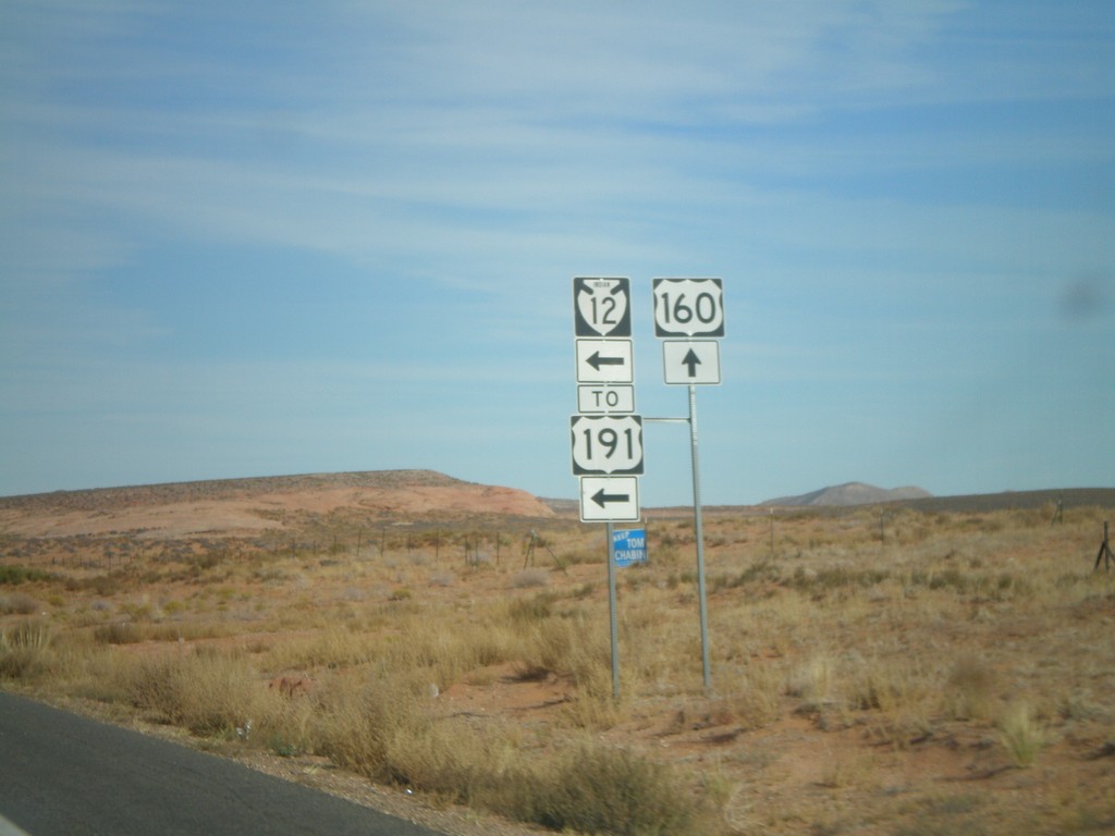
US-160 East at BIA-12/To US-191
US-160 east at BIA-12 North to US-191. All maps denote this as US-191, but the sign says BIA-12.
Taken 10-18-2008

 Red Mesa
Apache County
Arizona
United States
Red Mesa
Apache County
Arizona
United States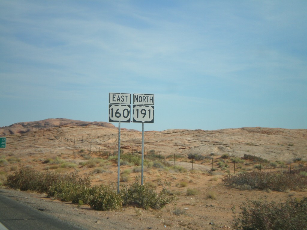
US-160 East/US-191 North
US-160 East/US-191 North
Taken 10-18-2008
Mexican Water
Apache County
Arizona
United States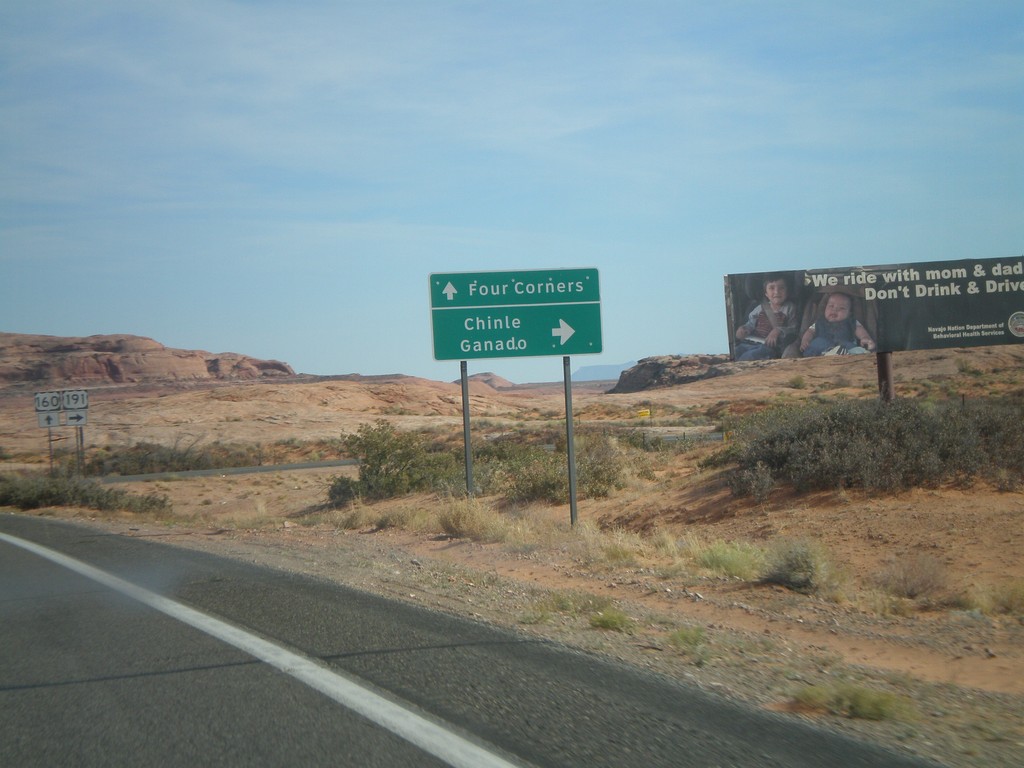
US-160 East at US-191 South
US-160 east at US-191 south to Ganado and Chinle. US-191 joins US-160 east next 3 miles.
Taken 10-18-2008
Mexican Water
Apache County
Arizona
United States