Signs Tagged With Shield
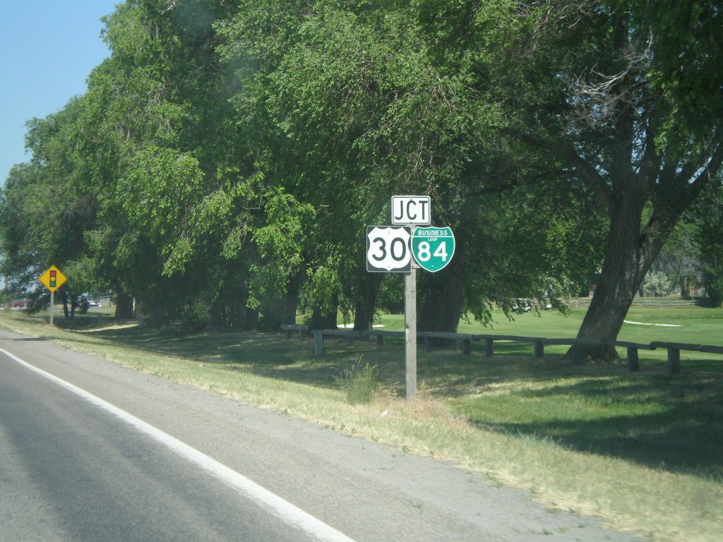
ID-81 North Approaching BL-84/US-30
Approaching BL-84/US-30 on ID-81 north in Burley.
Taken 07-05-2011


 Burley
Cassia County
Idaho
United States
Burley
Cassia County
Idaho
United States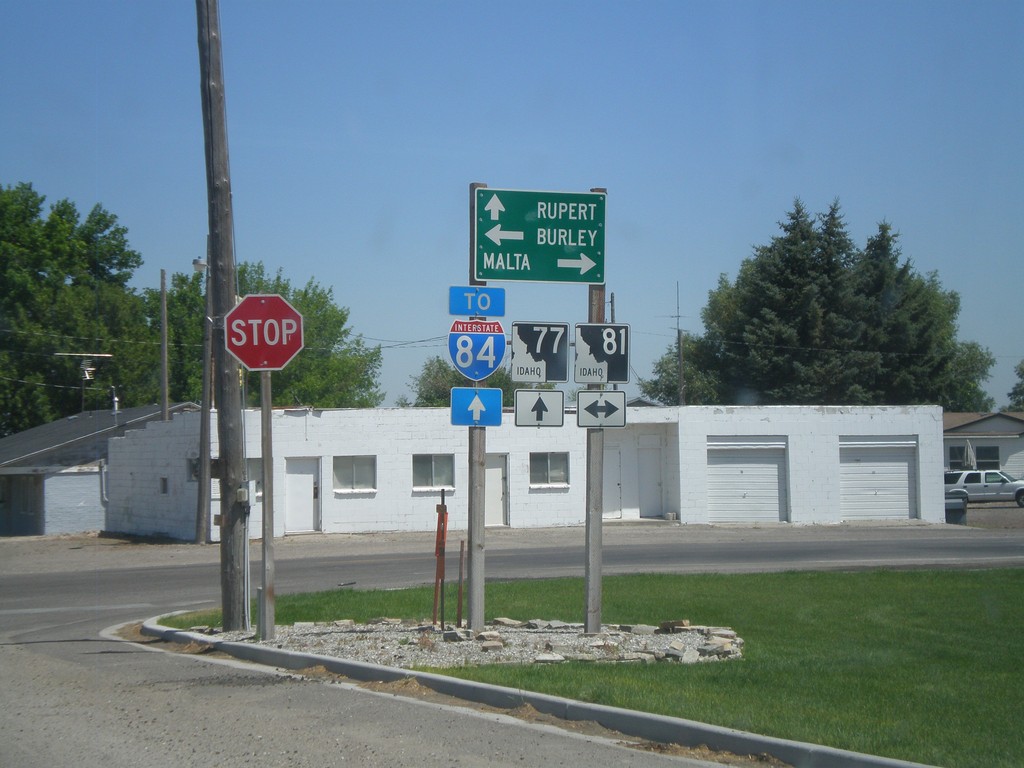
ID-77 North at ID-81
ID-77 north at ID-81. Use ID-77 north for Rupert and I-84; ID-81 south to Malta; and ID-81 north to Burley.
Taken 07-05-2011

 Declo
Cassia County
Idaho
United States
Declo
Cassia County
Idaho
United States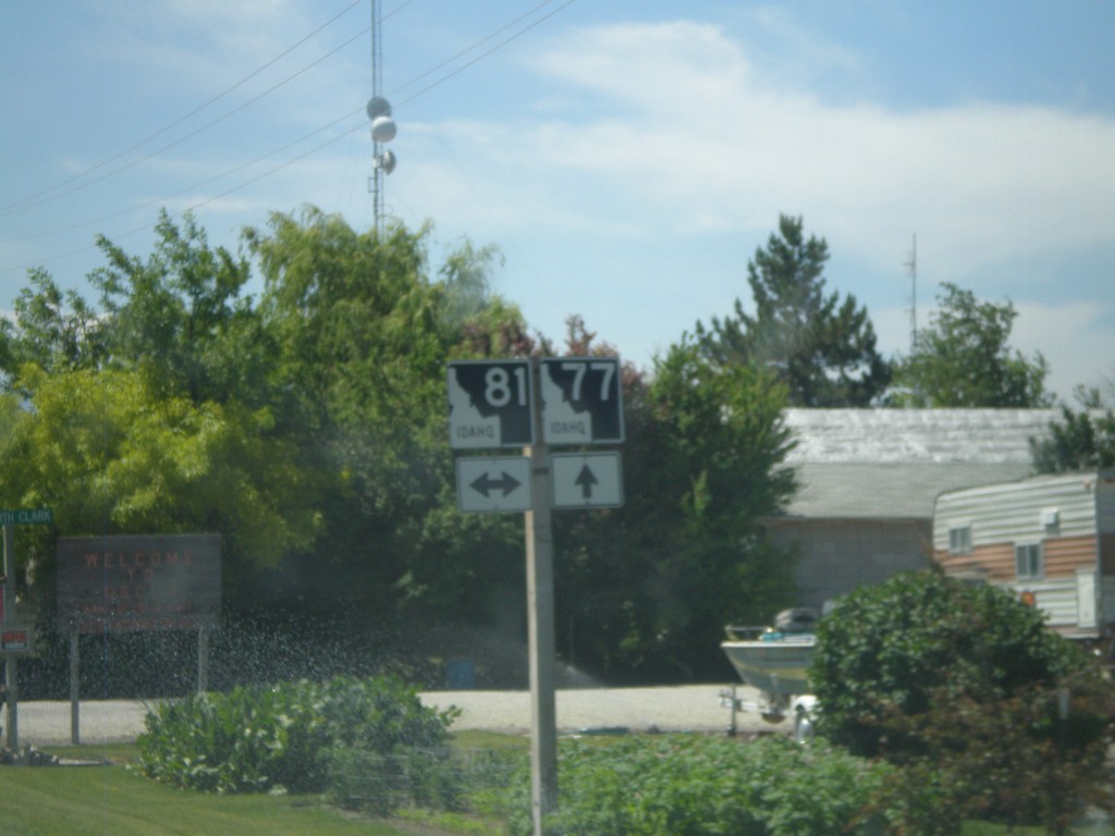
ID-77 South at ID-81
ID-77 south at ID-81 in Declo.
Taken 07-05-2011
Declo
Cassia County
Idaho
United States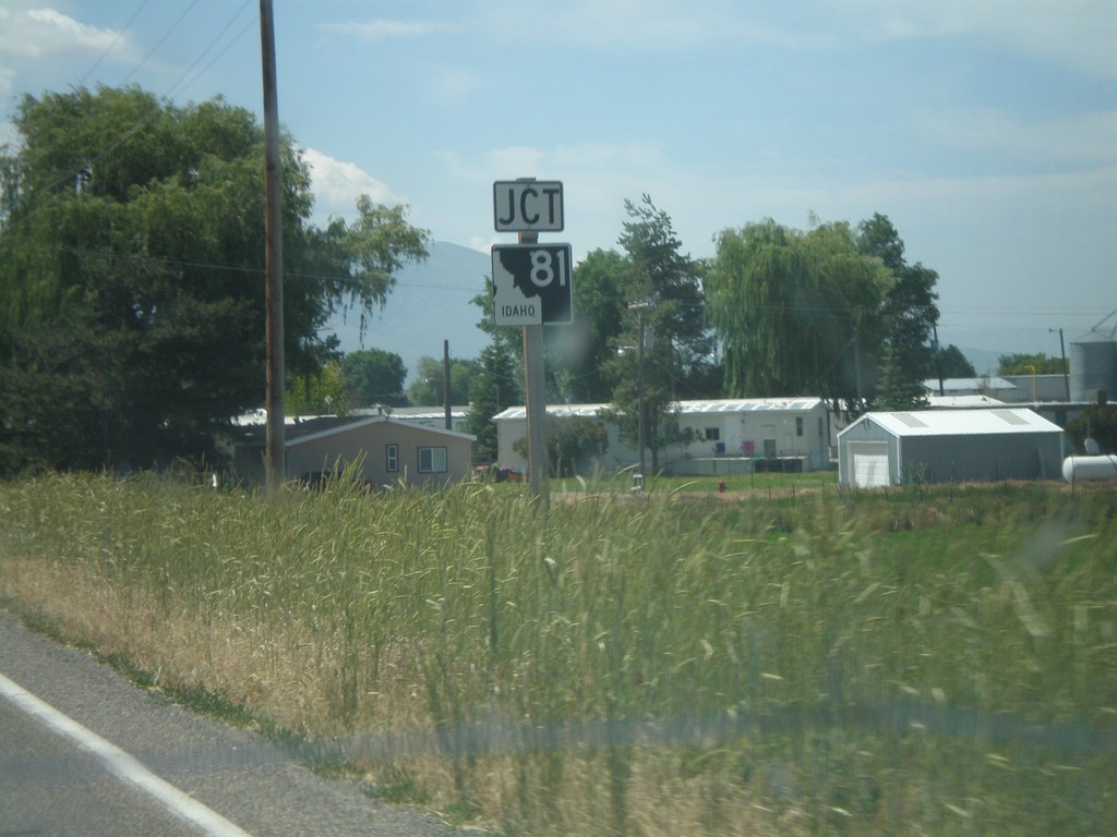
ID-77 South Approaching ID-81
ID-77 south approaching ID-81 in Declo.
Taken 07-05-2011
Declo
Cassia County
Idaho
United States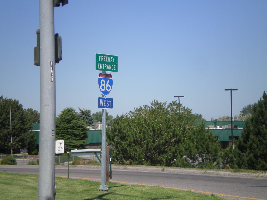
I-86 West - Freeway Entrance
I-86 west onramp at Exit 61. The Freeway Entrance type sign assembly is not common in Idaho.
Taken 07-05-2011

 Chubbuck
Bannock County
Idaho
United States
Chubbuck
Bannock County
Idaho
United States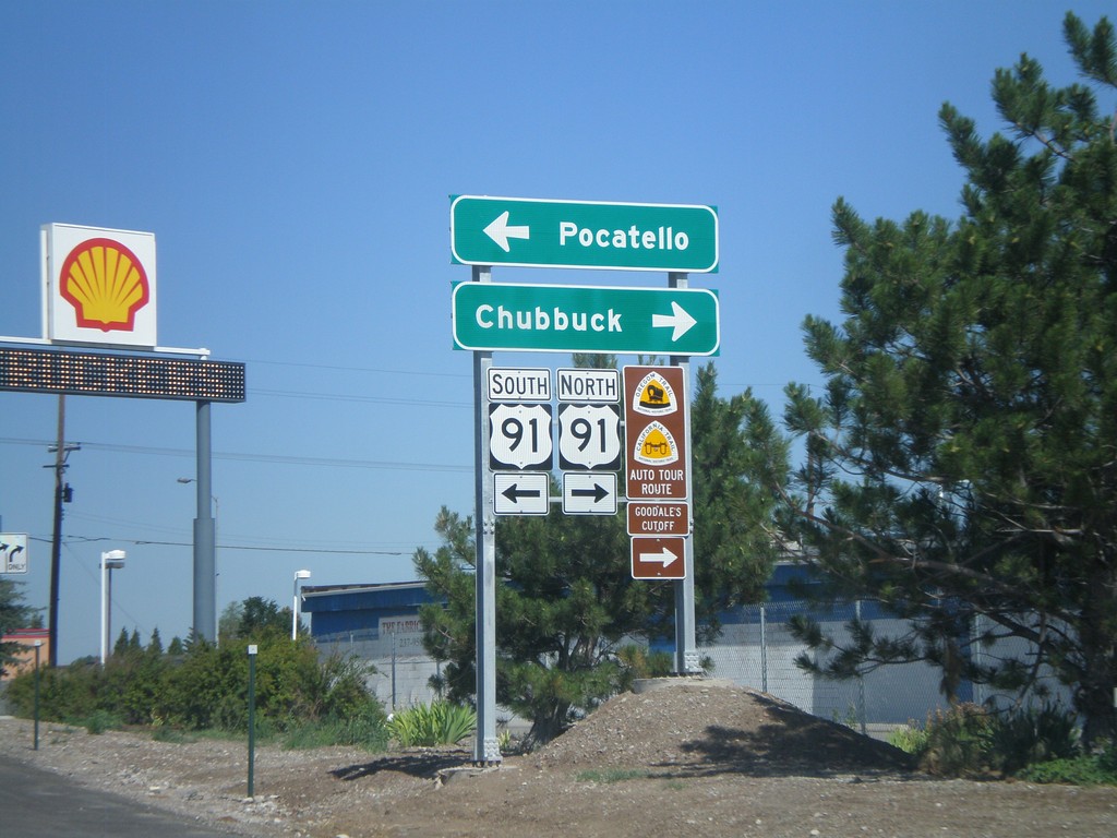
I-86 West - Exit 61 Offramp at US-91
I-86 west at Exit 61 offramp, US-91 jct. Use US-91 north for Chubbuck. Use US-91 south for Pocatello. US-91 north is part of the Oregon/California Trail - Goodale Cutoff.
Taken 07-05-2011
Pocatello
Bannock County
Idaho
United States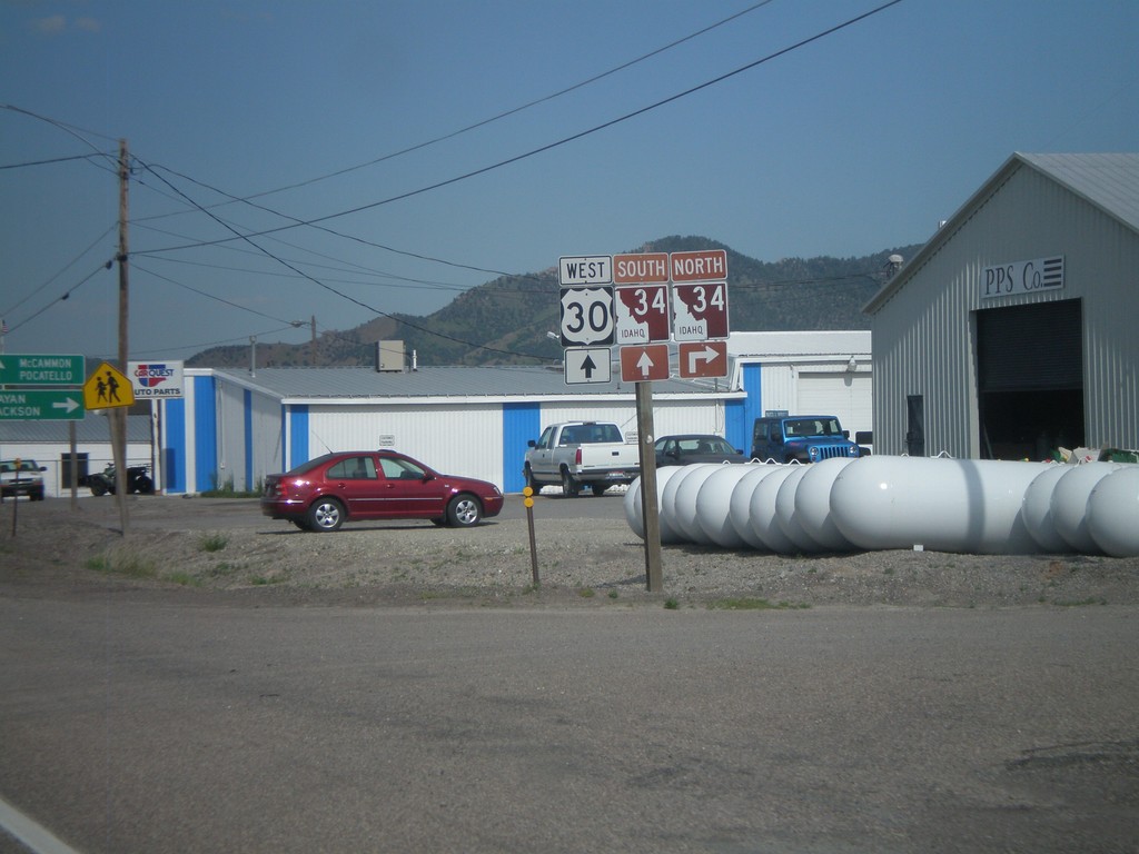
US-30 West at ID-34
US-30 west at ID-34 in Soda Springs. Turn right on ID-34 north for Afton and Jackson (both in Wyoming). ID-34 joins US-30 west through Soda Springs. Continue west on US-30/ID-34 for McCammon and Pocatello. ID-34 is part of the Pioneer Historic Byway, which is why the shield is a brown color.
Taken 07-05-2011
 Soda Springs
Caribou County
Idaho
United States
Soda Springs
Caribou County
Idaho
United States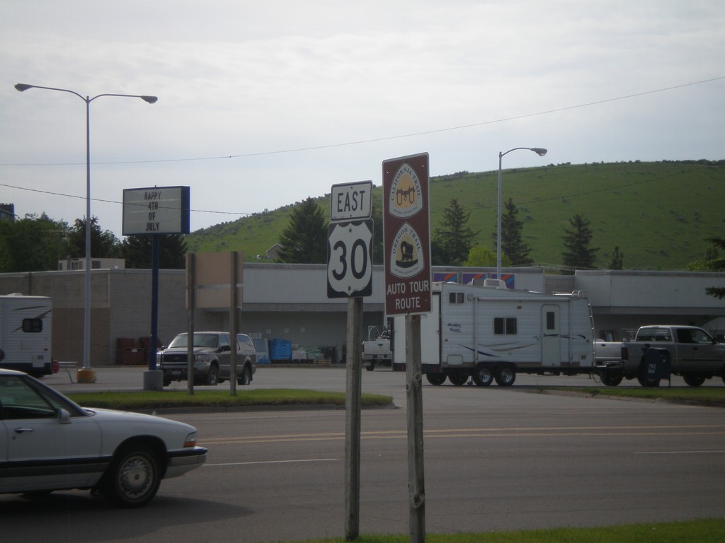
US-30 East - Oregon Trail/California Trail
US-30 east in Montpelier, with California and Oregon Trail Auto Tour Route signs.
Taken 07-05-2011
Montpelier
Bear Lake County
Idaho
United States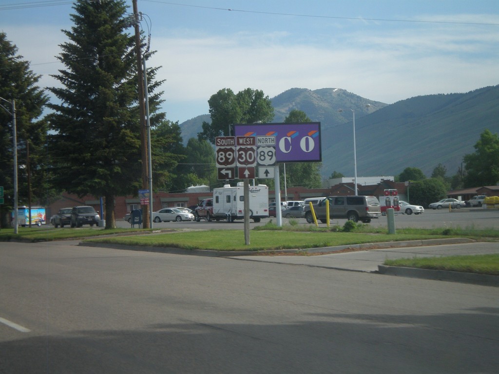
US-30 West at US-89
US-30 west at US-89 in Montpelier. US-89 joins US-30 through Montpelier. The Oregon Trail-Bear Lake Scenic Byway joins US-30 here, from US-89 south. That is why the US-89 south and US-30 west shields are brown.
Taken 07-05-2011
 Montpelier
Bear Lake County
Idaho
United States
Montpelier
Bear Lake County
Idaho
United States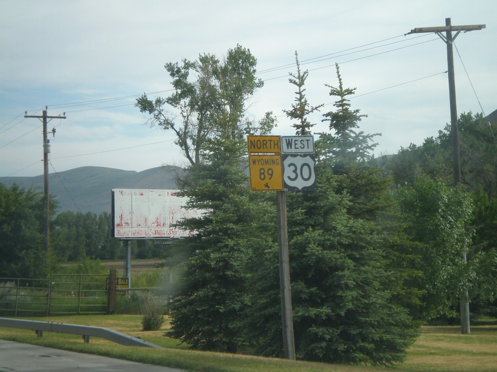
US-30 West/WY-89 North - Cokeville
US-30 West/WY-89 North in Cokeville.
Taken 07-05-2011
 Cokeville
Lincoln County
Wyoming
United States
Cokeville
Lincoln County
Wyoming
United States