Signs Tagged With Shield
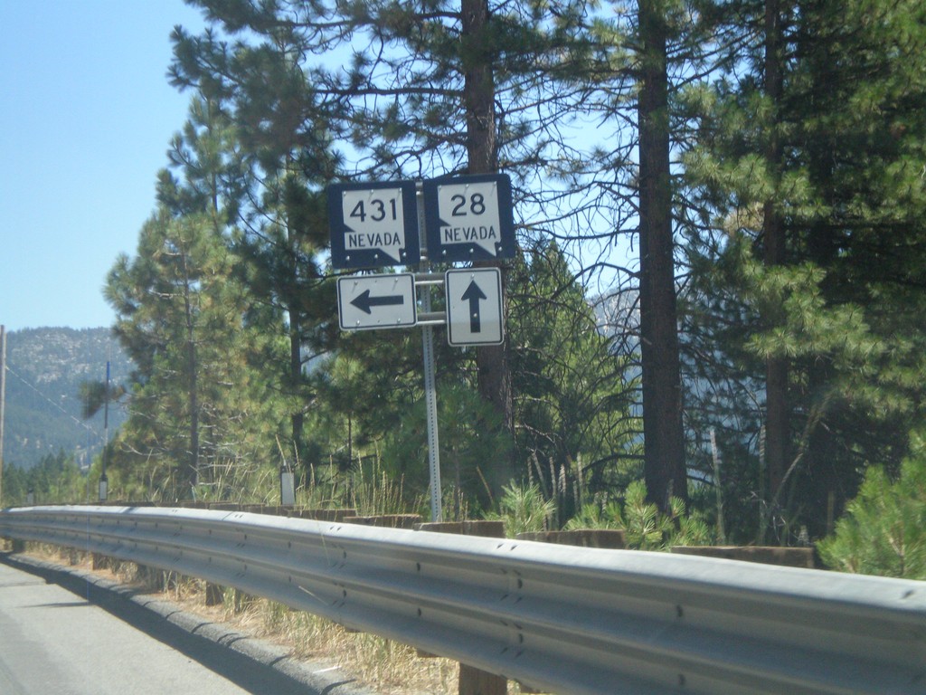
NV-28 East at NV-431
NV-28 east at NV-431 in Incline Village.
Taken 07-28-2012

 Incline Village
Washoe County
Nevada
United States
Incline Village
Washoe County
Nevada
United States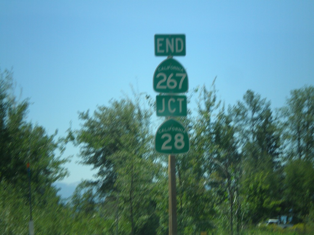
End CA-267 South at CA-28
End CA-267 south at CA-28 in Kings Beach.
Taken 07-28-2012

 Kings Beach
Placer County
California
United States
Kings Beach
Placer County
California
United States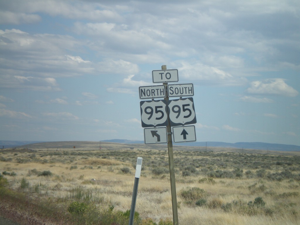
End OR-78 East at US-95
End OR-78 east at US-95. Continue straight for US-95 south; merge left for US-95 north.
Taken 05-28-2012

 Jordan Valley
Malheur County
Oregon
United States
Jordan Valley
Malheur County
Oregon
United States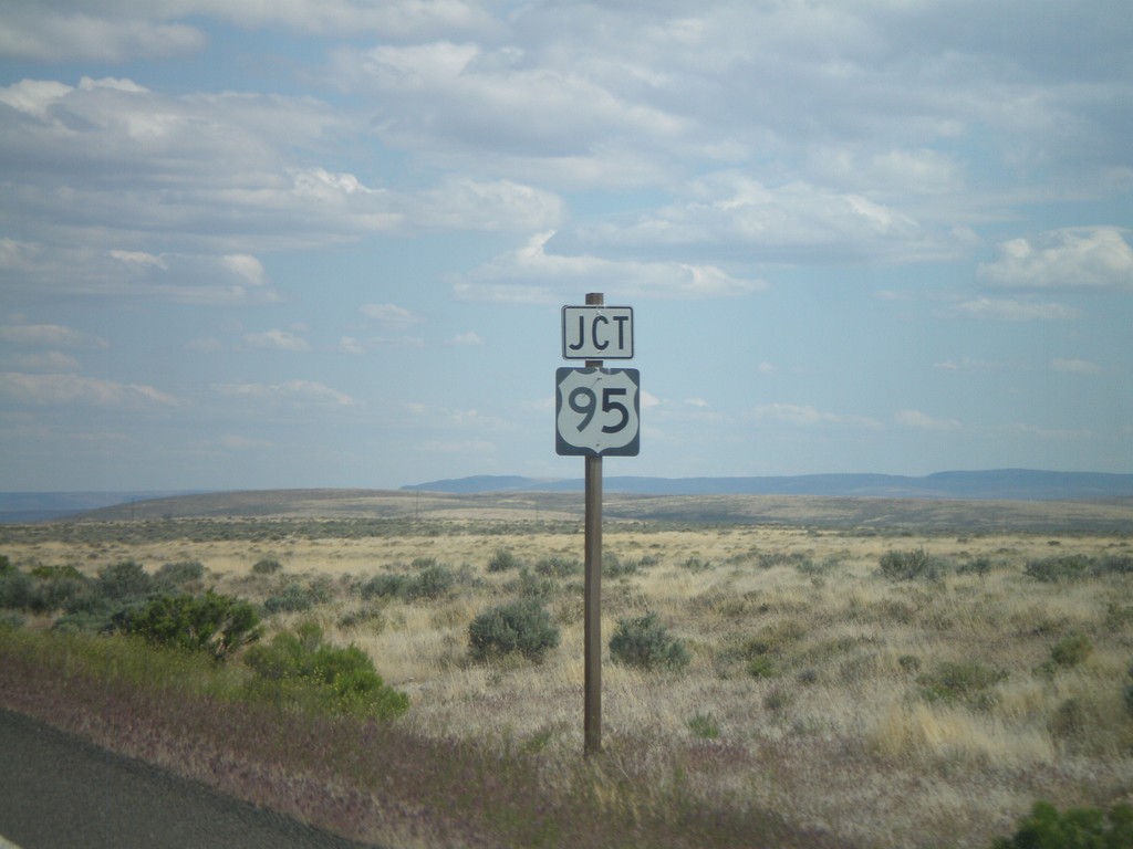
OR-78 East Approaching US-95
OR-78 East approaching US-95. This is the eastern end of OR-78.
Taken 05-28-2012
Jordan Valley
Malheur County
Oregon
United States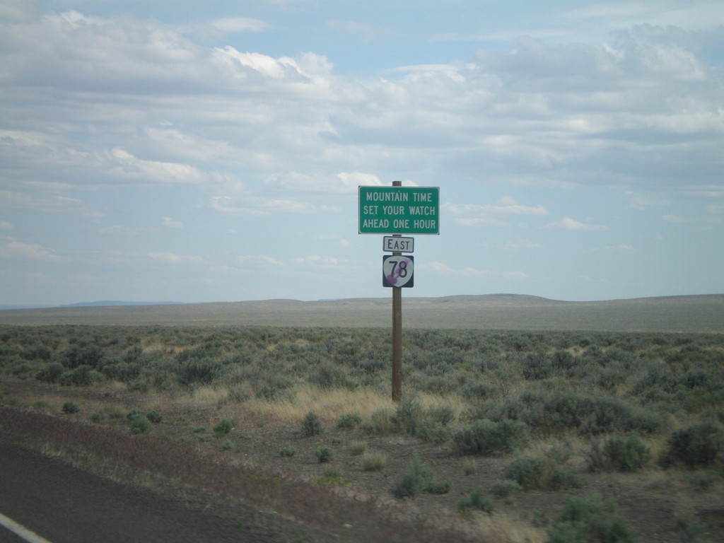
OR-78 East - Mountain Time Zone
Entering Mountain Time Zone on OR-78 east.
Taken 05-28-2012
Jordan Valley
Malheur County
Oregon
United States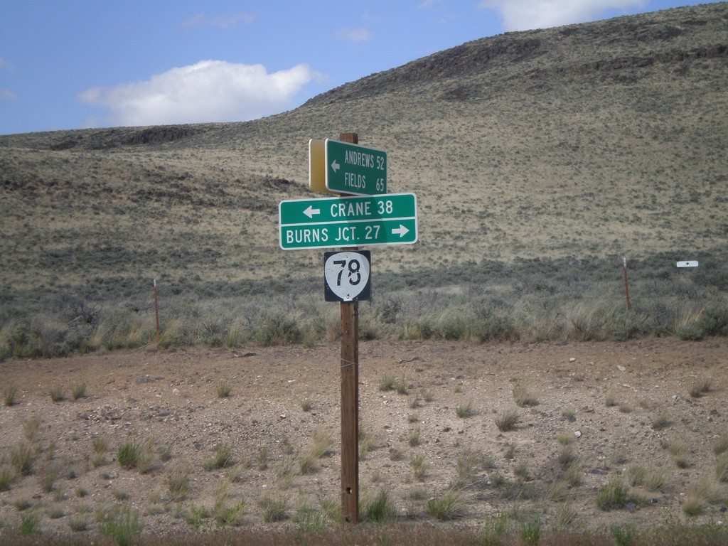
End Eastside Steens Mountain Road at OR-78
End Eastside Steens Mountain Road at OR-78. Turn right on OR-78 for Burns Junction; turn left on OR-78 for Crane. The eastside Steens Mountain road follows the east side of Steens Mountain south to Andrews, Fields, and eventually into Denio, Nevada.
Taken 05-28-2012
Jordan Valley
Malheur County
Oregon
United States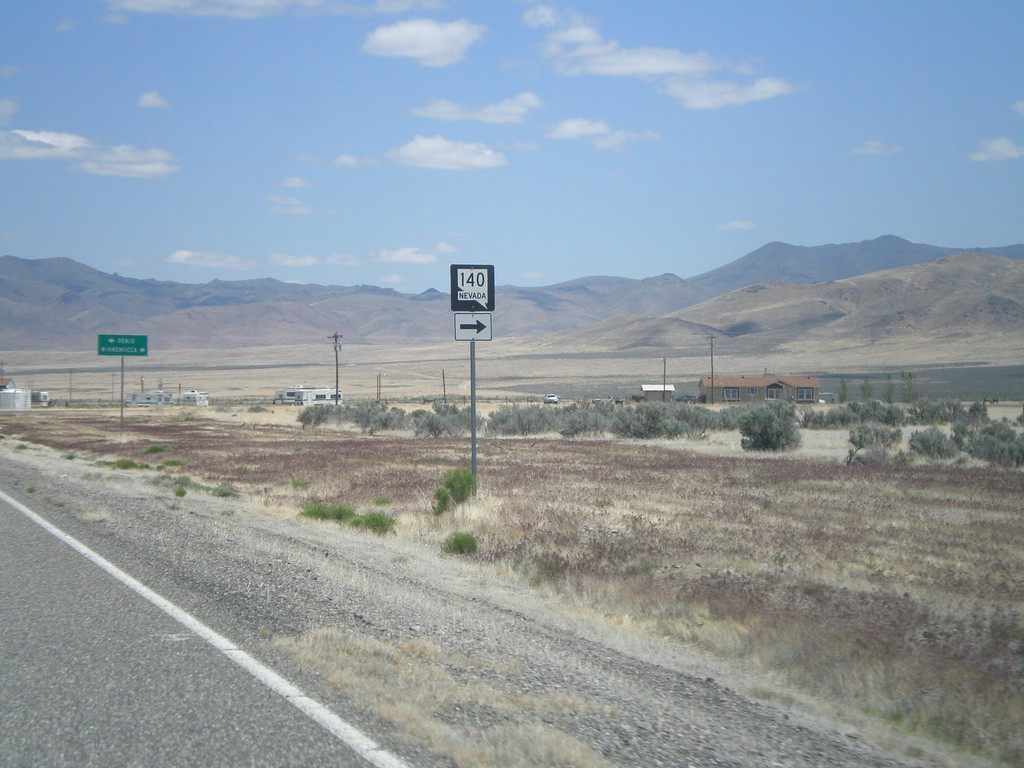
NV-140 East at NV-292 - Denio Junction
NV-140 east at NV-292. Turn right to continue east on NV-140.
Taken 05-28-2012

 Denio
Humboldt County
Nevada
United States
Denio
Humboldt County
Nevada
United States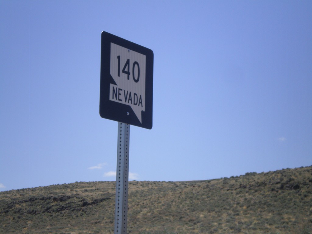
NV-140 East - Humboldt County
NV-140 east in Humboldt County. This is the first shield on NV-140 east in Nevada.
Taken 05-28-2012
Humboldt County
Nevada
United States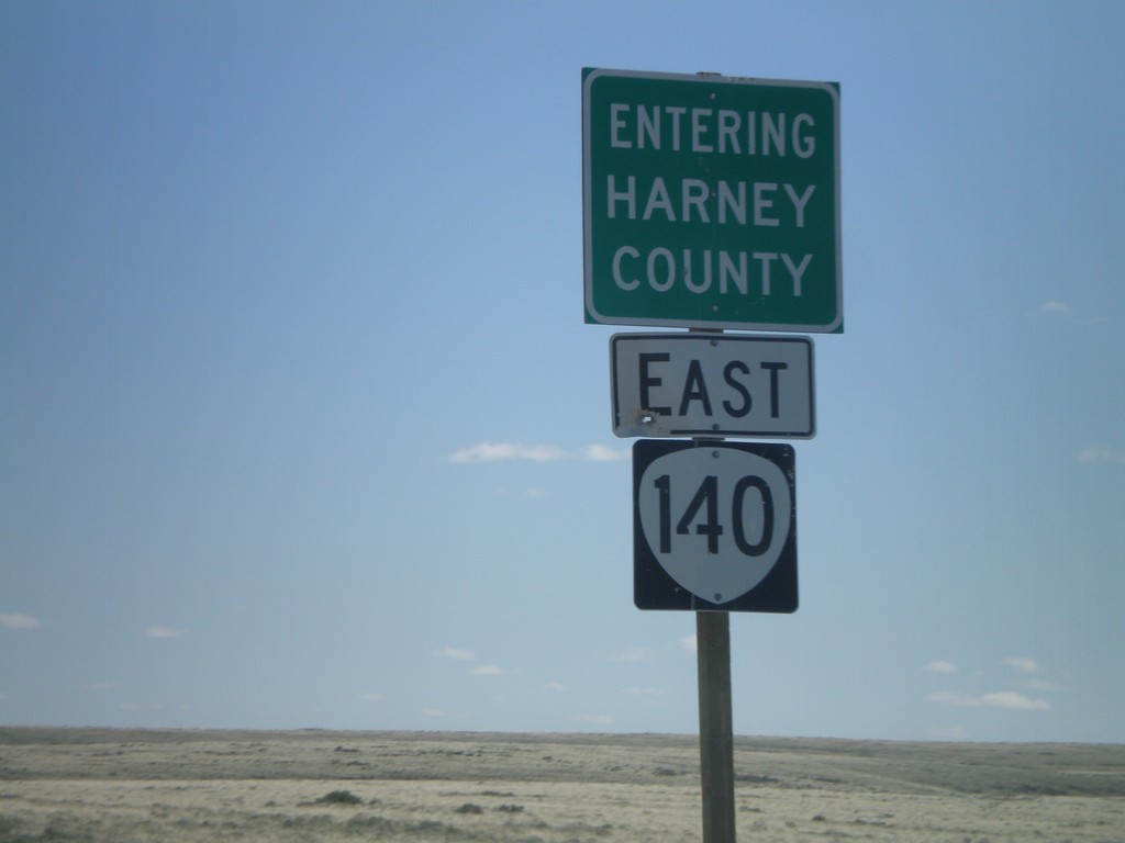
OR-140 East - Entering Harney County
Entering Harney County on OR-140 east. Taken at the Harney-Lake County Line. OR-140 briefly enters Harney County before leaving Oregon.
Taken 05-28-2012
 Lake County
Oregon
United States
Lake County
Oregon
United States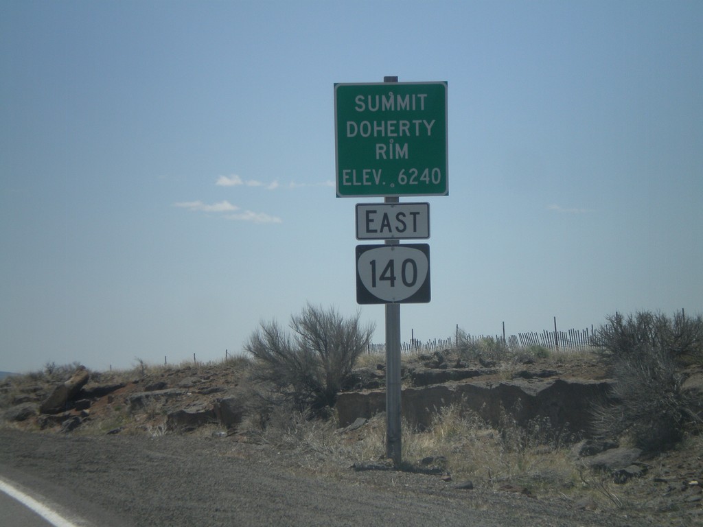
OR-140 East - Summit - Doherty Rim
Doherty Rim Summit, Elevation 6,240 Feet on OR-140 east in rural Lake County.
Taken 05-28-2012
Adel
Lake County
Oregon
United States