Signs Tagged With Shield
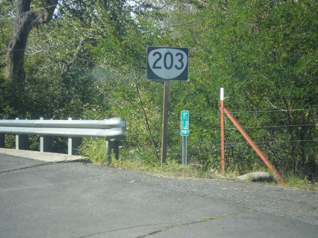
OR-203 Shield in Union
OR-203 Shield in Union crossing Catherine Creek.
Taken 09-13-2015
 Union
Union County
Oregon
United States
Union
Union County
Oregon
United States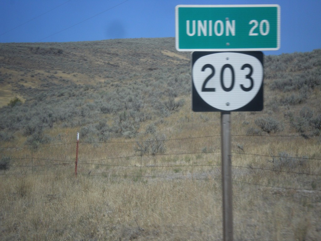
OR-203 North - Distance Marker
Distance marker on OR-203 north. Distance to Union.
Taken 09-13-2015
Medical Springs
Union County
Oregon
United States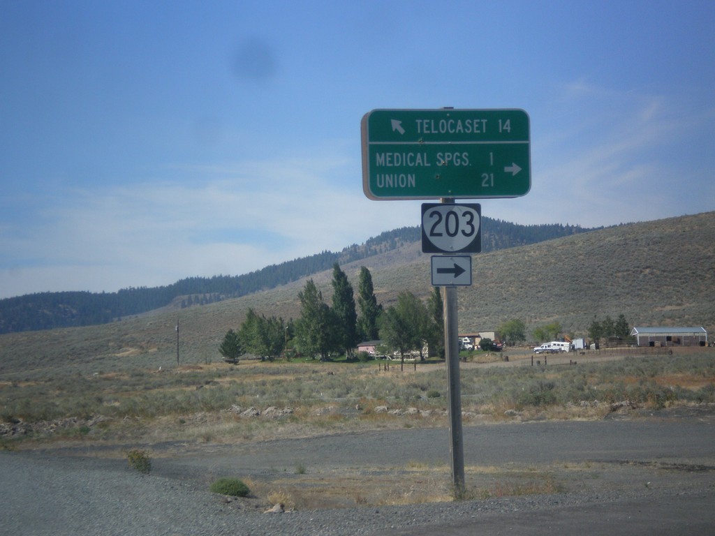
OR-203 North - Telocaset Lane
OR-203 North at Telocaset Lane to Telocaset. Turn right to continue north on OR-203 to Medical Springs and Union.
Taken 09-13-2015
Baker City
Union County
Oregon
United States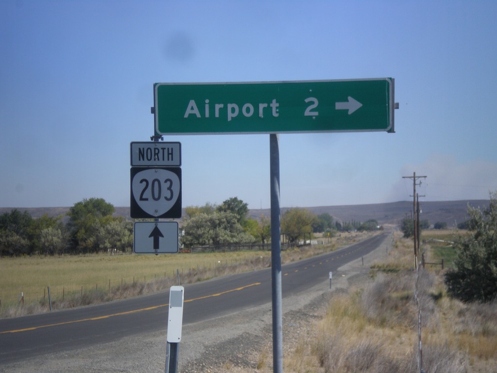
OR-203 North - Airport Road
OR-203 north at Airport Road jct.
Taken 09-13-2015
Baker City
Baker County
Oregon
United States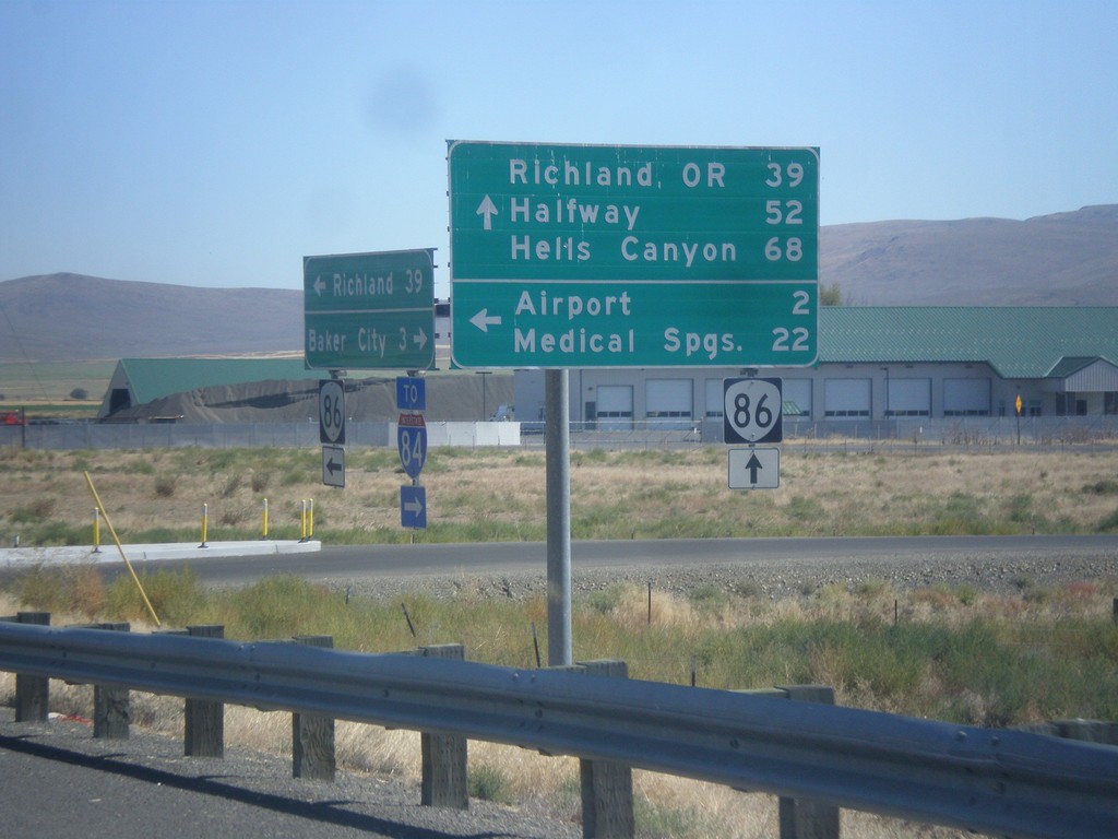
OR-86 East at West Airport Road (Medical Springs Highway)
OR-86 east West Airport Road (Medical Springs Highway) to the (Baker City) Airport and Medical Springs (via OR-203). Continue east on OR-86 for Richland, OR, Halfway and Hells Canyon. West Airport Road is a Frontage Road that extends south from the junction of OR-203 to OR-86. It is part of the Oregon State Highway system as the Medical Springs Highway but is not signed with a number.
Taken 09-13-2015
 Baker City
Baker County
Oregon
United States
Baker City
Baker County
Oregon
United States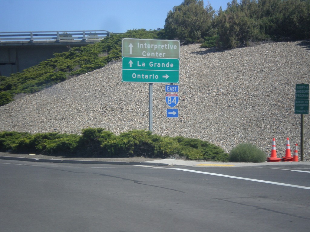
End OR-7 East at I-84 East
End OR-7 East at I-84 East. Turn right for I-84 east to Ontario; straight for I-84 west to La Grande and (Oregon Trail) Interpretive Center.
Taken 09-13-2015

 Baker City
Baker County
Oregon
United States
Baker City
Baker County
Oregon
United States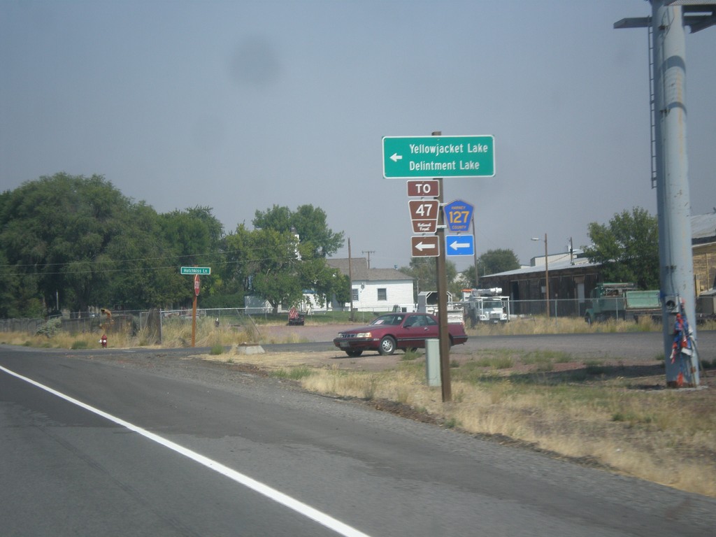
US-20 East/US-395 North - Hines Logging Road
US-20 East/US-395 North -at CR-127 Jct (Hines Logging Road). Use CR-127 for FR-47, Yellowjacket Lake, and Delintment Lake in the Malheur National Forest.
Taken 08-23-2015

 Hines
Harney County
Oregon
United States
Hines
Harney County
Oregon
United States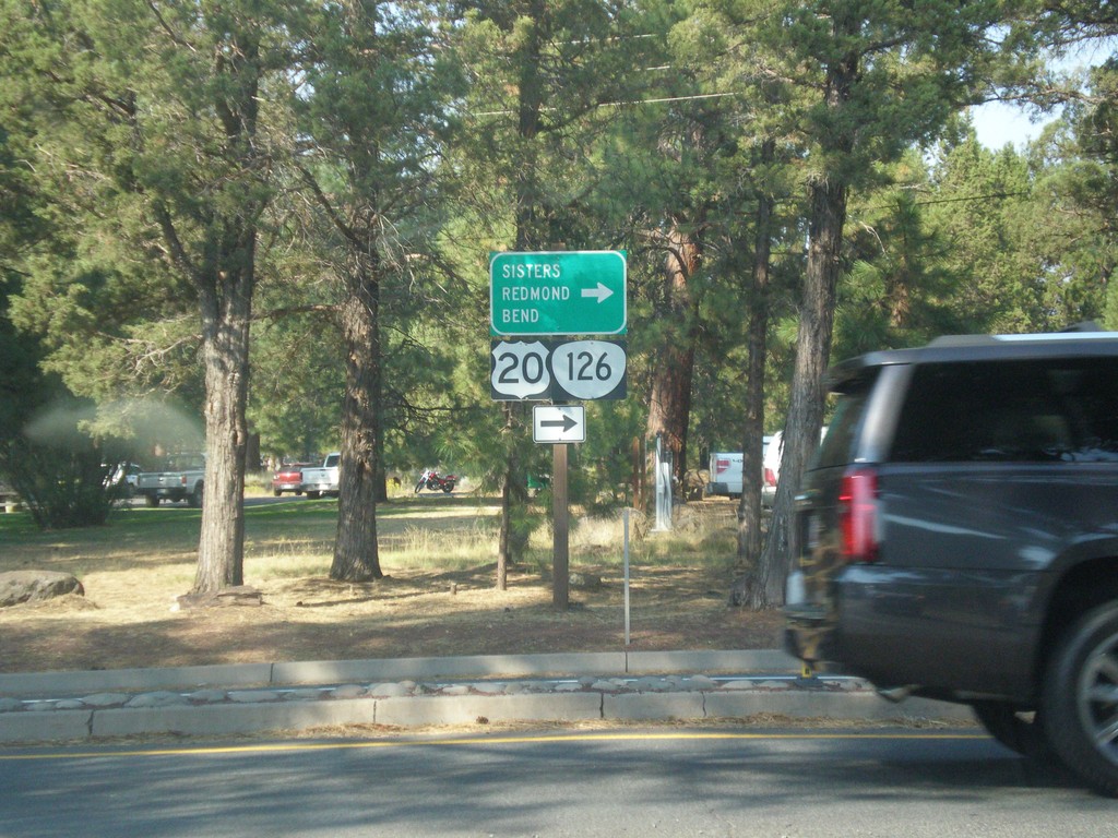
End OR-242 East at US-20/OR-126
End OR-242 East at US-20/OR-126. Use US-20/OR-126 East for Sisters, Bend, and Redmond.
Taken 08-22-2015

 Sisters
Deschutes County
Oregon
United States
Sisters
Deschutes County
Oregon
United States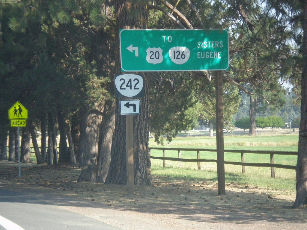
OR-242 East at Hood St. (To US-20/OR-126)
OR-242 East at Hood St. (To US-20/OR-126). Turn left to connect with US-20/OR-126 for Eugene and Sisters. Traffic can also continue east on current street for US-20/OR-126 East.
Taken 08-22-2015
Sisters
Deschutes County
Oregon
United States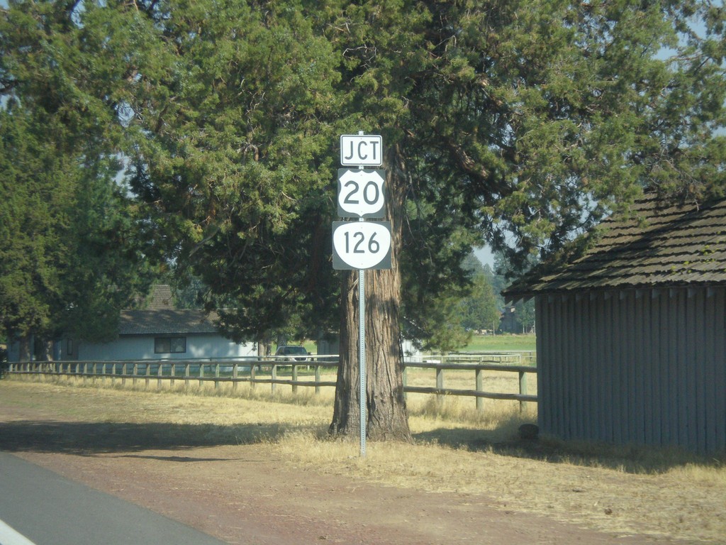
OR-242 East Approaching US-20/OR-126
OR-242 East approaching US-20/OR-126 in Sisters.
Taken 08-22-2015
Sisters
Deschutes County
Oregon
United States