Signs Tagged With Shield
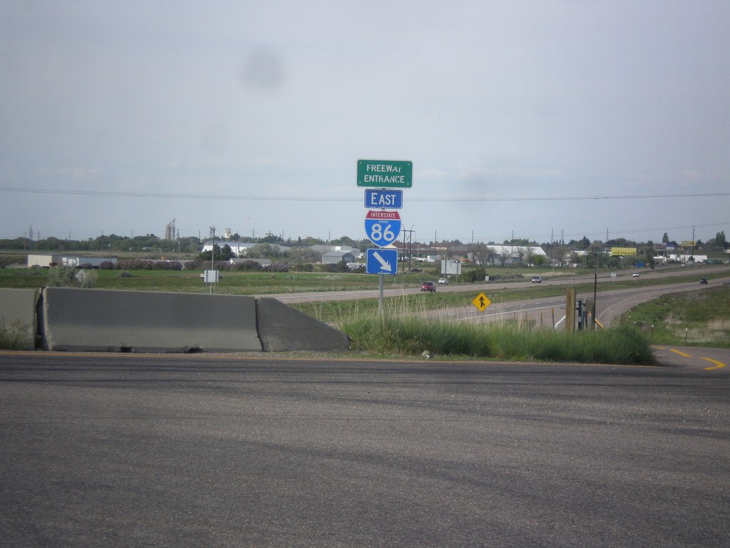
I-86 East - Freeway Entrance
Freeway Entrance on I-86 east. This style sign assembly for freeway entrances is not very common in Idaho. Also, note that the I-86 shield has the text IDAHO in it, which is also pretty rare. Most of the interstate shields that have the text IDAHO in them are older. This sign appears to be newer.
Taken 05-13-2016


 American Falls
Power County
Idaho
United States
American Falls
Power County
Idaho
United States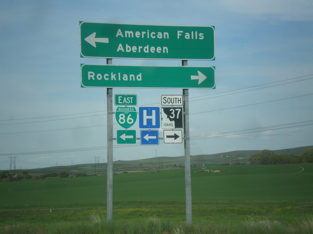
I-86 Exit 36 Offramp at BL-86/ID-37
I-86 Exit 36 offramp at BL-86/ID-37. Turn right on ID-37 south for Rockland. Turn left for BL-86 East to American Falls and Aberdeen (via ID-39). This is the west end of the American Falls business loop.
Taken 05-13-2016
American Falls
Power County
Idaho
United States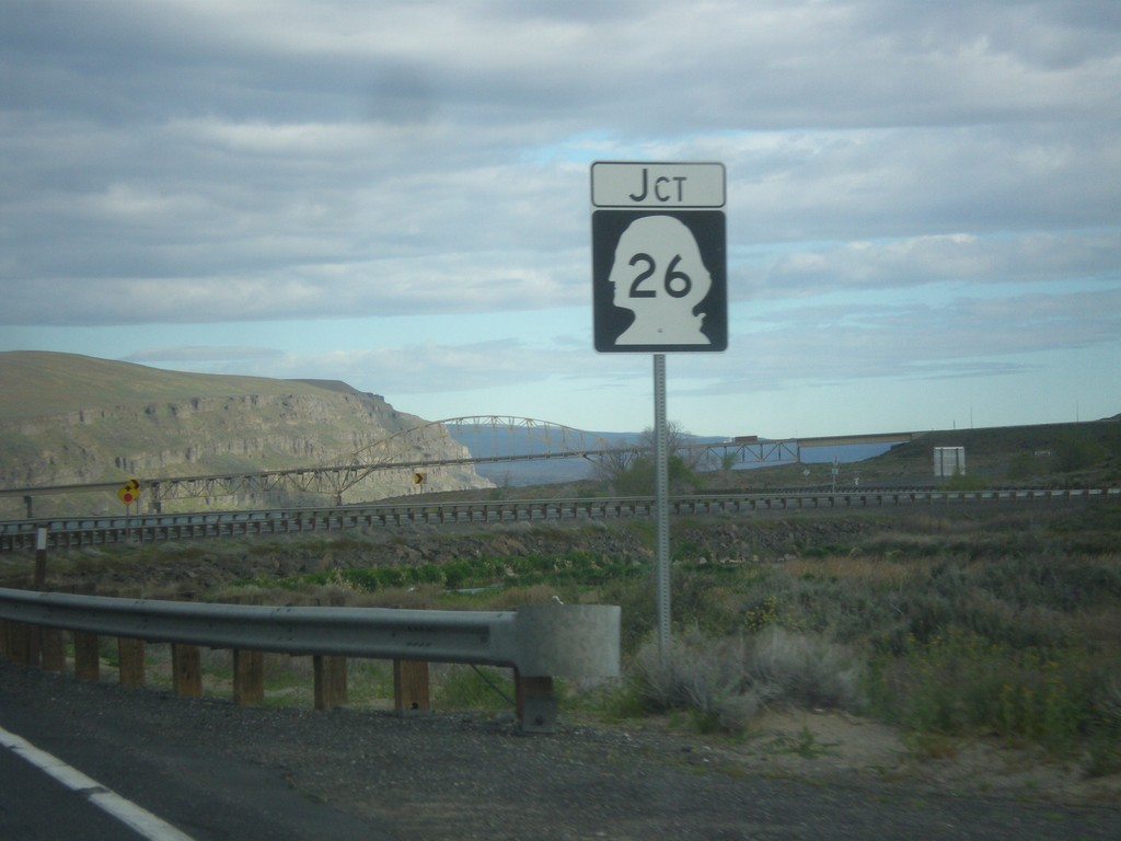
WA-243 North Approaching WA-26
WA-243 North approaching WA-26 in Grant County.
Taken 04-28-2016

 Royal City
Grant County
Washington
United States
Royal City
Grant County
Washington
United States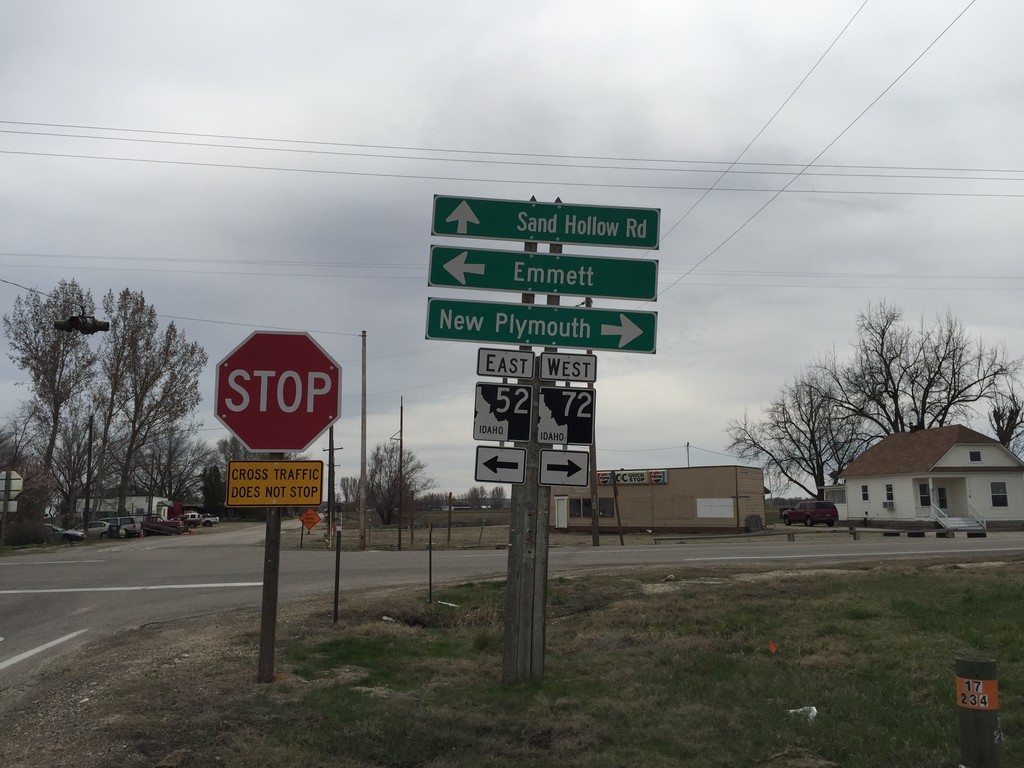
ID-52 East at ID-72
ID-52 east at ID-72 junction. Turn left to continue on ID-52 east to Emmett. Turn right for ID-72 west to New Plymouth. Sand Hollow Road (old US-30) continues south.
Taken 03-20-2016

 New Plymouth
Payette County
Idaho
United States
New Plymouth
Payette County
Idaho
United States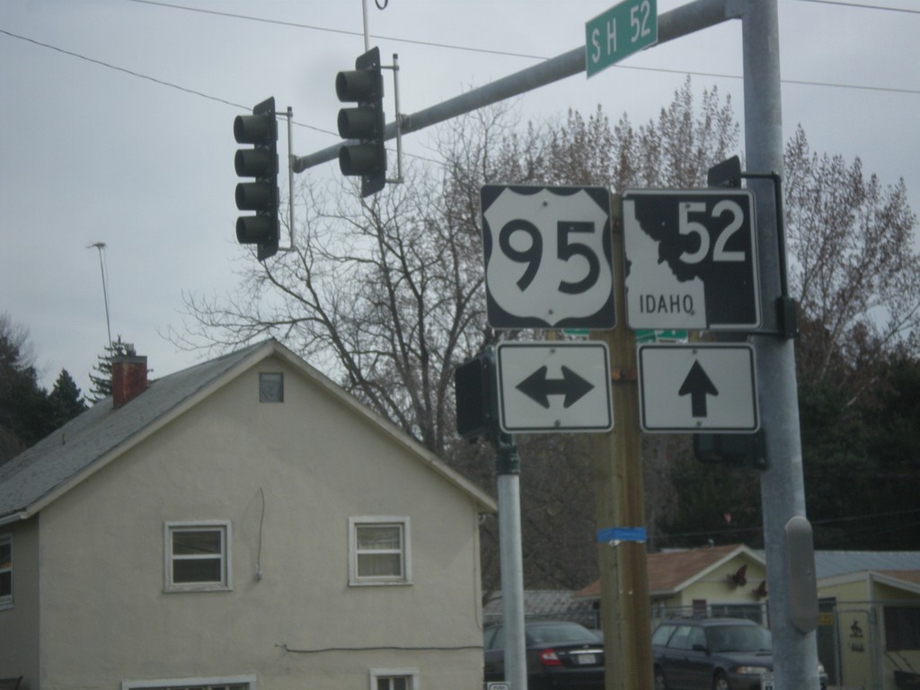
ID-52 East at US-95
ID-52 east at US-95 in Payette.
Taken 03-20-2016
 Payette
 County
Idaho
United States
Payette
Payette County
Idaho
United States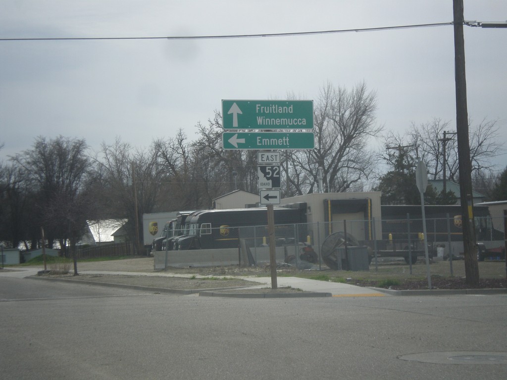
ID-52 East - Payette
ID-52 east (South 7th St.) at 2nd Ave. South. Turn left to continue east on ID-52 for Emmett. Continue south on South 7th St. for US-95 south to Fruitland and Winnemucca (Nevada).
Taken 03-20-2016
Payette
Payette County
Idaho
United States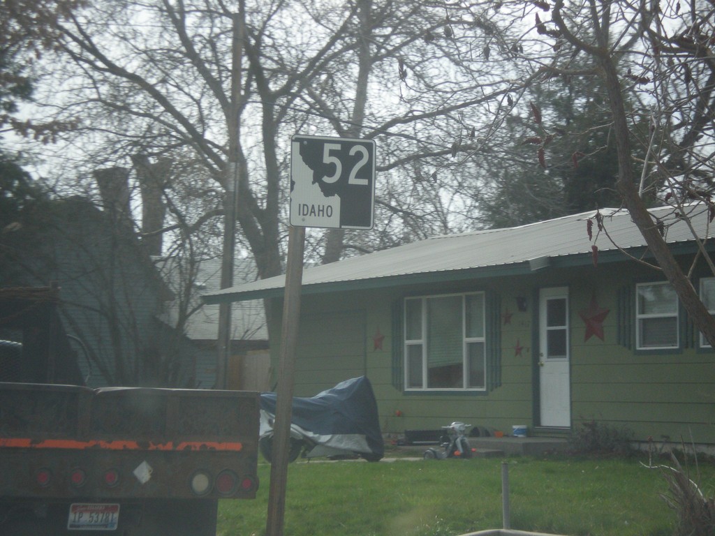
ID-52 East - Payette
ID-52 east in Payette. This is the first ID-52 shield eastbound on ID-52.
Taken 03-20-2016
Payette
Payette County
Idaho
United States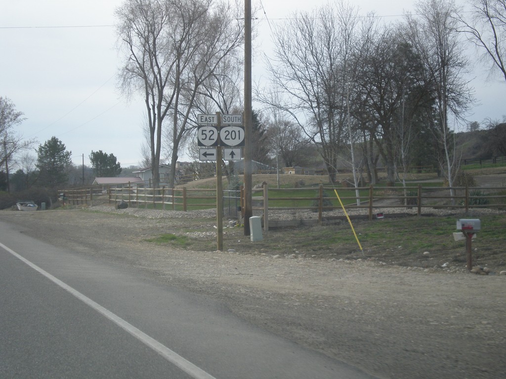
OR-201 South at OR-52
OR-201 south at OR-52 in Malheur County.
Taken 03-20-2016

 Ontario
Malheur County
Oregon
United States
Ontario
Malheur County
Oregon
United States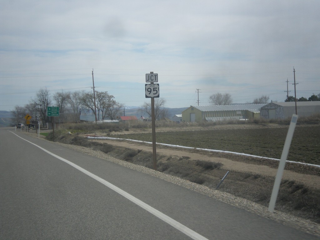
OR-201 South at US-95 Spur
OR-201 south approaching US-95 Spur, north.
Taken 03-20-2016
 Ontario
Malheur County
Oregon
United States
Ontario
Malheur County
Oregon
United States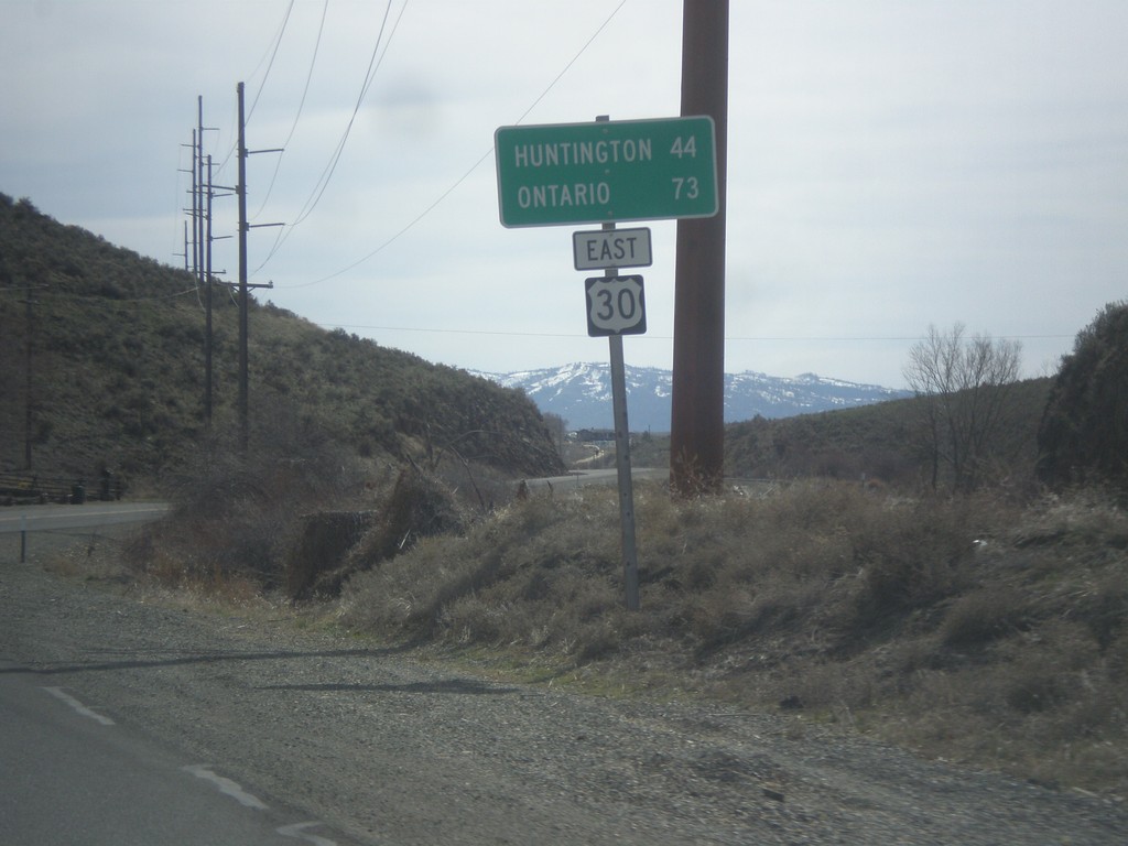
US-30 East - Distance Marker
Distance marker on US-30 east. Distance to Huntington and Ontario.
Taken 03-20-2016
Baker City
Baker County
Oregon
United States