Signs Tagged With Shield
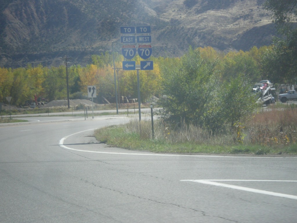
CO-13 South at US-6
CO-13 South at US-6 in Rifle. Turn right for US-6 west and for access to I-70 westbound; turn left for US-6 east and CO-13 south and access to I-70 eastbound.
Taken 10-07-2016


 Rifle
Garfield County
Colorado
United States
Rifle
Garfield County
Colorado
United States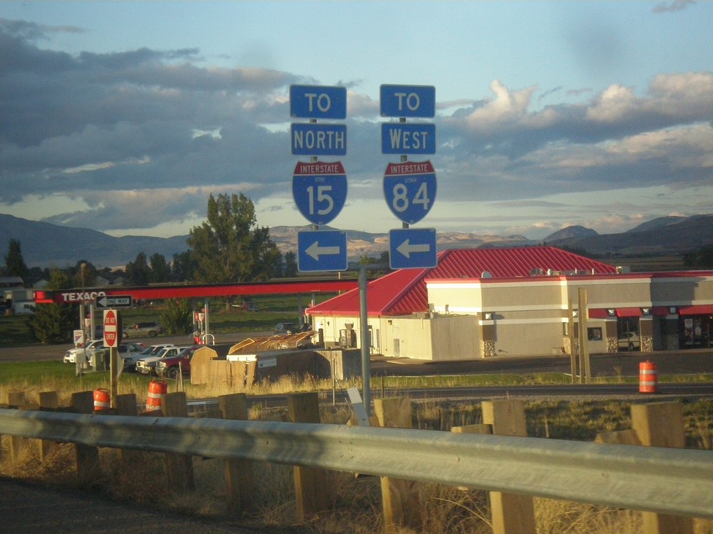
UT-13 North at I-15 North/I-84 West - Exit 376
UT-13 North at I-15 North/I-84 West (Exit 376) onramp. Interstate shields with the UTAH text are becoming more common in Utah. It appears that all new interstate shields contain the UTAH text - at least in the Salt Lake area.
Taken 10-06-2016


 Elwood
Box Elder County
Utah
United States
Elwood
Box Elder County
Utah
United States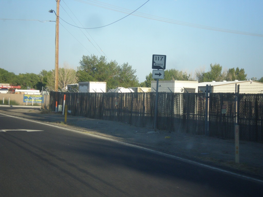
US-50 East At NV-117
US-50 east at NV-117 east in Churchill County.
Taken 08-15-2016

 Fallon
Churchill County
Nevada
United States
Fallon
Churchill County
Nevada
United States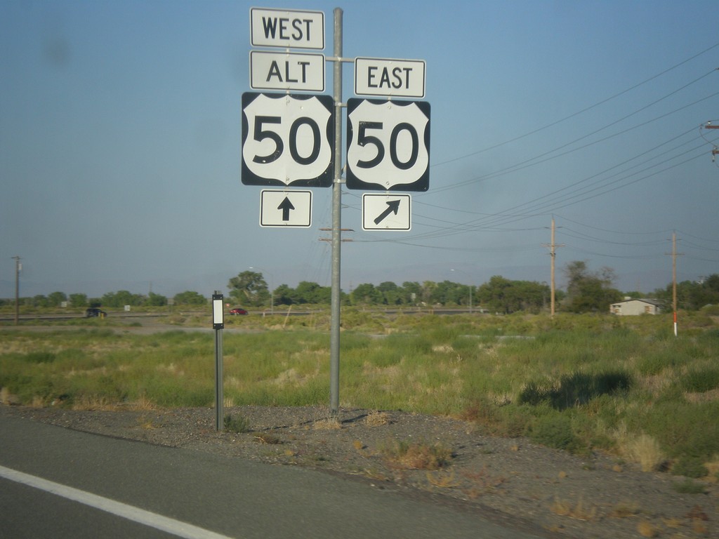
US-50 East approaching Alt. US-50 West
Approaching US-50/US-50 ALT Junction on US-50 East
Taken 08-15-2016
 Fernley
Lyon County
Nevada
United States
Fernley
Lyon County
Nevada
United States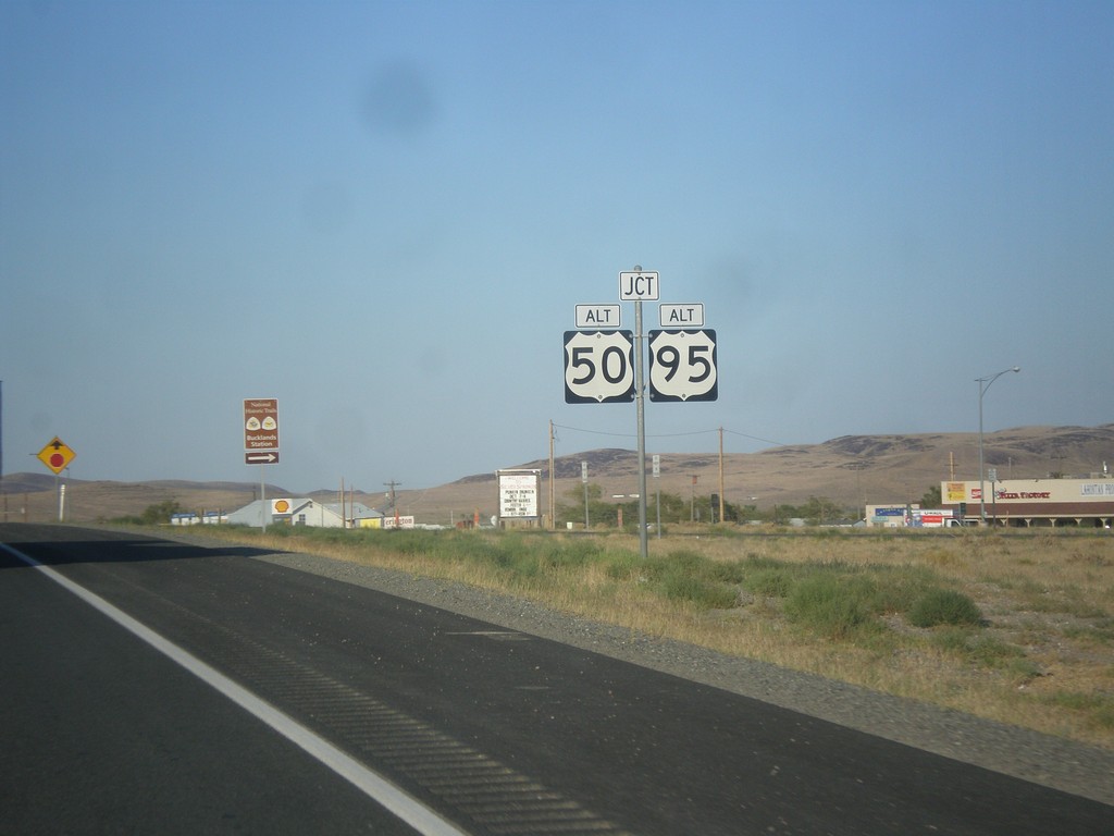
US-50 East Approaching Alt. US-95 and Alt. US-50
US-50 East approaching Alt. US-95 and Alt. US-50 in Silver Springs.
Taken 08-15-2016
 Silver Springs
Lyon County
Nevada
United States
Silver Springs
Lyon County
Nevada
United States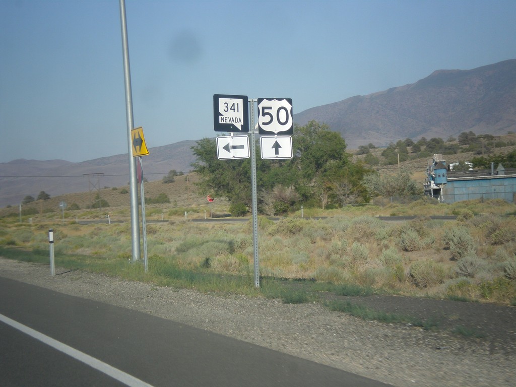
US-50 East at NV-341
US-50 East at NV-341 North in Lyon County.
Taken 08-15-2016
 Mound House
Lyon County
Nevada
United States
Mound House
Lyon County
Nevada
United States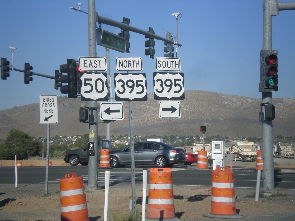
US-50 East at US-395
US-50 East at US-395 at the bottom of Spooner Summit in Carson City. US-50 joins US-395 north briefly through Carson City. Turn left for US-395 North/US-50 East; right for US-395 south. Construction is in progress on a new freeway that will terminate at this junction. US-50 east and US-395 north traffic would merge onto the freeway.
Taken 08-15-2016
 Carson City
Nevada
United States
Carson City
Nevada
United States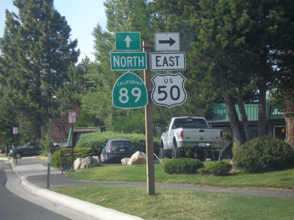
US-50 East/CA-89 North at US-50/CA-89 Split
US-50 East/CA-89 North at US-50/CA-89 Split in South Lake Tahoe. Turn right to continue east on US-50.
Taken 08-15-2016
 South Lake Tahoe
El Dorado County
California
United States
South Lake Tahoe
El Dorado County
California
United States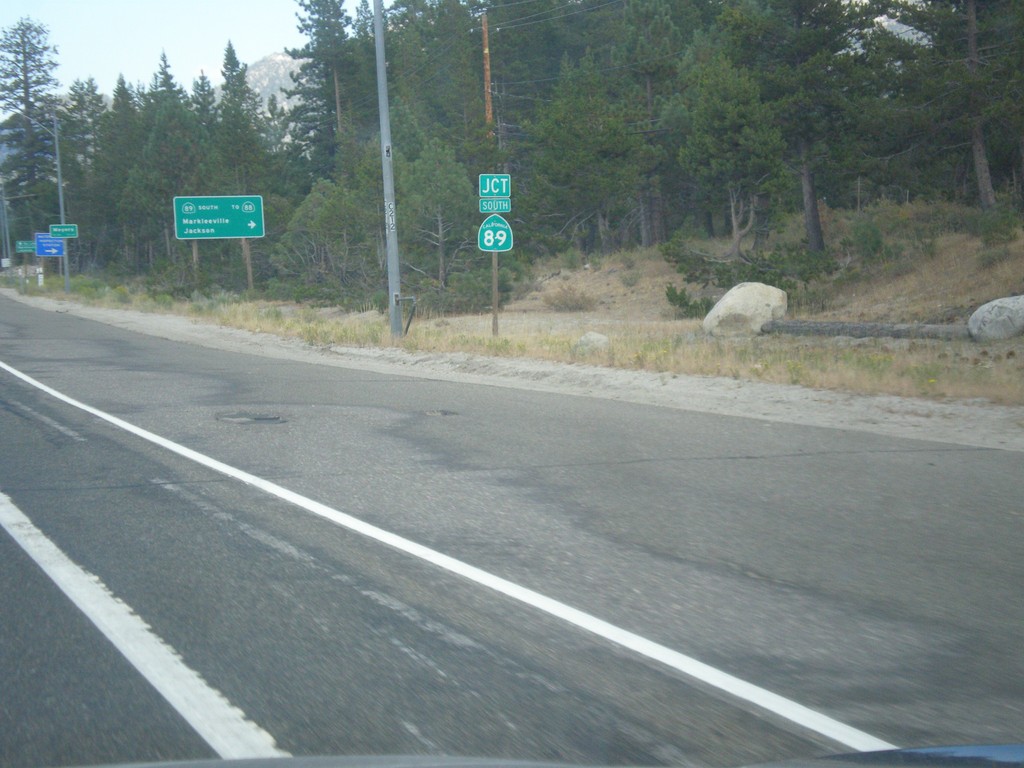
US-50 East at CA-89 Junction
US-50 East at CA-89 Junction in Meyers.
Taken 08-15-2016
South Lake Tahoe
El Dorado County
California
United States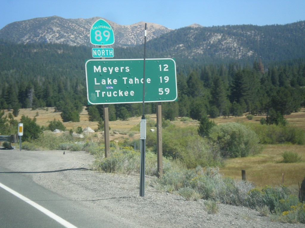
CA-89 North - Distance Marker
Distance marker on CA-89 north. Distance to Meyers, Lake Tahoe, and Truckee.
Taken 08-12-2016
Markleeville
Alpine County
California
United States