Signs Tagged With Overhead
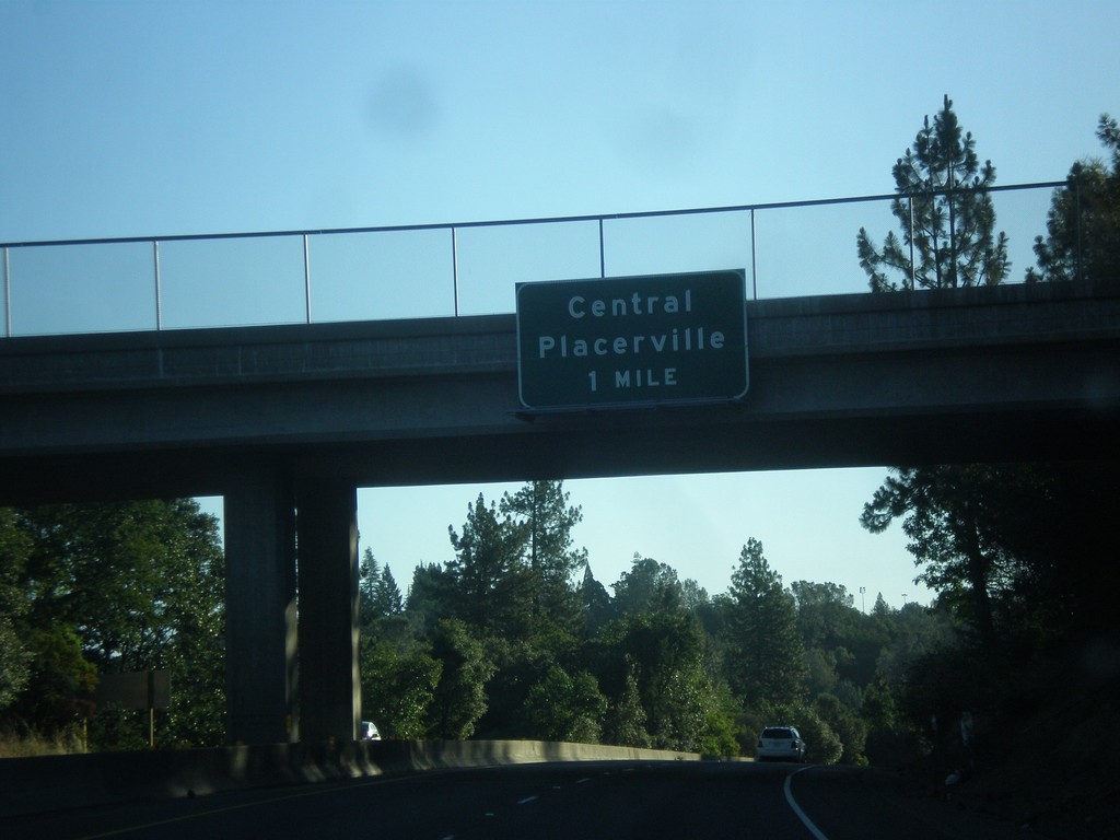
US-50 - Central Placerville
US-50 approaching Central Placerville. The US-50 freeway ends in central Placerville and becomes a city street for a few blocks through central Placerville.
Taken 06-15-2015
 Placerville
El Dorado County
California
United States
Placerville
El Dorado County
California
United States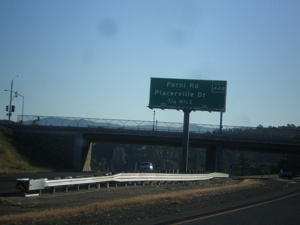
US-50 East - Exit 44B
US-50 east approaching Exit 44B - Forni Road/Placerville Drive.
Taken 06-15-2015
Perks Corner
El Dorado County
California
United States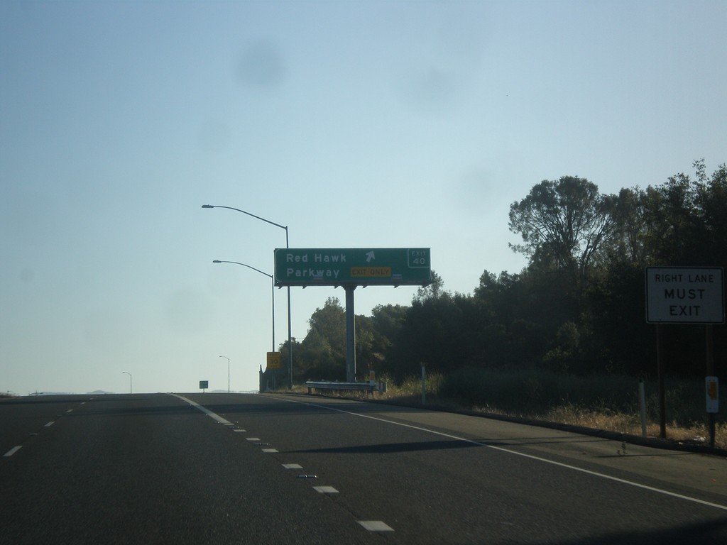
US-50 East - Exit 40
US-50 east at Exit 40 - Red Hawk Parkway.
Taken 06-15-2015
Shingle Springs
El Dorado County
California
United States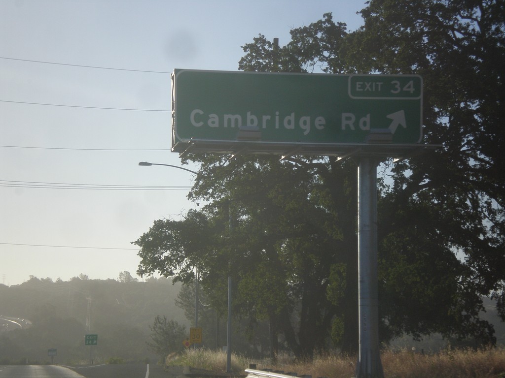
US-50 East - Exit 34
US-50 east at Exit 34 - Cambridge Road.
Taken 06-15-2015
Cameron Park
El Dorado County
California
United States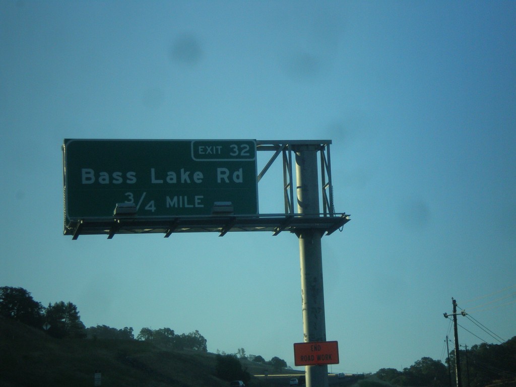
US-50 East - Exit 32
US-50 east approaching Exit 32 - Bass Lake Road.
Taken 06-15-2015
El Dorado Hills
El Dorado County
California
United States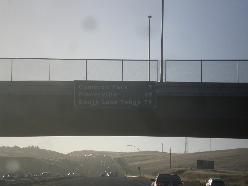
US-50 East - Distance Marker
Distance marker on US-50 east. Distance to Cameron Park, Placerville, and South Lake Tahoe.
Taken 06-15-2015
Folsom
Sacramento County
California
United States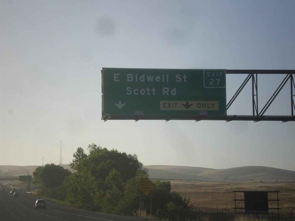
US-50 East - Exit 27
US-50 east at Exit 27 - E. Bidwell St./Scott Rd.
Taken 06-15-2015
Folsom
Sacramento County
California
United States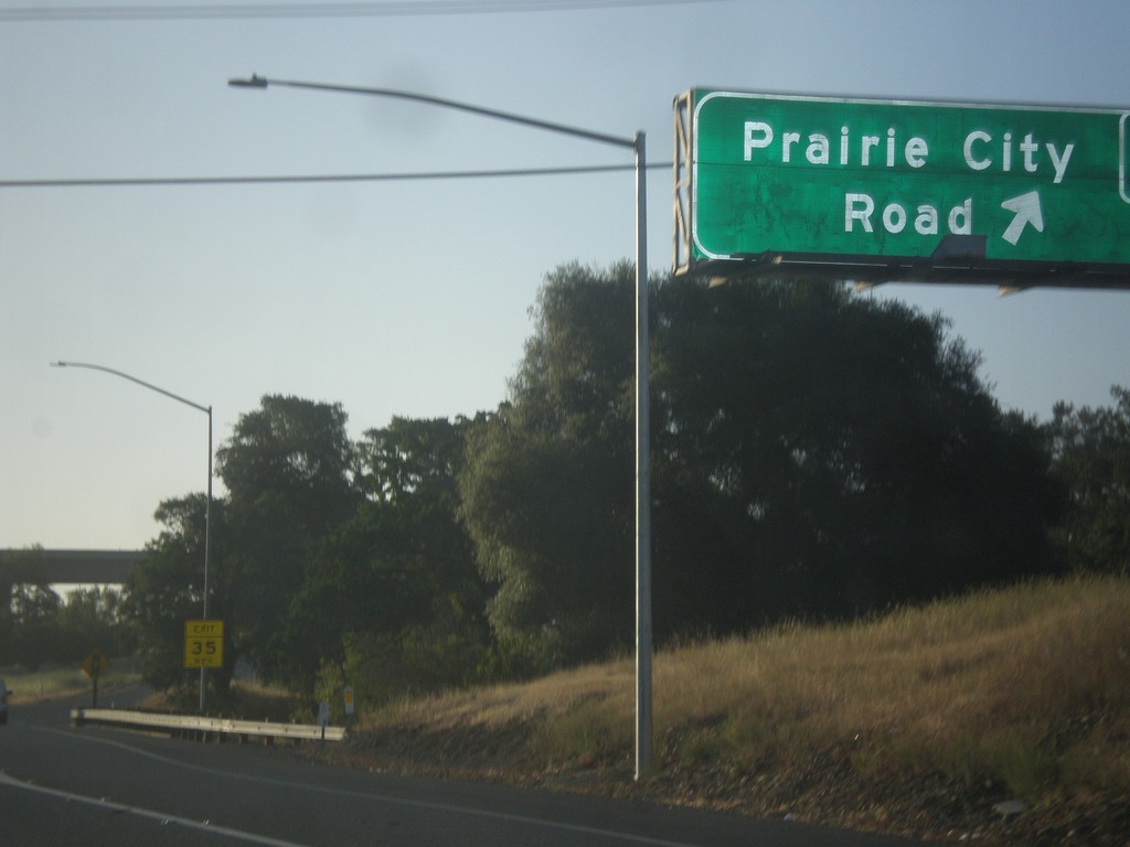
US-50 East - Exit 25
US-50 east at Exit 25 - Prairie City Road.
Taken 06-15-2015
Folsom
Sacramento County
California
United States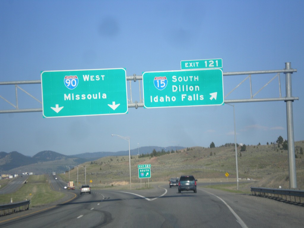
I-15 South/I-90 West - Exit 121
I-15 South/I-90 West at Exit 121 - I-15 South/Dillon/Idaho Falls. Continue west on I-90 for Missoula.
Taken 05-10-2015

 Butte
Silver Bow County
Montana
United States
Butte
Silver Bow County
Montana
United States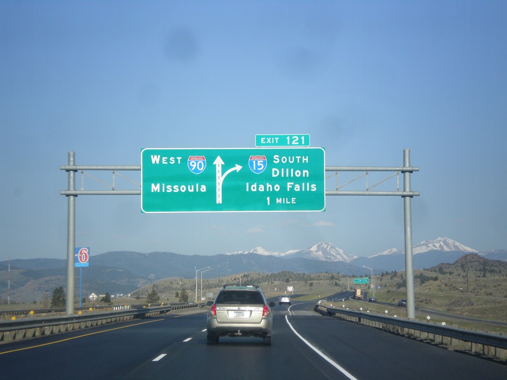
I-15 South/I-90 East - Exit 121
I-15 South/I-90 East approaching Exit 121 - I-15 South/Dillon/Idaho Falls. Continue west on I-90 for Missoula.
Taken 05-10-2015
Butte
Silver Bow County
Montana
United States