Signs Tagged With Overhead
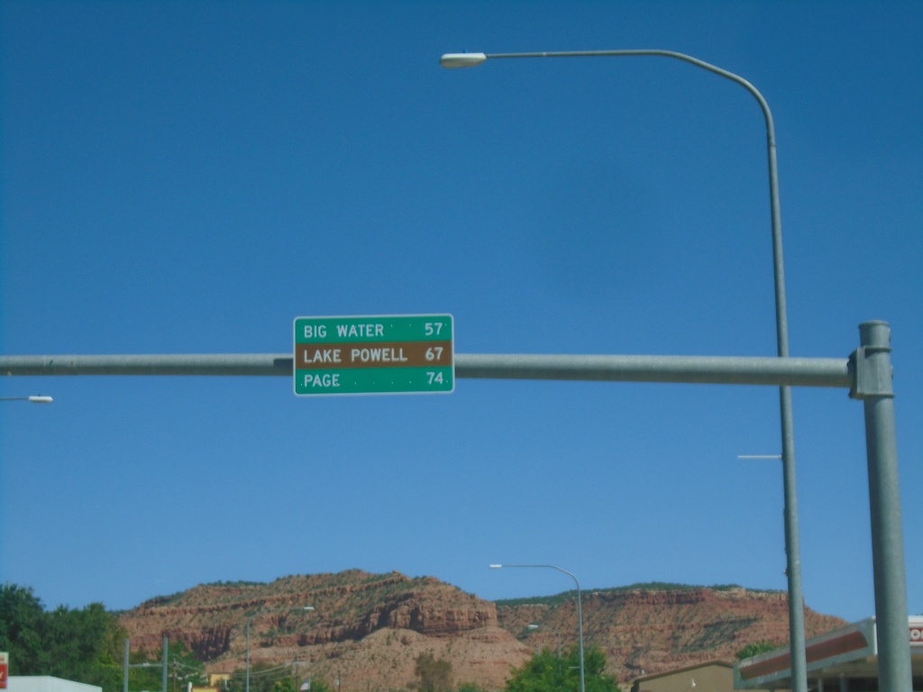
US-89 South - Distance Marker
Distance marker on US-89 south. Distance to Big Water, Lake Powell, and Page (Arizona).
Taken 09-07-2023
 Kanab
Kane County
Utah
United States
Kanab
Kane County
Utah
United States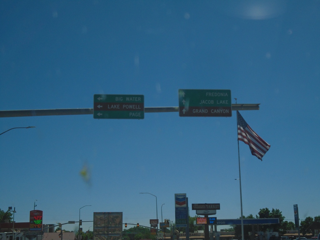
US-89 South at US-89A
US-89 South at US-89A in Kanab. Continue straight for US-89A south to Fredonia (Arizona), Jacob Lake (Arizona), and Grand Canyon (North Rim). Turn left to continue south on US-89 to Big Water, Page (Arizona) and Lake Powell.
Taken 09-07-2023
 Kanab
Kane County
Utah
United States
Kanab
Kane County
Utah
United States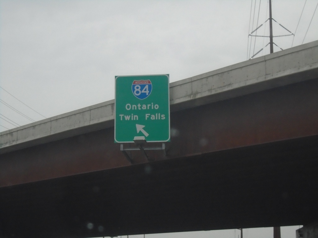
Franklin Road West at I-84
Franklin Road West at I-184 (Exit 1). Westbound I-184 traffic immediately merges into I-84. Use I-84 for Ontario (Oregon) and Twin Falls.
Taken 08-20-2023


 Boise
Ada County
Idaho
United States
Boise
Ada County
Idaho
United States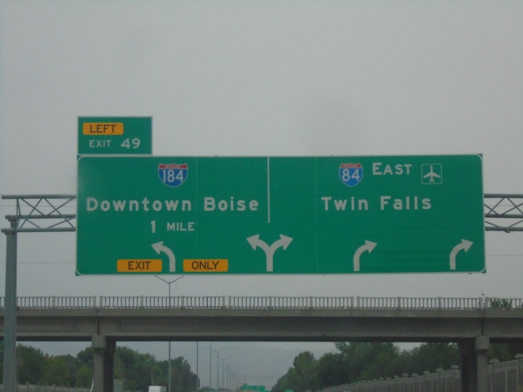
I-84 East - Exit 49
I-84 east approaching Exit 49 - I-184/Downtown Boise. Use right lanes for I-84 East/Twin Falls.
Taken 08-20-2023
Boise
Ada County
Idaho
United States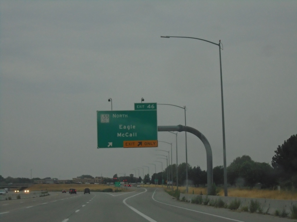
I-84 West - Exit 46
I-84 west at Exit 46 - ID-55 North/Eagle/McCall.
Taken 08-20-2023
 Meridian
Ada County
Idaho
United States
Meridian
Ada County
Idaho
United States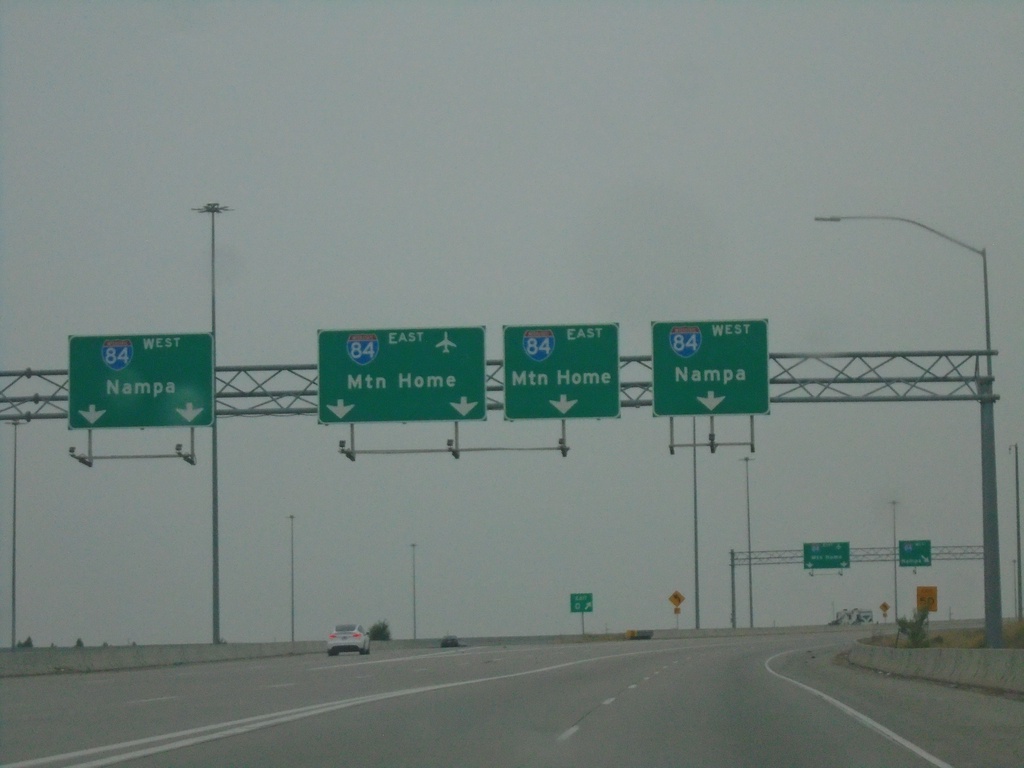
End I-184 Westbound I-84
End I-184 Westbound I-84. Use far left or far right lanes for I-84 West to Nampa; use middle lanes for I-84 East to Mountain Home.
Taken 08-20-2023
Boise
Ada County
Idaho
United States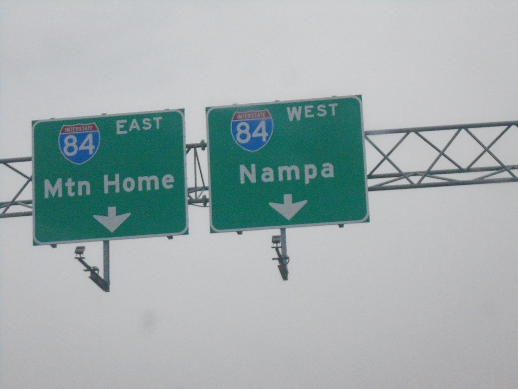
I-184 West - Exit 1A Onramp - Approaching I-84.
I-184 West - Exit 1A Onramp. I-184 immediately ends at the top of this ramp at I-84. Use right lane for I-84 west to Nampa; left lane for I-84 east to Mountain Home.
Taken 08-20-2023
Boise
Ada County
Idaho
United States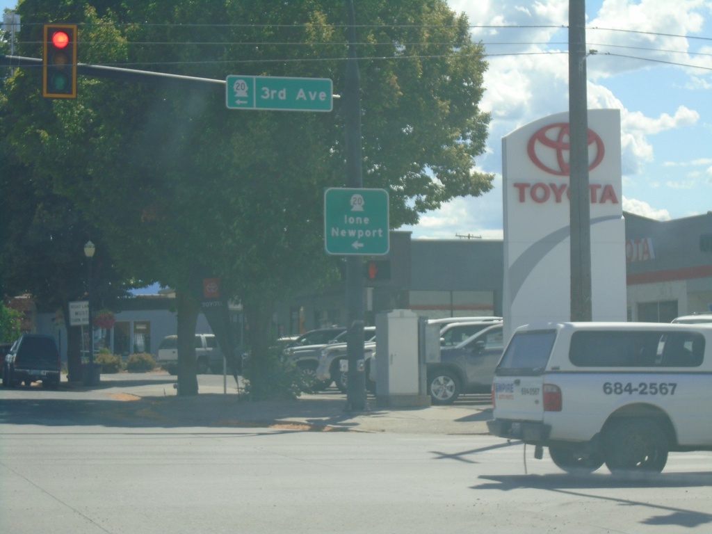
US-395 South/WA-20 East at US-395/WA-20 Split
US-395 South/WA-20 East at US-395/WA-20 Split in Colville. Turn left for WA-20 East (3rd Ave.) to Ione and Newport.
Taken 07-27-2023

 Colville
Stevens County
Washington
United States
Colville
Stevens County
Washington
United States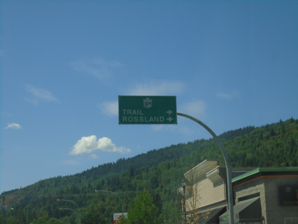
BC-3B West - Fruitvale
BC-3B West in Fruitvale. Turn right to continue on BC-3B to Trail and Rossland.
Taken 07-27-2023
 Fruitvale
Kootenay Boundary
British Columbia
Canada
Fruitvale
Kootenay Boundary
British Columbia
Canada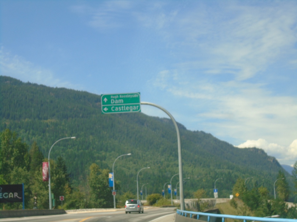
Robson Road at Columbia Ave - Castlegar
Robson Road at Columbia Ave at the end of the Columbia River Bridge. Turn left for (Columbia Ave.) to Castlegar. Continue straight for Hugh Keenleyside Dam. The Hugh Keenleyside Dam is on the Columbia River creating the Arrow Lakes.
Taken 07-27-2023
Castlegar Central Kootenay British Columbia Canada