Signs Tagged With Overhead
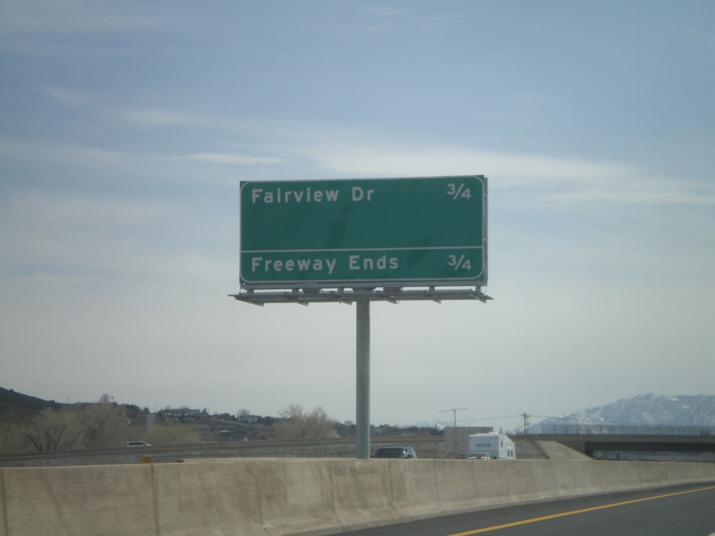
US-395 South/US-50 West - Distance Marker
Distance marker on US-395 South/US-50 west along the Carson City Bypass. Distance to Fairview Drive, which is the current end of the Carson City Bypass.
Taken 04-15-2010

 Carson City
Nevada
United States
Carson City
Nevada
United States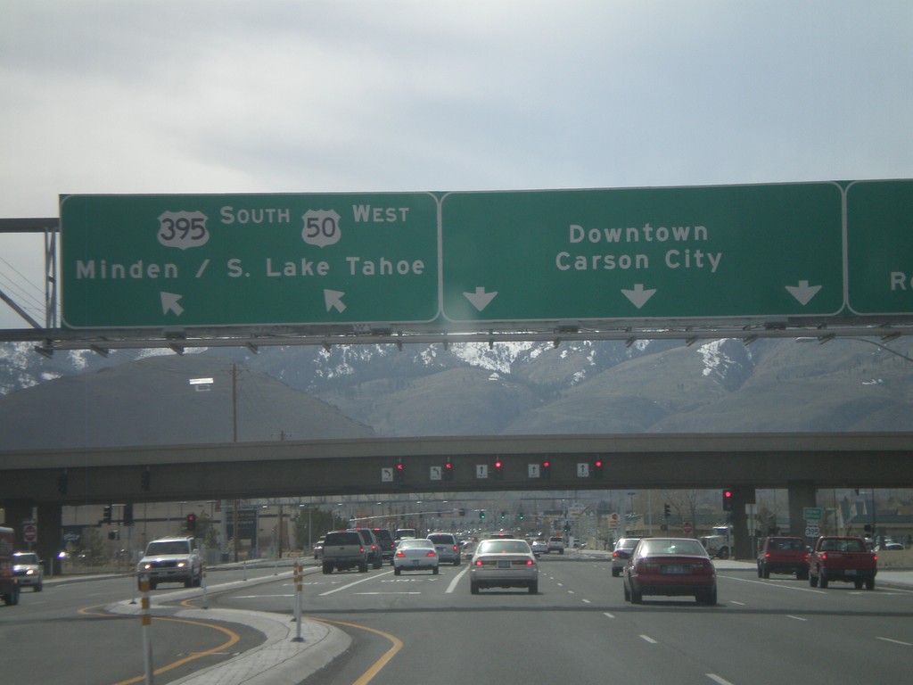
US-50 West Approaching US-395
US-50 west approaching US-395. Use US-395 north for Reno. US-50 west joins US-395 south for Minden and South Lake Tahoe (CA). Continue on William St. for Downtown Carson City.
Taken 04-15-2010
Carson City
Nevada
United States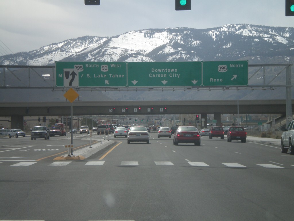
US-50 West Approaching US-395
US-50 west approaching US-395. Use US-395 north for Reno. US-50 west joins US-395 south for Minden and South Lake Tahoe (CA). Continue on William St. for Downtown Carson City.
Taken 04-15-2010
Carson City
Nevada
United States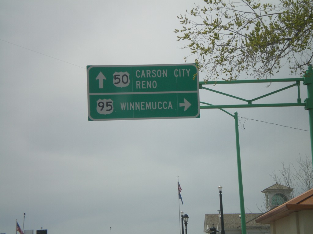
US-50 West at US-95 North
US-50 west at US-95 north to Winnemucca. Continue on US-50 west for Carson City and Reno.
Taken 04-15-2010
 Fallon
Churchill County
Nevada
United States
Fallon
Churchill County
Nevada
United States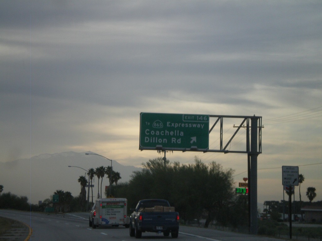
I-10 West - Exit 146
I-10 west at Exit 146 - To CA-86S Expressway/Coachella/Dillon Road. This is the first exit in the Coachella Valley westbound.
Taken 03-22-2010

 Coachella
Riverside County
California
United States
Coachella
Riverside County
California
United States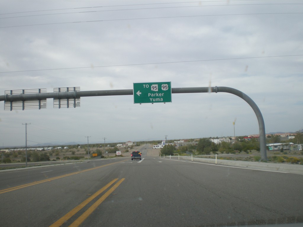
BL-10 West at Main St. - Quartzsite
BL-10 west at Main St. in Quartzsite. Turn left on Main St. for US-95, AZ-95 to Yuma and Parker. Turn left to continue on BL-10.
Taken 03-22-2010

 Quartzsite
La Paz County
Arizona
United States
Quartzsite
La Paz County
Arizona
United States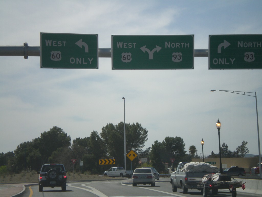
US-60 West at US-93
US-60 west at US-93 roundabout. This is the southern terminus of US-93.
Taken 03-22-2010

 Wickenburg
Maricopa County
Arizona
United States
Wickenburg
Maricopa County
Arizona
United States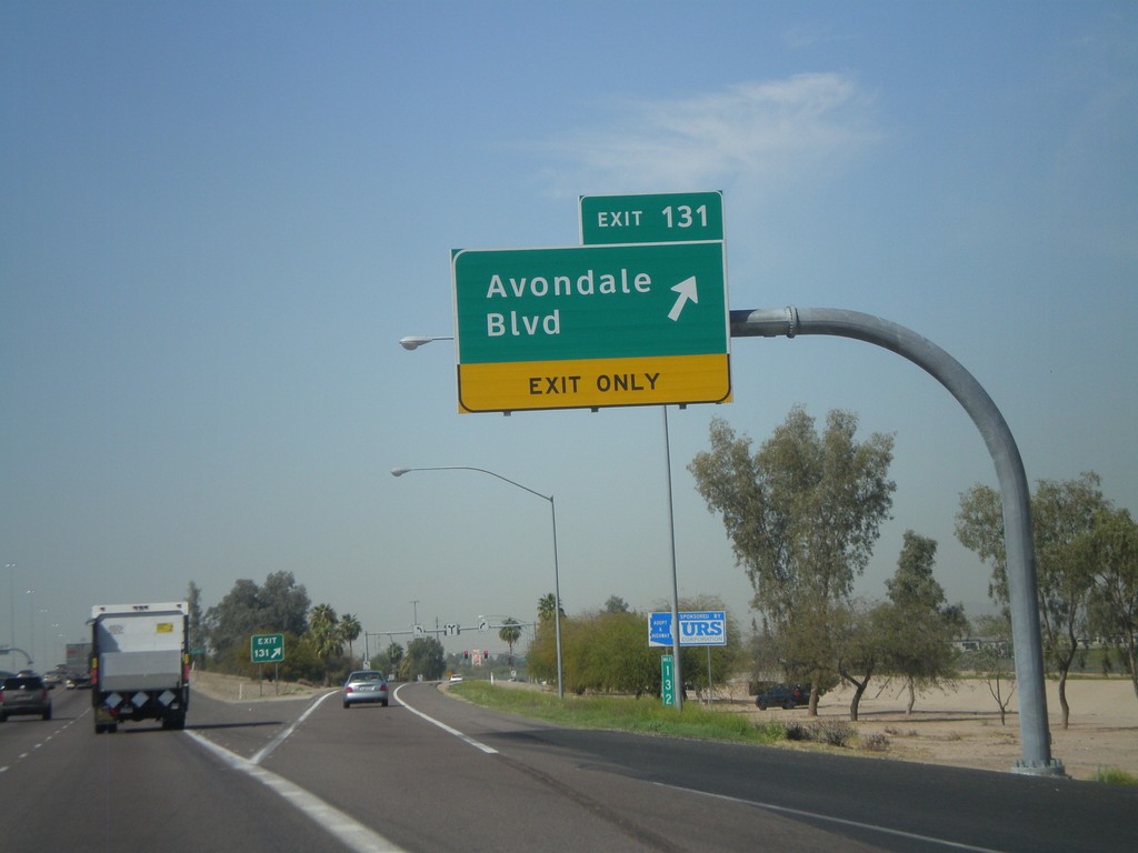
I-10 West - Exit 131
I-10 west at Exit 131 - Avondale Blvd
Taken 03-22-2010
Avondale
Maricopa County
Arizona
United States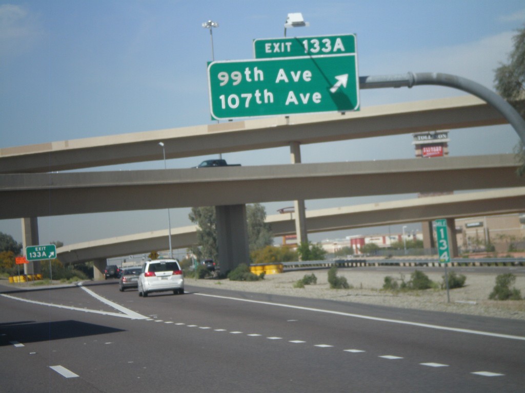
I-10 West at Exit 133A
I-10 west at Exit 133A - 99th Ave/107th Ave
Taken 03-22-2010
Tolleson
Maricopa County
Arizona
United States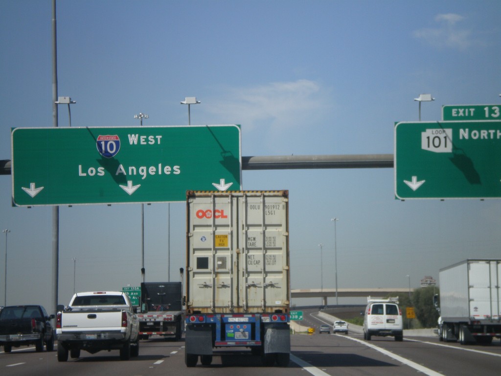
I-10 West at Exit 133B
I-10 west at Exit 133B - AZ-101 Loop North. This is the western end of the AZ-101 Loop. I-10 continues west to Los Angeles.
Taken 03-22-2010
 Tolleson
Maricopa County
Arizona
United States
Tolleson
Maricopa County
Arizona
United States