Signs Tagged With Overhead
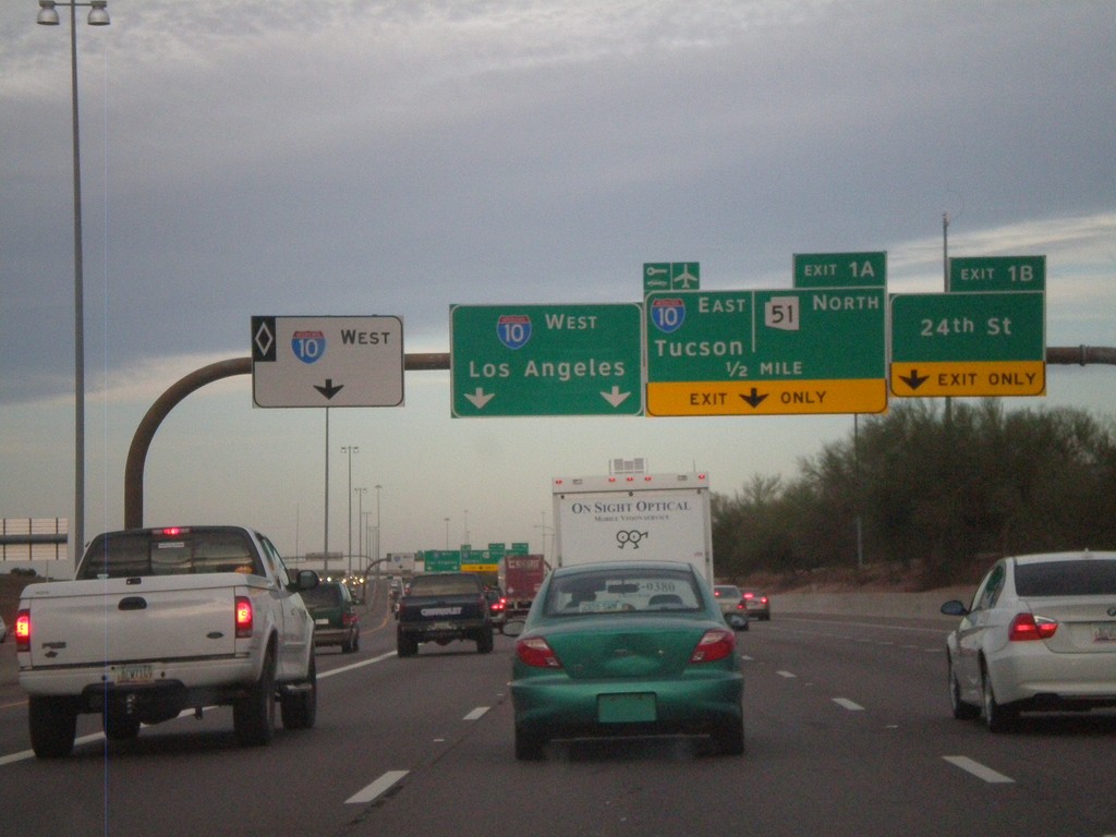
AZ-202 Loop West - Exits 1B and 1A
AZ-202 Loop west at Exit 1B - 24th St. Approaching Exit 1A - I-10 East/Tucson/AZ-51 North. Continue ahead for I-10 west for Los Angeles. The left most lane is for I-10 west HOV traffic.
Taken 02-25-2011


 Phoenix
Maricopa County
Arizona
United States
Phoenix
Maricopa County
Arizona
United States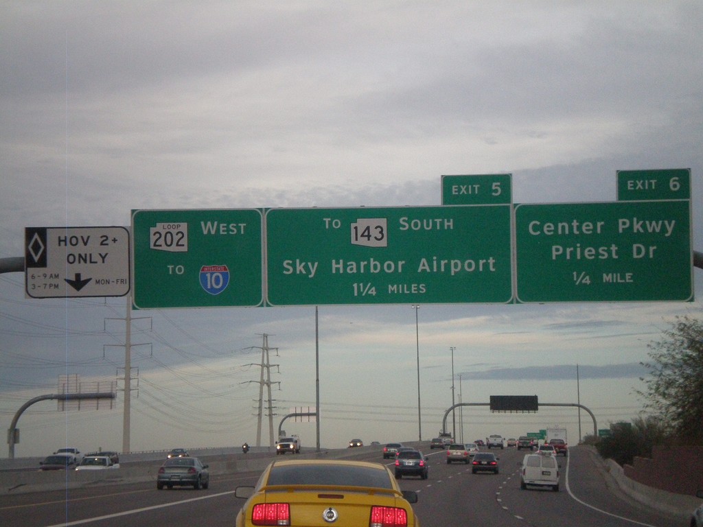
AZ-202 Loop West Approaching Exits 6 and 5
AZ-202 Loop west approaching Exit 6 - Center Parkway/Priest Drive and Exit 7 - To AZ-143 South/Sky Harbor Airport. AZ-202 Loop continues west towards I-10. The left most lane is a HOV lane.
Taken 02-25-2011
 Tempe
Maricopa County
Arizona
United States
Tempe
Maricopa County
Arizona
United States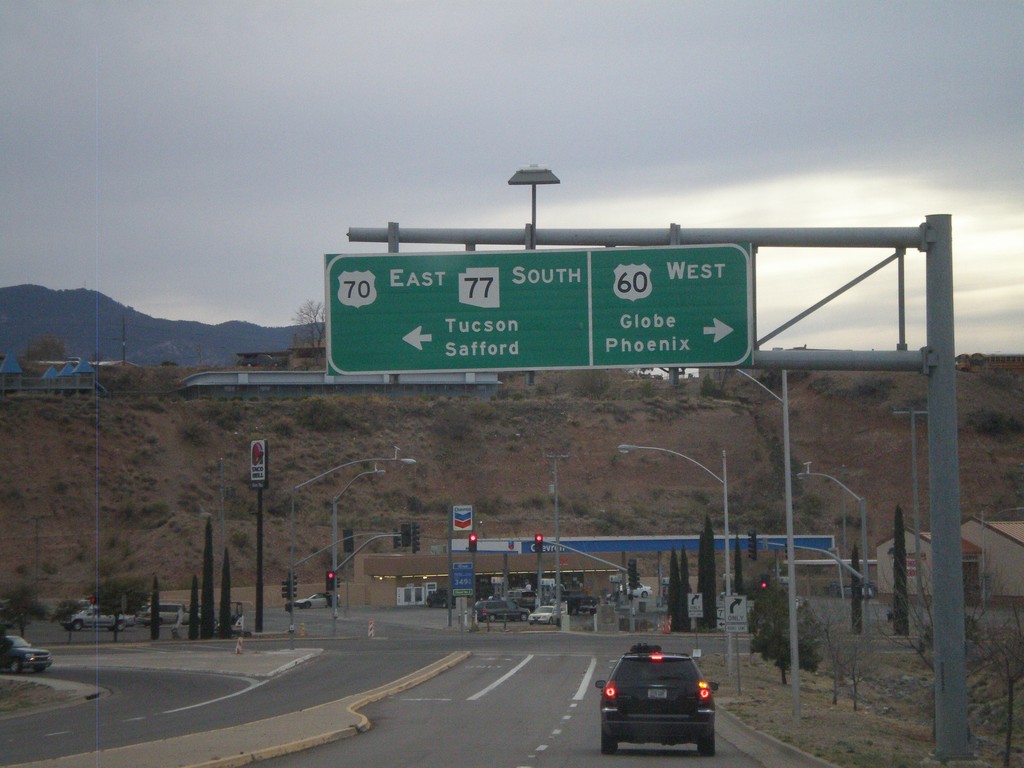
US-60 West/AZ-77 South Approaching US-70
US-60 West/AZ-77 South approaching US-70. Use US-60 west for Globe and Phoenix. Use US-70 west/AZ-77 south for Tucson (via AZ-77) and Safford (via US-70). This is the western end of US-70.
Taken 02-24-2011


 Globe
Gila County
Arizona
United States
Globe
Gila County
Arizona
United States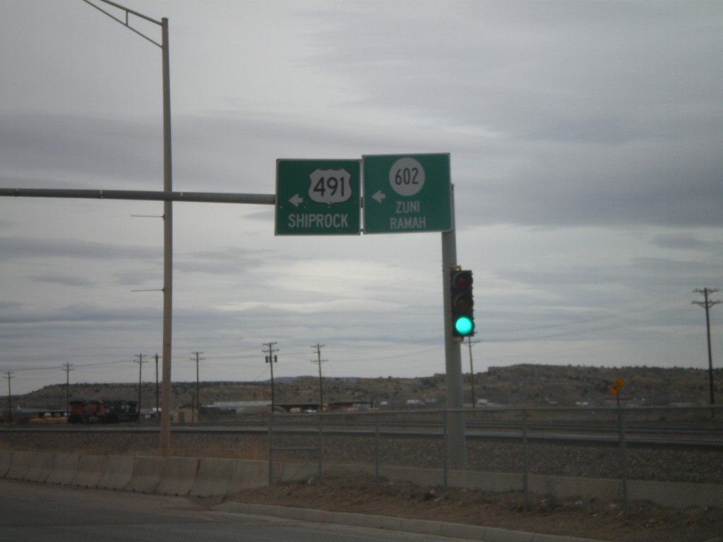
NM-118 West at NM-602/US-491
NM-118 west at Arnold St., to NM-602/Zuni/Ramah and US-491/Shiprock.
Taken 02-24-2011


 Gallup
McKinley County
New Mexico
United States
Gallup
McKinley County
New Mexico
United States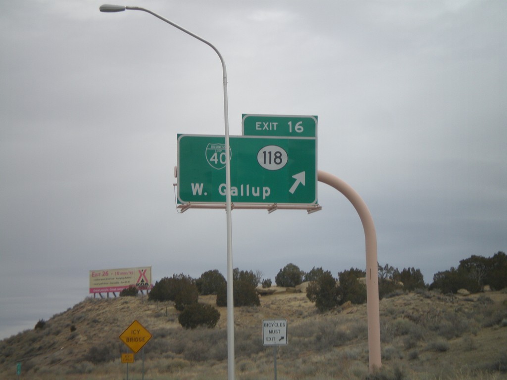
I-40 East - Exit 16
I-40 east at Exit 16 - BL-40/NM-118/West Gallup.
Taken 02-24-2011
 Gallup
McKinley County
New Mexico
United States
Gallup
McKinley County
New Mexico
United States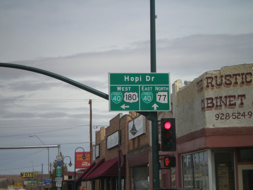
US-180 West/AZ-77 North at BL-40
US-180 West/AZ-77 North at BL-40. Continue straight for BL-40 East/AZ-77 North (Navajo Blvd.). Turn left for BL-40 West/US-180 West (Hopi Drive).
Taken 02-24-2011
 Holbrook
Navajo County
Arizona
United States
Holbrook
Navajo County
Arizona
United States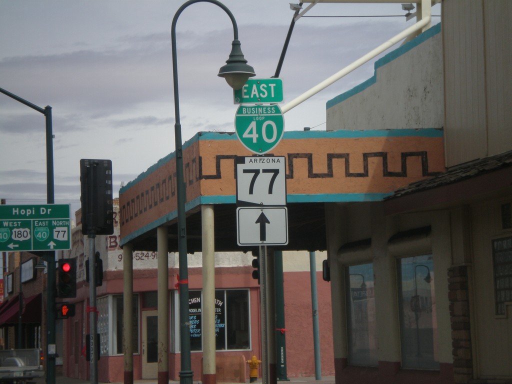
AZ-77 North/US-180 West at BL-40
AZ-77 North/US-180 West at BL-40 in downtown Holbrook. Continue straight on Navajo Blvd. for AZ-77 North/BL-40 East. Turn left on Hopi Drive for US-180 West/BL-40 west.
Taken 02-24-2011
Holbrook
Navajo County
Arizona
United States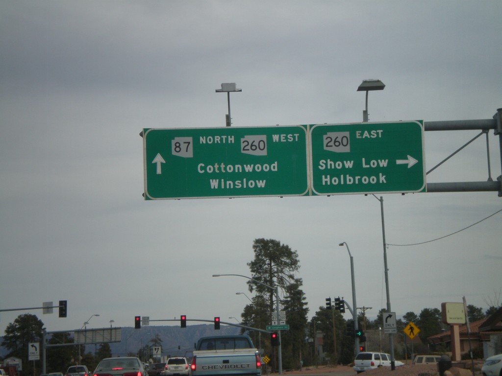
AZ-87 North at AZ-260
AZ-87 north at AZ-260. Turn right for AZ-260 east for Show Low and Holbrook. Continue straight for AZ-260 west/AZ-87 north for Cottonwood (via AZ-260) and Winslow (via AZ-87). AZ-260 west joins AZ-87 north to the top of the Mogollon Rim.
Taken 02-24-2011

 Payson
Gila County
Arizona
United States
Payson
Gila County
Arizona
United States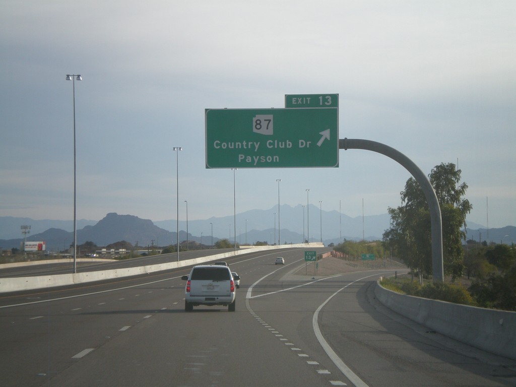
AZ-202 Loop East - Exit 13
AZ-202 Loop east at Exit 13 - AZ-87/Country Club Drive/Payson.
Taken 02-24-2011
Mesa
Maricopa County
Arizona
United States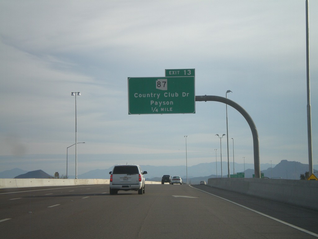
AZ-202 Loop East Approaching Exit 13
AZ-202 Loop East approaching Exit 13 - AZ-87/Country Club Drive/Payson.
Taken 02-24-2011
Mesa
Maricopa County
Arizona
United States