Signs Tagged With Milemarker
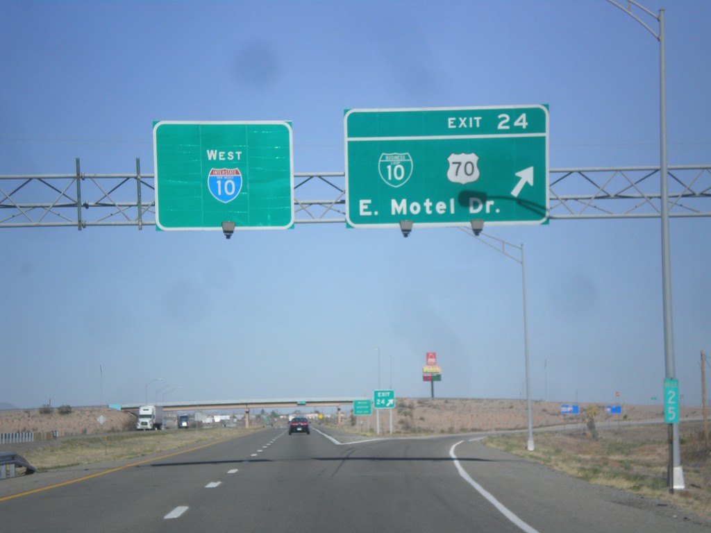
I-10 West - Exit 24
I-10 west at Exit 24 - BL-10/US-70/East Motel Drive.
Taken 04-14-2013


 Lordsburg
Hidalgo County
New Mexico
United States
Lordsburg
Hidalgo County
New Mexico
United States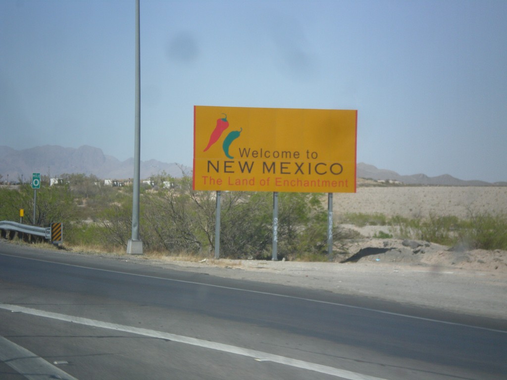
I-10 West - Welcome To New Mexico
Welcome to New Mexico - Land of Enchantment on I-10 west. Taken at the Texas - New Mexico State Line.
Taken 04-14-2013
Anthony
Doña Ana County
New Mexico
United States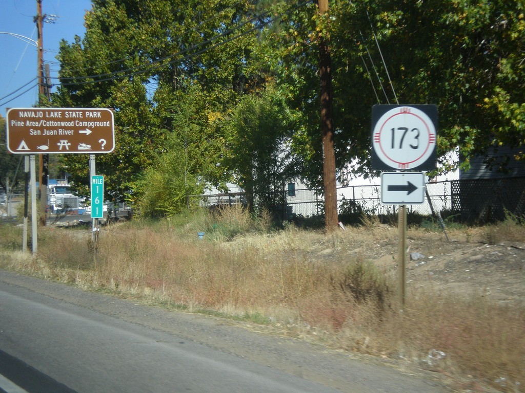
US-550 North at NM-173
US-550 north at NM-173 west to Navajo Lake State Park.
Taken 10-15-2012

 Aztec
San Juan County
New Mexico
United States
Aztec
San Juan County
New Mexico
United States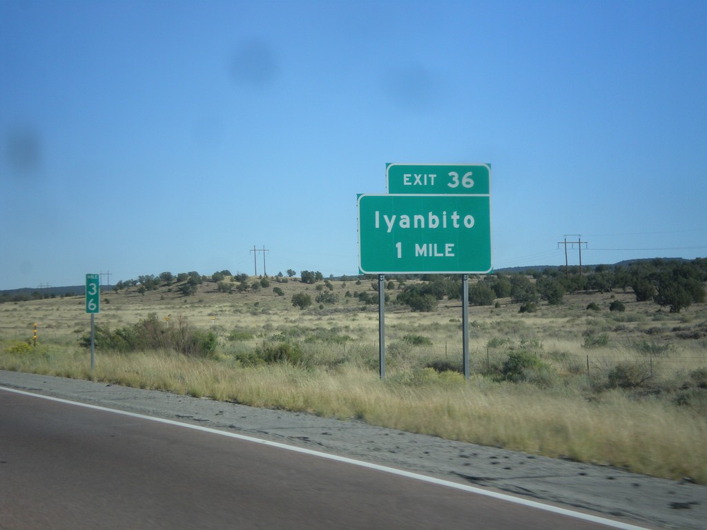
I-40 East Approaching Exit 36
I-40 east approaching Exit 36 - Iyanbito.
Taken 10-10-2012
 Fort Wingate
McKinley County
New Mexico
United States
Fort Wingate
McKinley County
New Mexico
United States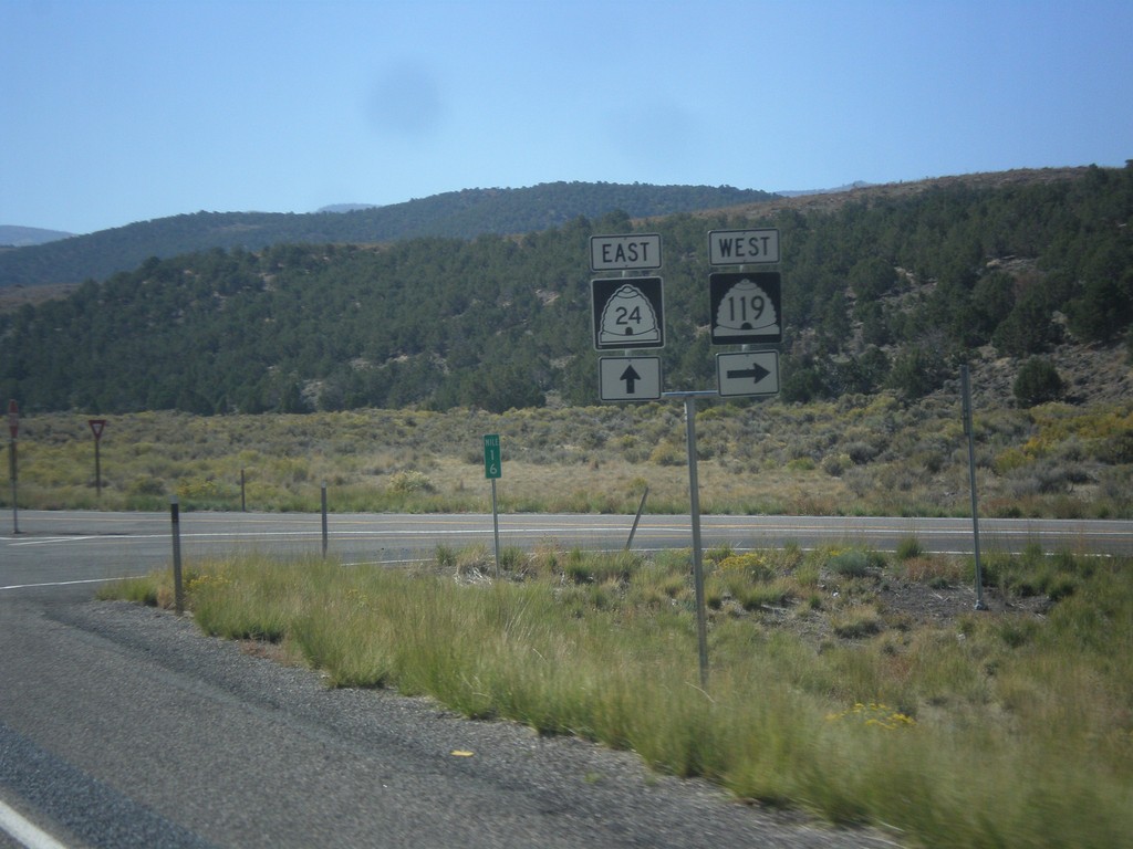
UT-24 East at UT-119
UT-24 east at UT-119 west.
Taken 10-07-2012

 Richfield
Sevier County
Utah
United States
Richfield
Sevier County
Utah
United States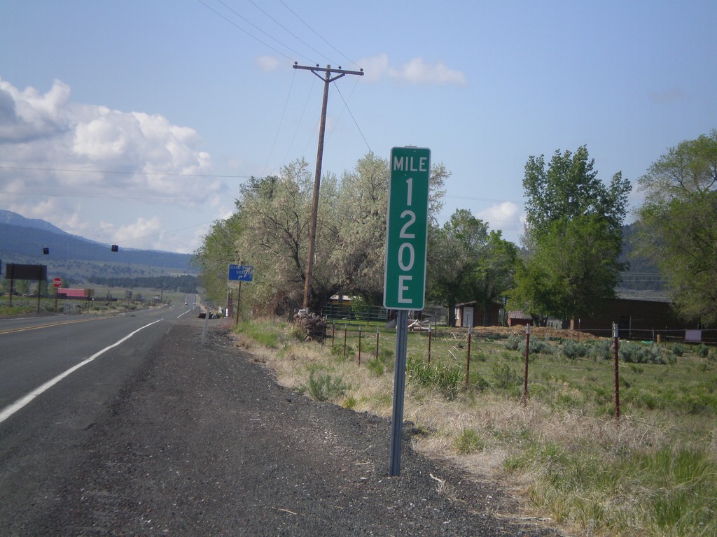
Milemarker at OR-31/US-395 Junction
Milemarker 120E at OR-31/US-395 junction. These type of milemarkers with the letter suffix have started to appear around Oregon. The letter indicates the segment of highway that the mileage is for. In Oregon, mile markers are posted according to internal highway, not posted route number (except for intersate highways). In this case the milemarker is for Fremont Highway. A posted highway can be composed of have multiple segments of internal highways. The milemarker in this photo is for the 5th (E is the 5th letter) segment of internal highway along posted route US-395. See here for more discussion: en.wikipedia.org/wiki/State_highways_in_Oregon#Highways_a…
Taken 05-28-2012

 Lakeview
Lake County
Oregon
United States
Lakeview
Lake County
Oregon
United States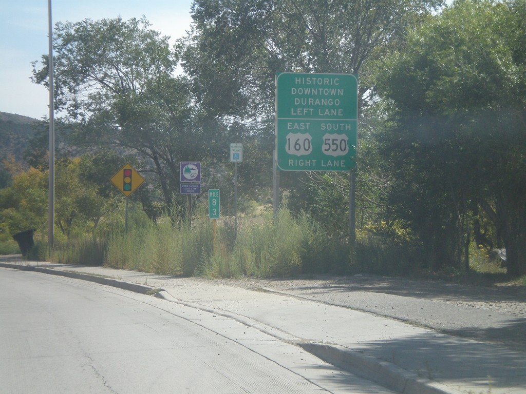
US-160 East Approaching US-550
US-160 East approaching US-550. Turn right for US-160 East/US-550 South; left for Historic Downtown Durango.
Taken 10-02-2011
 Durango
La Plata County
Colorado
United States
Durango
La Plata County
Colorado
United States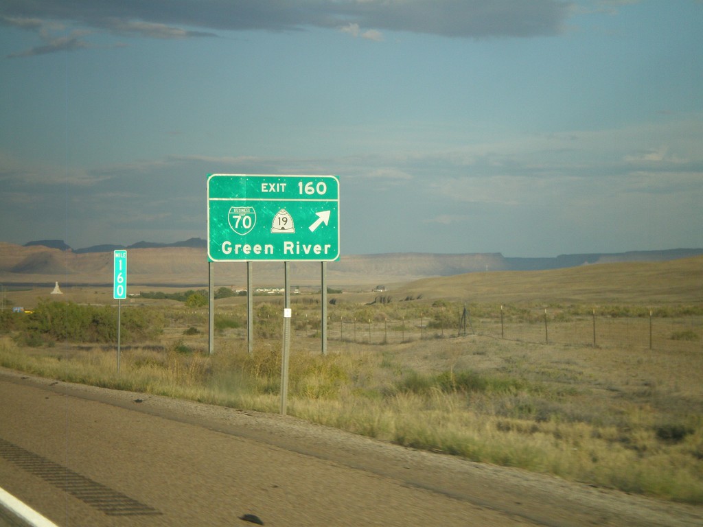
I-70 East - Exit 160
I-70 east at Exit 160 - BL-70/UT-19/Green River.
Taken 10-01-2011


 Green River
Emery County
Utah
United States
Green River
Emery County
Utah
United States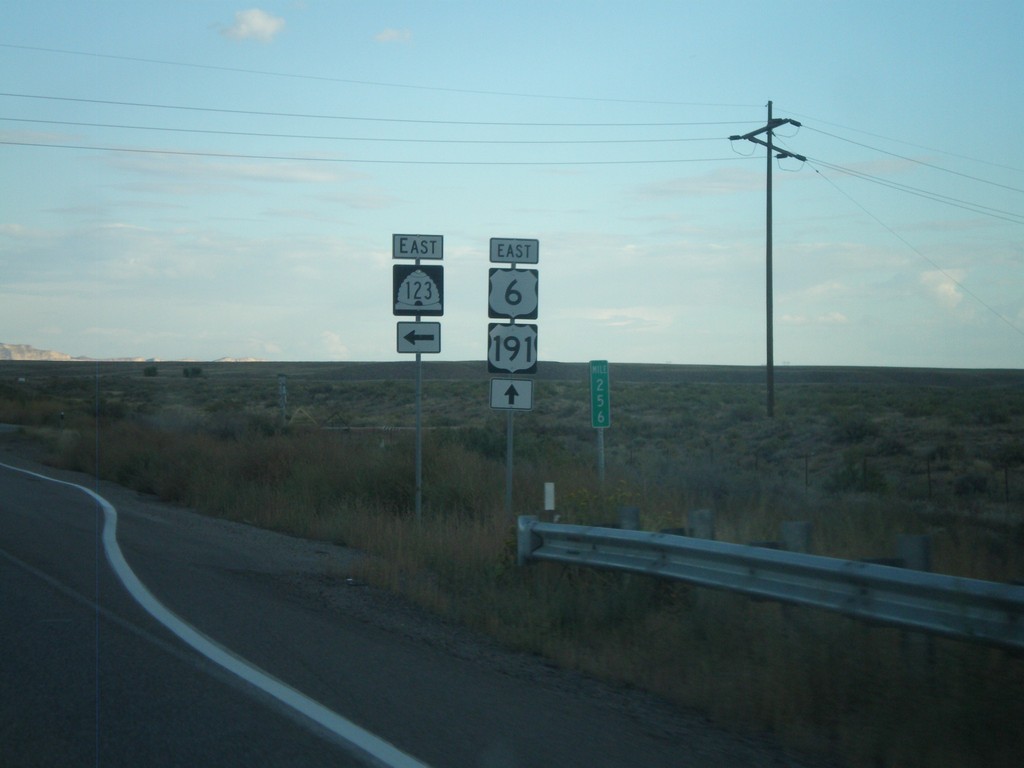
US-6 East/US-191 South at UT-123
US-6 East/US-191 South at UT-123 in Carbon County.
Taken 10-01-2011
 Price
Carbon County
Utah
United States
Price
Carbon County
Utah
United States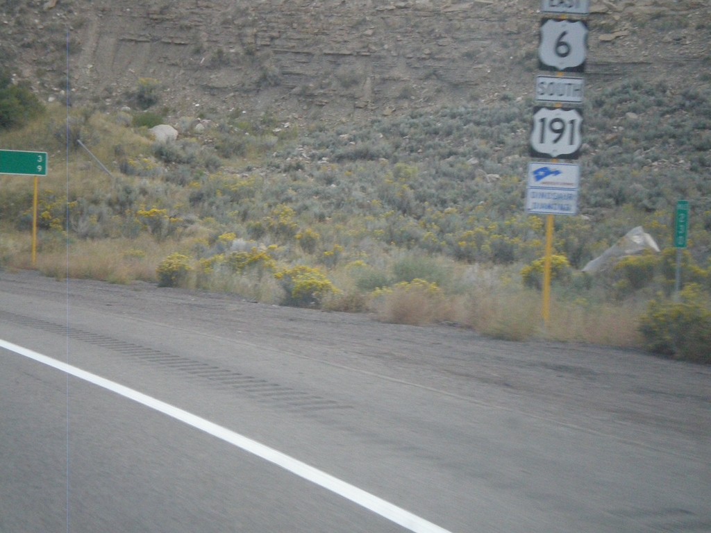
US-6 East/US-191 South near Helper
US-6 East/US-191 South near Helper. The sign beneath the shield designates this stretch of highway as a segment of Dinosaur Diamond Byway - part of America’s Byway System.
Taken 10-01-2011
Helper
Carbon County
Utah
United States