Signs Tagged With Milemarker
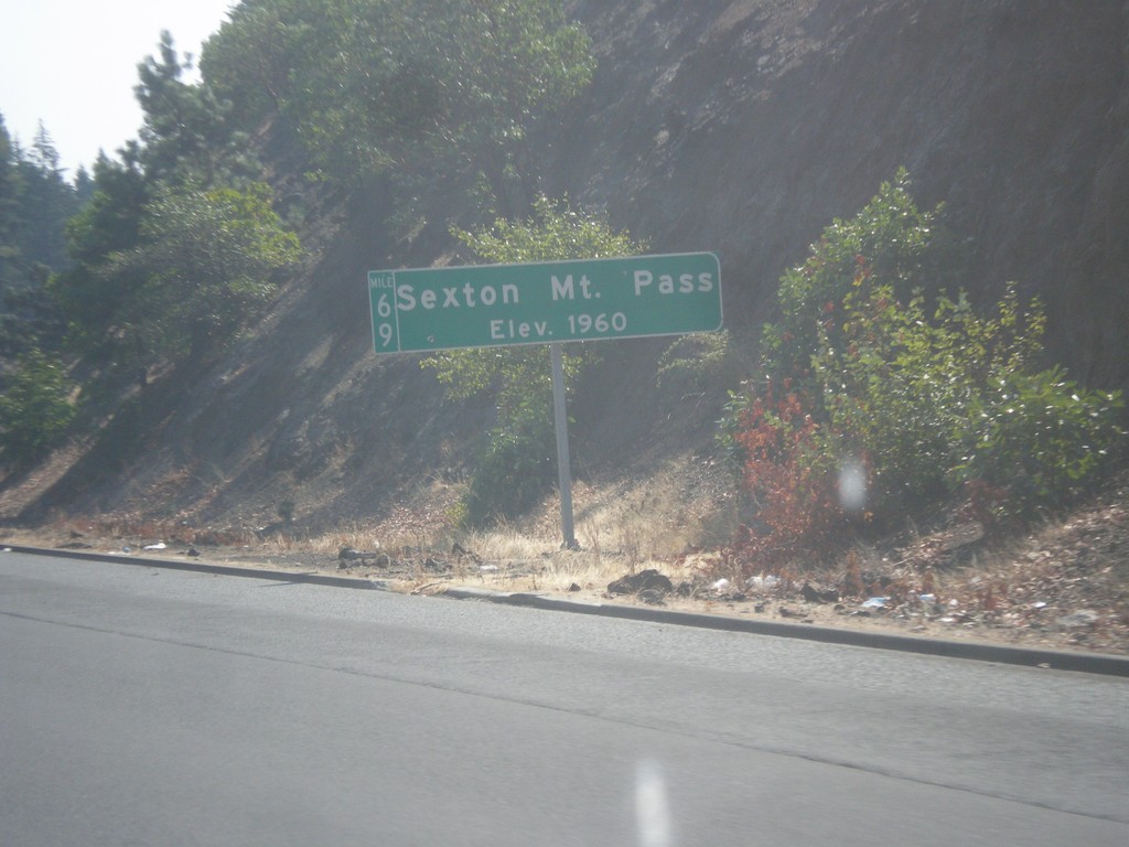
I-5 South - Sexton Mountain Summit
I-5 south at Sexton Mountain Summit - Elevation 1960 Feet. This summit is one a series of passes I-5 crosses between Canyonville and Grants Pass in the Klamath Mountains. The milepost is also attached to the main sign.
Taken 08-17-2015
 Wolf Creek
Josephine County
Oregon
United States
Wolf Creek
Josephine County
Oregon
United States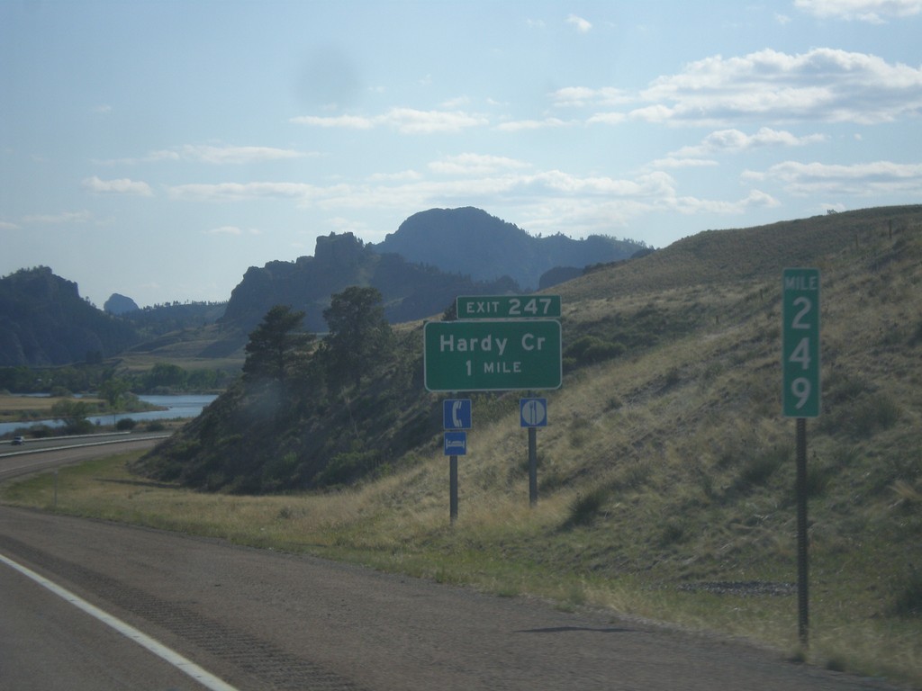
I-15 South - Exit 247
I-15 south approaching Exit 247 - Hardy Creek.
Taken 05-09-2015
 Cascade
 County
Montana
United States
Cascade
Cascade County
Montana
United States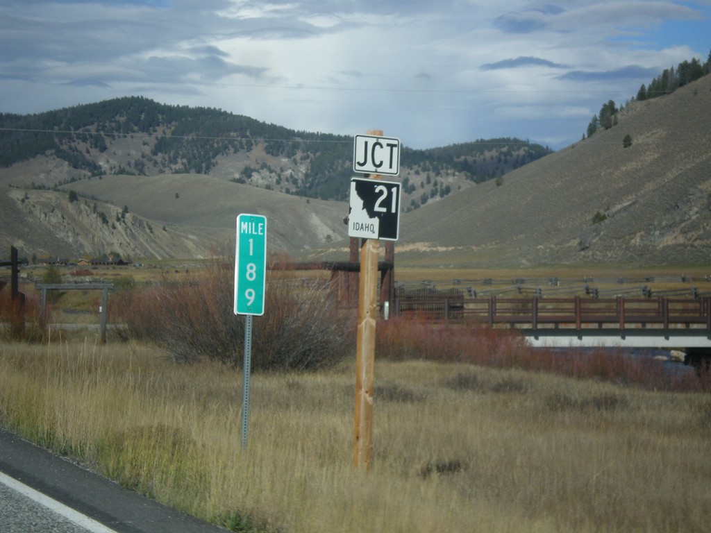
ID-75 North Approaching ID-21
Approaching ID-21 Junction on ID-75 North in Stanley. Milemarker 189.
Taken 10-04-2014

 Stanley
Custer County
Idaho
United States
Stanley
Custer County
Idaho
United States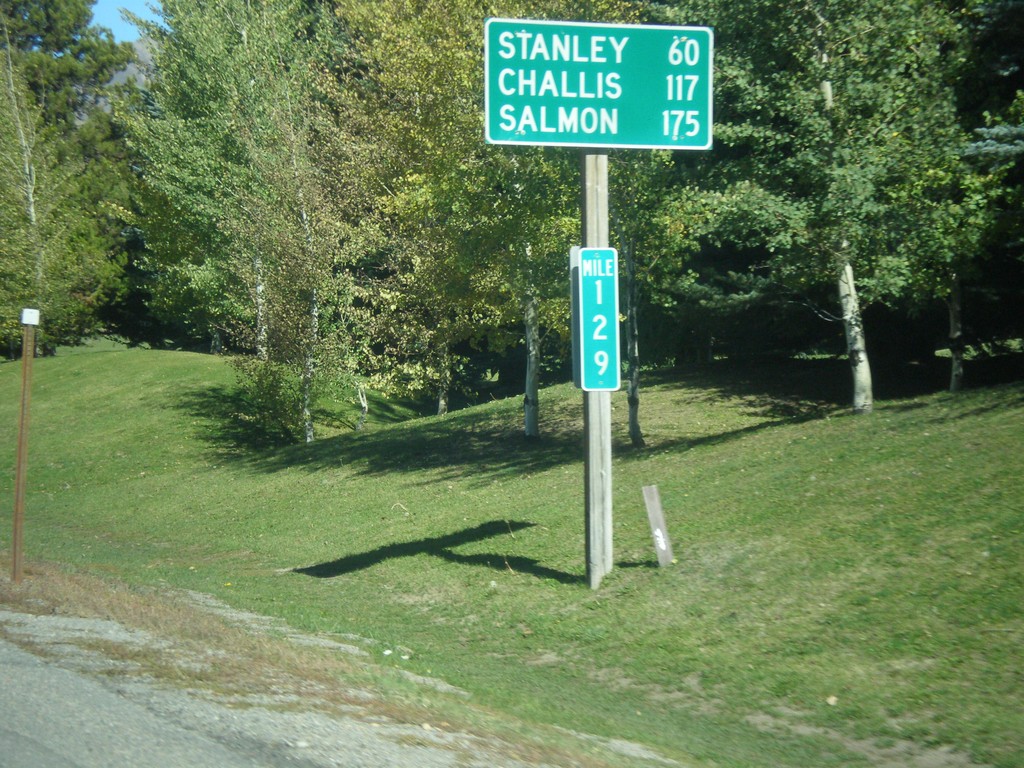
ID-75 North - Distance Marker
Distance marker on ID-75 north. Distance to Stanley, Challis, and Salmon. Milemarker 129. The milemarkers on ID-75 continue reflect the distance from the Idaho-Nevada state line (via US-93) rather than the beginning of ID-75. Originally, ID-75 was signed as US-93.
Taken 10-04-2014
Sun Valley
Blaine County
Idaho
United States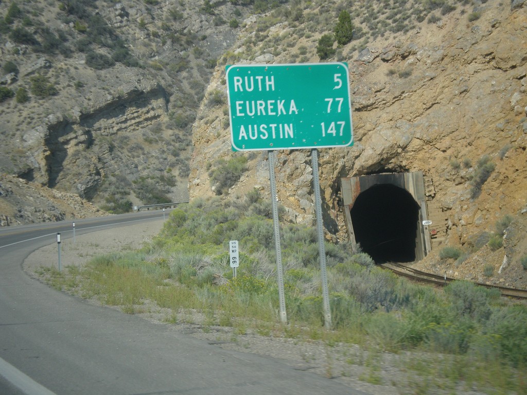
US-50 West - Distance Marker
Distance marker on US-50 west. Distance to Ruth, Eureka, and Austin.
Taken 08-31-2014
 Ely
White Pine County
Nevada
United States
Ely
White Pine County
Nevada
United States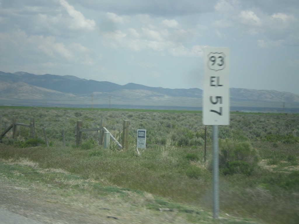
US-93 North - Mile Marker
This is an unusual mile marker on US-93 north in Nevada. Typical mile markers in Nevada are much smaller and do not have a shield outline on them, just a text description of the route. There are two or there on this stretch of road between Wells and Lages Junction.
Taken 05-22-2014
 Wells
Elko County
Nevada
United States
Wells
Elko County
Nevada
United States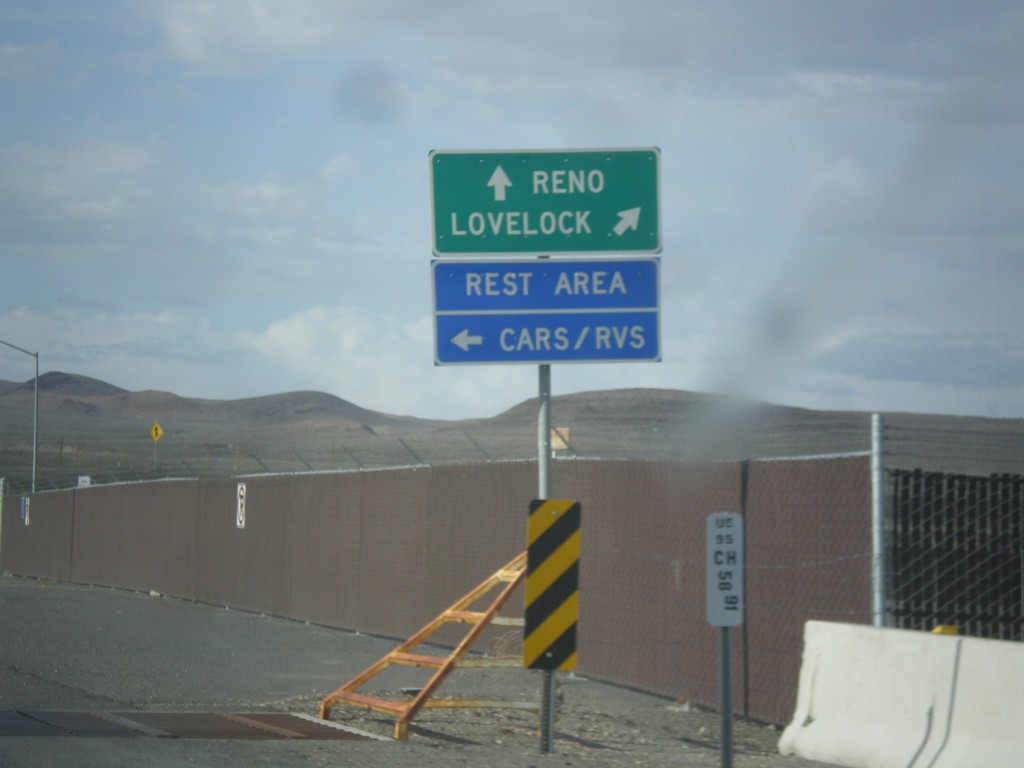
US-95 North Approaching I-80
US-95 north approaching I-80. Use I-80 East/US-95 North to Lovelock; use I-80 West/Alt. US-95 South to Reno. Turn left to enter the Rest Area. Notice the post mile marker at the base of the sign.
Taken 05-05-2014


 Churchill County
Nevada
United States
Churchill County
Nevada
United States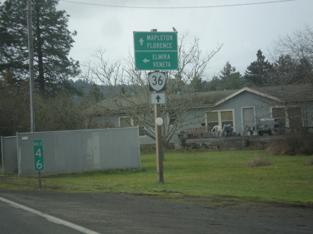
OR-36 West at Territorial Highway
OR-36 west at Territorial Highway south to Veneta and Elmira. Continue west on OR-36 for Mapleton and Florence.
Taken 02-13-2014
 Cheshire
Lane County
Oregon
United States
Cheshire
Lane County
Oregon
United States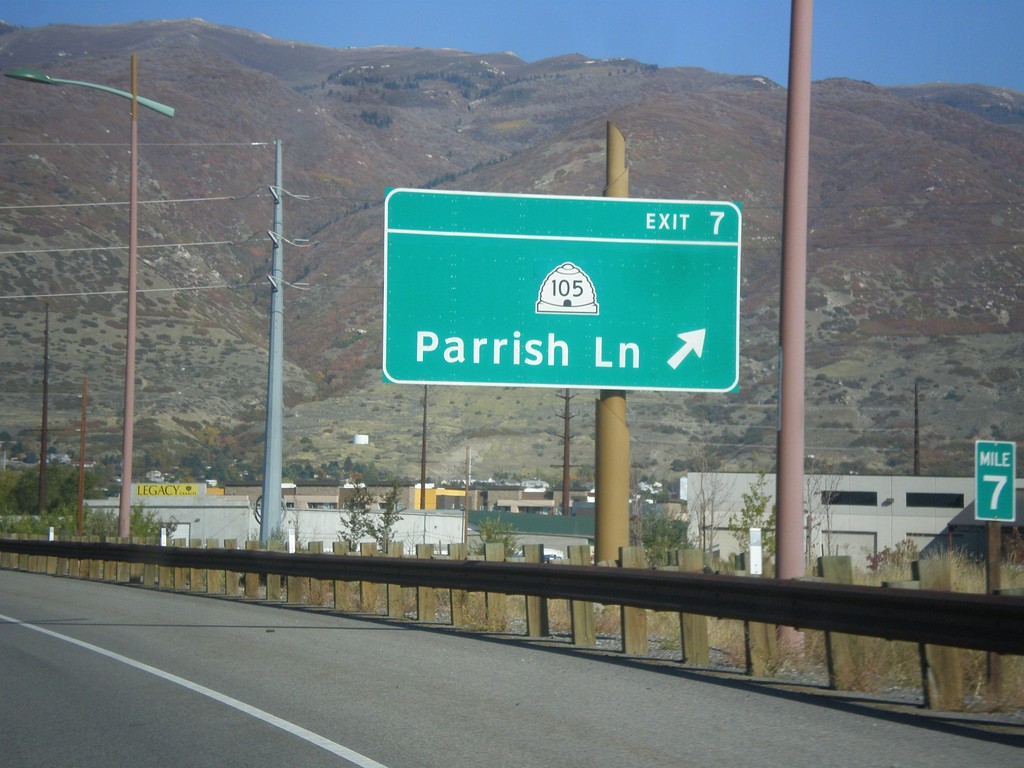
Legacy Parkway (UT-67) North - Exit 7
Legacy Parkway (UT-67) north at Exit 7 - UT-105/Parrish Lane.
Taken 10-18-2013

 Centerville
Davis County
Utah
United States
Centerville
Davis County
Utah
United States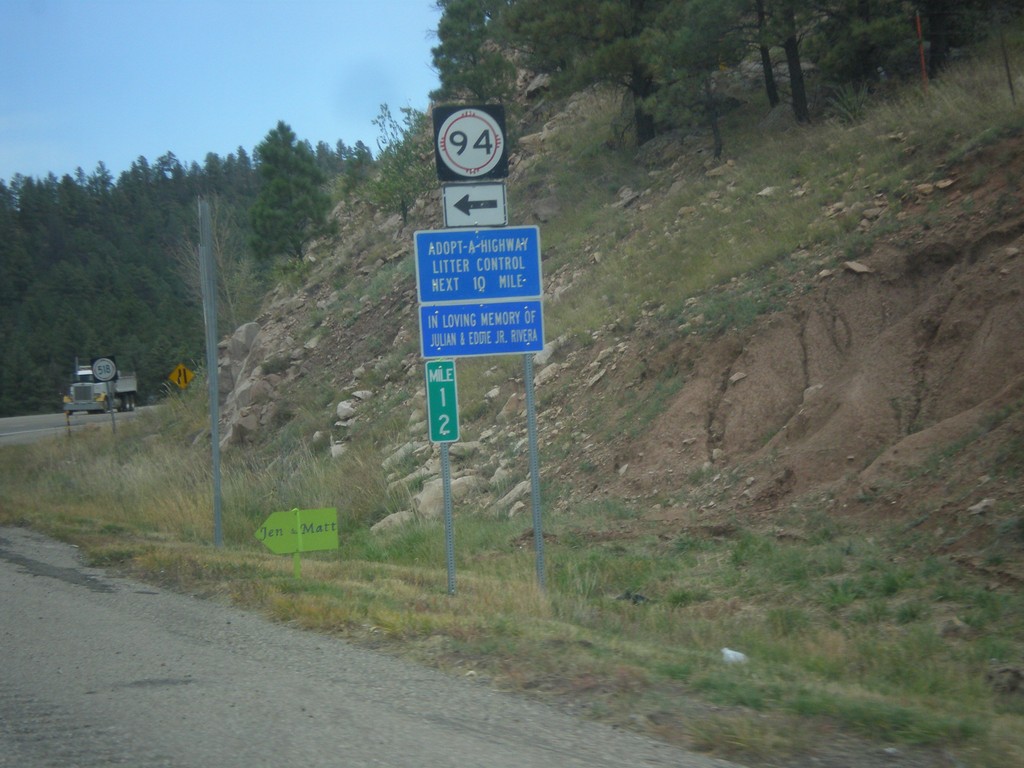
NM-518 North At NM-94
NM-518 north at NM-94 in San Miguel County.
Taken 10-10-2013

 Sapello
San Miguel County
New Mexico
United States
Sapello
San Miguel County
New Mexico
United States