Signs Tagged With Map
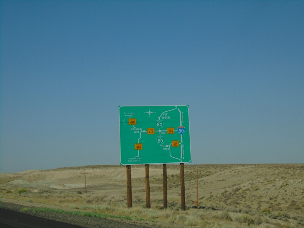
I-80 West - Bridger Valley Route Diagram
Bridger Valley route diagram on I-80 west. This sign is posted on I-80 on both entrances to the Bridger Valley on I-80, as well as at a truck parking area.
Taken 08-15-2020
 Lyman
Uinta County
Wyoming
United States
Lyman
Uinta County
Wyoming
United States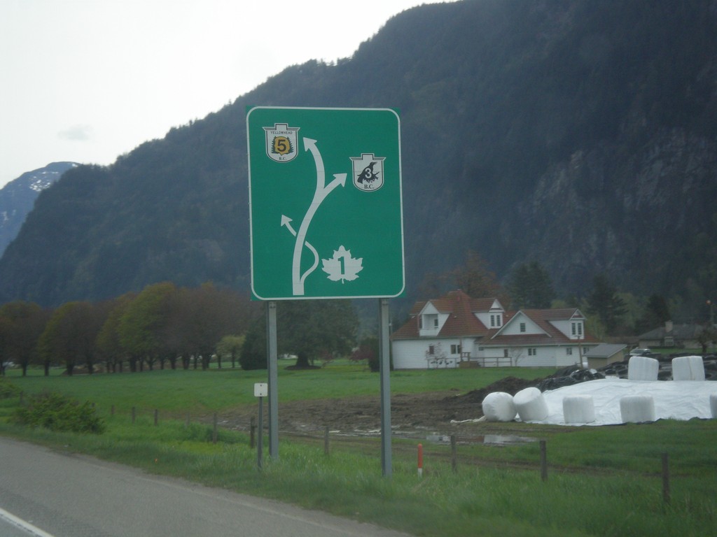
TC-1 East - Route Diagram
TC-1 East - Route Diagram showing BC-5 (Coquihalla Highway), BC-3 (Crowsnest Highway) and TC-1 (Trans-Canada Highway). TC-1 leaves the freeway at Hope.
Taken 04-29-2017


 Hope
Fraser Valley
British Columbia
Canada
Hope
Fraser Valley
British Columbia
Canada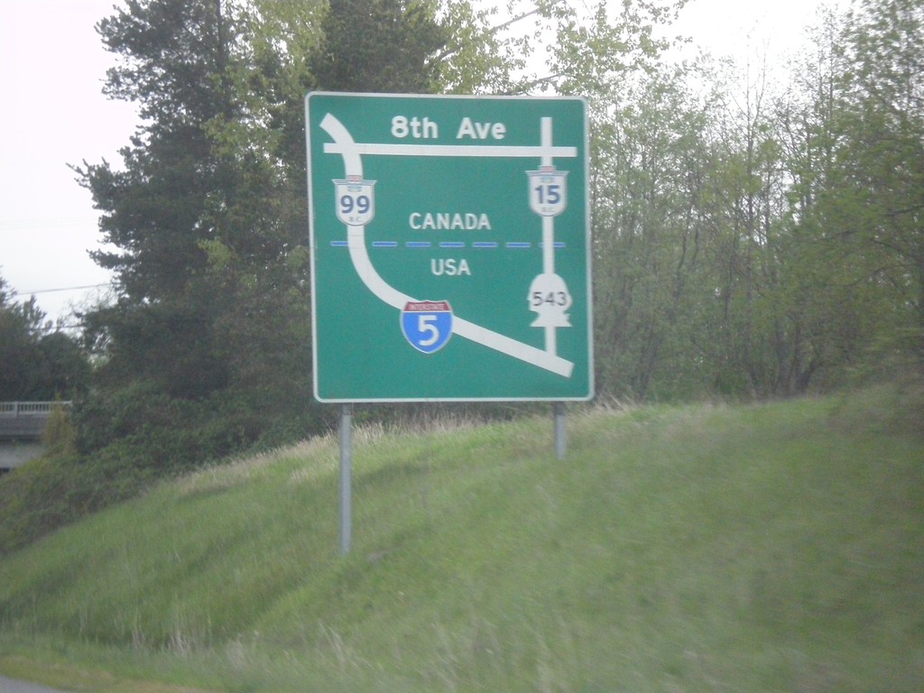
I-5 North - Border Crossing Map
Border Crossing map on I-5 north approaching WA-543.
Taken 04-29-2017

 Blaine
Whatcom County
Washington
United States
Blaine
Whatcom County
Washington
United States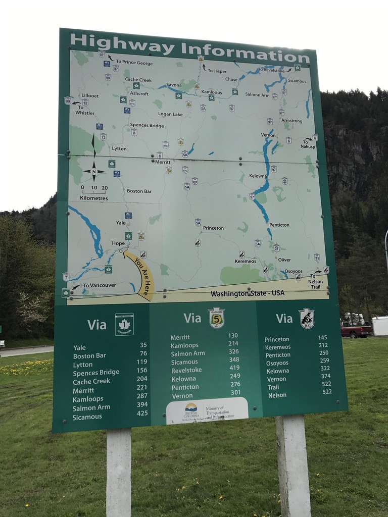
Hunter Creek Rest Area - Highway Information
Route map for the adjacent area of British Columbia, and distances to major destinations. Three routes split off into the interior of British Columbia at Hope just east of here: BC-5 to Coquihalla Pass, TC-1 through the Frasier River Canyon, and BC-3 over Allison Pass.
Taken 04-29-2017
Hope
Fraser Valley
British Columbia
Canada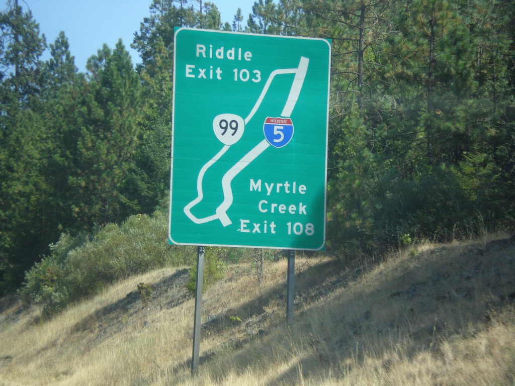
I-5 South - Exit 109 and 103 Route Diagram
Route Diagram showing OR-99 access to I-5 for Myrtle Creek and Riddle.
Taken 08-17-2015
 Myrtle Creek
Douglas County
Oregon
United States
Myrtle Creek
Douglas County
Oregon
United States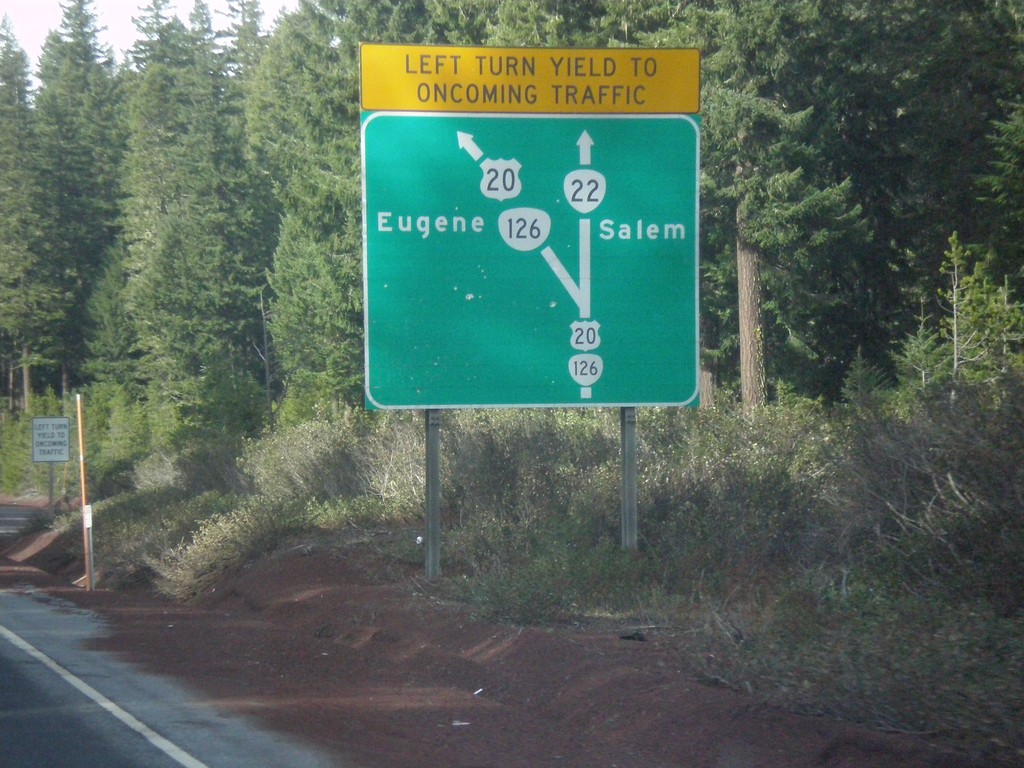
Diagram of US-20/OR-126/OR-22 Junction - US-20/OR-126 West
Map diagram of junction at US-20/OR-126/OR-22 junction on US-20/OR-126 West. Continue straight for OR-22 west to Salem; merge left to continue west on US-20/OR-126 West to Eugene.
Taken 02-13-2015


 Santiam Junction
Linn County
Oregon
United States
Santiam Junction
Linn County
Oregon
United States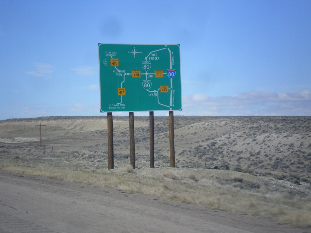
I-80 West - Bridger Valley Route Diagram
Bridger Valley route diagram on I-80 west.
Taken 03-31-2014
Lyman
Uinta County
Wyoming
United States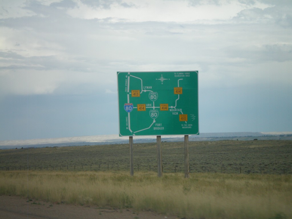
Bridger Valley Route Diagram
Route diagram for the Bridger Valley on I-80 east, descending into the Bridger Valley.
Taken 07-31-2010


 Fort Bridger
Uinta County
Wyoming
United States
Fort Bridger
Uinta County
Wyoming
United States