Signs Tagged With Intersection
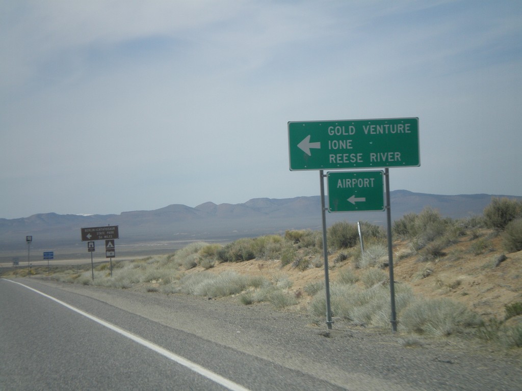
US-50 West Approaching NV-722
US-50 west approaching NV-722 west to Ione, Reese River, Gold Venture, and the Austin Airport.
Taken 04-15-2010

 Austin
Lander County
Nevada
United States
Austin
Lander County
Nevada
United States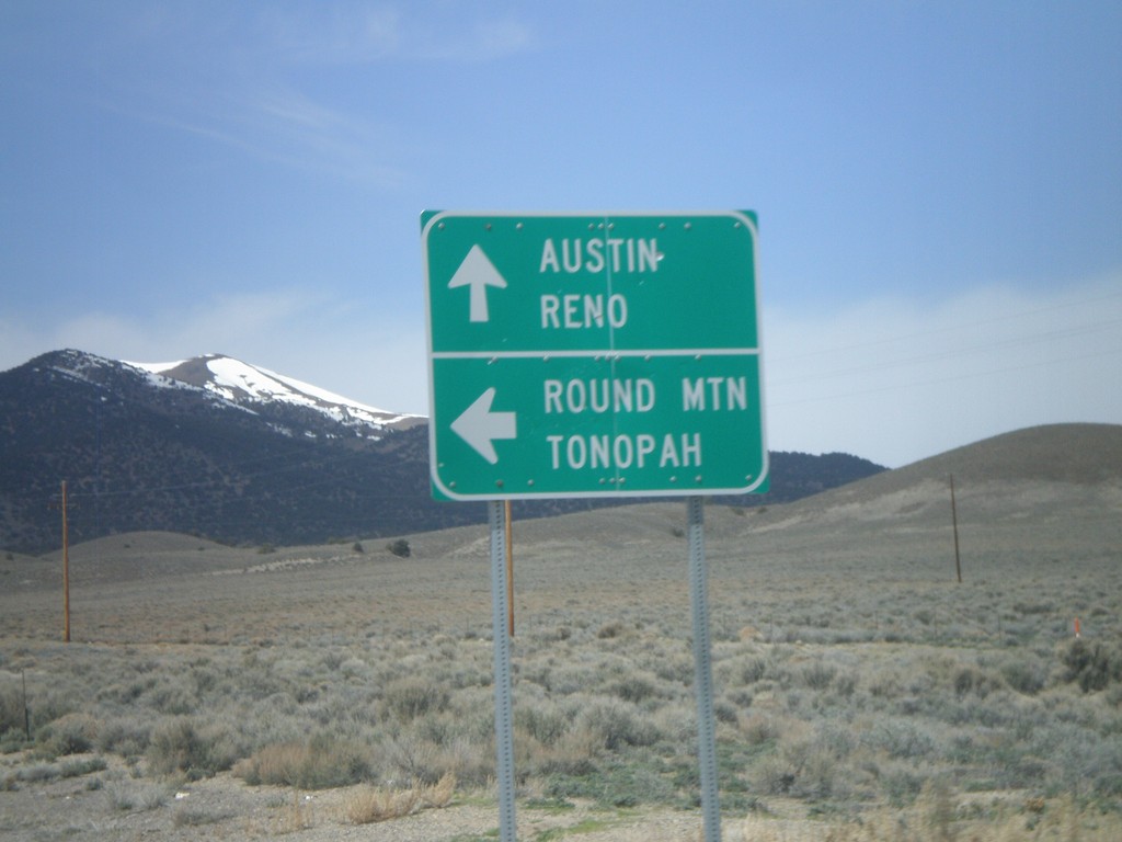
US-50 West at NV-376 South
US-50 west at NV-376 south for Round Mountain and Tonopah. Continue west for Austin and Reno.
Taken 04-15-2010
Austin
Lander County
Nevada
United States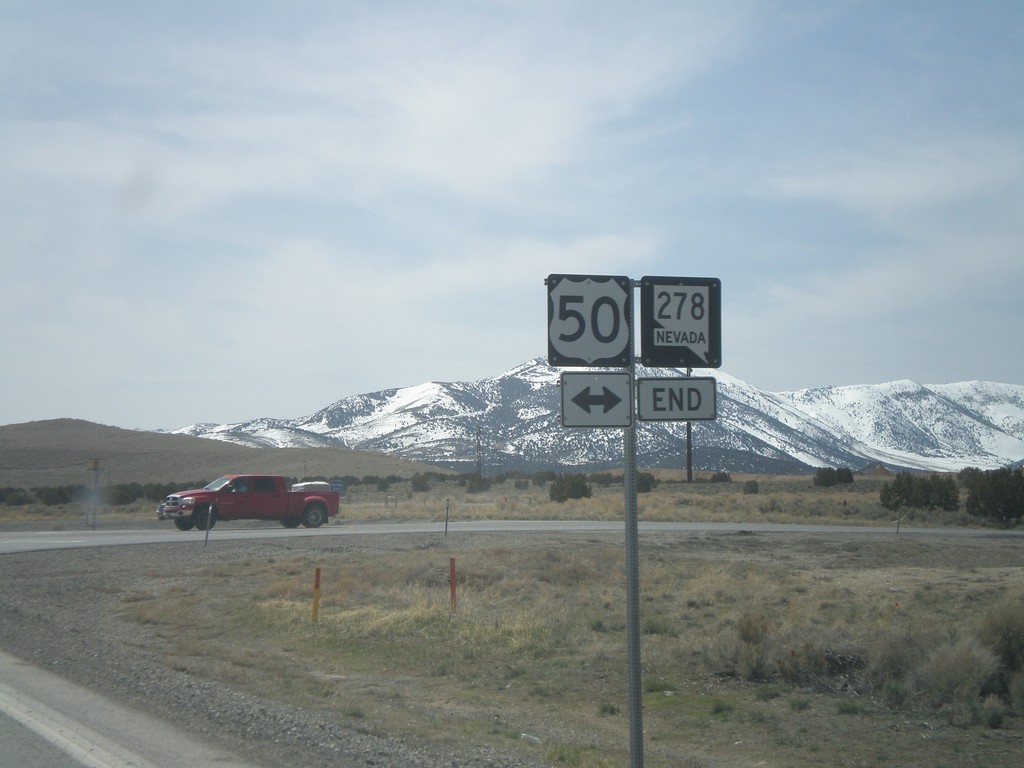
NV-278 South Approaching US-50
NV-278 south approaching US-50
Taken 04-15-2010
 Eureka
 County
Nevada
United States
Eureka
Eureka County
Nevada
United States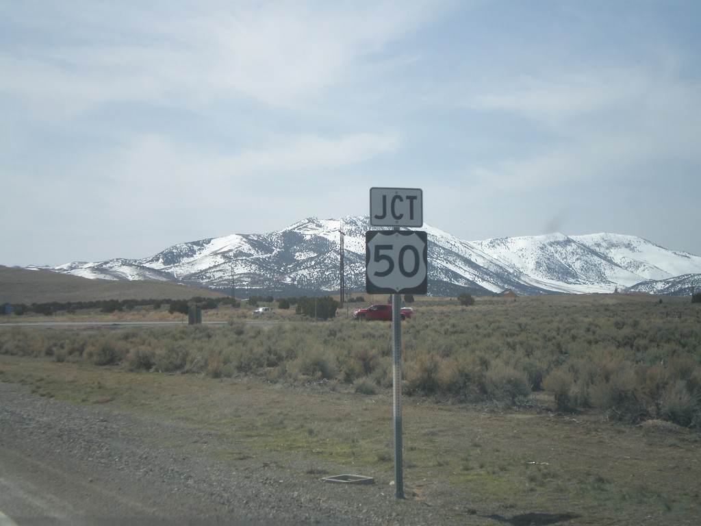
Jct. US-50 On NV-278 South
Jct. US-50 on NV-278 South
Taken 04-15-2010
Eureka
Eureka County
Nevada
United States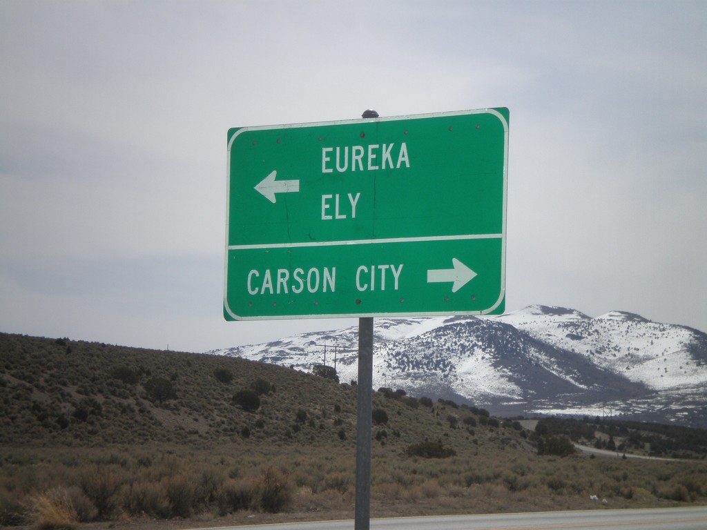
End NV-278 South at US-50
End NV-278 south at US-50. Use US-50 west for Carson City. Use US-50 east for Eureka and Ely.
Taken 04-15-2010
Eureka
Eureka County
Nevada
United States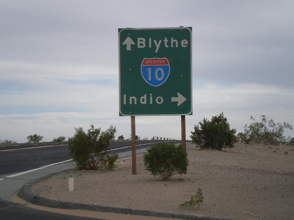
Wileys Well Road at I-10
Wileys Well Road at I-10 (Exit 222). Use I-10 west for Indio. Use I-10 east for Blythe.
Taken 03-22-2010
 Blythe
Riverside County
California
United States
Blythe
Riverside County
California
United States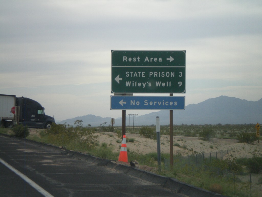
I-10 West - Exit 222 Offramp
I-10 west at Exit 222 offramp - Wiley’s Well. Turn south for Wiley’s Well Road, north for Rest Area.
Taken 03-22-2010
Blythe
Riverside County
California
United States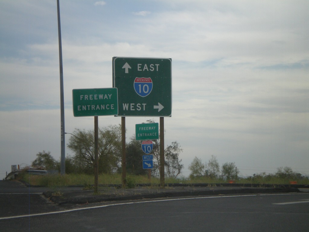
Neighbors Blvd. South at I-10
Neighbors Blvd. south at I-10. BL-10 ends here and CA-78 begins.
Taken 03-22-2010

 Blythe
Riverside County
California
United States
Blythe
Riverside County
California
United States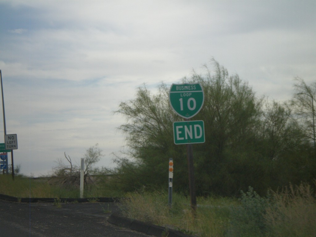
End I-10 Business at I-10 and CA-78
Western end of I-10 Blythe business loop at I-10 on Neighbors Blvd. Neighbors Blvd. continues south as CA-78.
Taken 03-22-2010
Blythe
Riverside County
California
United States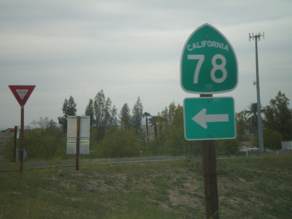
I-10 West Exit 236 Offramp at CA-78
I-10 west Exit 236 offramp at CA-78. CA-78 heads southwest to the Imperial Valley and eventually Oceanside. This is also the western end of the Blythe I-10 Business Loop.
Taken 03-22-2010
Blythe
Riverside County
California
United States