Signs Tagged With Intersection
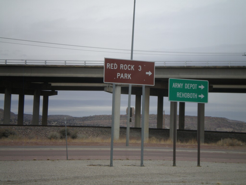
I-40 East Offramp at BL-40/NM-118
I-40 east offramp at BL-40/NM-118. Use NM-118 east for Army Depot. Rehoboth, and and Red Rock Park.
Taken 02-24-2011


 Gallup
McKinley County
New Mexico
United States
Gallup
McKinley County
New Mexico
United States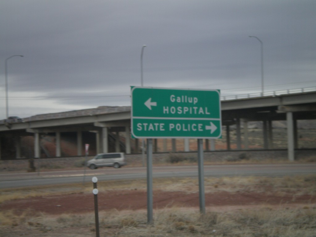
I-40 East at Exit 26 Offramp
I-40 east at Exit 26 Offramp. Turn right for State Police; turn left for Gallup and Hospital.
Taken 02-24-2011
Gallup
McKinley County
New Mexico
United States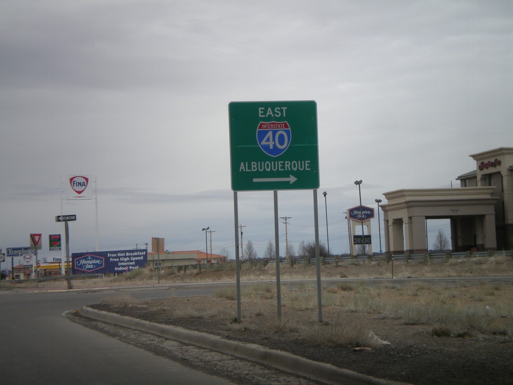
NM-118 East at I-40 East Onramp
NM-118 east at I-40 east onramp, at Exit 16. Use I-40 east for Albuquerque.
Taken 02-24-2011
Gallup
McKinley County
New Mexico
United States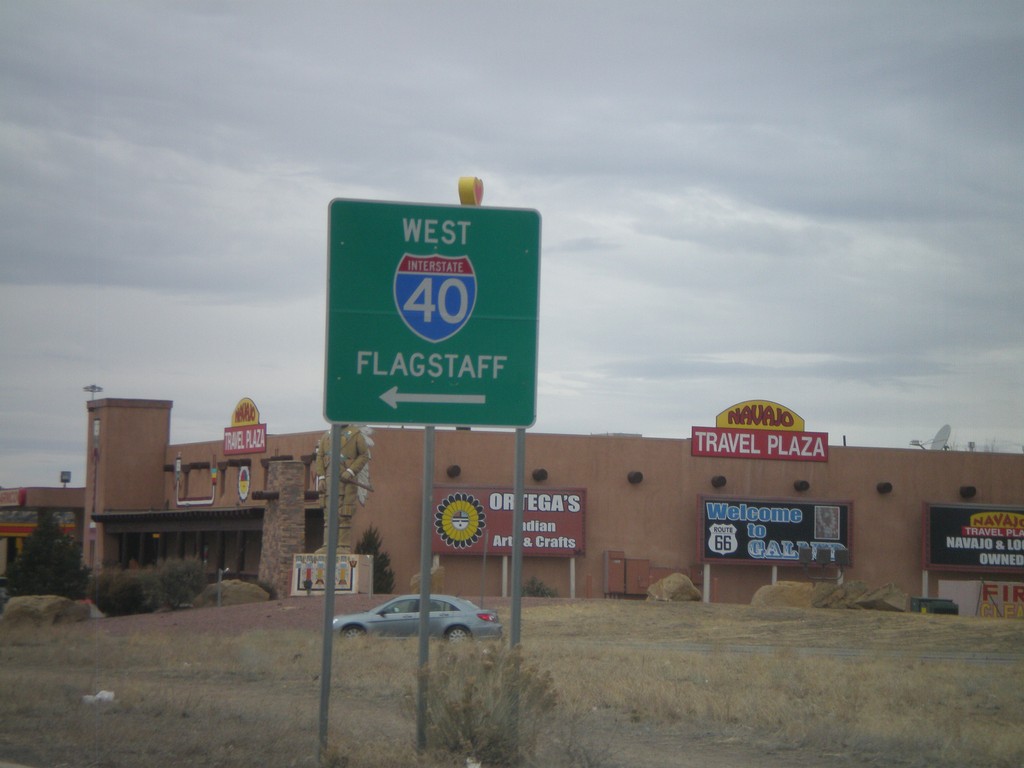
BL-40/NM-118 West at I-40 West
BL-40/NM-118 west at I-40 west to Flagstaff. This is the western end of the Gallup business loop.
Taken 02-24-2011
Gallup
McKinley County
New Mexico
United States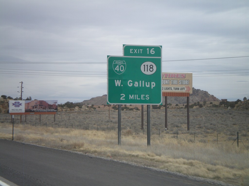
I-40 East Approaching Exit 16
I-40 east approaching Exit 16 - BL-40/NM-118/West Gallup.
Taken 02-24-2011
Gallup
McKinley County
New Mexico
United States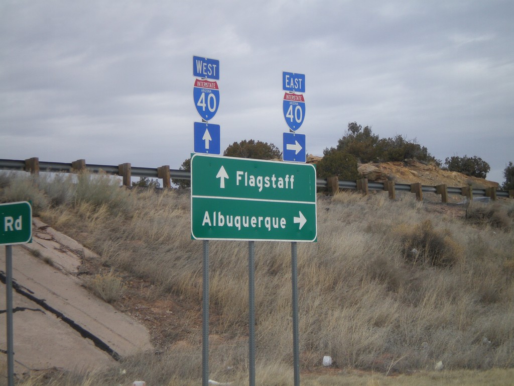
I-40 Onramp at Exit 346
I-40 onramp at Exit 346. Use I-40 west for Flagstaff; use I-40 east for Albuquerque.
Taken 02-24-2011
Houck
Apache County
Arizona
United States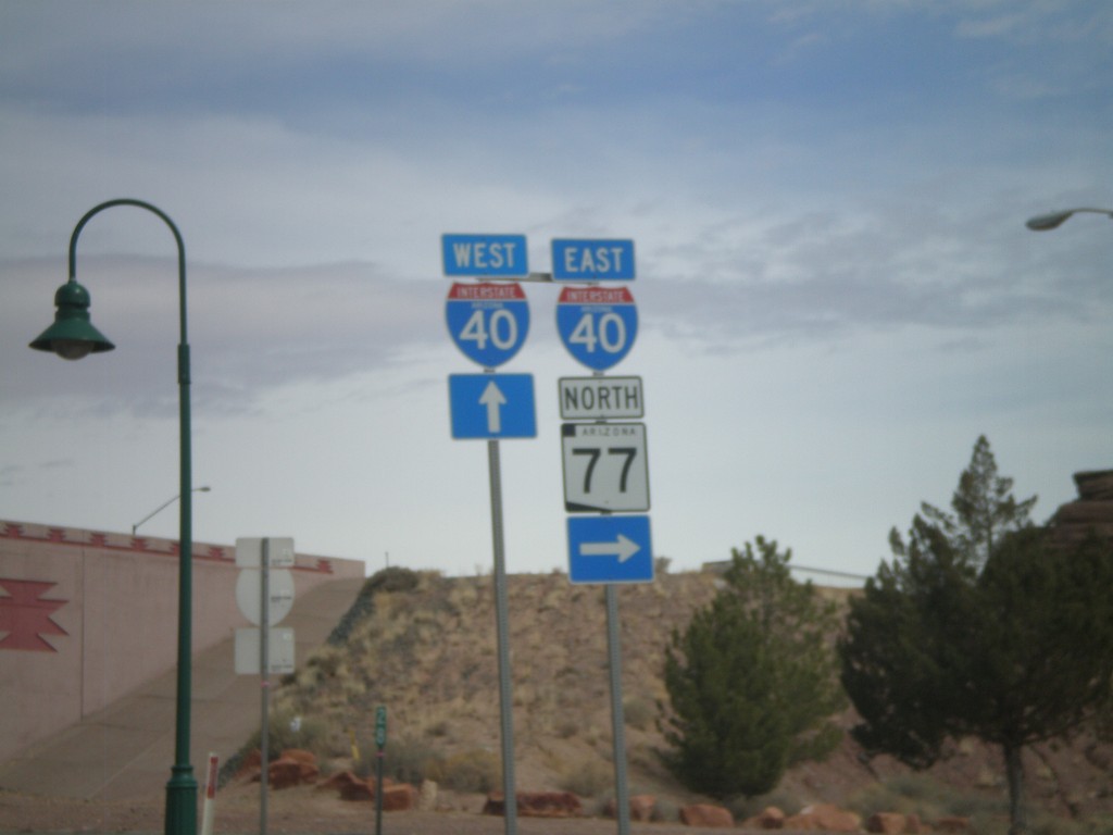
BL-40 East/AZ-77 North at I-40
BL-40 East/AZ-77 North at I-40 freeway entrance. Use I-40 west for Flagstaff; use I-40 east for Albuquerque. AZ-77 joins I-40 east through Holbrook.
Taken 02-24-2011
 Holbrook
Navajo County
Arizona
United States
Holbrook
Navajo County
Arizona
United States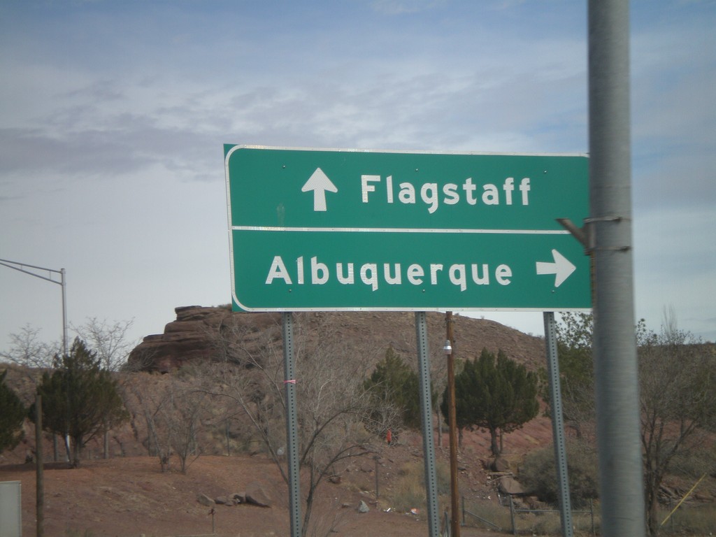
BL-40 East/AZ-77 North at I-40
BL-40 East/AZ-77 North at I-40 freeway entrance. Use I-40 west for Flagstaff; use I-40 east for Albuquerque. AZ-77 joins I-40 east through Holbrook.
Taken 02-24-2011
Holbrook
Navajo County
Arizona
United States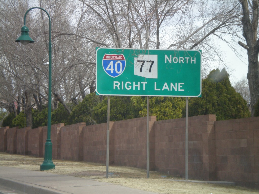
BL-40 East/AZ-77 North Approaching I-40
BL-40 East/AZ-77 North approaching I-40. AZ-77 joins I-40 east through Holbrook.
Taken 02-24-2011
Holbrook
Navajo County
Arizona
United States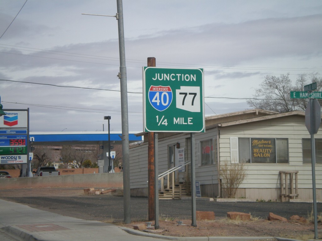
AZ-77 North/BL-40 East Approaching I-40
AZ-77 North/BL-40 East approaching I-40. AZ-77 north joins I-40 east to the east side of Holbrook.
Taken 02-24-2011
Holbrook
Navajo County
Arizona
United States