Signs Tagged With Intersection
WA-260 West/WA-261 South Approaching WA-261
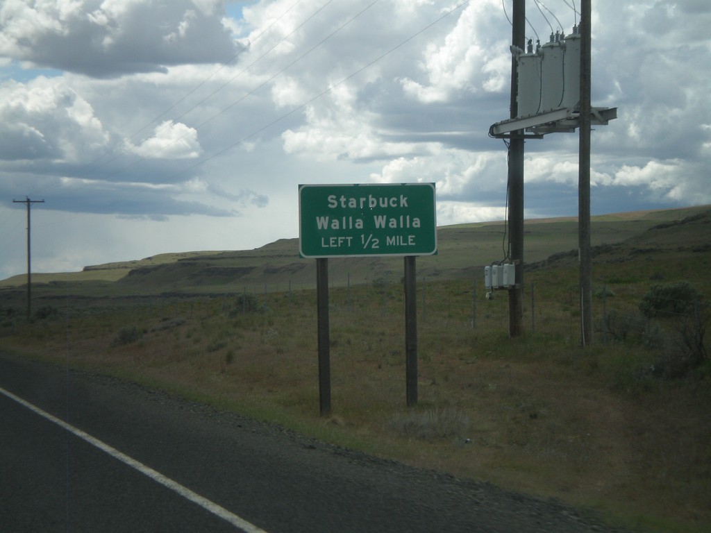
WA-260 West/WA-261 South approaching WA-261. Turn left to continue south on WA-261 towards Starbuck and Walla Walla.
Taken 04-28-2011

 Washtucna
Franklin County
Washington
United States
Washtucna
Franklin County
Washington
United States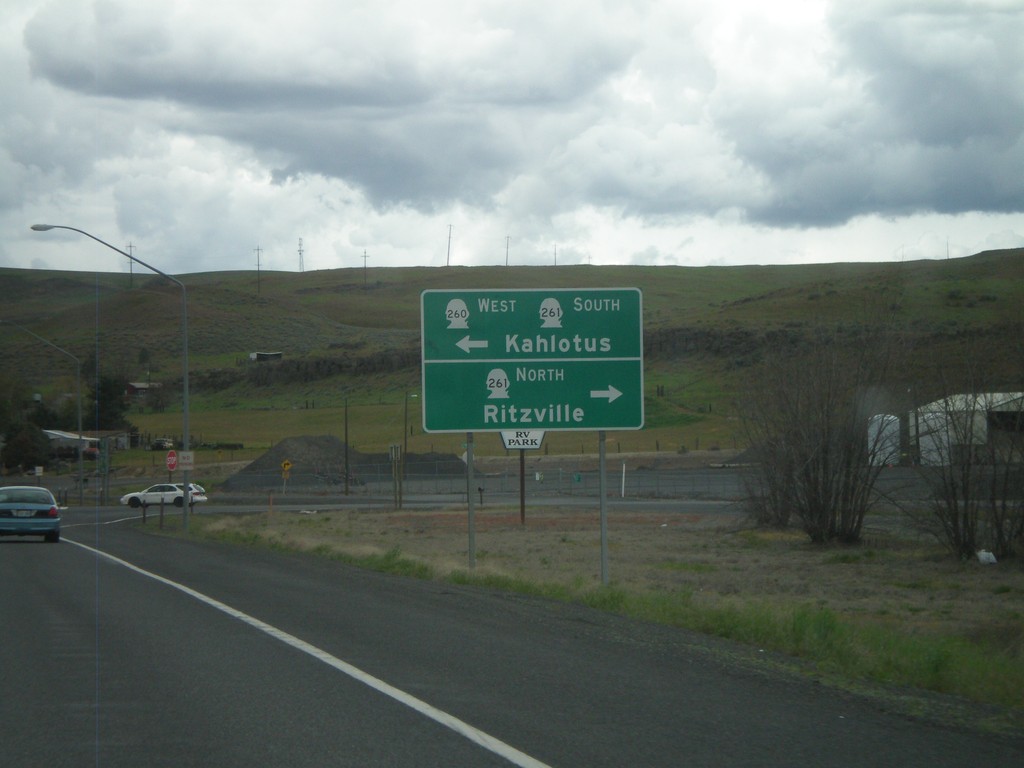
WA-26 West at WA-260/WA-261
WA-26 West at WA-260/WA-261 in Washtucna. Turn left for WA-260 West/WA-261 South to Kahlotus. Turn right on WA-261 North to Ritzville.
Taken 04-28-2011
 Washtucna
Adams County
Washington
United States
Washtucna
Adams County
Washington
United States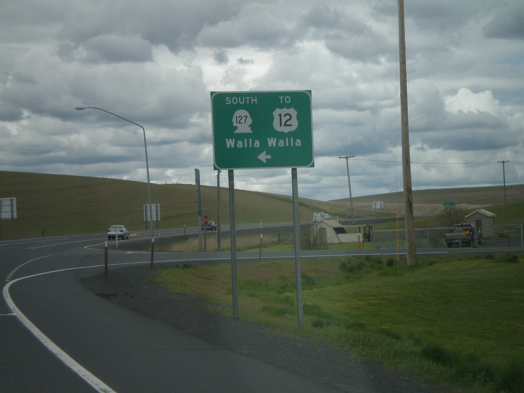
WA-26 West at WA-127
WA-26 West at WA-127. Use WA-127 south for US-12 and Walla Walla.
Taken 04-28-2011

 LaCrosse
Whitman County
Washington
United States
LaCrosse
Whitman County
Washington
United States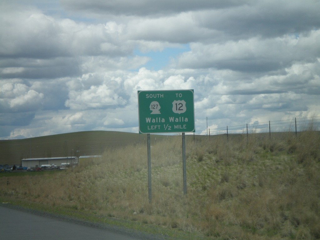
WA-26 West Approaching WA-127
WA-26 west approaching WA-127 south to US-12 and Walla Walla. Access to Walla Walla is via US-12.
Taken 04-28-2011
LaCrosse
Whitman County
Washington
United States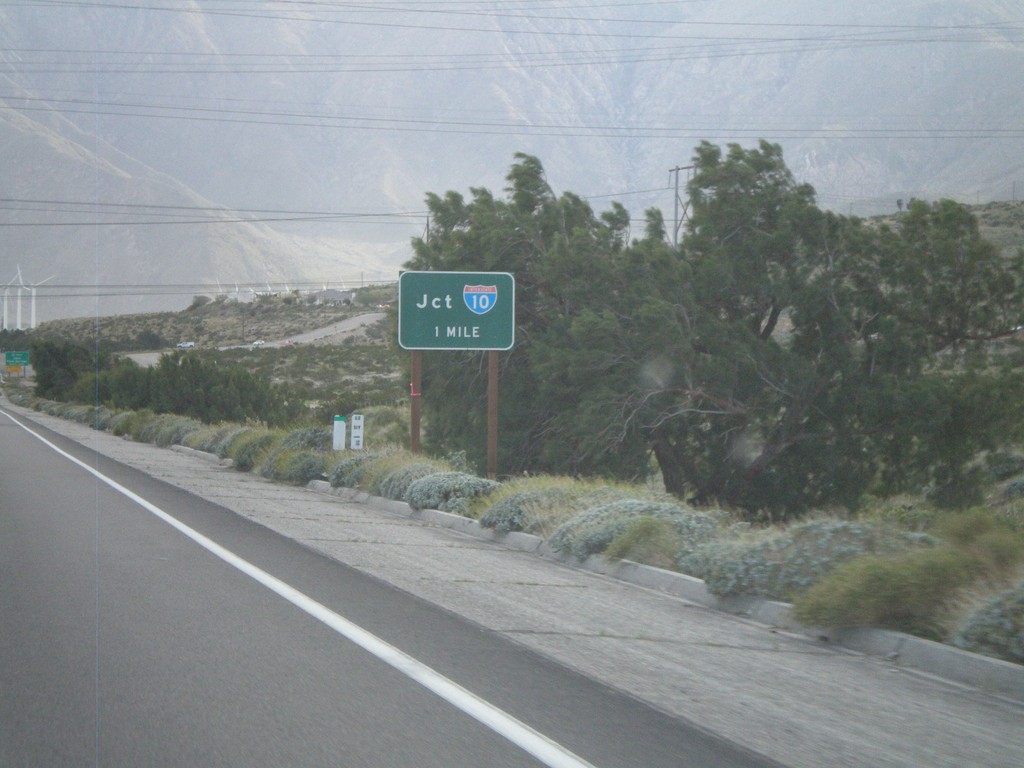
CA-62 West Approaching I-10
Approaching I-10 on CA-62 west.
Taken 02-25-2011

 Whitewater
Riverside County
California
United States
Whitewater
Riverside County
California
United States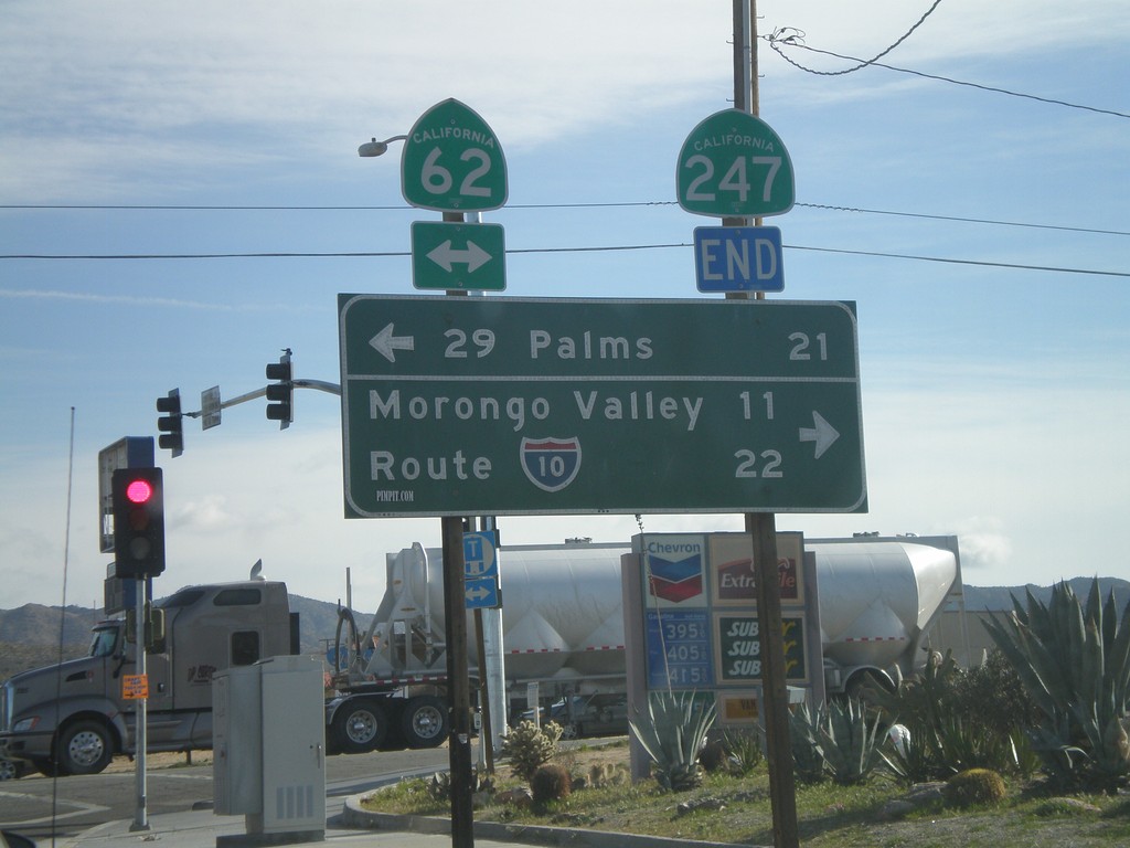
End CA-247 South at CA-62
End CA-247 south at CA-62. Use CA-62 east for 29 Palms; use CA-62 east for I-10 and Morongo Valley.
Taken 02-25-2011
 Yucca Valley
San Bernardino County
California
United States
Yucca Valley
San Bernardino County
California
United States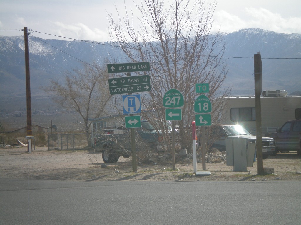
CA-247 South at CA-18
CA-247 south at CA-18. This is not the true junction with CA-18, which lies a little to the south and east. Use CA-18 west for Victorville; use CA-18 east for Big Bear Lake; use CA-247 south for 29 Palms.
Taken 02-25-2011
 Lucerne Valley
San Bernardino County
California
United States
Lucerne Valley
San Bernardino County
California
United States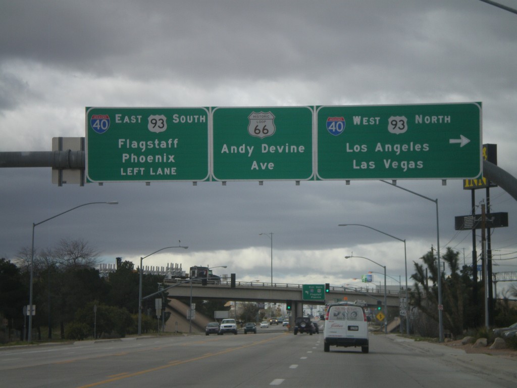
End AZ-66 West At I-40/US-93
End AZ-66 west at I-40/US-93 jct. Use I-40 West/US-93 North for Los Angeles and Las Vegas. Use I-40 East/US-93 South for Phoenix and Flagstaff. Continue straight for Andy Devine Avenue and Historic Loop US-66.
Taken 02-25-2011


 Kingman
Mohave County
Arizona
United States
Kingman
Mohave County
Arizona
United States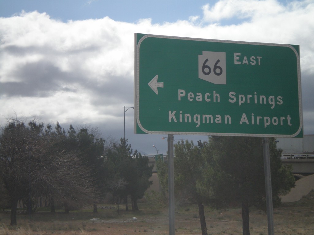
I-40 West at AZ-66
I-40 west at AZ-66 (and Historic Loop US-66) at Exit 53 onramp. Use AZ-66 east for Peach Springs and Kingman Airport.
Taken 02-25-2011
Kingman
Mohave County
Arizona
United States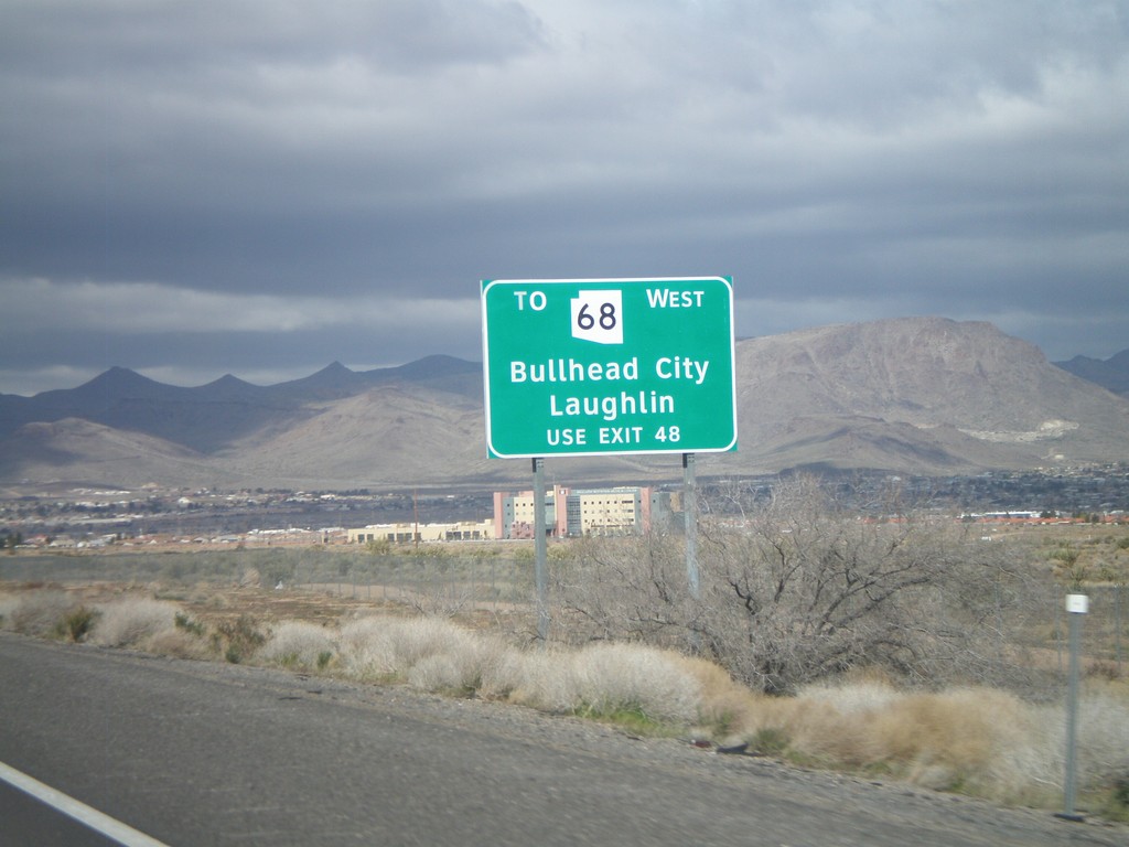
I-40 West - AZ-68 Traffic Use Exit 48
AZ-68 traffic for Bullhead City, and Laughlin (Nevada), use Exit 48. This sign is posted on the east end of Kingman approaching Exit 53.
Taken 02-25-2011
 Kingman
Mohave County
Arizona
United States
Kingman
Mohave County
Arizona
United States