Signs Tagged With Intersection
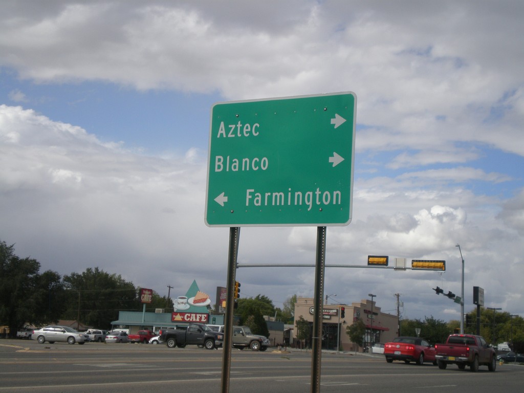
US-550 North at US-64
US-550 north at US-64. Turn right for US-550 North/US-64 East for Aztec and Blanco. Turn left for US-64 West to Farmington.
Taken 10-07-2011

 Bloomfield
San Juan County
New Mexico
United States
Bloomfield
San Juan County
New Mexico
United States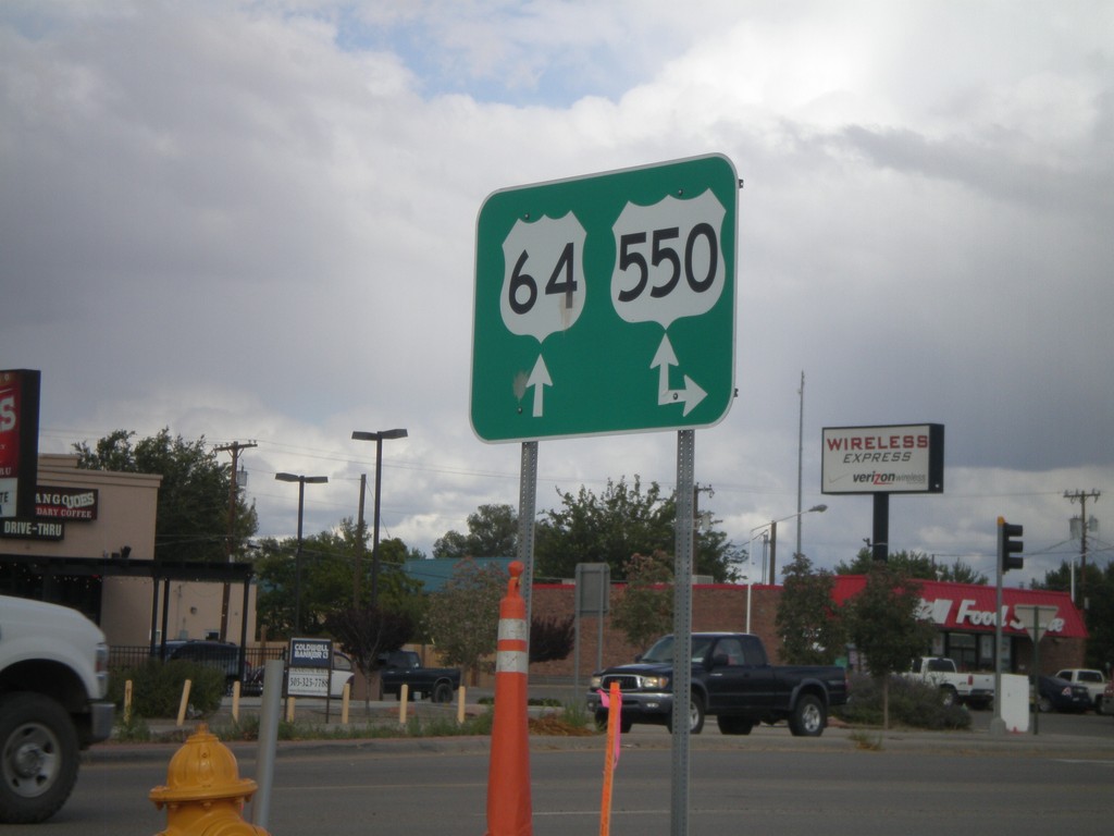
US-64 East at US-550
US-64 east at US-550. Turn right for US-550 south; continue ahead for US-64 East/US-550 North. US-550 joins US-64 through Bloomfield.
Taken 10-07-2011
Bloomfield
San Juan County
New Mexico
United States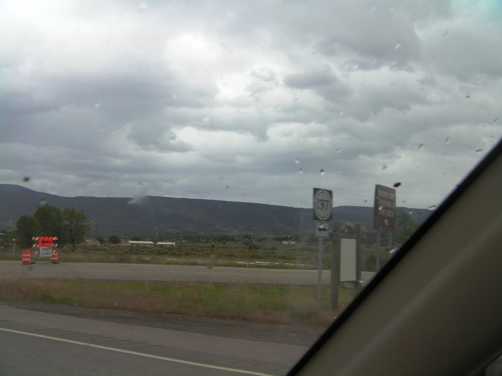
US-550 North at NM-197
US-550 North at NM-197 in Cuba.
Taken 10-06-2011
 Cuba
Sandoval County
New Mexico
United States
Cuba
Sandoval County
New Mexico
United States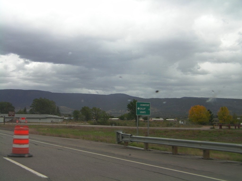
US-550 North at NM-197
US-550 north at NM-197 south to Crownpoint, Grants, and Gallup.
Taken 10-06-2011
Cuba
Sandoval County
New Mexico
United States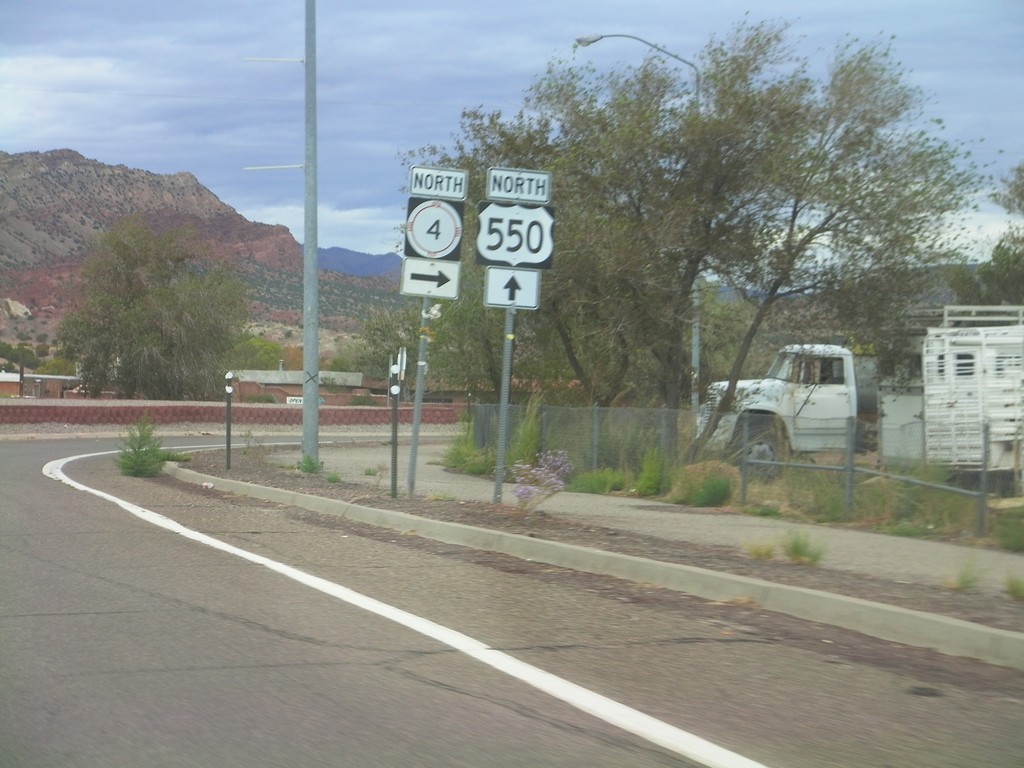
US-550 North at NM-4
US-550 north at NM-4 North in San Ysidro.
Taken 10-06-2011
 San Ysidro
Sandoval County
New Mexico
United States
San Ysidro
Sandoval County
New Mexico
United States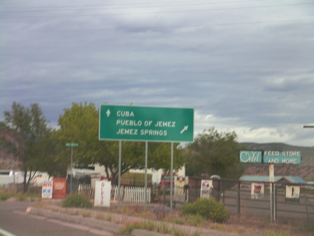
US-550 North at NM-4
US-550 north at NM-4 north to Jemez Pueblo and Jemez Springs. Continue north on US-550 for Cuba.
Taken 10-06-2011
Rio Rancho
Sandoval County
New Mexico
United States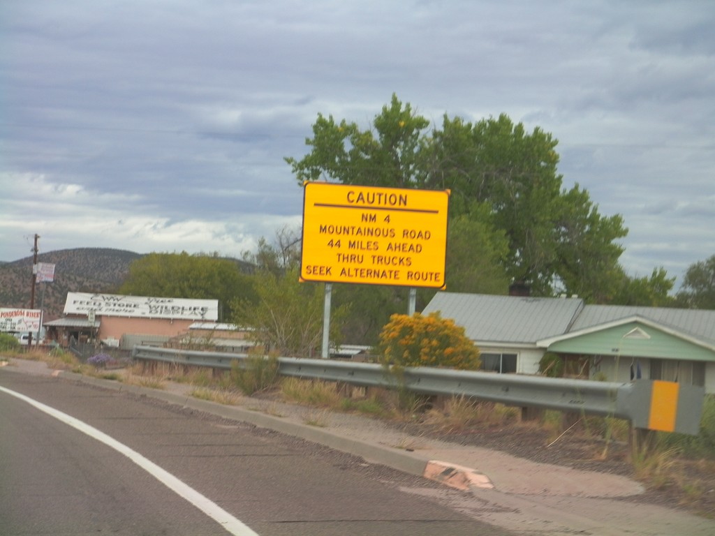
US-550 North Approaching NM-4
US-550 north approaching NM-4. NM-4 is a mountainous road 44 miles north of here and is not advised for trucks.
Taken 10-06-2011
San Ysidro
Sandoval County
New Mexico
United States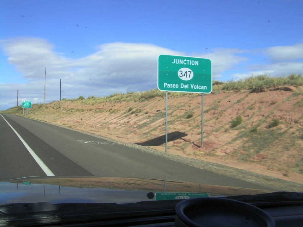
US-550 North Approaching NM-347
US-550 North approaching NM-347 - Paseo Del Volcan.
Taken 10-06-2011
 Rio Rancho
Sandoval County
New Mexico
United States
Rio Rancho
Sandoval County
New Mexico
United States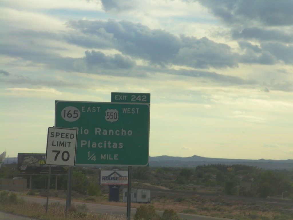
I-25 South - Exit 242
I-25 south approaching Exit 242 - US-550 West/NM-165 East/Rio Rancho/Placitas. This is the southern end of US-550. The speed limit drops from 75 miles per hour to 70 miles per hour as the highway enters the edge of the Albuquerque metropolitan area.
Taken 10-05-2011

 Bernalillo
Sandoval County
New Mexico
United States
Bernalillo
Sandoval County
New Mexico
United States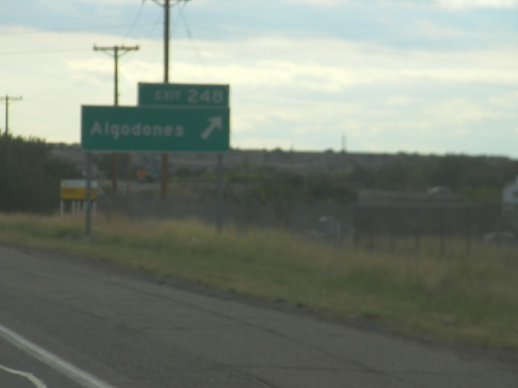
I-25 South - Exit 248
I-25 south at Exit 248 - Algodones.
Taken 10-05-2011
Algodones
Sandoval County
New Mexico
United States