Signs Tagged With Intersection
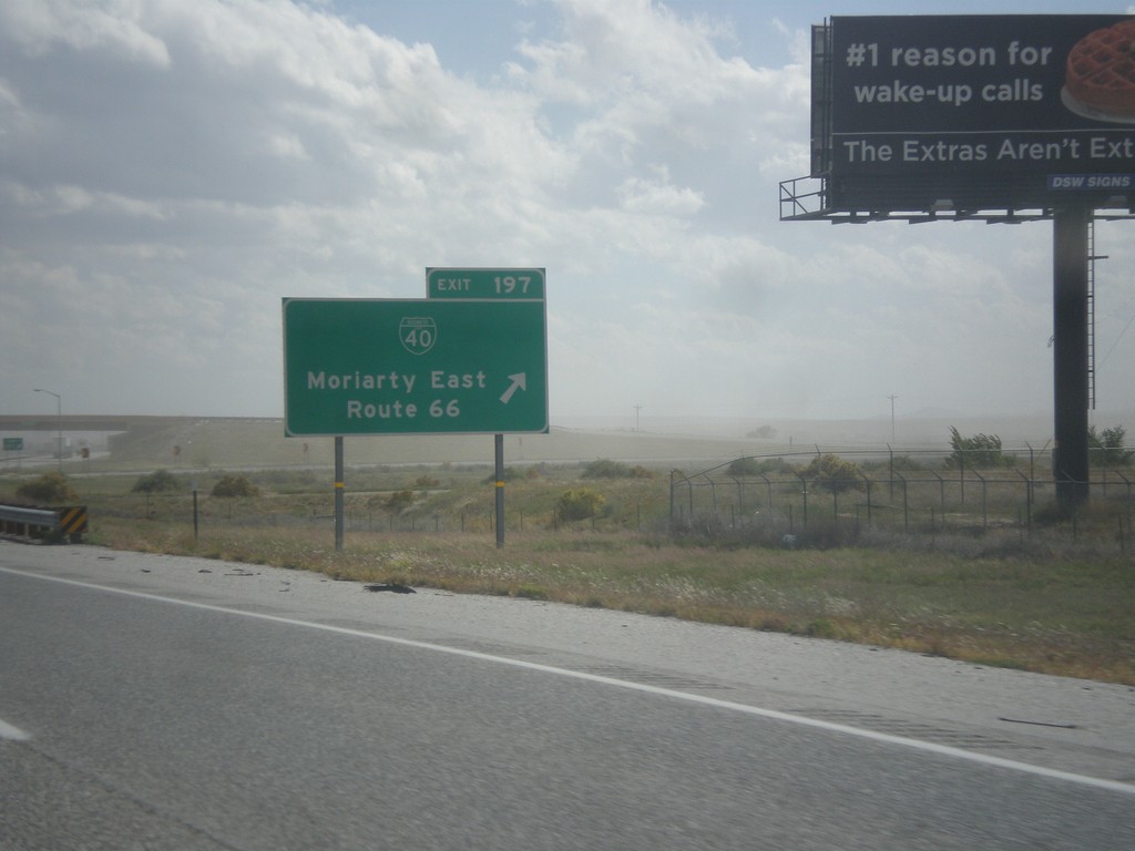
I-40 East - Exit 198
I-40 east at Exit 198 - BL-40/Moriarty East/Route 66. This is the eastern end of the Moriarty business loop.
Taken 10-10-2013

 Moriarty
Torrance County
New Mexico
United States
Moriarty
Torrance County
New Mexico
United States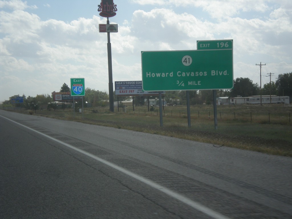
I-40 East - Exit 196
I-40 East approaching Exit 196 - NM-41/Howards Cavasos Blvd. The I-40 sign in the background is pretty common on I-40 east out of Albuquerque.
Taken 10-10-2013
 Moriarty
Torrance County
New Mexico
United States
Moriarty
Torrance County
New Mexico
United States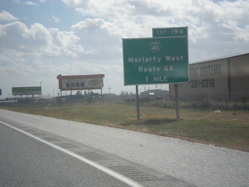
I-40 East Approaching Exit 194
I-40 east approaching Exit 194 - BL-40/Moriarty West/Route 66.
Taken 10-10-2013
Moriarty
Torrance County
New Mexico
United States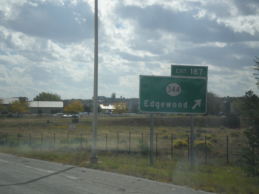
I-40 East - Exit 187
I-40 east at Exit 187 - NM-344/Edgewood.
Taken 10-10-2013
 Edgewood
Santa Fe County
New Mexico
United States
Edgewood
Santa Fe County
New Mexico
United States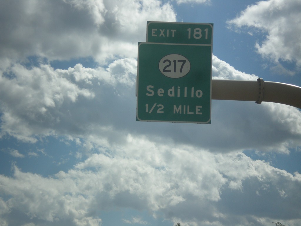
I-40 East - Exit 181
I-40 east approaching Exit 181 - NM-217/Sedillo.
Taken 10-10-2013
 Tijeras
Bernalillo County
New Mexico
United States
Tijeras
Bernalillo County
New Mexico
United States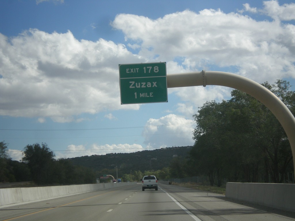
I-40 East - Exit 178
I-40 east at Exit 178 - Zuzax.
Taken 10-10-2013
Tijeras
Bernalillo County
New Mexico
United States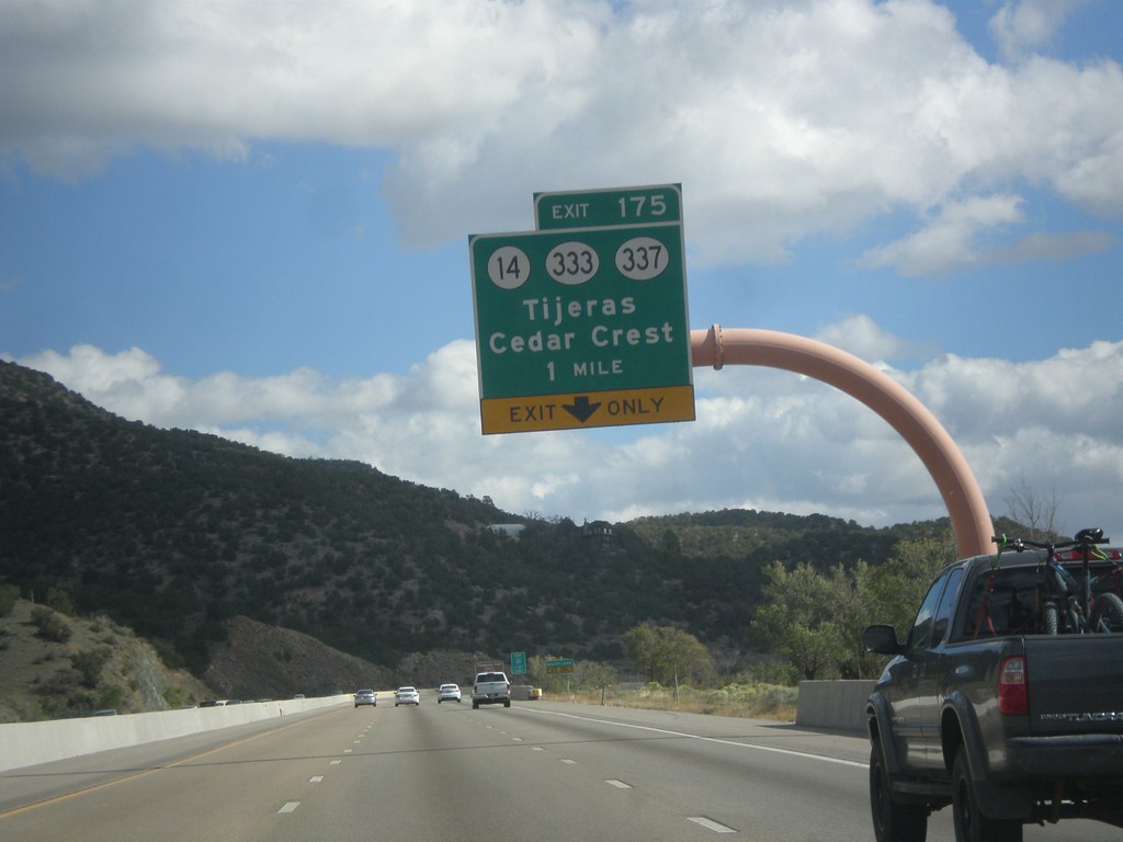
I-40 East - Exit 175
I-40 east at Exit 175 - NM-14/NM-333/NM-337/Tijeras/Cedar Crest. Use NM-14 for the Turquoise Trail National Scenic Byway and the Sandia Crest Ski Area.
Taken 10-10-2013


 Cedar Crest
Bernalillo County
New Mexico
United States
Cedar Crest
Bernalillo County
New Mexico
United States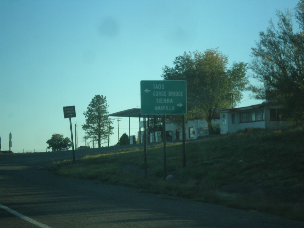
US-285 South at US-64
US-285 south at US-64 in Tres Piedras. Turn left on US-64 for Taos and (Rio Grande) Gorge Bridge. Turn right for Tierra Amarilla.
Taken 10-08-2013

 Tres Piedras
Taos County
New Mexico
United States
Tres Piedras
Taos County
New Mexico
United States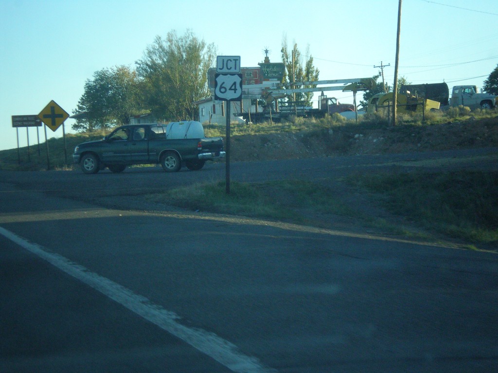
US-285 South Approaching US-64
US-285 south approaching US-64 in Tres Piedras.
Taken 10-08-2013
Tres Piedras
Taos County
New Mexico
United States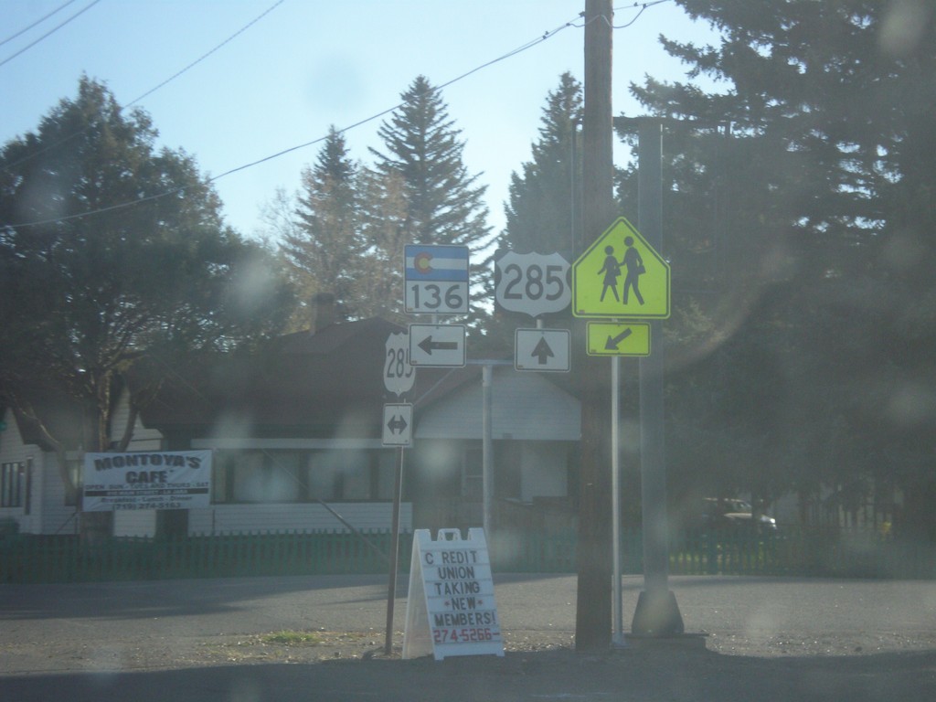
US-285 South at CO-136
US-285 south at CO-136 in La Jara.
Taken 10-08-2013
 La Jara
Conejos County
Colorado
United States
La Jara
Conejos County
Colorado
United States