Signs Tagged With Intersection
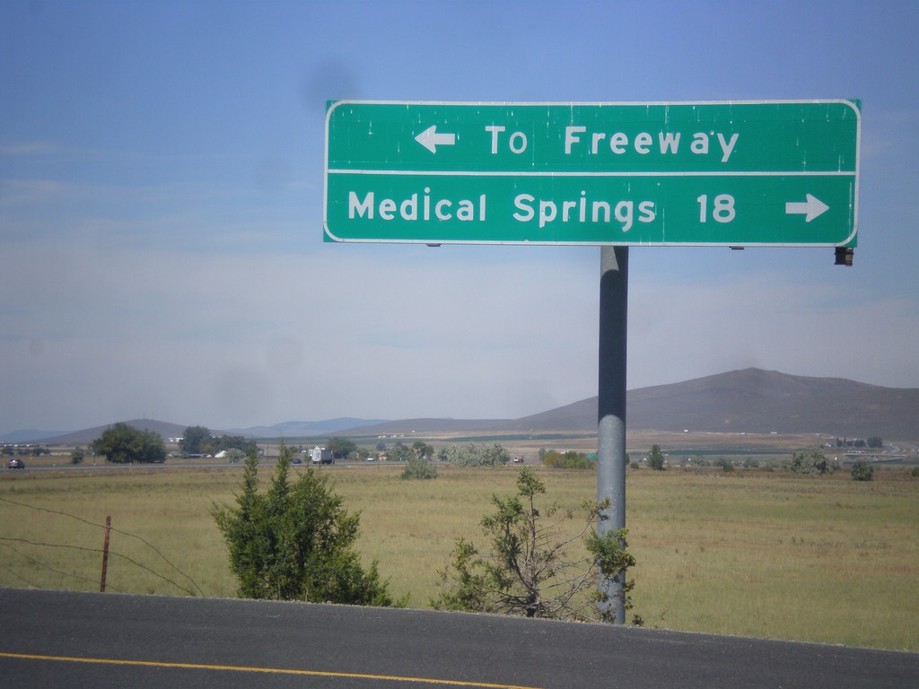
Airport Road North - OR-203 Jct.
Airport Road north at OR-203. Turn right for Medical Springs; left for (I-84) Freeway.
Taken 09-13-2015
 Baker City
Baker County
Oregon
United States
Baker City
Baker County
Oregon
United States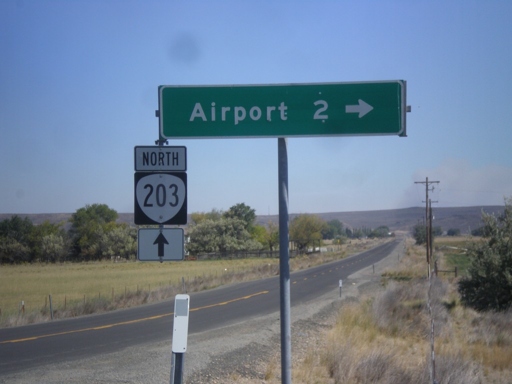
OR-203 North - Airport Road
OR-203 north at Airport Road jct.
Taken 09-13-2015
Baker City
Baker County
Oregon
United States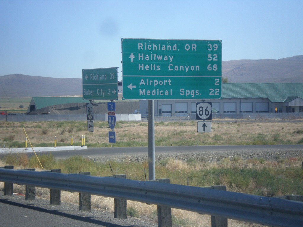
OR-86 East at West Airport Road (Medical Springs Highway)
OR-86 east West Airport Road (Medical Springs Highway) to the (Baker City) Airport and Medical Springs (via OR-203). Continue east on OR-86 for Richland, OR, Halfway and Hells Canyon. West Airport Road is a Frontage Road that extends south from the junction of OR-203 to OR-86. It is part of the Oregon State Highway system as the Medical Springs Highway but is not signed with a number.
Taken 09-13-2015
 Baker City
Baker County
Oregon
United States
Baker City
Baker County
Oregon
United States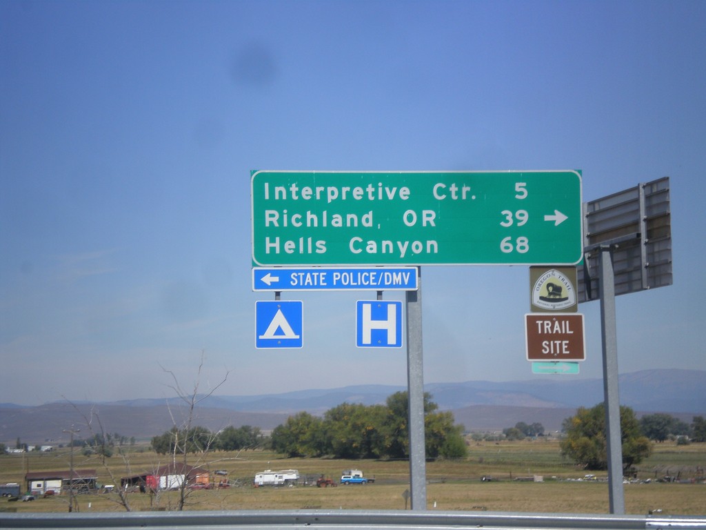
I-84 East (Exit 302) Off Ramp at OR-86
I-84 East (Exit 302) off ramp at OR-86. Turn right for OR-86 west to (Oregon Trail) Interpretive Center, Richland, OR, and Hells Canyon. Turn left for Baker City access.
Taken 09-13-2015
 Baker City
Baker County
Oregon
United States
Baker City
Baker County
Oregon
United States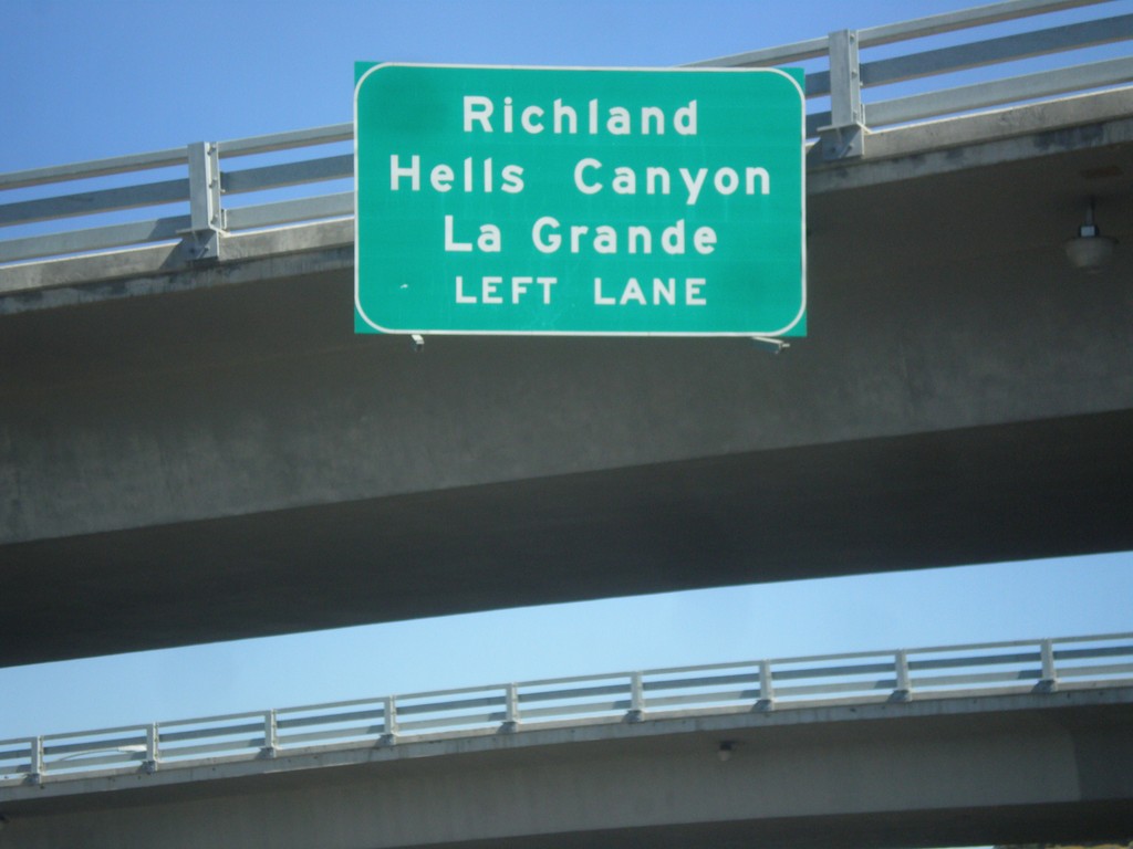
End OR-7 East Approaching I-84 West
End OR-7 East approaching I-84 West to Richland (via OR-86), Hells Canyon (via OR-86) and La Grande.
Taken 09-13-2015
 Baker City
Baker County
Oregon
United States
Baker City
Baker County
Oregon
United States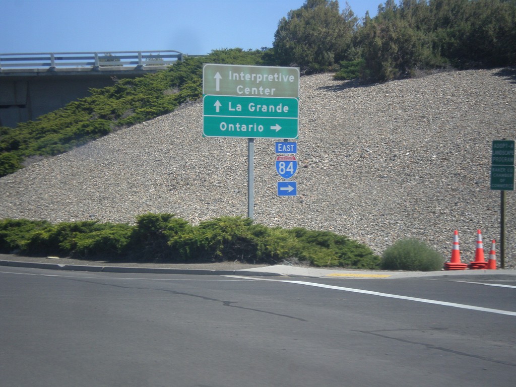
End OR-7 East at I-84 East
End OR-7 East at I-84 East. Turn right for I-84 east to Ontario; straight for I-84 west to La Grande and (Oregon Trail) Interpretive Center.
Taken 09-13-2015
Baker City
Baker County
Oregon
United States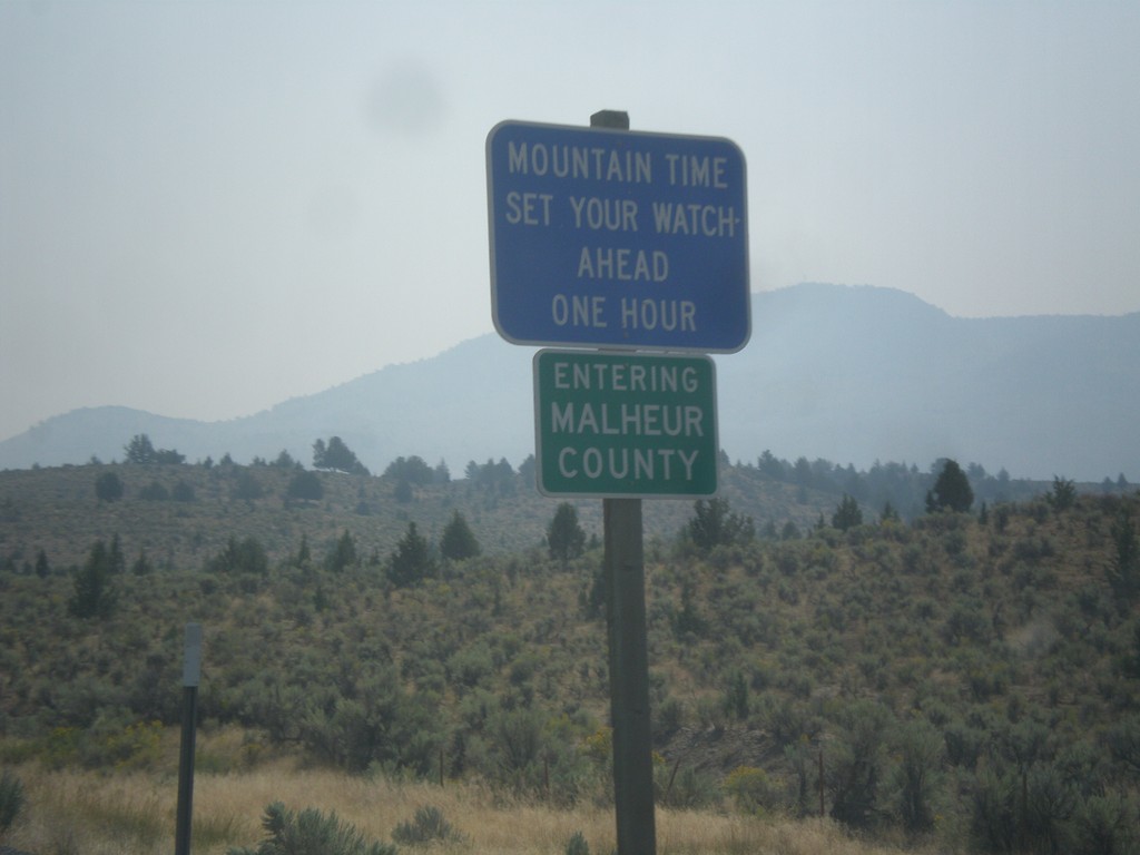
US-20 East - Malheur County/Mountain Time Zone
Entering Malheur County and Mountain Time Zone on US-20 East. The northern portion of Malheur County is the only area in Oregon that follows Mountain Time. From my travels in Oregon, this is the only blue time zone sign in the state. The rest are the standard green color.
Taken 08-23-2015
 Drewsey
Malheur County
Oregon
United States
Drewsey
Malheur County
Oregon
United States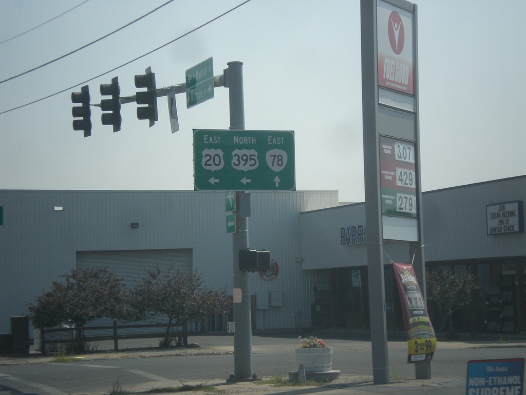
US-20 East/US-395 North at OR-78
US-20 East/US-395 north at OR-78 in Burns.
Taken 08-23-2015

 Burns
Harney County
Oregon
United States
Burns
Harney County
Oregon
United States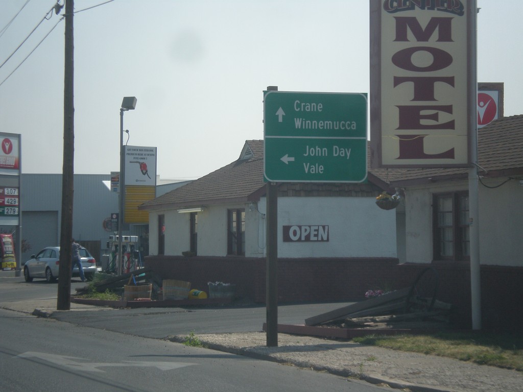
US-20 East/US-395 North Approaching OR-78
US-20 East/US-395 North approaching OR-78. Turn left for US-20 East/US-395 North to John Day (via US-395) and Value (via US-20). Continue straight for OR-78 East to Crane and Winnemucca (Nevada).
Taken 08-23-2015
Burns
Harney County
Oregon
United States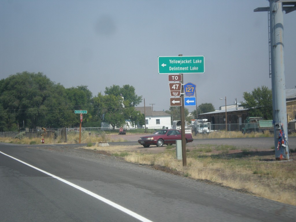
US-20 East/US-395 North - Hines Logging Road
US-20 East/US-395 North -at CR-127 Jct (Hines Logging Road). Use CR-127 for FR-47, Yellowjacket Lake, and Delintment Lake in the Malheur National Forest.
Taken 08-23-2015
Hines
Harney County
Oregon
United States