Signs Tagged With Intersection
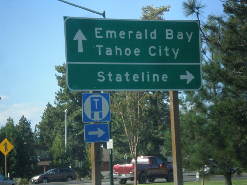
US-50 East/CA-89 North at US-50/CA-89 Split
US-50 East/CA-89 North at US-50/CA-89 split. Turn right to continue east on US-50 for Stateline (Nevada); continue north on CA-89 for Emerald Bay and Tahoe City.
Taken 08-15-2016

 South Lake Tahoe
El Dorado County
California
United States
South Lake Tahoe
El Dorado County
California
United States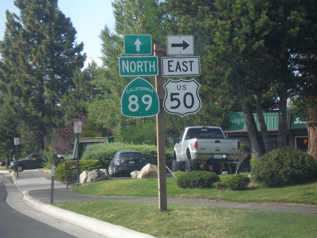
US-50 East/CA-89 North at US-50/CA-89 Split
US-50 East/CA-89 North at US-50/CA-89 Split in South Lake Tahoe. Turn right to continue east on US-50.
Taken 08-15-2016
South Lake Tahoe
El Dorado County
California
United States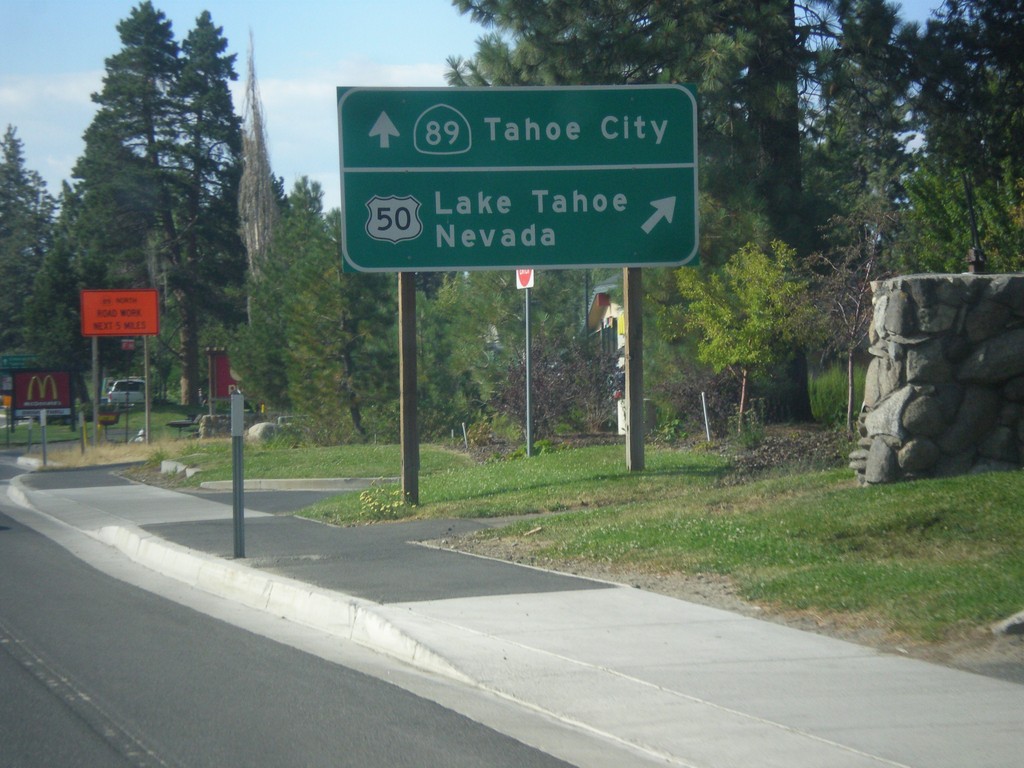
US-50 East/CA-89 North Approaching Split
US-50 East/CA-89 North Approaching US-50/CA-89 split. Merge right for US-50 east to Lake Tahoe Nevada; continue straight for CA-89 north to Tahoe City.
Taken 08-15-2016
South Lake Tahoe
El Dorado County
California
United States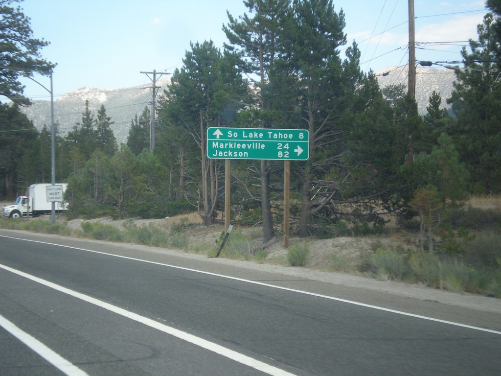
US-50 East At CA-89
US-50 east at CA-89 south to Markleeville and Jackson (via CA-88). Continue straight ahead for US-50 East/CA-89 north to South Lake Tahoe.
Taken 08-15-2016
South Lake Tahoe
El Dorado County
California
United States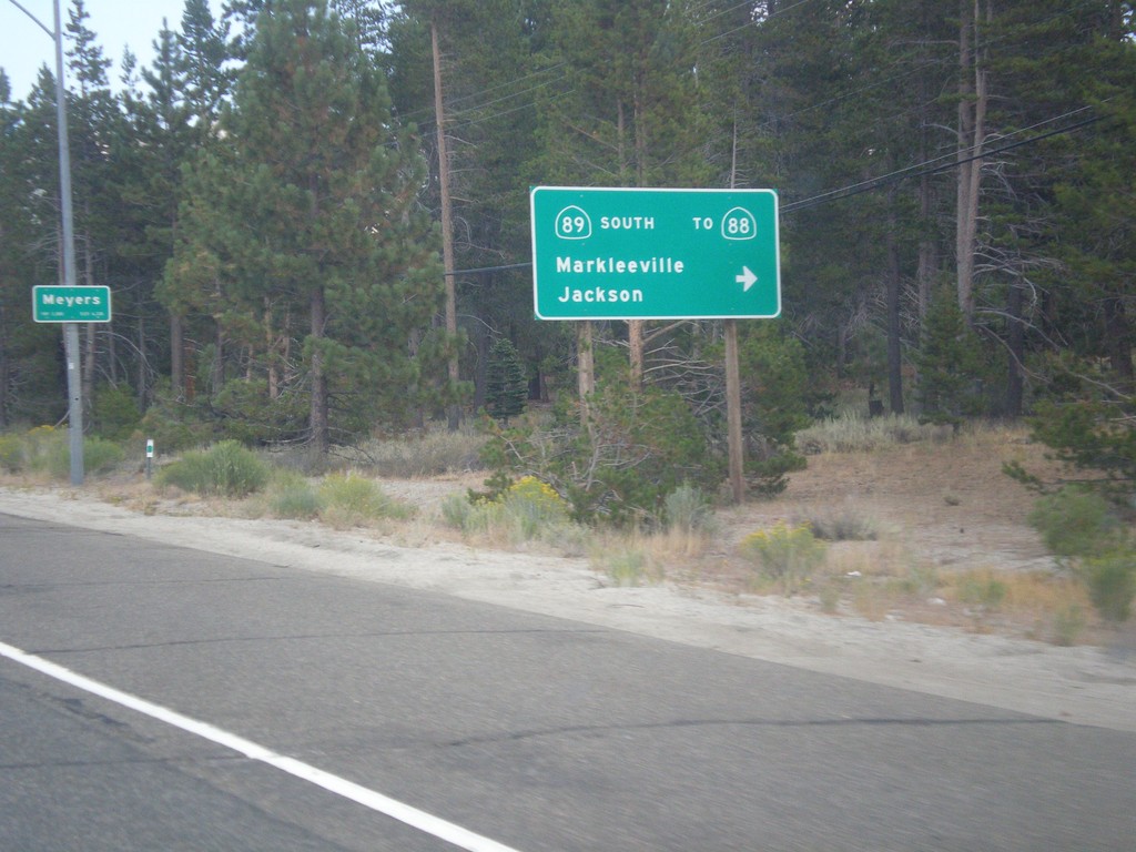
US-50 East At CA-89 South
US-50 east at CA-89 south/Markleeville/Jackson to CA-88. CA-89 north joins US-50 east to South Lake Tahoe. Entering Meyers.
Taken 08-15-2016
 South Lake Tahoe
El Dorado County
California
United States
South Lake Tahoe
El Dorado County
California
United States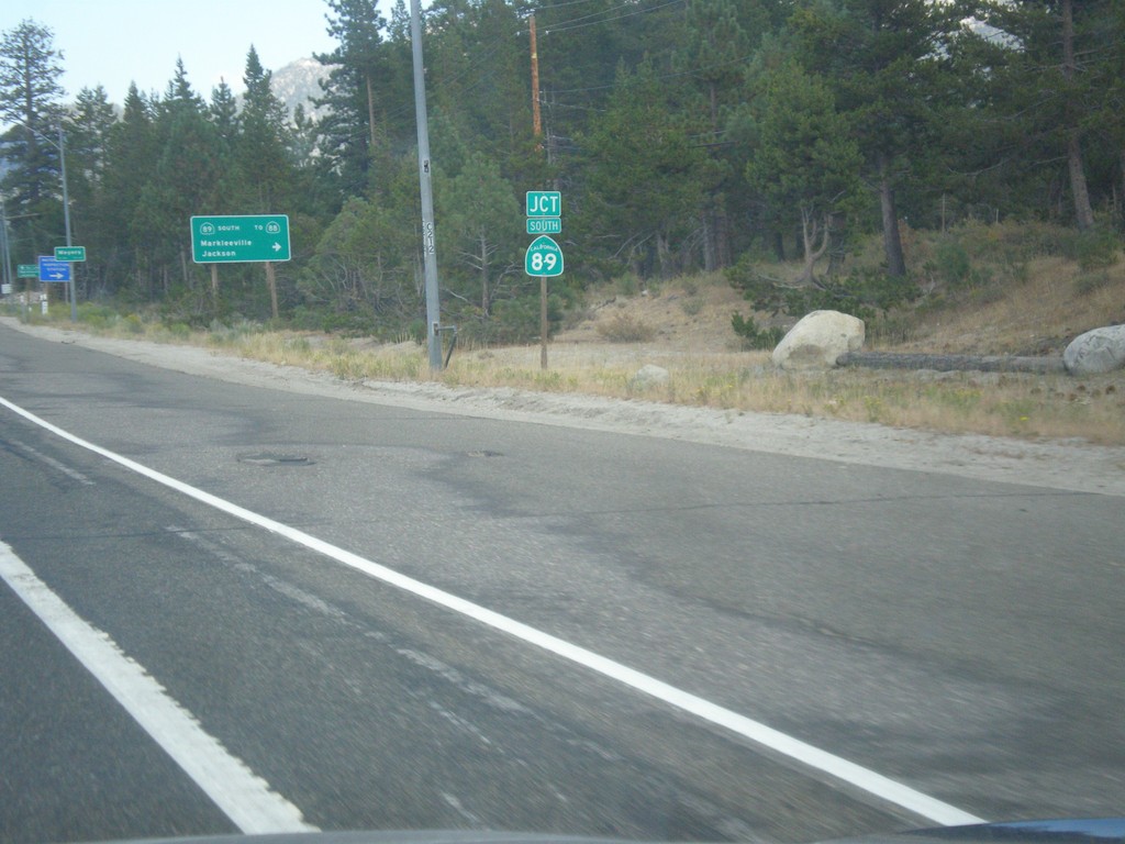
US-50 East at CA-89 Junction
US-50 East at CA-89 Junction in Meyers.
Taken 08-15-2016
South Lake Tahoe
El Dorado County
California
United States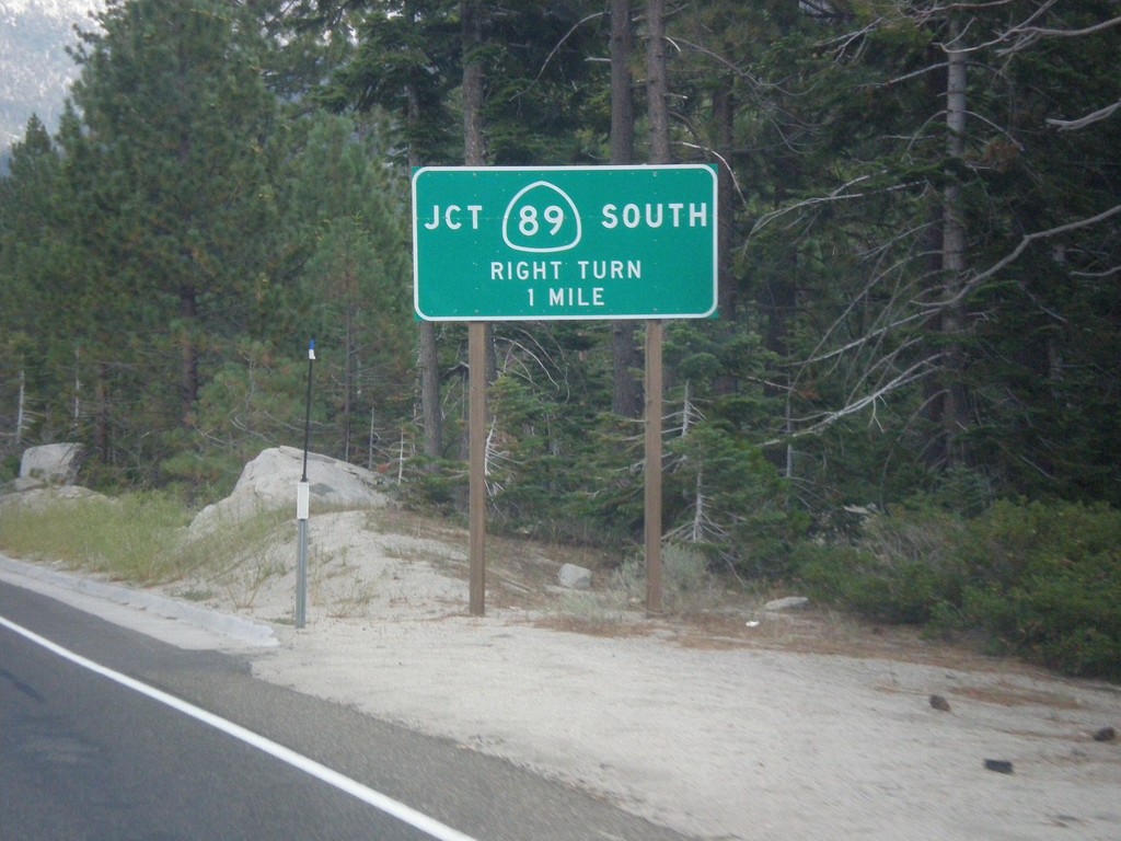
US-50 East at CA-89
US-50 east at CA-89. Turn right for CA-89 south. CA-89 north joins US-50 eastbound to South Lake Tahoe.
Taken 08-15-2016
South Lake Tahoe
El Dorado County
California
United States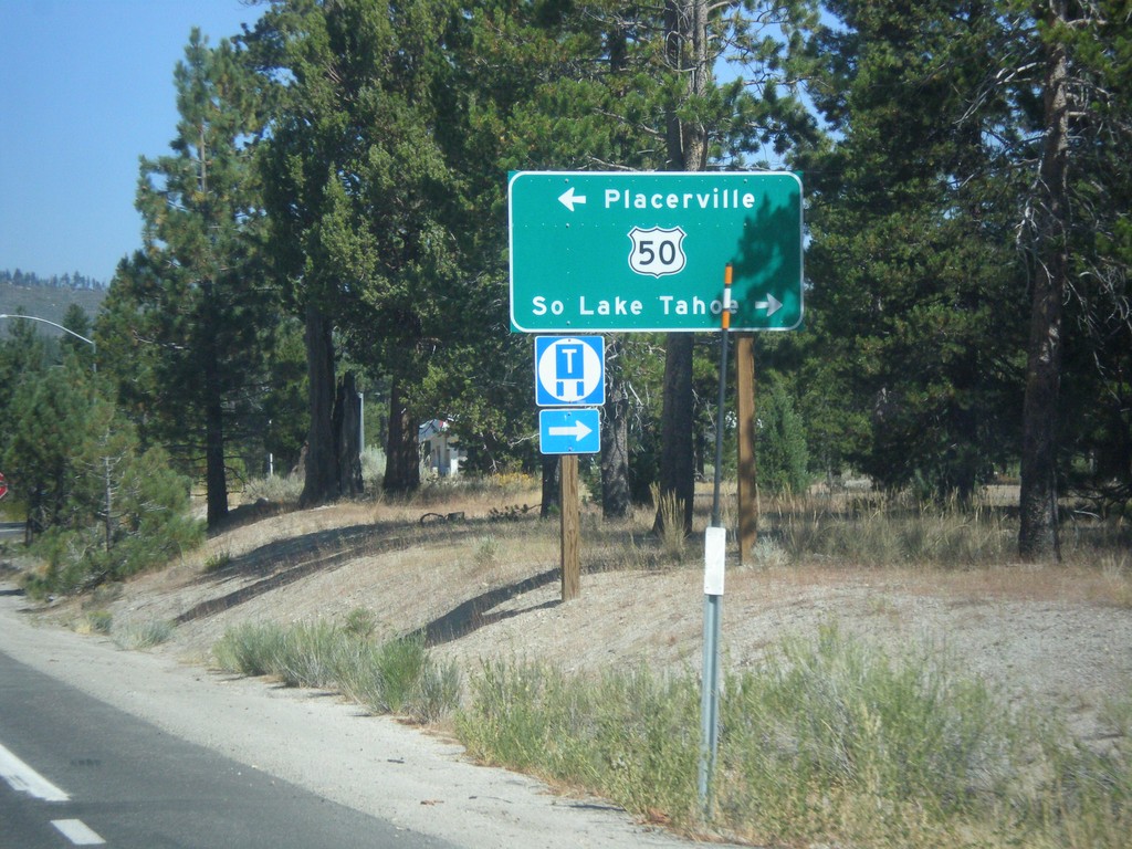
CA-89 North at US-50
CA-89 North at US-50 in Meyers. Turn left on US-50 west for Placerville; right for US-50 East/CA-89 North to South Lake Tahoe.
Taken 08-12-2016
South Lake Tahoe
El Dorado County
California
United States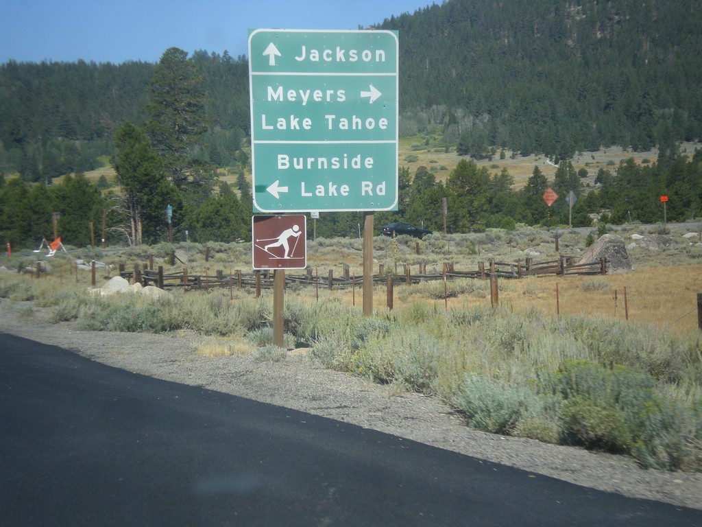
CA-88 West/CA-89 North at CA-88/CA-89 Split
CA-88 West/CA-89 North at CA-89 North. Turn right for CA-89 north to Meyers and Lake Tahoe. Continue west on CA-88 to Jackson. Turn right for Burnside Lake Road.
Taken 08-12-2016
Markleeville
Alpine County
California
United States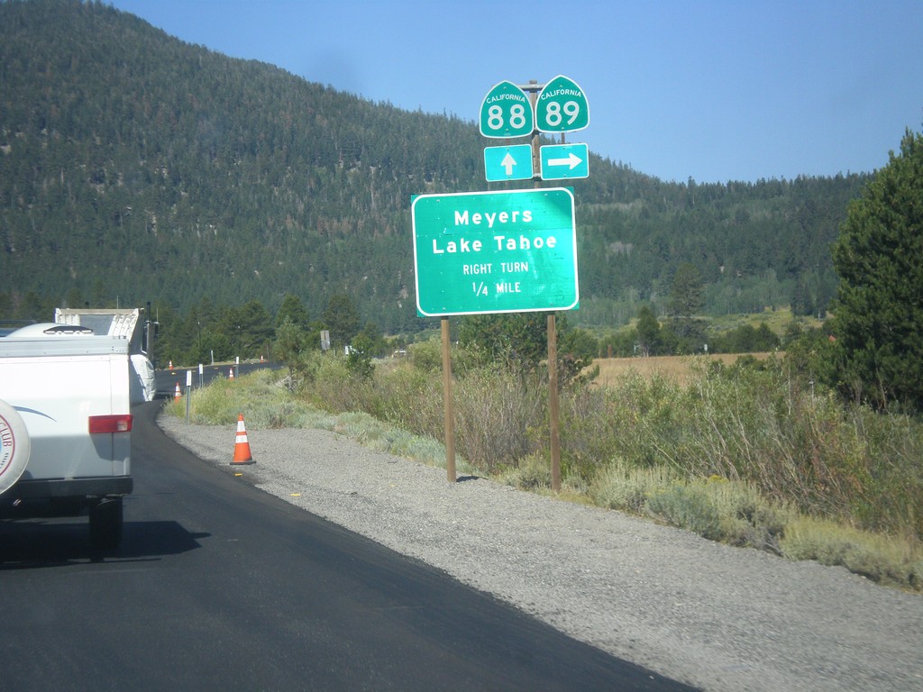
CA-89 North/CA-88 West approaching CA-89/CA-88 Split
CA-89 North/CA-88 West approaching CA-89 north. Use CA-89 north for Meyers and Lake Tahoe.
Taken 08-12-2016
Markleeville
Alpine County
California
United States