Signs Tagged With Intersection
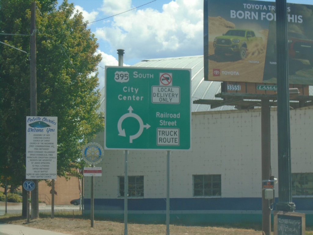
US-395 South/WA-20 East - Railroad St. Junction
US-395 South/WA-20 East at Railroad St. roundabout in Colville. Use Railroad St. southbound for Truck Route. Continue on US-395 South/(WA-20 East) for City Center.
Taken 07-27-2023

 Colville
Stevens County
Washington
United States
Colville
Stevens County
Washington
United States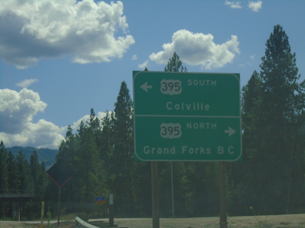
WA-25 South at US-395/WA-20
WA-25 South at US-395/WA-20 near Kettle Falls. Turn right for US-395 North/(WA-20 West) to Grand Forks, BC (Canada). Turn left for US-395 South/(WA-20 East) to Colville.
Taken 07-27-2023
 Kettle Falls
Stevens County
Washington
United States
Kettle Falls
Stevens County
Washington
United States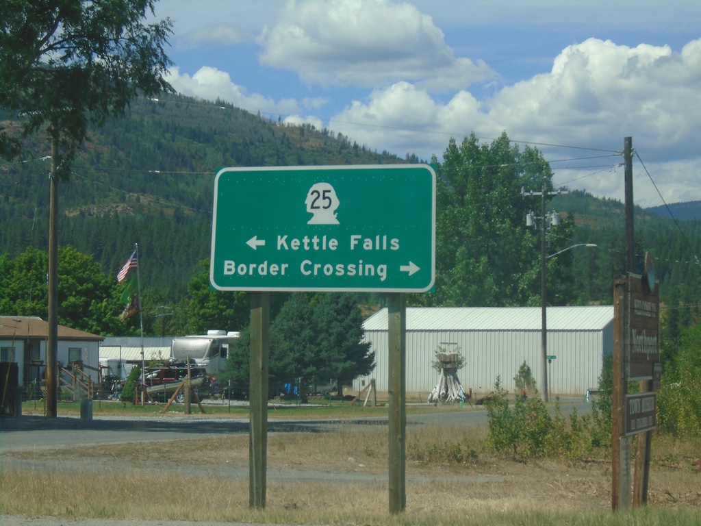
End Northport-Waneta Road at WA-25
End Northport-Waneta Road at WA-25 in Northport. Turn right on WA-25 North to (Port of Patterson) Border Crossing. Turn left on WA-25 South to Kettle Falls.
Taken 07-27-2023
Northport
Stevens County
Washington
United States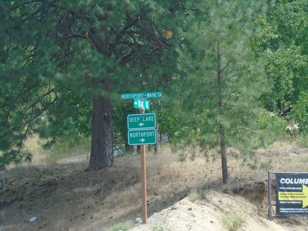
Northport-Waneta Road South at Deep Lake-Boundary Road
Northport-Waneta Road South at Deep Lake-Boundary Road. Turn right to continue south on Northport-Waneta Road to Northport. Turn left for Deep Lake-Boundary Road to Deep Lake.
Taken 07-27-2023
Colville Stevens County Washington United States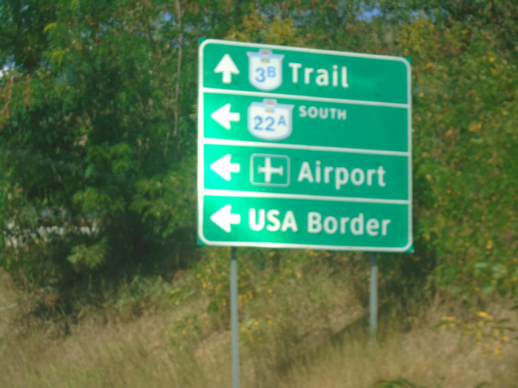
BC-3B West at BC-22A South
BC-3B West at BC-22A South in Trail. Use BC-22A south to (Trail Regional) Airport and USA Border (Port of Boundary). Continue west on BC-3B for Trail.
Taken 07-27-2023

 Trail
Kootenay Boundary
British Columbia
Canada
Trail
Kootenay Boundary
British Columbia
Canada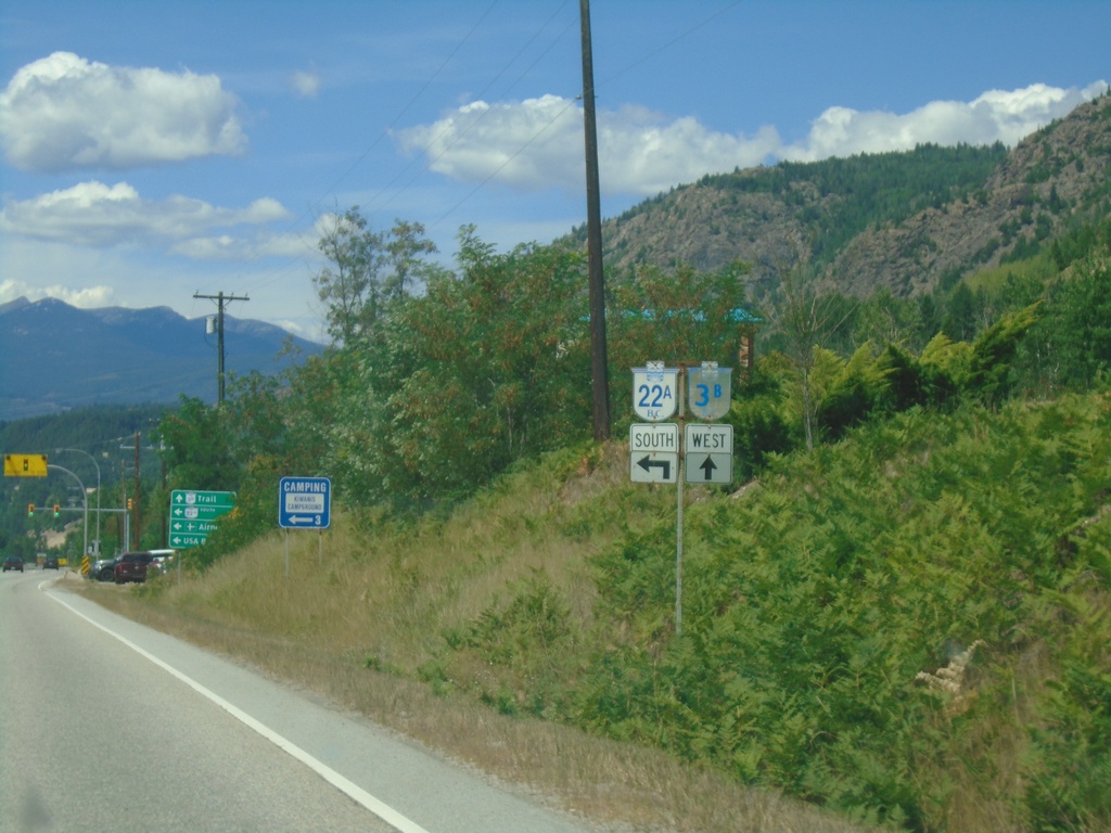
BC-3B West at BC-22A
BC-3B West at BC-22A South in Trail.
Taken 07-27-2023
Trail
Kootenay Boundary
British Columbia
Canada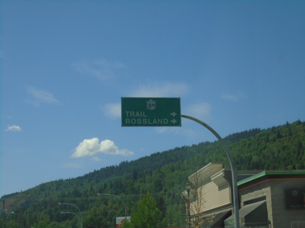
BC-3B West - Fruitvale
BC-3B West in Fruitvale. Turn right to continue on BC-3B to Trail and Rossland.
Taken 07-27-2023
Fruitvale
Kootenay Boundary
British Columbia
Canada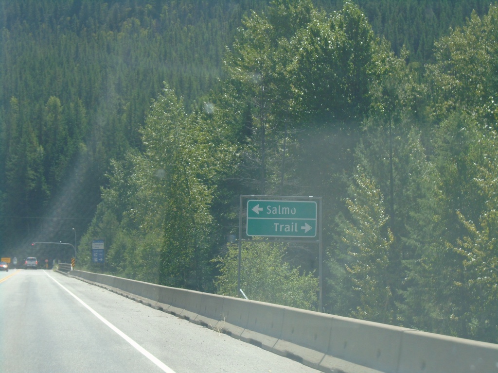
BC-3 East Approaching BC-3B
BC-3 East approaching BC-3B in Central Kootenay Regional District. Turn left for BC-3 East to Salmo; right for BC-3B West to Trail.
Taken 07-27-2023
 Salmo
Central Kootenay
British Columbia
Canada
Salmo
Central Kootenay
British Columbia
Canada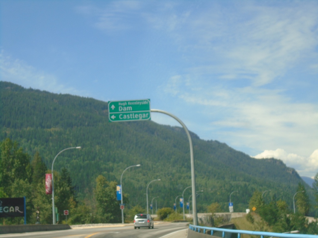
Robson Road at Columbia Ave - Castlegar
Robson Road at Columbia Ave at the end of the Columbia River Bridge. Turn left for (Columbia Ave.) to Castlegar. Continue straight for Hugh Keenleyside Dam. The Hugh Keenleyside Dam is on the Columbia River creating the Arrow Lakes.
Taken 07-27-2023
Castlegar Central Kootenay British Columbia Canada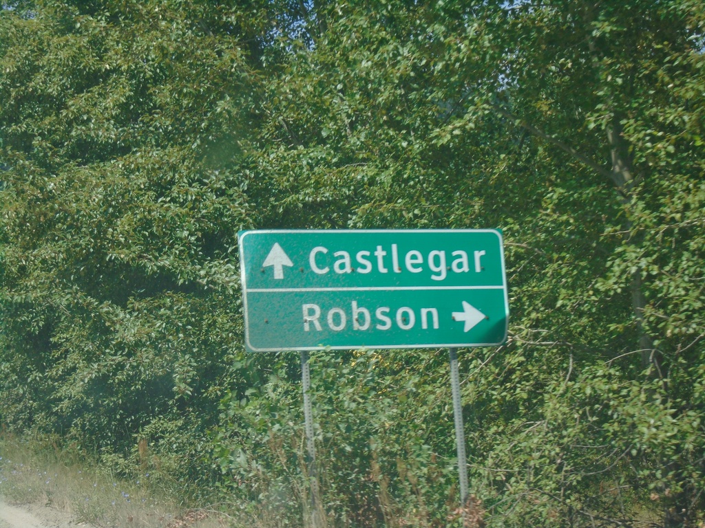
Robson Access Road East at Broadwater Road
Robson Access Road East at Broadwater Road. Turn right for Robson; continue straight for Castlegar.
Taken 07-27-2023
Castlegar Central Kootenay British Columbia Canada