Signs Tagged With Freeway Junction
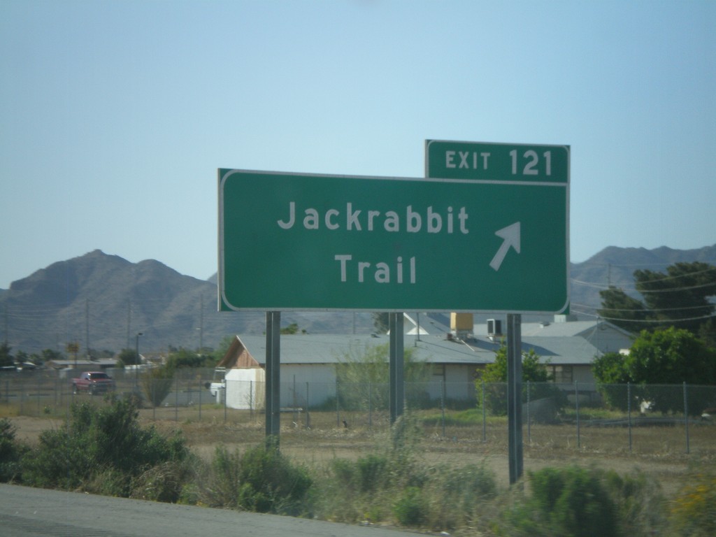
I-10 West - Exit 121
I-10 west at Exit 121 - Jackrabbit Trail
Taken 03-23-2009
 Buckeye
Maricopa County
Arizona
United States
Buckeye
Maricopa County
Arizona
United States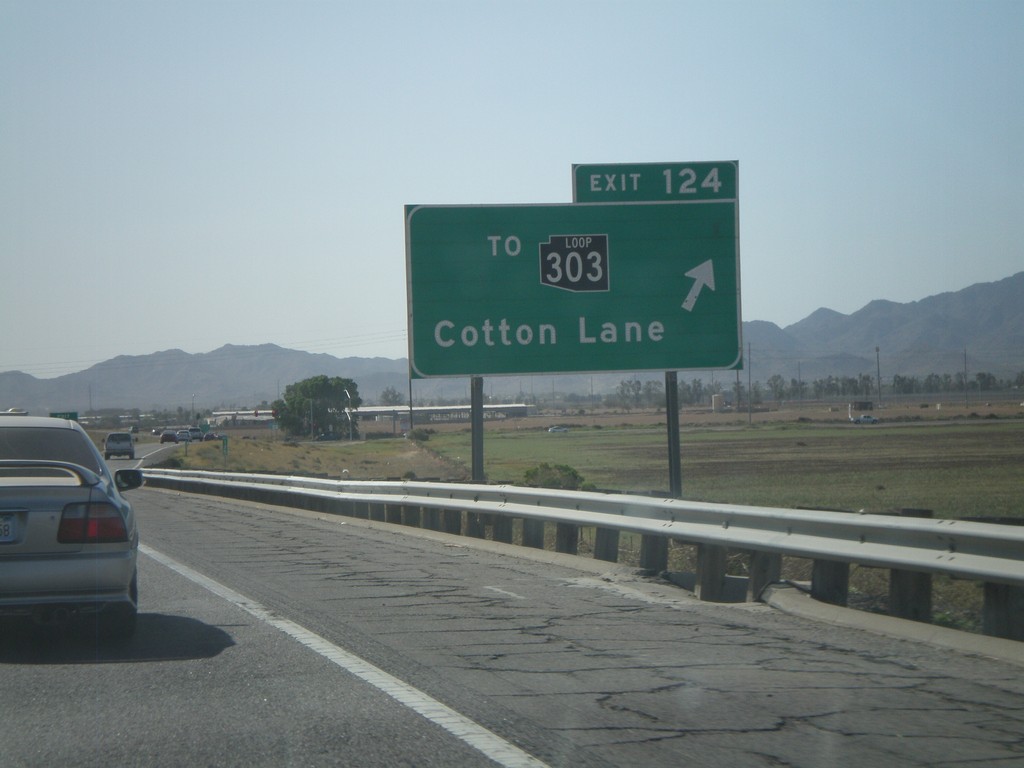
I-10 West - Exit 124
I-10 west at Exit 124 - To AZ-303 Loop/Cotton Lane. AZ-303 is the outermost of the three Phoenix beltways. Each of the three loops has a different color for the shield, although the newer signs just use white. The AZ-303 Loop shield is black.
Taken 03-23-2009
 Goodyear
Maricopa County
Arizona
United States
Goodyear
Maricopa County
Arizona
United States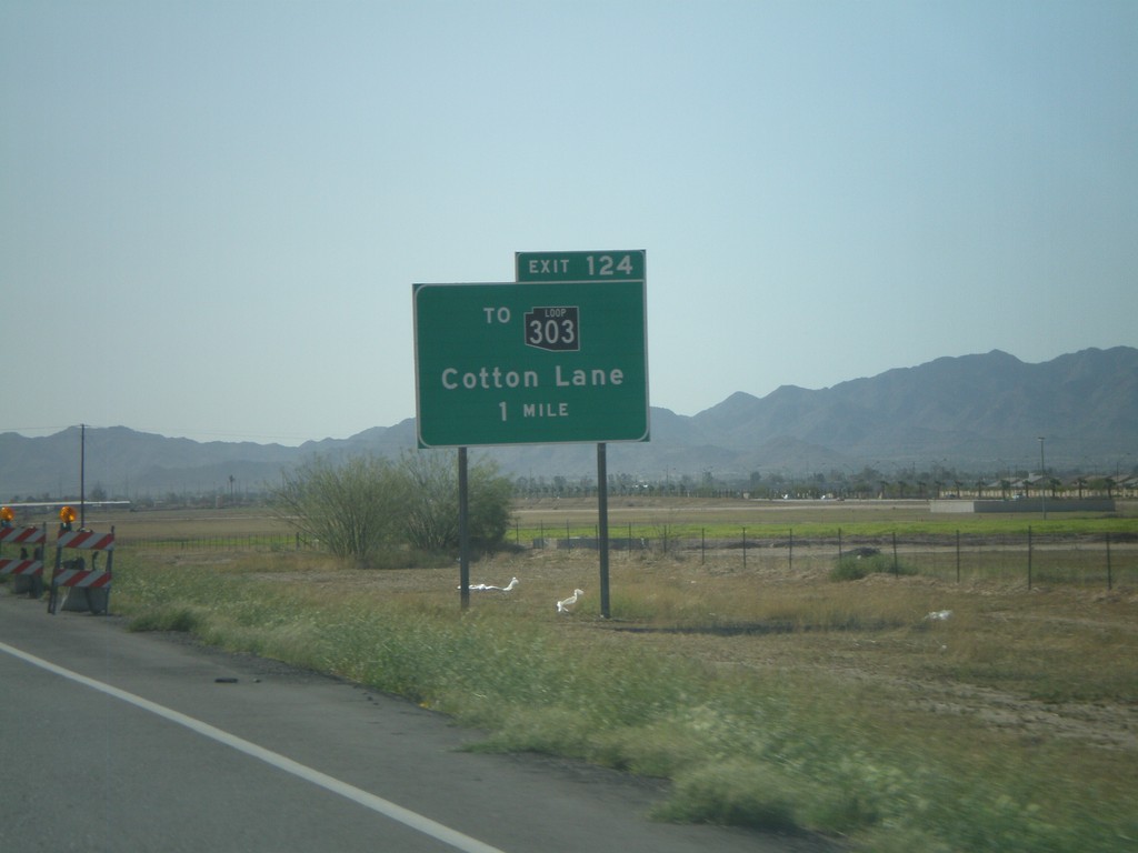
I-10 West Approaching Exit 124
I-10 west approaching Exit 124 - To AZ-303 Loop/Cotton Lane.
Taken 03-23-2009
Goodyear
Maricopa County
Arizona
United States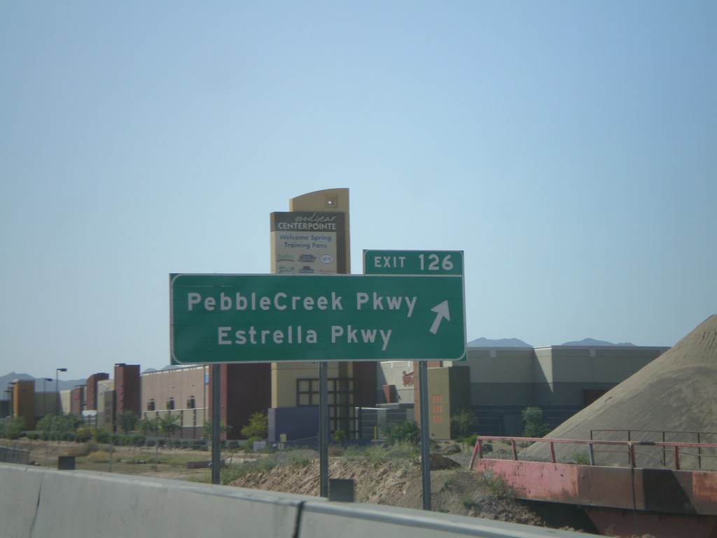
I-10 West - Exit 126
I-10 west at Exit 126 - Pebble Creek Parkway/Estrella Parkway
Taken 03-23-2009
Goodyear
Maricopa County
Arizona
United States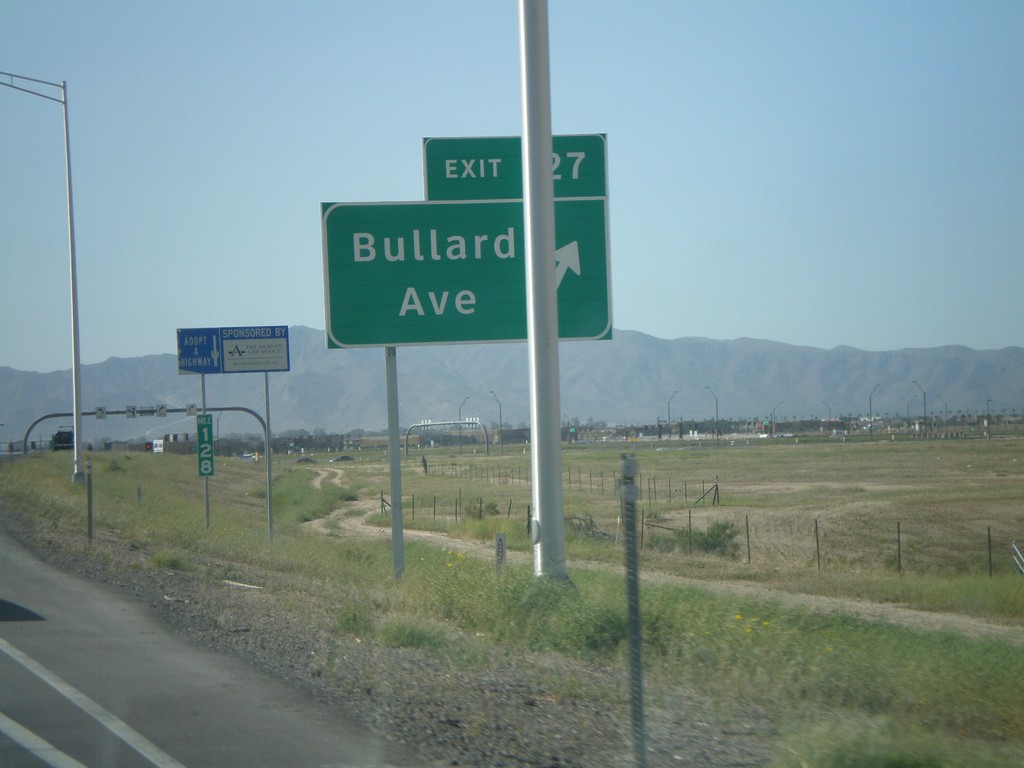
I-10 West - Exit 127
I-10 west at Exit 127 - Bullard Ave. This is a new interchange.
Taken 03-23-2009
Goodyear
Maricopa County
Arizona
United States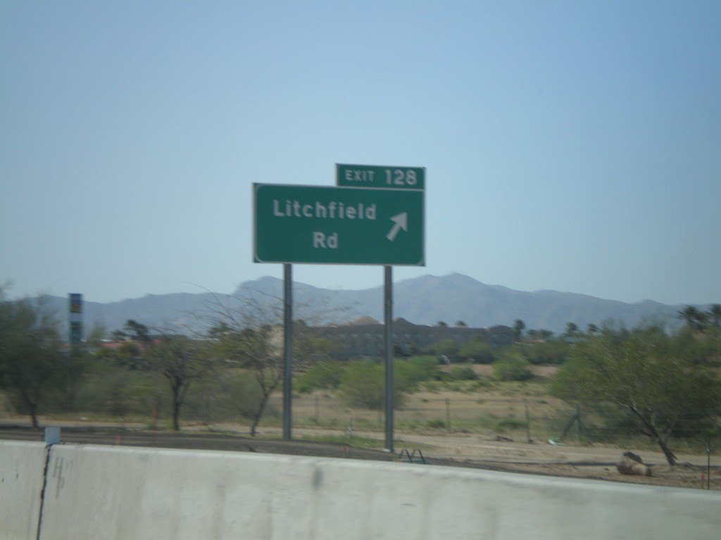
I-10 West - Exit 128
I-10 west at Exit 128 - Litchfield Road
Taken 03-23-2009
Goodyear
Maricopa County
Arizona
United States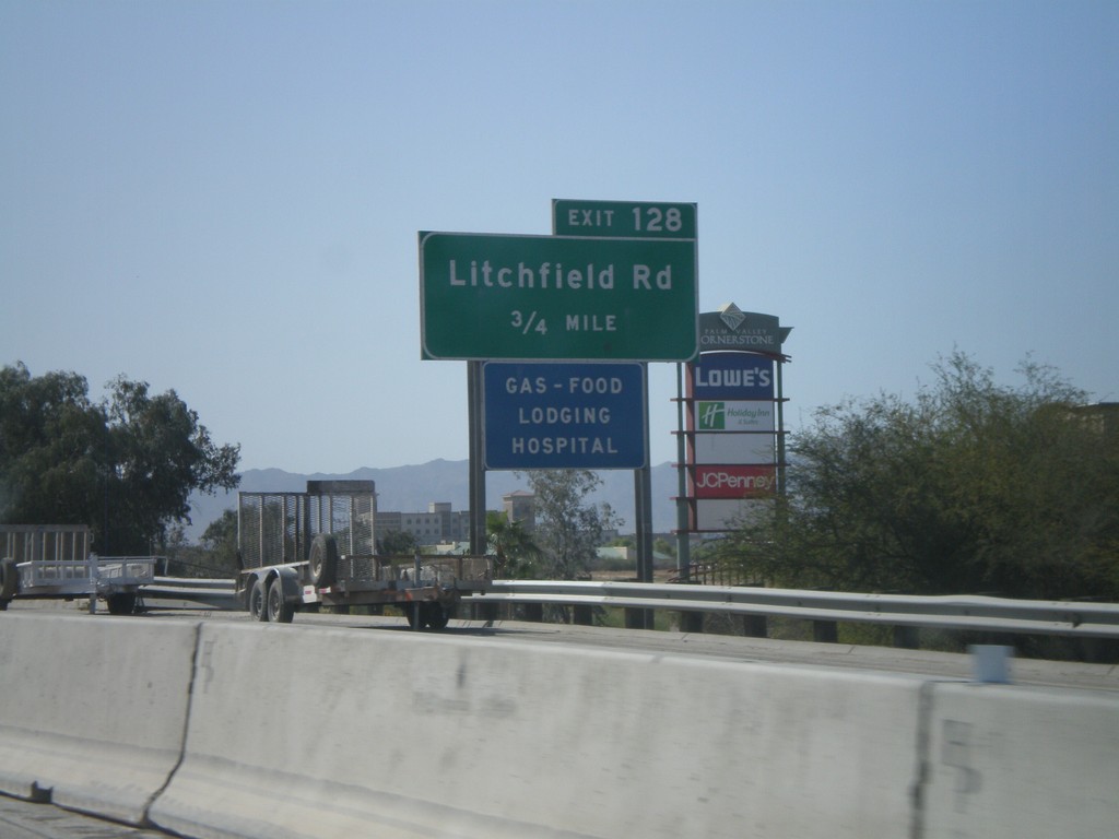
I-10 West Approaching Exit 128
I-10 west approaching Exit 128 - Litchfield Road
Taken 03-23-2009
Goodyear
Maricopa County
Arizona
United States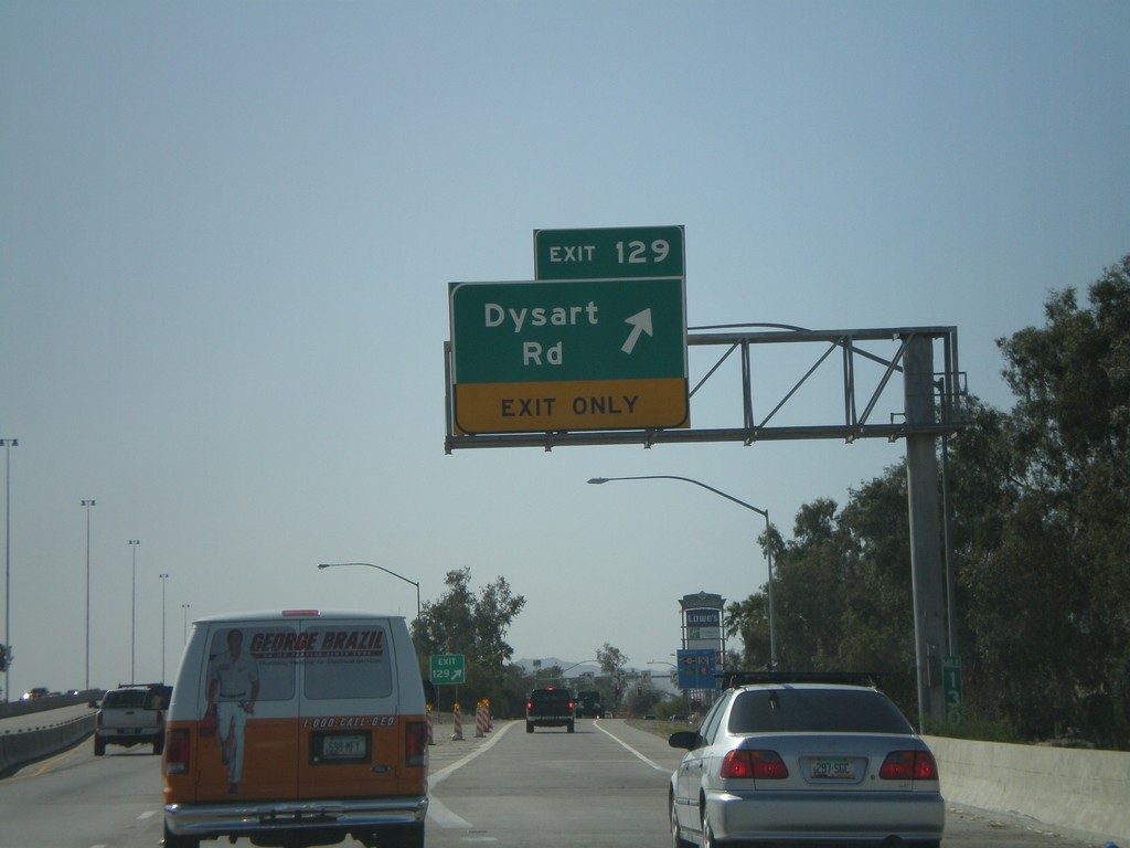
I-10 West - Exit 129
I-10 west at Exit 129 - Dysart Road
Taken 03-23-2009
Avondale
Maricopa County
Arizona
United States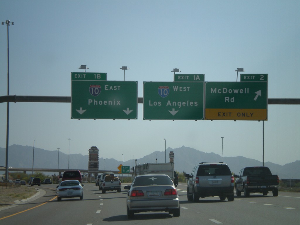
AZ-101 South - Exit 2 and Exit 1AB
AZ-101 Loop South at Exit 2 - McDowell Road. Approaching Exit 1B - I-10 East/Phoenix.
Taken 03-23-2009
 Phoenix
Maricopa County
Arizona
United States
Phoenix
Maricopa County
Arizona
United States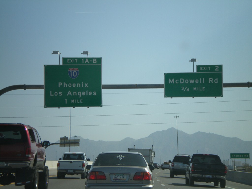
AZ-101 Loop South - Exit 2 and Exit 1AB
AZ-101 Loop South approaching Exit 2 - McDowell Road and Exit 1AB-I-10/Phoenix/Los Angeles.
Taken 03-23-2009
Phoenix
Maricopa County
Arizona
United States