Signs Tagged With Freeway Junction
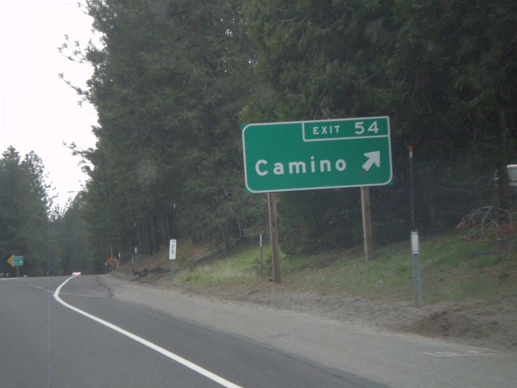
US-50 West - Exit 54
US-50 west at Exit 54 - Camino
Taken 04-15-2010
 Camino
El Dorado County
California
United States
Camino
El Dorado County
California
United States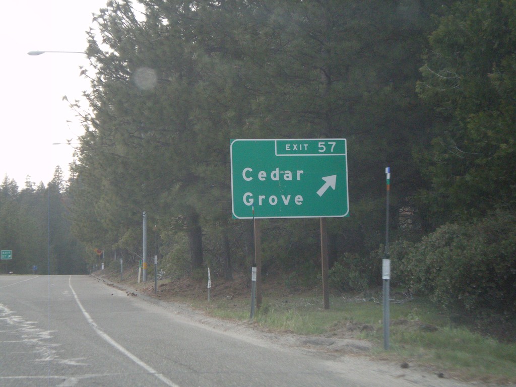
US-50 West - Exit 57
US-50 west at Exit 57 - Cedar Grove
Taken 04-15-2010
Camino
El Dorado County
California
United States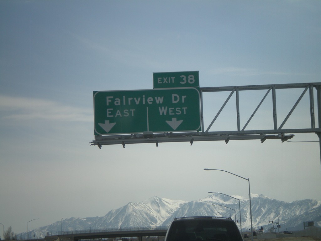
US-395 South/US-50 West - Exit 38
US-395 South/US-50 west at Exit 38 - Fairview Drive. This is the current southern end of the Carson City Bypass. Traffic is temporarily routed onto Fairview Drive west to the former route of US-395.
Taken 04-15-2010
 Carson City
Nevada
United States
Carson City
Nevada
United States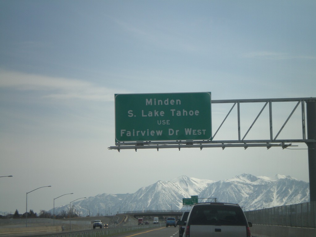
US-395 South/US-50 West Approaching Exit 38
US-395 South/US-50 west approaching Exit 38 - Fairview Drive. The Carson City Bypass currently ends here, so all Minden and South Lake Tahoe bound traffic must exit here.
Taken 04-15-2010
Carson City
Nevada
United States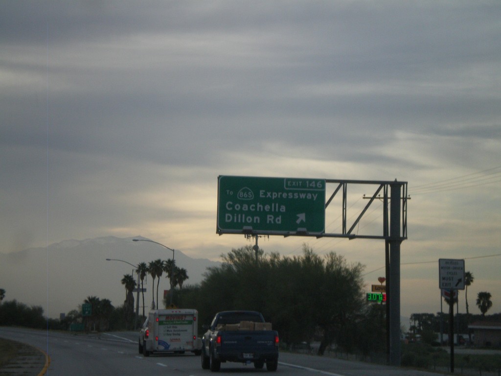
I-10 West - Exit 146
I-10 west at Exit 146 - To CA-86S Expressway/Coachella/Dillon Road. This is the first exit in the Coachella Valley westbound.
Taken 03-22-2010

 Coachella
Riverside County
California
United States
Coachella
Riverside County
California
United States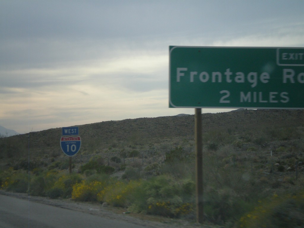
I-10 West Approaching Exit 162
I-10 west approaching Exit 162 - Frontage Road.
Taken 03-22-2010
Cactus City
Riverside County
California
United States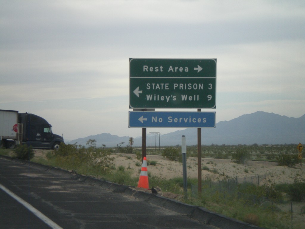
I-10 West - Exit 222 Offramp
I-10 west at Exit 222 offramp - Wiley’s Well. Turn south for Wiley’s Well Road, north for Rest Area.
Taken 03-22-2010
Blythe
Riverside County
California
United States
Neighbors Blvd. South at I-10
Neighbors Blvd. south at I-10. BL-10 ends here and CA-78 begins.
Taken 03-22-2010

 Blythe
Riverside County
California
United States
Blythe
Riverside County
California
United States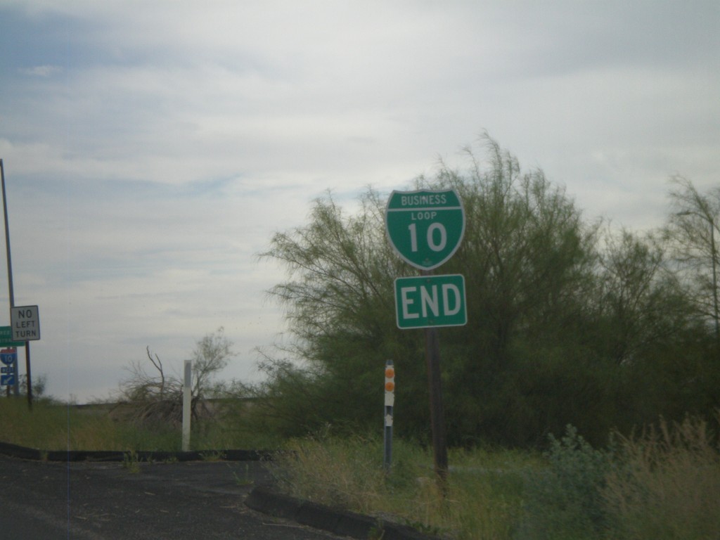
End I-10 Business at I-10 and CA-78
Western end of I-10 Blythe business loop at I-10 on Neighbors Blvd. Neighbors Blvd. continues south as CA-78.
Taken 03-22-2010
Blythe
Riverside County
California
United States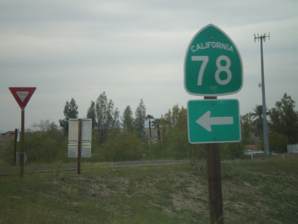
I-10 West Exit 236 Offramp at CA-78
I-10 west Exit 236 offramp at CA-78. CA-78 heads southwest to the Imperial Valley and eventually Oceanside. This is also the western end of the Blythe I-10 Business Loop.
Taken 03-22-2010
Blythe
Riverside County
California
United States