Signs Tagged With Freeway Junction
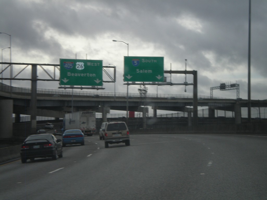
I-5 South at I-405 Split
I-5 south at the I-405 split in Portland. Use left lane for I-405 North/US-26 West/Beaverton. Use right lane for I-5 South/Salem. This exit ramp is on the end of the Marquam Bridge over the Willamette River.
Taken 02-18-2012


 Portland
Multnomah County
Oregon
United States
Portland
Multnomah County
Oregon
United States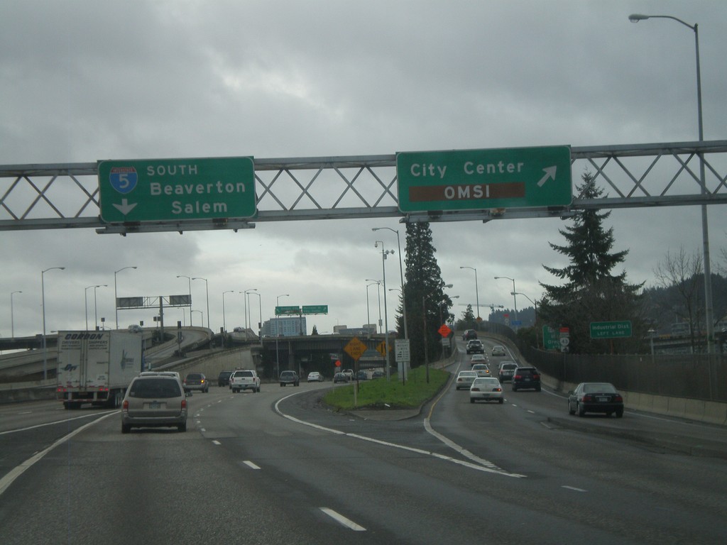
I-84 To I-5 Ramp at City Center IC
Ramp connecting I-84 west to I-5 south at City Center/OMSI exit. Continue south for I-5 south to Beaverton and Salem. OMSI stands for the Oregon Museum of Science and Industry.
Taken 02-18-2012
 Portland
Multnomah County
Oregon
United States
Portland
Multnomah County
Oregon
United States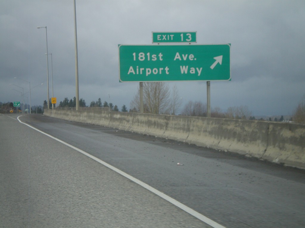
I-84 West - Exit 13
I-84 west at Exit 13 - 181st Ave./Airport Way.
Taken 02-18-2012
 Portland
Multnomah County
Oregon
United States
Portland
Multnomah County
Oregon
United States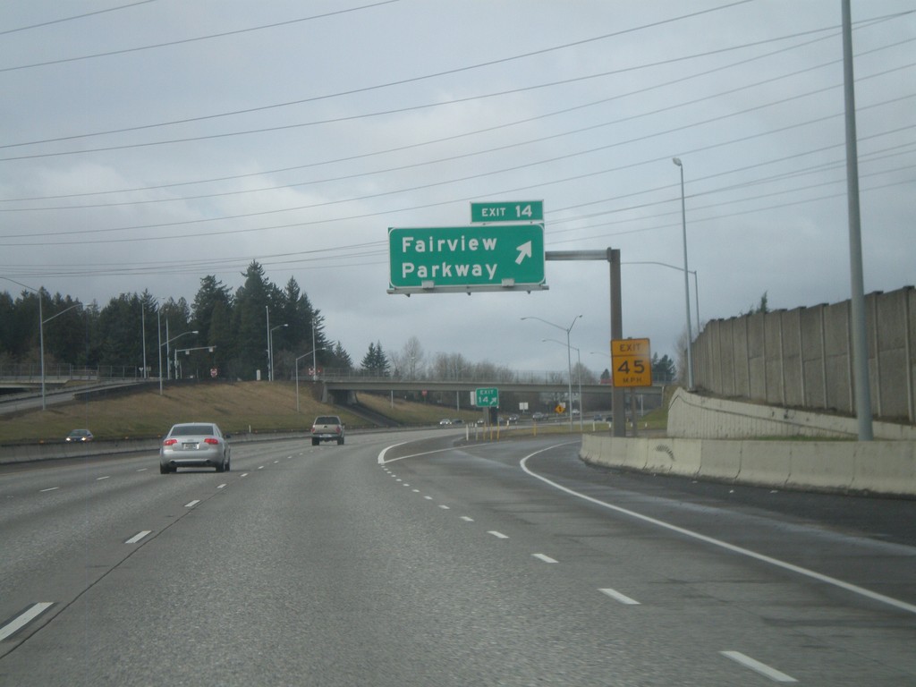
I-84 West - Exit 14
I-84 west at Exit 14 - Fairview Parkway.
Taken 02-18-2012
Fairview
Multnomah County
Oregon
United States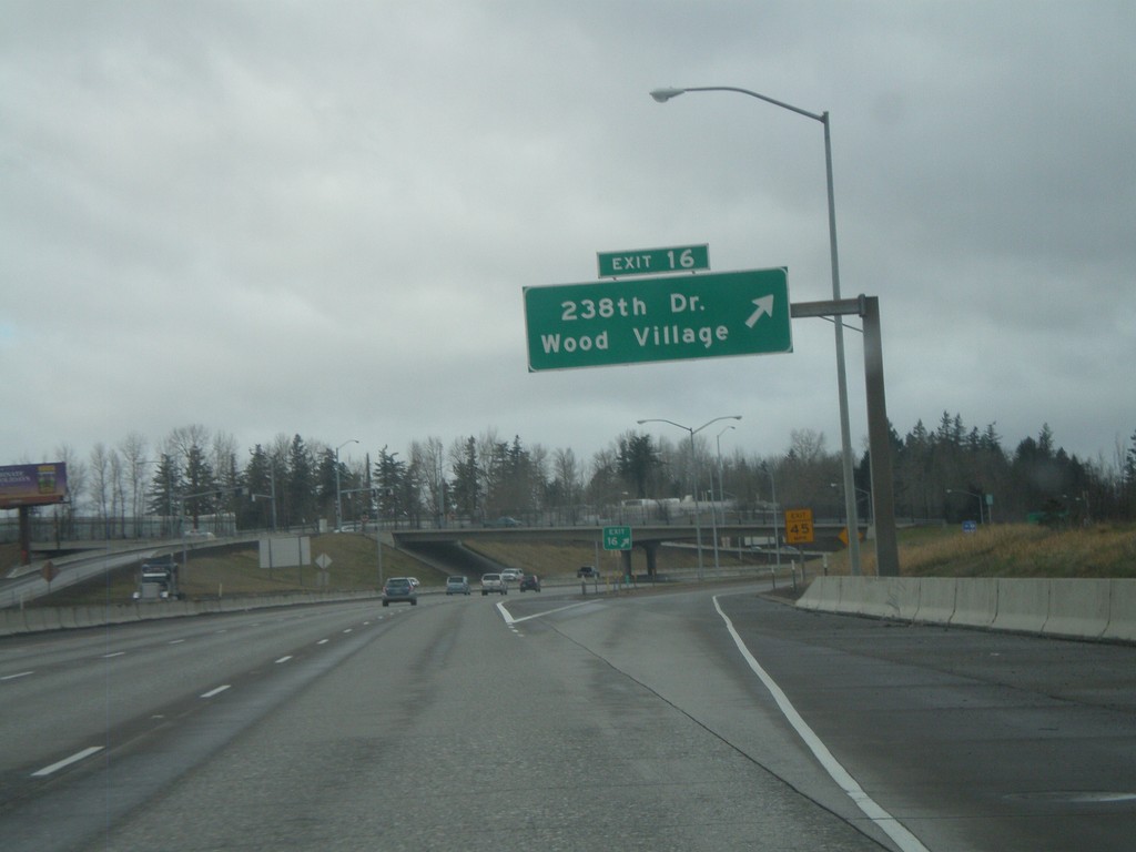
I-84 West - Exit 16
I-84 west at Exit 16 - 238th Drive/Wood Village.
Taken 02-18-2012
Troutdale
Multnomah County
Oregon
United States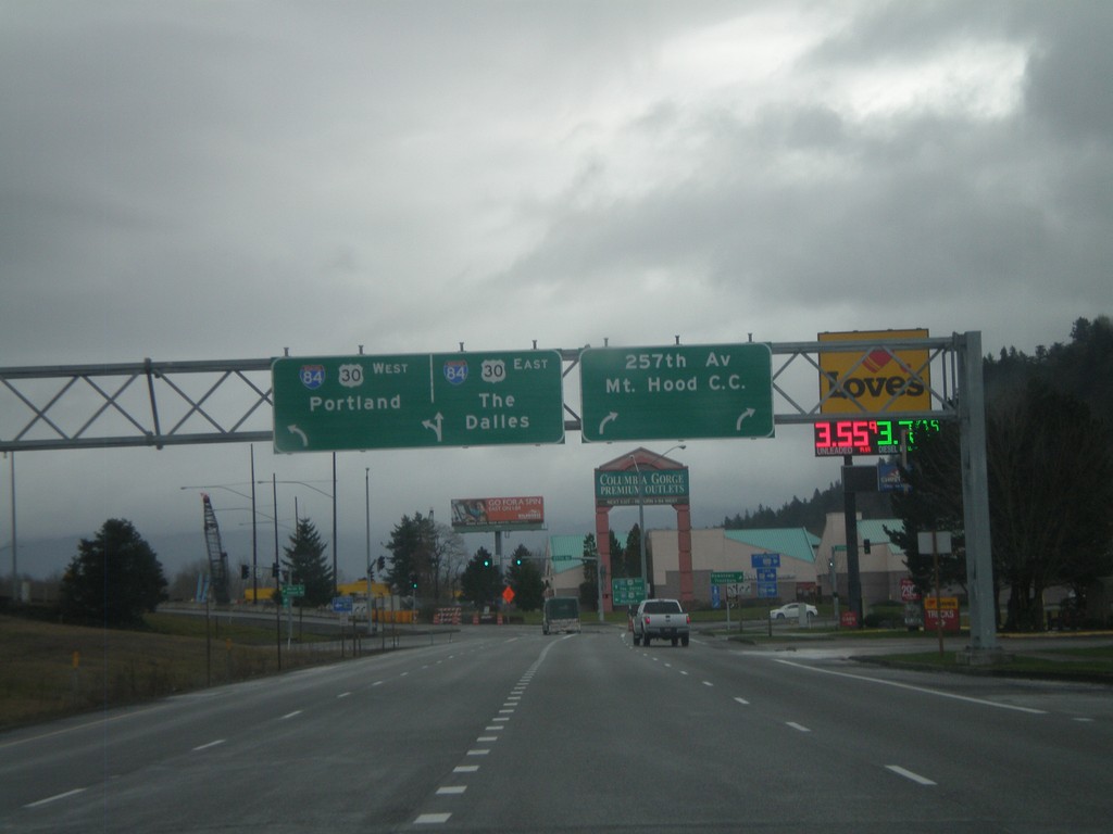
I-84 Frontage Road at 257th Ave. and I-84
I-84 Frontage Road East at 257th Ave. and I-84. Turn right for 257th Ave. and Mount Hood Community College. Continue straight for I-84/US-30 east onramp to The Dalles. Turn left for I-84/US-30 west to Portland.
Taken 02-18-2012
Troutdale
Multnomah County
Oregon
United States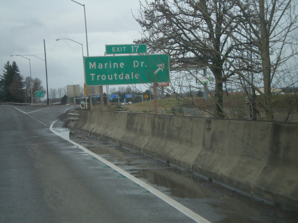
I-84 West - Exit 17
I-84 west at Exit 17 - Marine Drive/Troutdale. This is the first exit westbound in the Portland Metropolitan Area. Directly east of here is the Columbia River Gorge National Scenic Area.
Taken 02-18-2012
Troutdale
Multnomah County
Oregon
United States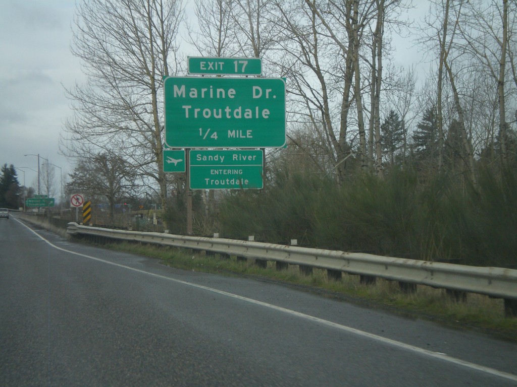
I-84 West - Exit 17
I-84 west approaching Exit 17 - Marine Drive/Troutdale. Entering Troutdale and crossing the Sandy River. The Sandy River is the boundary of the Columbia River Gorge National Scenic Area.
Taken 02-18-2012
Troutdale
Multnomah County
Oregon
United States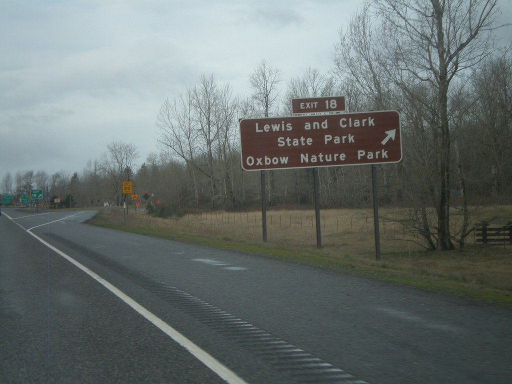
I-84 West - Exit 18
I-84 west at Exit 18 - Lewis and Clark State Park/Oxbow Nature Park.
Taken 02-18-2012
Troutdale
Multnomah County
Oregon
United States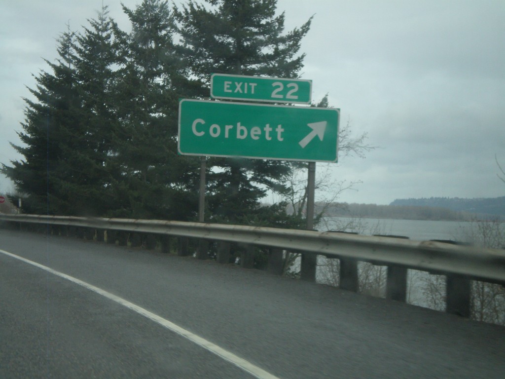
I-84 West - Exit 22
I-84 west at Exit 22 - Corbett. The Columbia River is in the background of the photograph.
Taken 02-18-2012
Corbett
Multnomah County
Oregon
United States