Signs Tagged With Freeway Junction
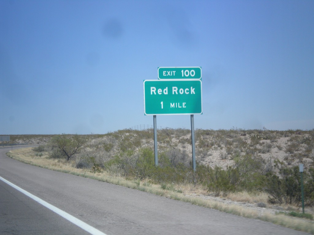
I-25 North - Exit 100
I-25 north approaching Exit 100 - Red Rock.
Taken 04-15-2013
 Truth or Consequences
Sierra County
New Mexico
United States
Truth or Consequences
Sierra County
New Mexico
United States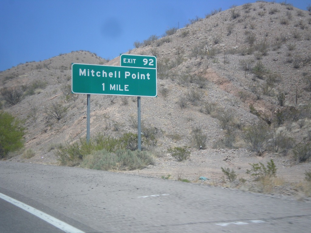
I-25 North - Exit 92
I-25 north approaching Exit 92 - Mitchell Point.
Taken 04-15-2013
 Truth or Consequences
Sierra County
New Mexico
United States
Truth or Consequences
Sierra County
New Mexico
United States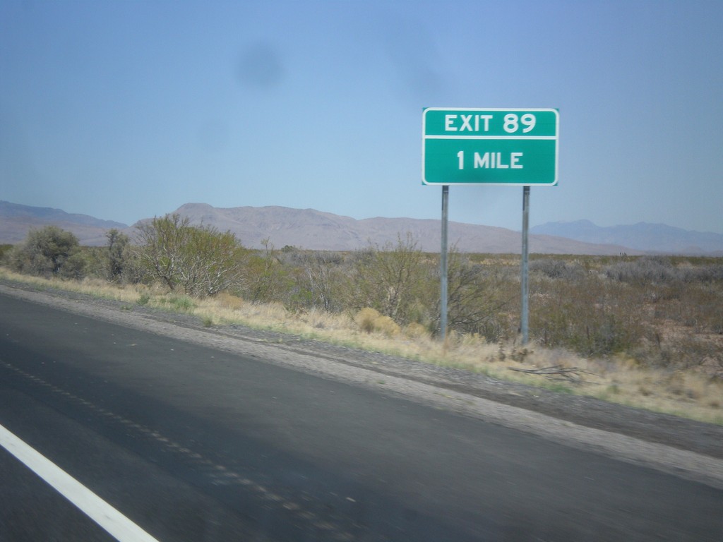
I-25 North - Exit 189
I-25 north approaching Exit 189. This exit does not have any destinations northbound. Southbound Exit 189 is signed: NM-52/NM-181/Cuchillo/Monticello.
Taken 04-15-2013

 Truth or Consequences
Sierra County
New Mexico
United States
Truth or Consequences
Sierra County
New Mexico
United States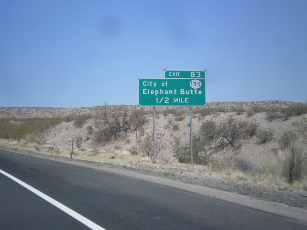
I-25 North - Exit 83
I-25 north approaching Exit 83 - NM-195/City of Elephant Butte.
Taken 04-15-2013
 Elephant Butte
Sierra County
New Mexico
United States
Elephant Butte
Sierra County
New Mexico
United States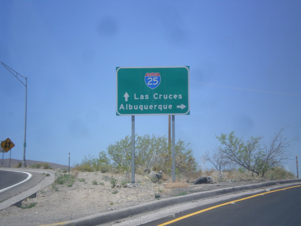
BL-25 North at I-25 Jct.
BL-25 north at I-25 junction. Merge right for I-25 north to Albuquerque; merge left for I-25 south to Las Cruces.
Taken 04-15-2013
 Truth or Consequences
Sierra County
New Mexico
United States
Truth or Consequences
Sierra County
New Mexico
United States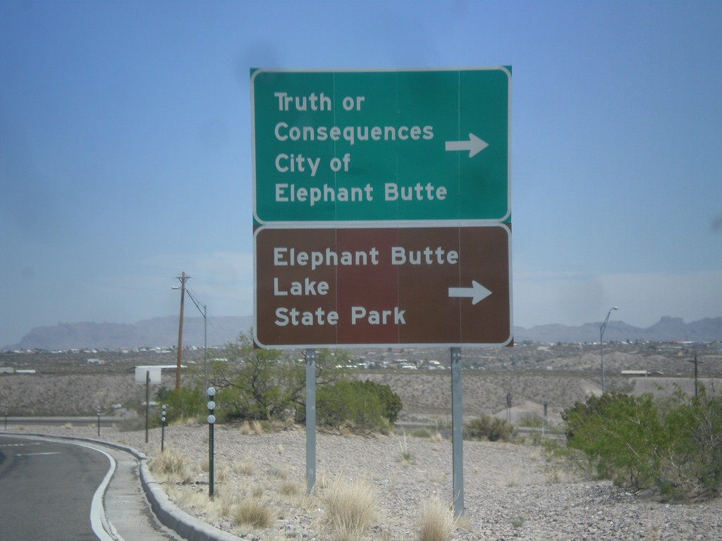
I-25 North at Exit 80 Offramp
I-25 north at Exit 80 offramp, BL-25 jct. Turn right for Truth or Consequences, City of Elephant Butte, and Elephant Butte State Park.
Taken 04-15-2013
Truth or Consequences
Sierra County
New Mexico
United States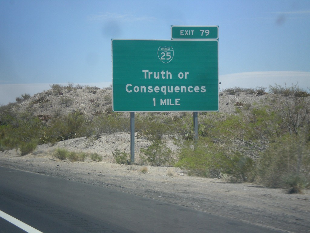
I-25 North - Exit 79
I-25 north approaching Exit 79 - BL-25/Truth or Consequences.
Taken 04-15-2013
Truth or Consequences
Sierra County
New Mexico
United States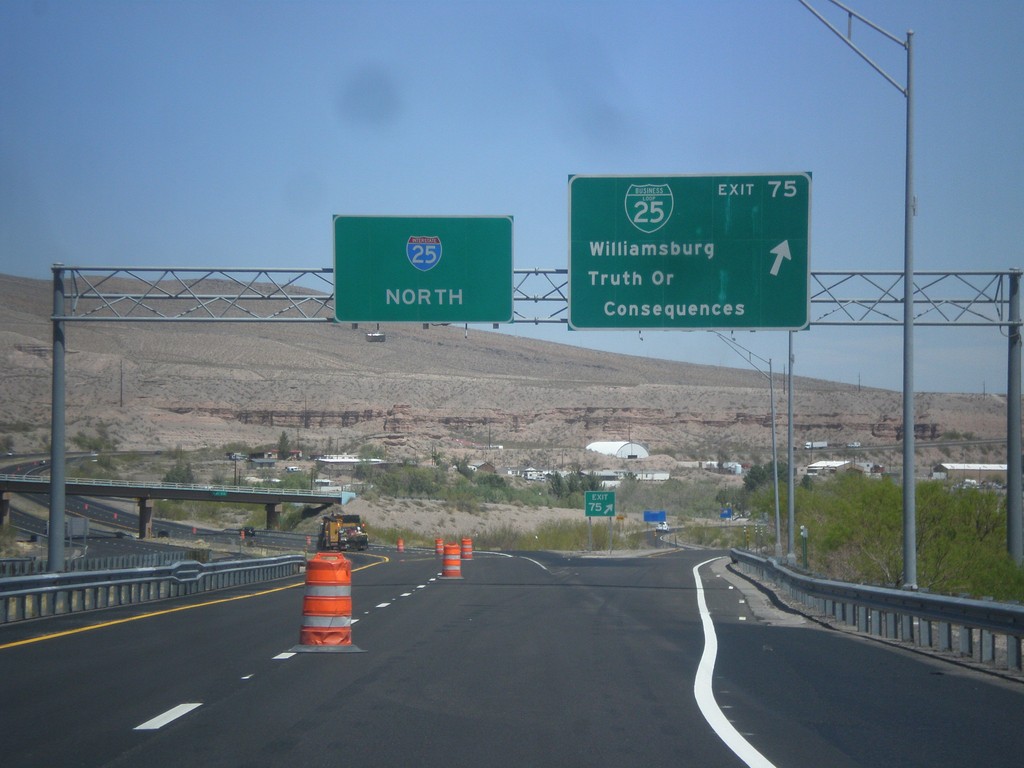
I-25 North - Exit 75
I-25 north at Exit 75 - BL-25/Williamsburg/Truth of Consequences. This is the southern end of the Truth of Consequences business loop.
Taken 04-15-2013
Williamsburg
Sierra County
New Mexico
United States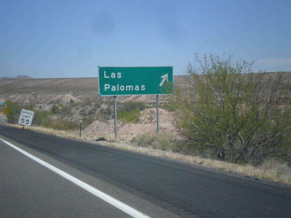
I-25 North - Exit 71
I-25 north at Exit 72 - Los Palomas. The exit number tab is missing from this sign.
Taken 04-15-2013
Williamsburg
Sierra County
New Mexico
United States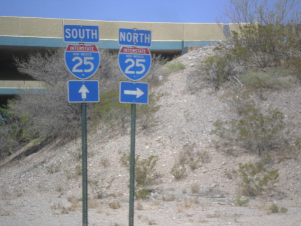
NM-152 West at I-25
NM-152 West at I-25 in rural Sierra County.
Taken 04-15-2013
 Caballo
Sierra County
New Mexico
United States
Caballo
Sierra County
New Mexico
United States