Signs Tagged With Freeway Junction
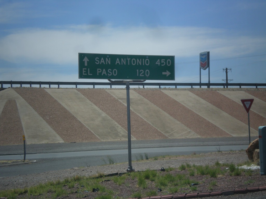
BL-10 (Golf Course Dr.) at I-10
BL-10 (Golf Course Dr.) at I-10. Turn right for I-10 west to El Paso; left for I-10 east to San Antonio.
Taken 04-15-2013

 Van Horn
Culberson County
Texas
United States
Van Horn
Culberson County
Texas
United States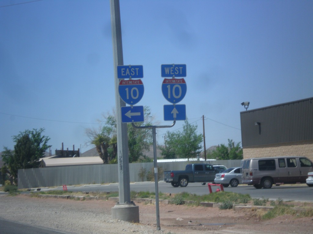
BL-10 West at I-10
BL-10 west at I-10 jct. Turn left for I-10 east; continue straight ahead for I-10 west.
Taken 04-15-2013
Van Horn
Culberson County
Texas
United States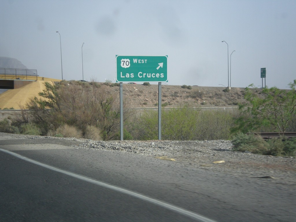
US-70 West/US-54 South at US-70 West
US-54 South/US-70 West (Relief Route) at US-70 West exit to Las Cruces.
Taken 04-15-2013

 Alamogordo
Otero County
New Mexico
United States
Alamogordo
Otero County
New Mexico
United States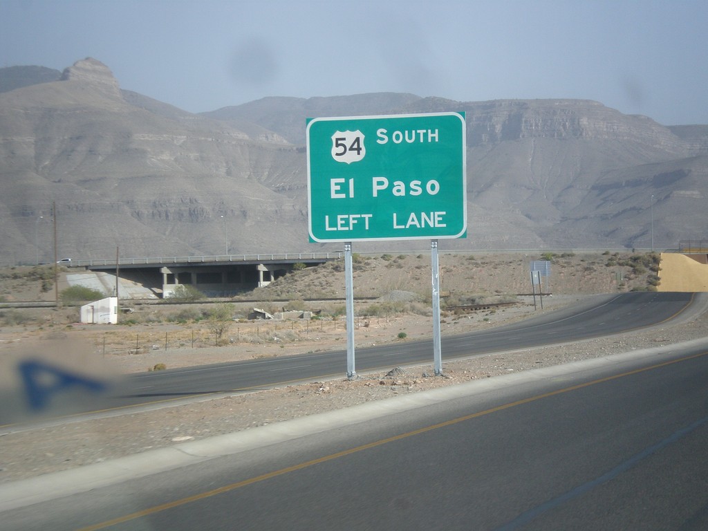
US-54 South/US-70 West - US-70/US-54 Split
US-70/US-54 Split on US-70 West/US-54 South (Alamogordo Relief Route). Use left lanes for US-54 south to El Paso.
Taken 04-15-2013
Alamogordo
Otero County
New Mexico
United States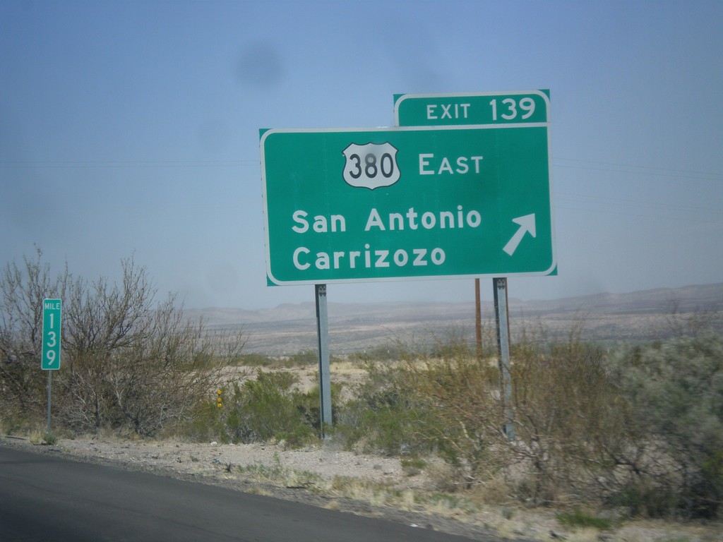
I-25 North - Exit 139
I-25 north at Exit 139 - US-380 East/San Antonio/Carrizozo. This is the western terminus of US-380.
Taken 04-15-2013

 San Antonio
Socorro County
New Mexico
United States
San Antonio
Socorro County
New Mexico
United States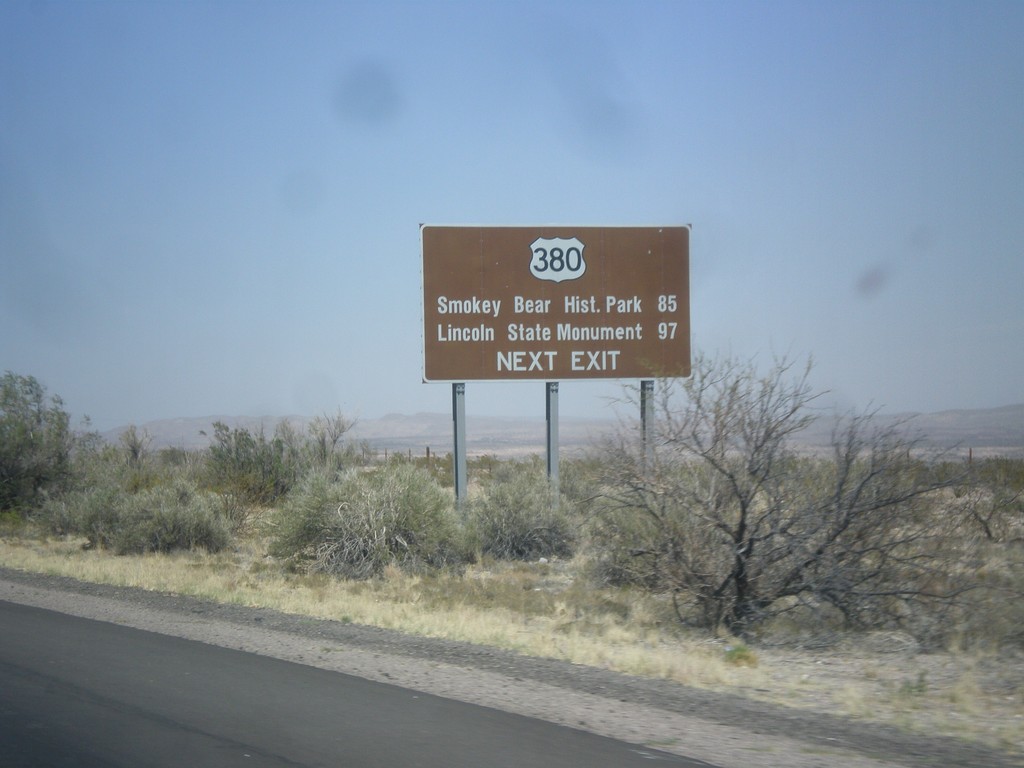
I-25 North Approaching US-380
I-25 north approaching US-380 (Exit 139). Use US-380 east for Smokey Bear Historical Park, and Lincoln State Monument.
Taken 04-15-2013
San Antonio
Socorro County
New Mexico
United States
I-25 North - Exit 139
I-25 north approaching Exit 139 - US-380 East/San Antonio/Carrizozo.
Taken 04-15-2013
San Antonio
Socorro County
New Mexico
United States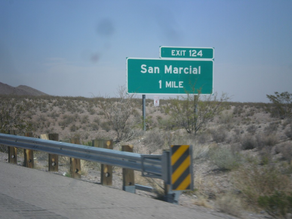
I-25 North Approaching Exit 124
I-25 north approaching Exit 124 - San Marcial.
Taken 04-15-2013
San Antonio
Socorro County
New Mexico
United States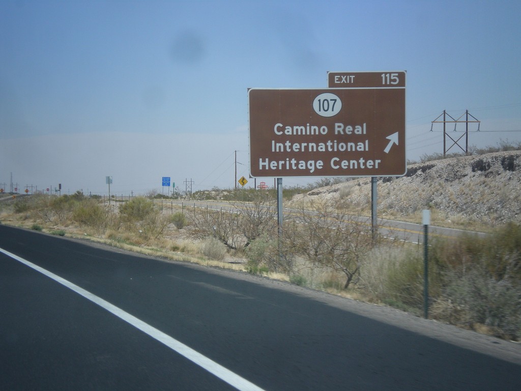
I-25 North - Exit 115
I-25 north at Exit 115 - NM-107/Camino Real International Heritage Center.
Taken 04-15-2013
Magdalena
Socorro County
New Mexico
United States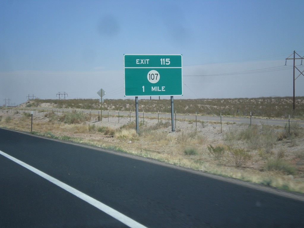
I-25 North Approaching Exit 115
I-25 north approaching Exit 115 - NM-107.
Taken 04-15-2013
 Magdalena
Socorro County
New Mexico
United States
Magdalena
Socorro County
New Mexico
United States