Signs Tagged With Elevation
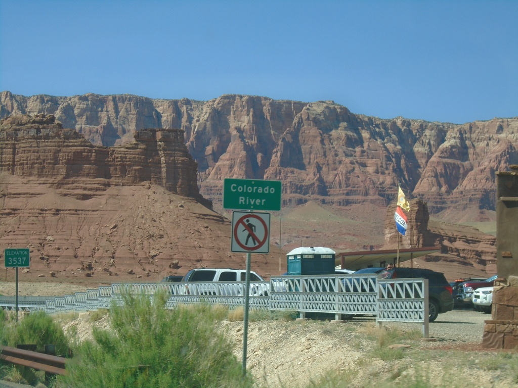
US-89A North - Colorado River
Colorado River (Navajo Bridge) on US-89A north. Elevation 3537 Feet. The Vermillion Cliffs are in the background. The next road crossing of the Colorado River south of here is US-93 below Hoover Dam. Between the Navajo Bridge and Hoover Dam lies the Grand Canyon and Lake Mead.
Taken 09-08-2023
 Marble Canyon
Coconino County
Arizona
United States
Marble Canyon
Coconino County
Arizona
United States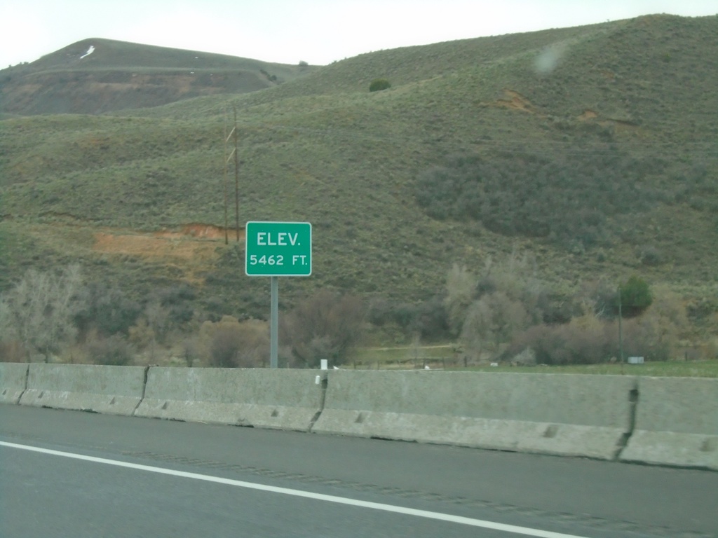
I-84 East - Elevation 5462 Feet
Elevation 5462 approaching the eastern end of I-84. There is also an elevation sign at the Idaho-Utah state line on I-84.
Taken 04-24-2021
 Echo
Summit County
Utah
United States
Echo
Summit County
Utah
United States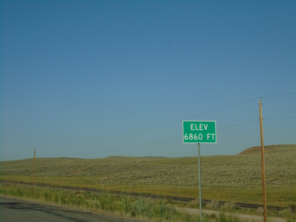
I-80 West - Elevation 6860 Feet
I-80 west Elevation 6860 Feet. Many highways entering Utah have the elevation listed at or near the state line.
Taken 07-18-2020

 Wahsatch
Summit County
Utah
United States
Wahsatch
Summit County
Utah
United States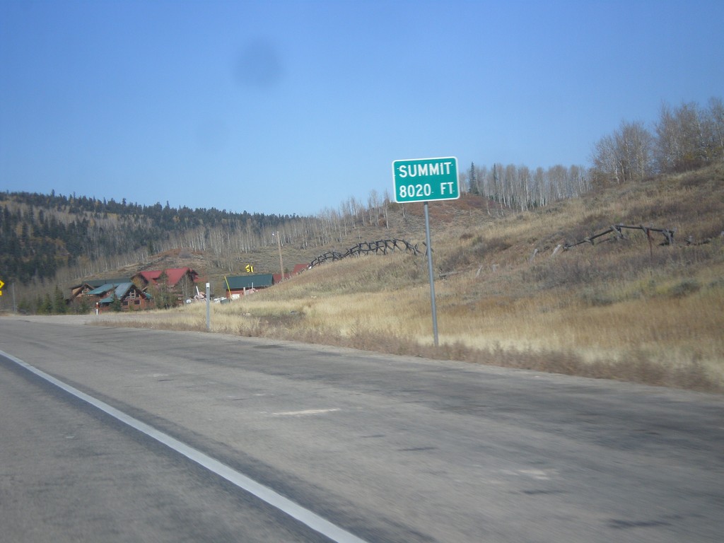
US-40 West - Daniels Summit
Daniels Summit - Elevation 8020 Feet on US-40 west.
Taken 10-09-2016
 Wallsburg
Wasatch County
Utah
United States
Wallsburg
Wasatch County
Utah
United States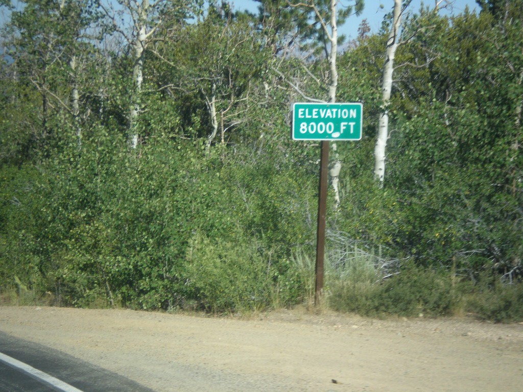
CA-89 North - Elevation 8000 Feet
Elevation 8000 Feet on CA-89 north. Taken on north descent from Monitor Pass.
Taken 08-12-2016
 Markleeville
Alpine County
California
United States
Markleeville
Alpine County
California
United States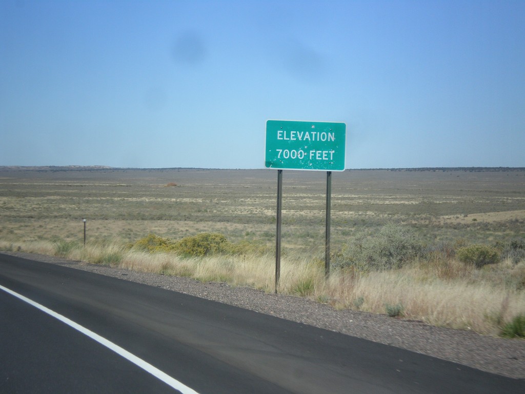
US-550 North - Elevation 7000 Feet
Elevation 7000 Feet, descending from the Continental Divide on US-550 north.
Taken 10-15-2012
 Cuba
Sandoval County
New Mexico
United States
Cuba
Sandoval County
New Mexico
United States