Signs Tagged With Distance Marker
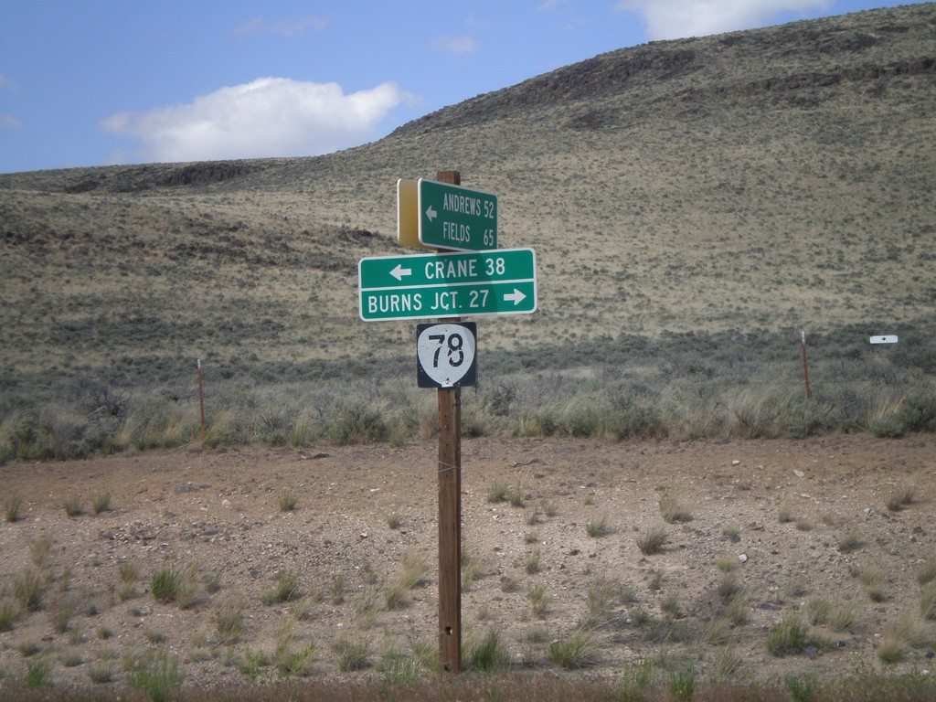
End Eastside Steens Mountain Road at OR-78
End Eastside Steens Mountain Road at OR-78. Turn right on OR-78 for Burns Junction; turn left on OR-78 for Crane. The eastside Steens Mountain road follows the east side of Steens Mountain south to Andrews, Fields, and eventually into Denio, Nevada.
Taken 05-28-2012
 Jordan Valley
Malheur County
Oregon
United States
Jordan Valley
Malheur County
Oregon
United States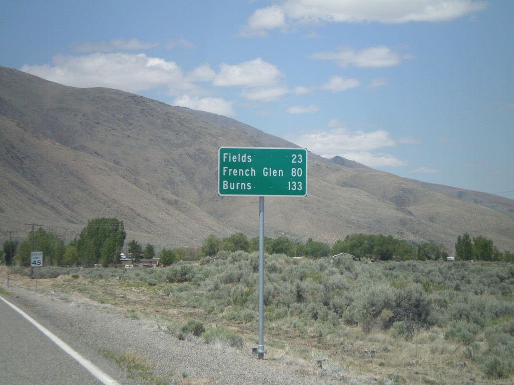
NV-292 North - Distance Marker
Distance marker entering Denio on NV-292 north. Distance to Fields, French Glen, and Burns. All three destinations are in Oregon. The Oregon-Nevada state line is at the north end of Denio.
Taken 05-28-2012
 Denio
Humboldt County
Nevada
United States
Denio
Humboldt County
Nevada
United States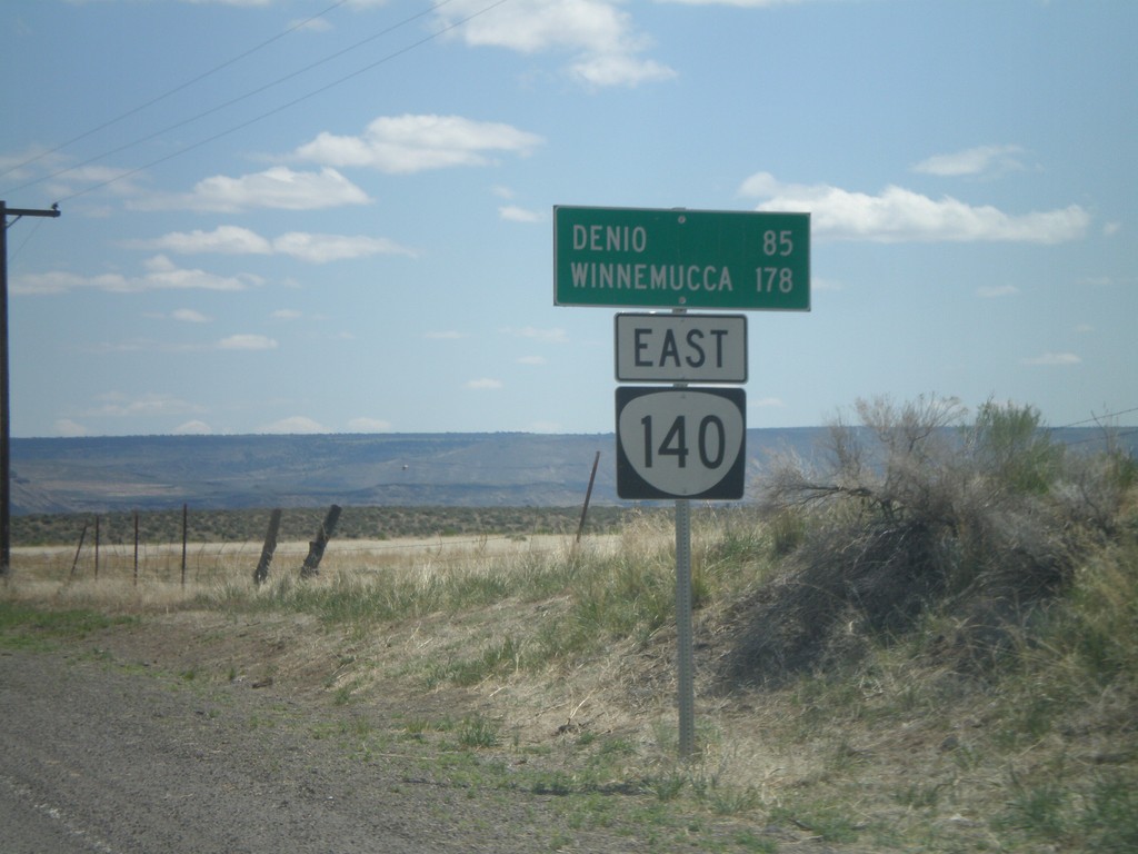
OR-140 East - Distance Marker
Distance marker to Denio and Winnemucca (both in Nevada) along OR-140 east, leaving Adel.
Taken 05-28-2012
 Adel
Lake County
Oregon
United States
Adel
Lake County
Oregon
United States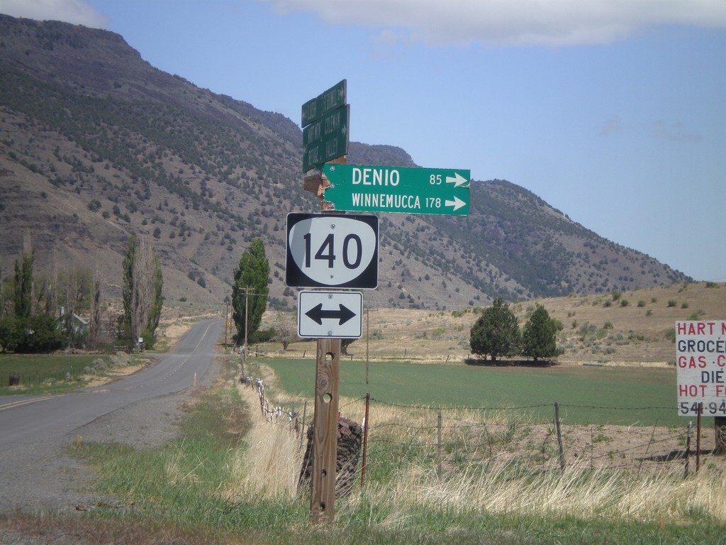
Twentymile Road North at OR-140
Twentymile Road north at OR-140 in Adel. Turn right on OR-140 for Denio and Winnemucca (both in Nevada). Westbound destinations on fingerboard are broken off.
Taken 05-28-2012
Adel
Lake County
Oregon
United States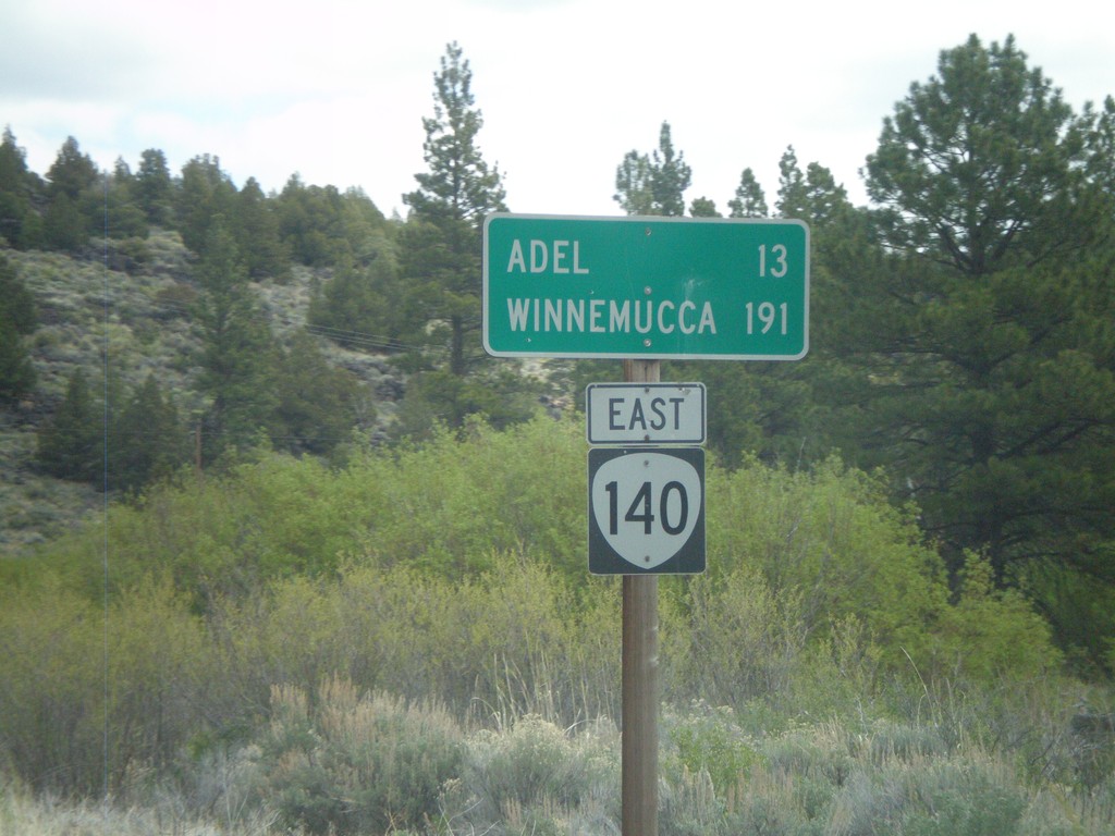
OR-140 East - Distance Marker
Distance marker on OR-140 east. Distance to Adel and Winnemucca (Nevada).
Taken 05-28-2012
Lakeview
Lake County
Oregon
United States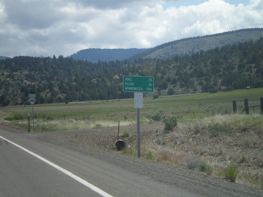
OR-140 East - Distance Marker
Distance marker on OR-140 east. Distance to Adel, Plush, and Winnemucca (Nevada). In the background is an OR-140 shield. This was taken just east of the US-395/OR-140 junction.
Taken 05-28-2012
Lakeview
Lake County
Oregon
United States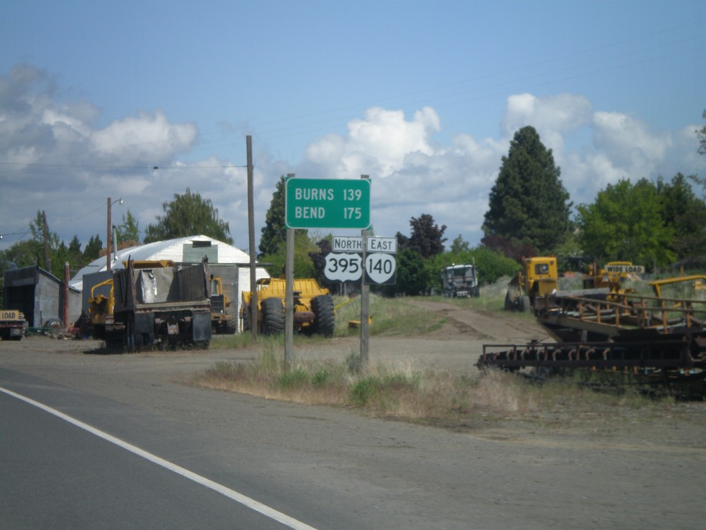
US-395 North/OR-140 East - Distance Marker
Distance marker on US-395 North/OR-140 East. Distance to Burns and Bend.
Taken 05-28-2012
 Lakeview
Lake County
Oregon
United States
Lakeview
Lake County
Oregon
United States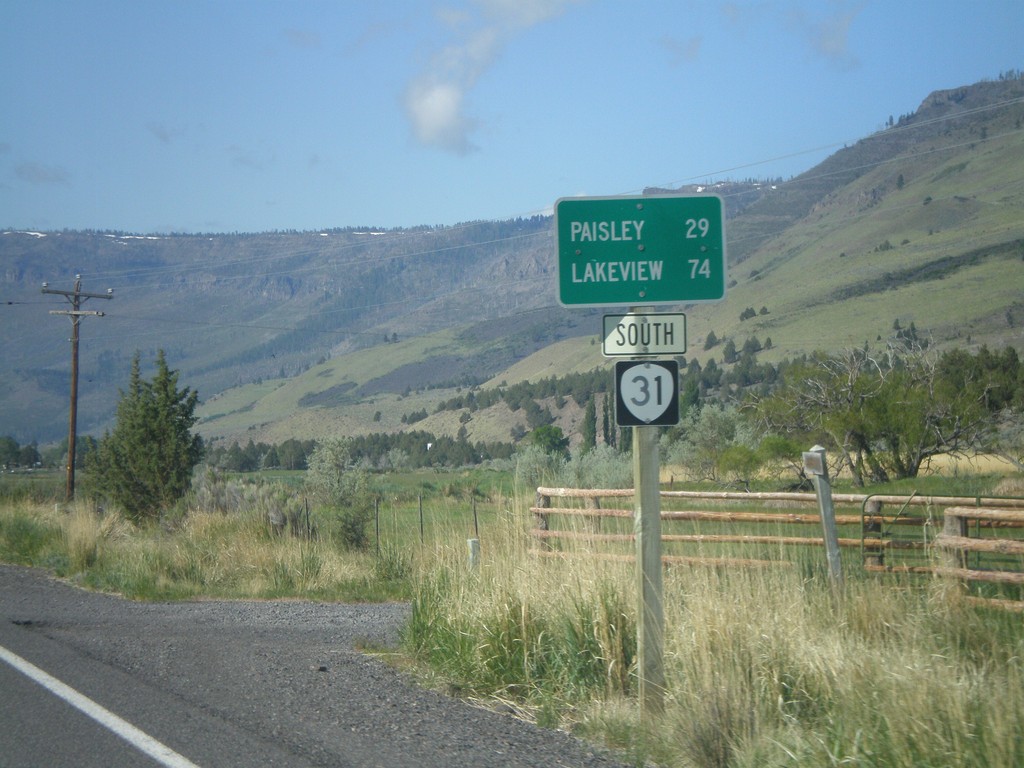
OR-31 South - Distance Marker
Distance marker on OR-31 south, leaving Summer Lake, Oregon. Distance to Paisley and Lakeview.
Taken 05-28-2012
 Summer Lake
Lake County
Oregon
United States
Summer Lake
Lake County
Oregon
United States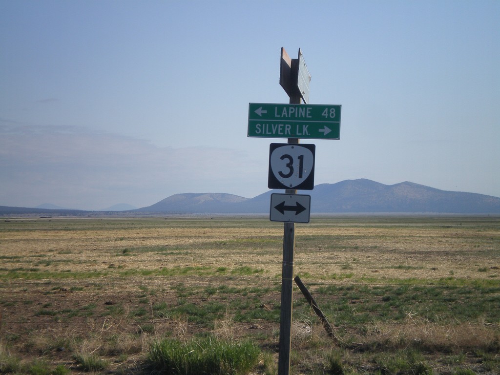
End Silver Lake Marsh Road at OR-31
End Silver Lake Marsh Road at OR-31. Turn right on OR-31 for Silver Lake. Turn left on OR-31 for La Pine.
Taken 05-28-2012
Silver Lake
Lake County
Oregon
United States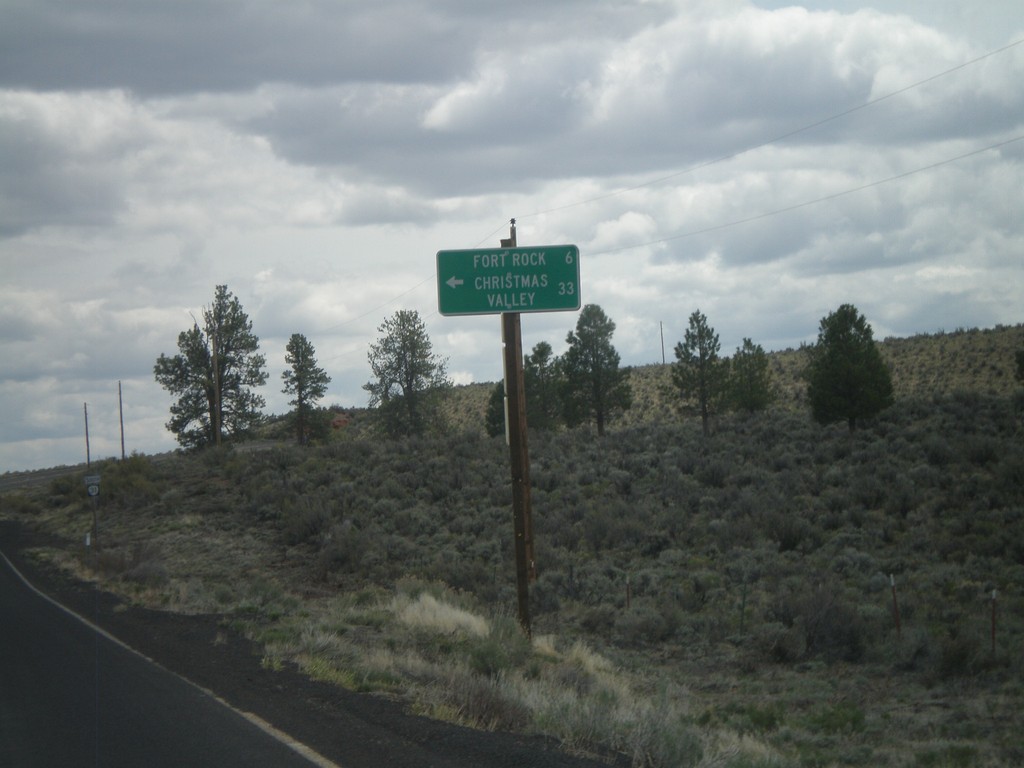
OR-31 South at Fort Rock Jct.
OR-31 south at Fort Rock/Christmas Valley Jct.
Taken 05-27-2012
Fort Rock
Lake County
Oregon
United States