Signs Tagged With Distance Marker
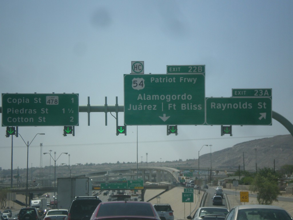
I-10 West - Exits 23A and 22B
I-10 west at Exit 23A - Raynolds St. Approaching Exit 22B - US-54/Patriot Freeway/Alamogordo (NM)/Fort Bliss/Juarez (Mexico). Continue west on I-10 for Copia St./TX 478 Loop/Piedras St./Cotton St.
Taken 04-14-2013


 El Paso
 County
Texas
United States
El Paso
El Paso County
Texas
United States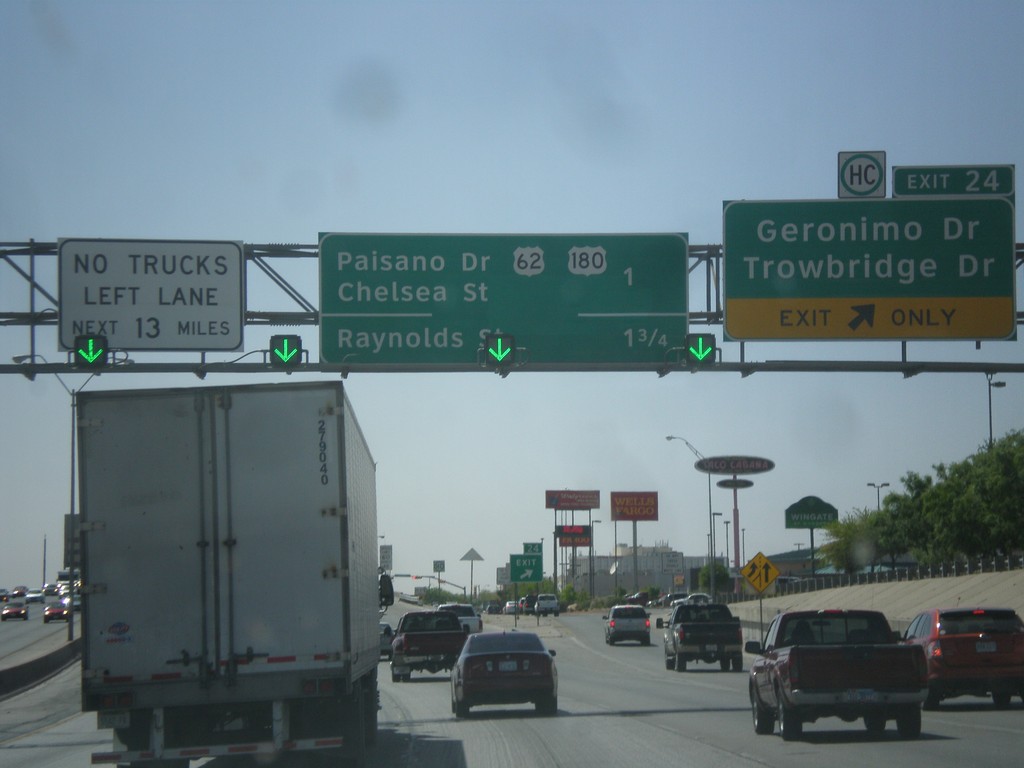
I-10 West - Exit 24
I-10 west at Exit 24 - Geronimo Drive/Trowbridge Drive. Approaching US-62/US-180 Jct. and Raynolds St. Jct.
Taken 04-14-2013
El Paso
El Paso County
Texas
United States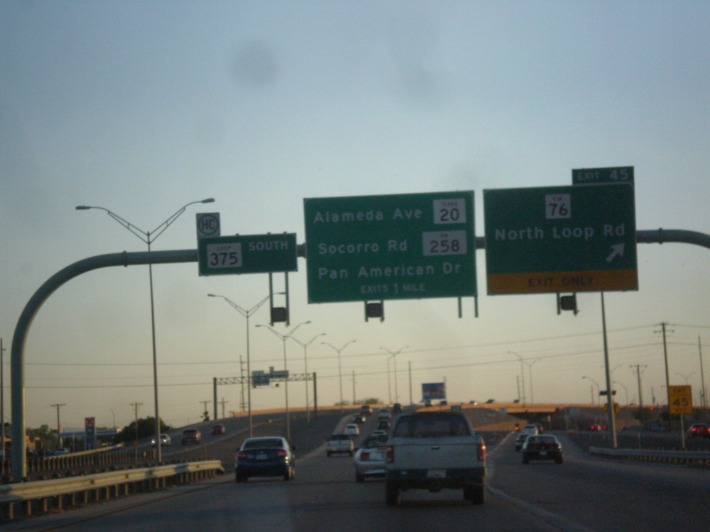
TX-375 Loop South - Exit 45
TX-375 Loop South at Exit 45 - FM-76/North Loop Road. Approaching TX-20/Alameda Ave. and FM-258/Soccoro Road/Pan American Drive.
Taken 04-13-2013


 El Paso
 County
Texas
United States
El Paso
El Paso County
Texas
United States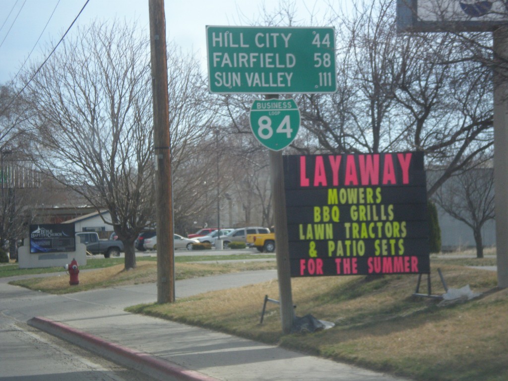
BL-84 East - Distance Marker
Distance marker on BL-84 east in Mountain Home. Distance to Hill City, Fairfield, and Sun Valley. All these cities are via US-20 east, which BL-84 turns into.
Taken 03-16-2013
 Mountain Home
Elmore County
Idaho
United States
Mountain Home
Elmore County
Idaho
United States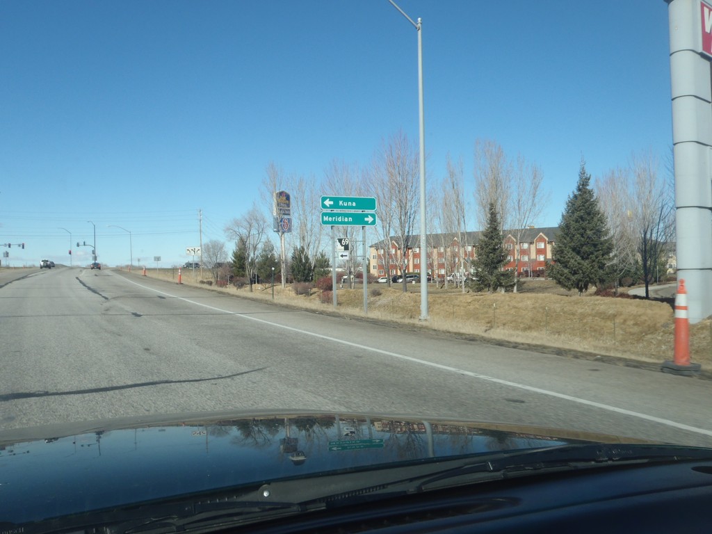
I-84 West - Exit 44 Offramp
I-84 east Exit 44 offramp at ID-69 junction. Turn left for ID-69 south to Kuna; turn right for Meridian Road to Meridian (City Center).
Taken 02-17-2013


 Meridian
Ada County
Idaho
United States
Meridian
Ada County
Idaho
United States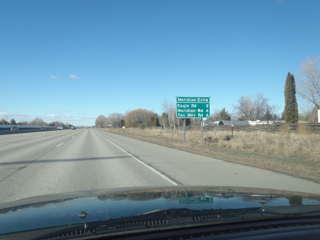
I-84 West - Meridian Exits
Meridian Exits on I-84 west: Eagle Road (ID-55), Meridian Road (ID-69), and Ten Mile Road.
Taken 02-17-2013
Boise
Ada County
Idaho
United States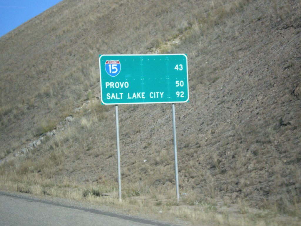
US-6 West - Distance Marker
Distance Marker on US-6 west. Distance to I-15, Provo, and Salt Lake City.
Taken 10-20-2012
 Colton
Utah County
Utah
United States
Colton
Utah County
Utah
United States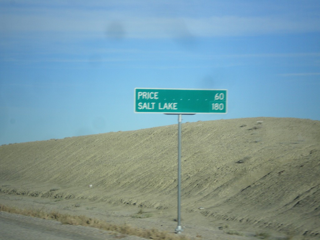
US-6 West/US-191 North - Distance Marker
Distance marker on US-6 West/US-191 North. Distance to Price and Salt Lake. Taken just north of I-70.
Taken 10-20-2012
 Green River
Emery County
Utah
United States
Green River
Emery County
Utah
United States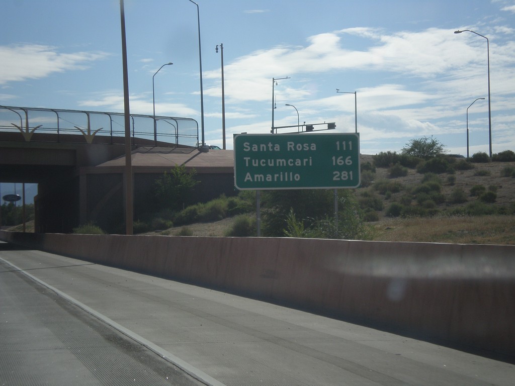
I-40 East - Distance Marker
Distance marker on I-40 east in Albuquerque. Distance to: Santa Rosa, Tucumcari, Amarillo (Texas).
Taken 10-11-2012
 Albuquerque
Bernalillo County
New Mexico
United States
Albuquerque
Bernalillo County
New Mexico
United States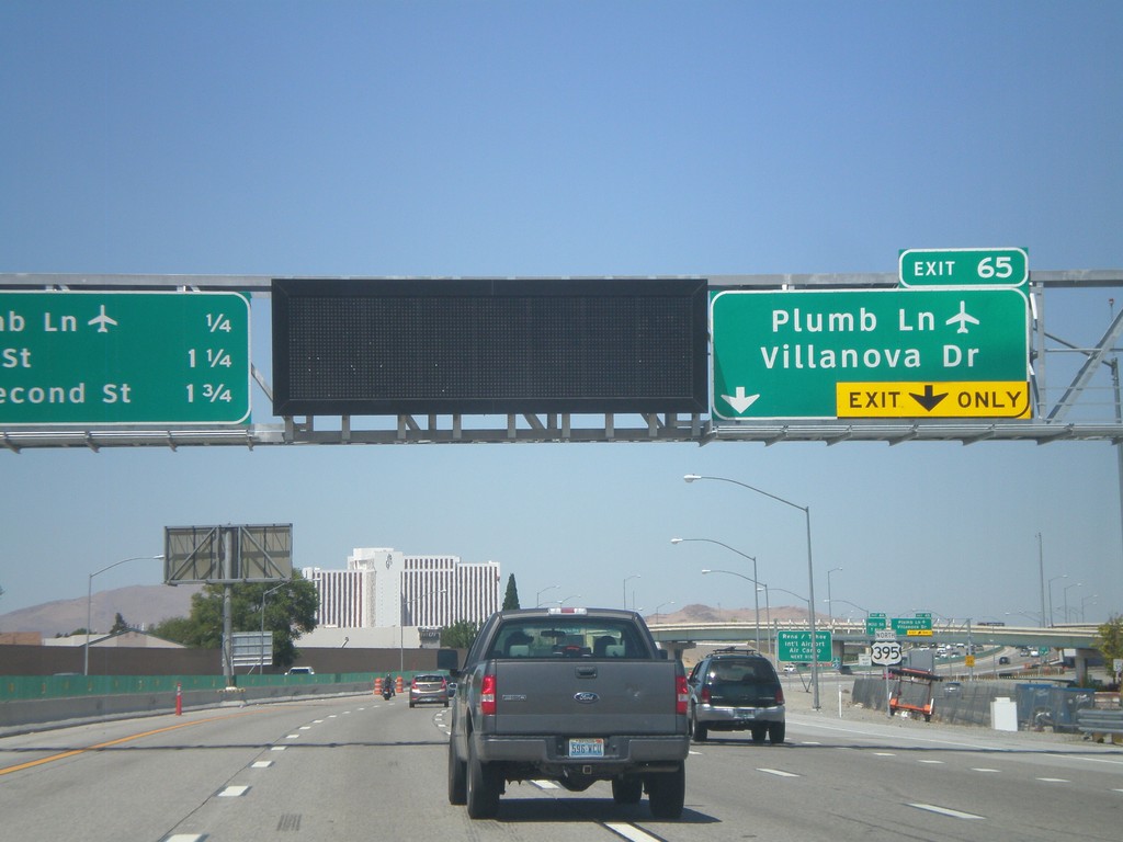
US-395 North Approaching Exit 65
US-395 north approaching Exit 65 - Plumb Lane/Villanova Drive. A distance marker showing the next three Reno exits is on the left side of the picture. The next three exits are: Plumb Lane, Mill St., and E. Second St. Use the Plumb Lane exist for the Reno-Tahoe International Airport.
Taken 07-28-2012
 Reno
Washoe County
Nevada
United States
Reno
Washoe County
Nevada
United States