Signs Tagged With Distance Marker
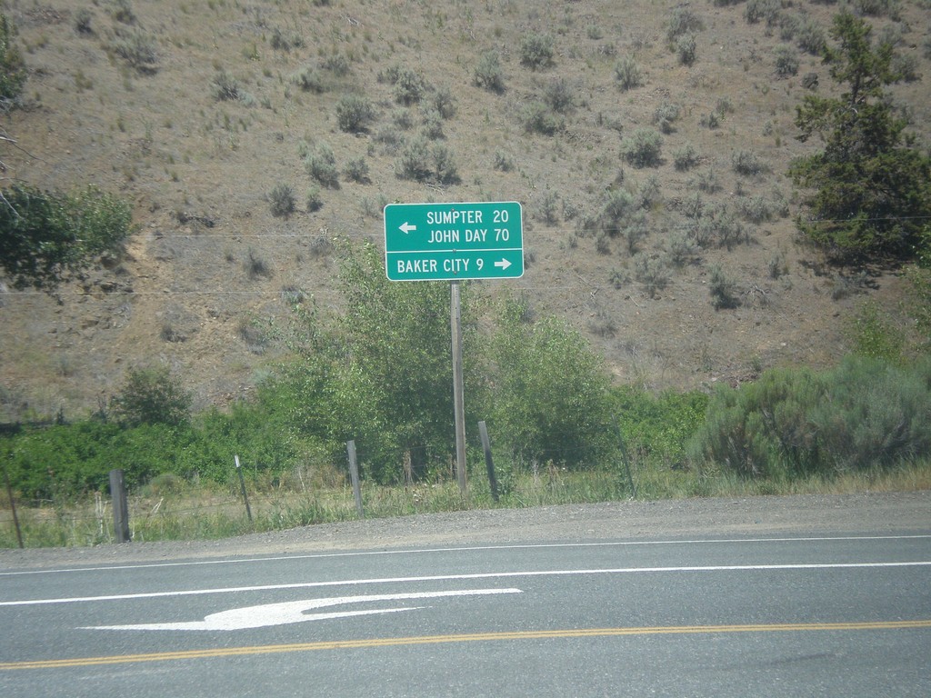
End OR-245 East at OR-7
End OR-245 east at OR-7. Turn right on OR-7 east for Baker City; turn left on OR-7 west for Sumpter and John Day.
Taken 07-15-2013

 Baker City
Baker County
Oregon
United States
Baker City
Baker County
Oregon
United States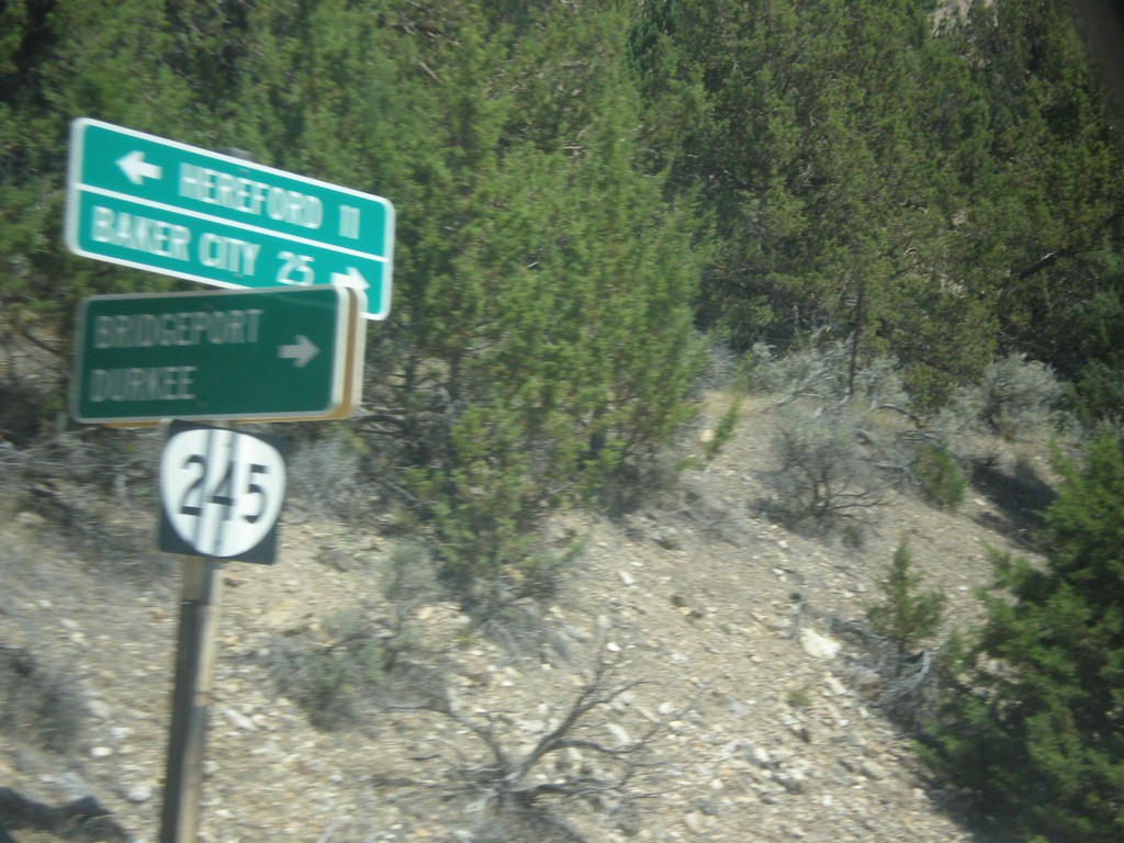
OR-245 East at Bridgeport/Durkee Jct.
OR-245 east at Bridgeport/Durkee Junction.
Taken 07-15-2013
Bridgeport
Baker County
Oregon
United States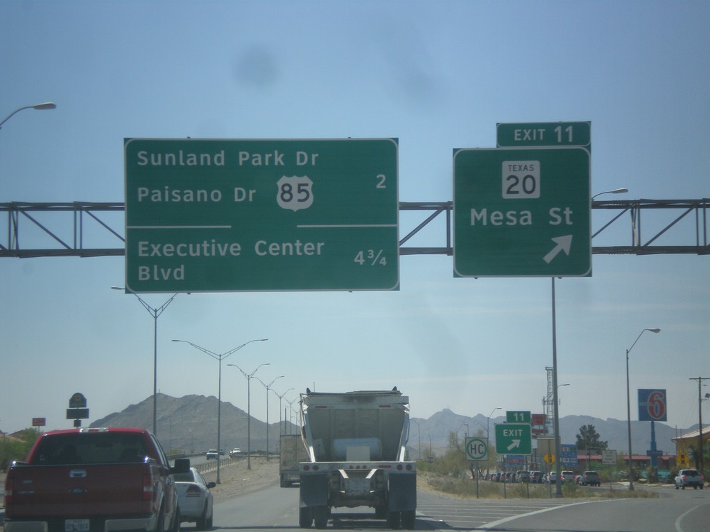
I-10 East - Exit 11
I-10 east at Exit 11 - TX-20/Mesa St. Next exits are - US-85/Sunland Park Drive/Paisano Drive and Executive Center Blvd.
Taken 04-15-2013


 El Paso
 County
Texas
United States
El Paso
El Paso County
Texas
United States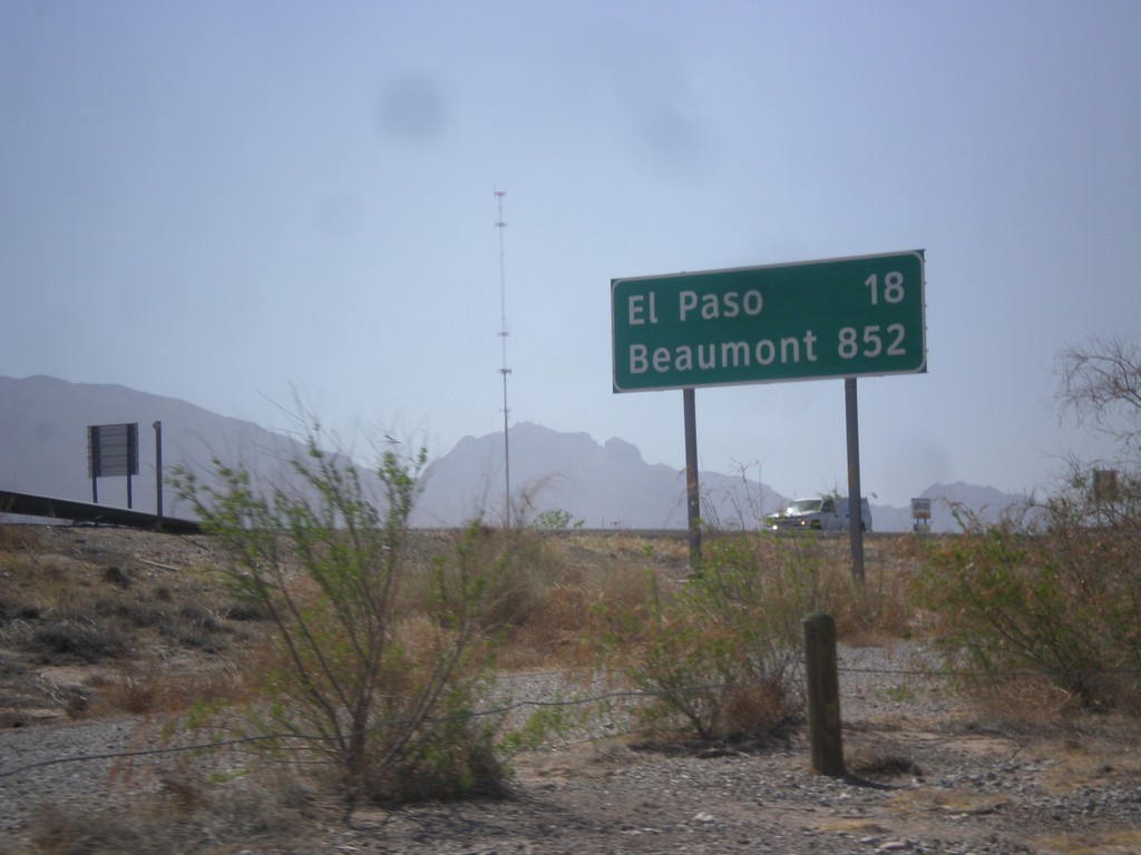
I-10 East - Distance Marker
First distance marker along I-10 east in Texas. Distance to El Paso and Beaumont. Beaumont is at the opposite side of Texas on the Louisiana state line - 852 miles away.
Taken 04-15-2013
Anthony
El Paso County
Texas
United States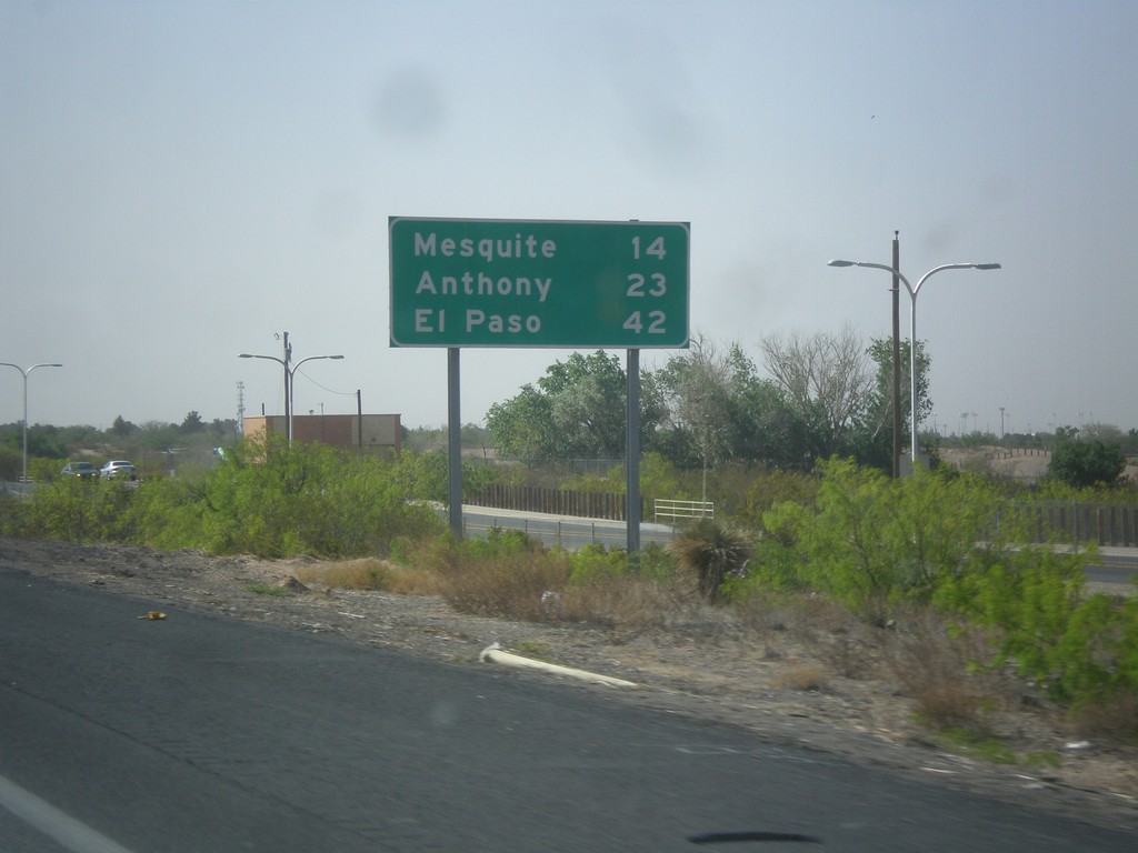
I-25 South - Distance Marker
Distance marker on I-25 south. Distance to Mesquite, Anthony, and El Paso. All of these locales are accessed via I-10 east.
Taken 04-15-2013
 Las Cruces
Doña Ana County
New Mexico
United States
Las Cruces
Doña Ana County
New Mexico
United States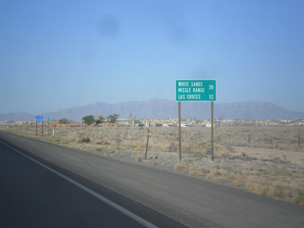
US-70 West - Distance Marker
Distance marker on US-70 west. Distance to White Sands Missile Range and Las Cruces.
Taken 04-15-2013
 Tularosa
Otero County
New Mexico
United States
Tularosa
Otero County
New Mexico
United States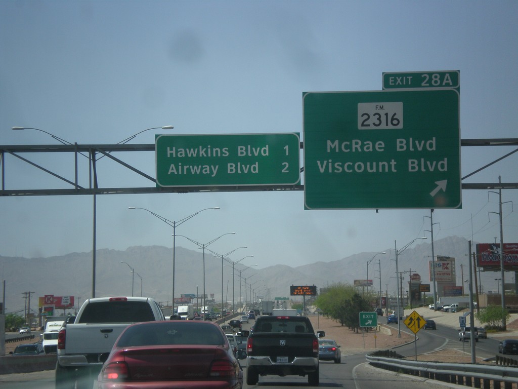
I-10 West - Exit 28A
I-10 west at Exit 28A - FM-2316/McRae Blvd./Viscount Blvd. Approaching Hawkins Blvd. and Airways Blvd.
Taken 04-15-2013
 El Paso
 County
Texas
United States
El Paso
El Paso County
Texas
United States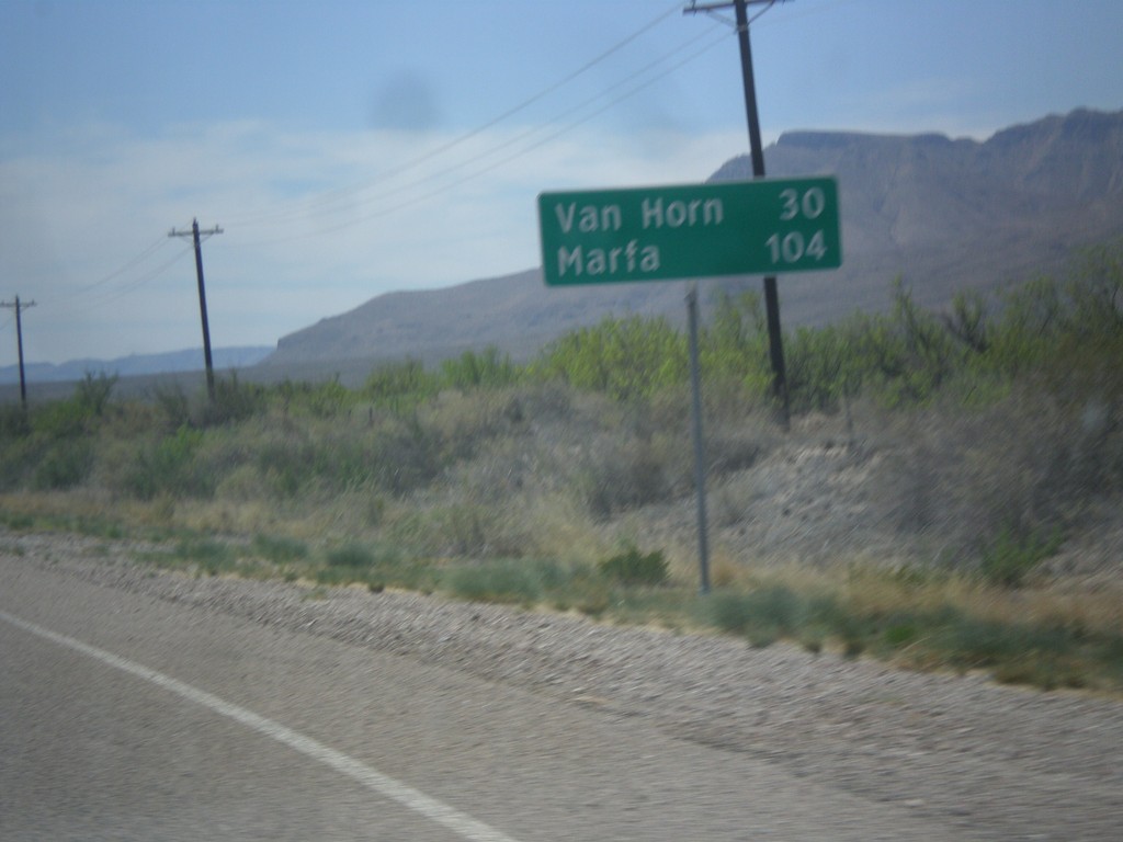
TX-54 South - Distance Marker
Distance marker on TX-54 south. Distance to Van Horn and Marfa (via US-90).
Taken 04-15-2013
 Van Horn
Culberson County
Texas
United States
Van Horn
Culberson County
Texas
United States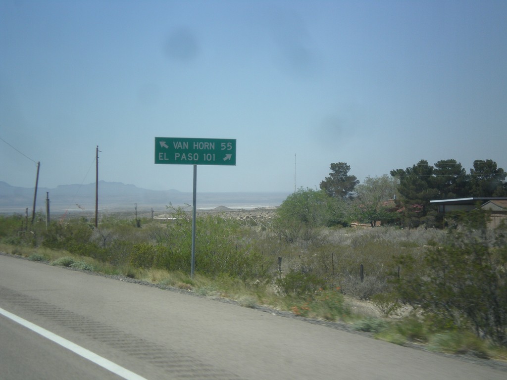
US-62/US-180 West at TX-54
US-62/US-180 west at TX-54 junction. Use TX-54 south for Van Horn; use US-62/US-180 west for El Paso.
Taken 04-15-2013

 Pine Springs
Culberson County
Texas
United States
Pine Springs
Culberson County
Texas
United States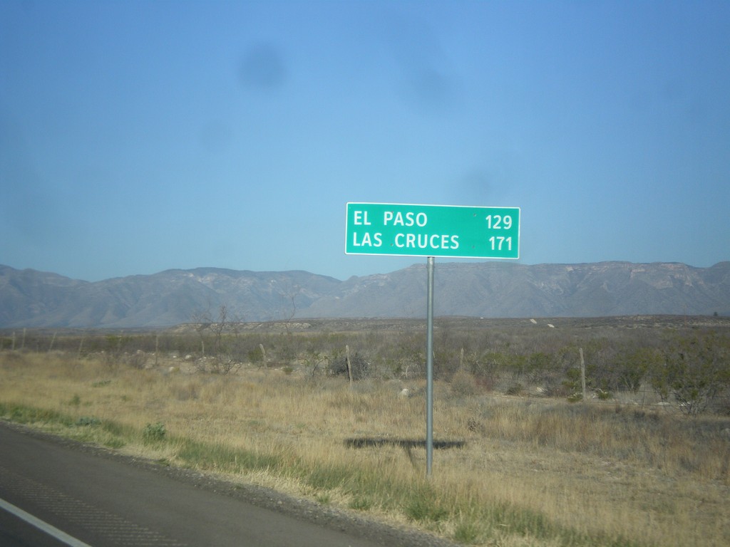
US-62/US-180 West - Distance Marker
Distance marker on US-62/US-180 west. Distance to El Paso and Las Cruces (NM). Taken just west of RM-652 and the Texas-New Mexico state line.
Taken 04-15-2013
Carlsbad
Culberson County
Texas
United States