Signs Tagged With Distance Marker
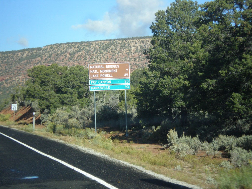
UT-95 West - Distance Marker
Distance marker on UT-95 west to Natural Bridges National Monument, Lake Powell, Fry Canyon, and Hanksville.
Taken 10-14-2013
 Lake Powell
San Juan County
Utah
United States
Lake Powell
San Juan County
Utah
United States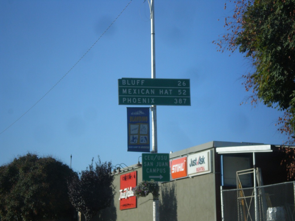
US-191 South - Distance Marker
Distance marker on US-191 south in Blanding. Distance to Bluff, Mexican Hat, and Phoenix. The last city is interesting, because US-191 does not go anywhere near Phoenix. A distance marker between Monticello and Blanding lists Flagstaff as the control city, which is also not on US-191.
Taken 10-14-2013
 Blanding
San Juan County
Utah
United States
Blanding
San Juan County
Utah
United States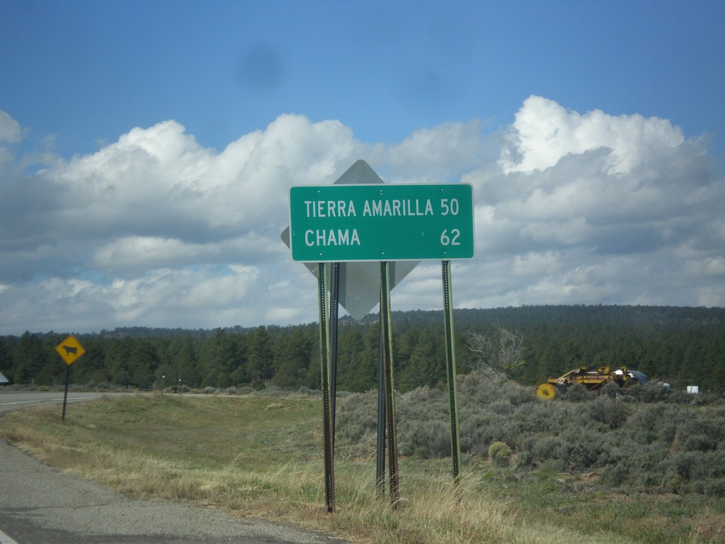
US-64 West - Distance Marker
Distance marker on US-64 west in Tres Piedras. Distance to Tierra Amarilla, and Chama.
Taken 10-13-2013
 Tres Piedras
Taos County
New Mexico
United States
Tres Piedras
Taos County
New Mexico
United States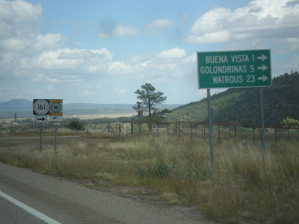
NM-518 North at NM-116
NM-518 north at NM-116 east to Buena Vista, Golondrinas, and Watrous. NM-116 follows the route of the Santa Fe Trail.
Taken 10-10-2013

 Sapello
Mora County
New Mexico
United States
Sapello
Mora County
New Mexico
United States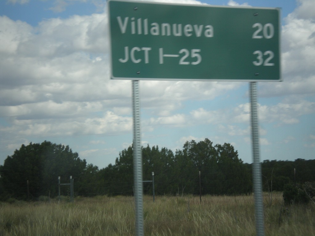
NM-3 North - Distance Marker
Distance marker on NM-3 north. Distance to Villanueva and I-25.
Taken 10-10-2013
 Encino
Torrance County
New Mexico
United States
Encino
Torrance County
New Mexico
United States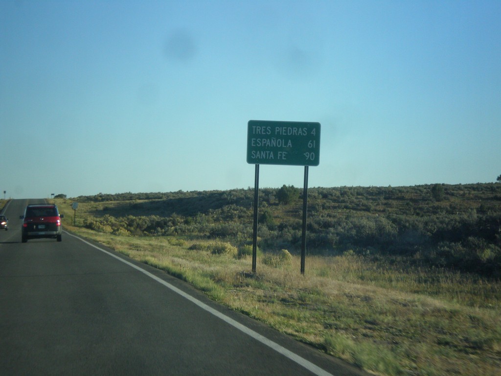
US-285 South - Distance Marker
Distance marker on US-285 south. Distance to Tres Piedras, Espanola, and Santa Fe.
Taken 10-08-2013
 Tres Piedras
Rio Arriba County
New Mexico
United States
Tres Piedras
Rio Arriba County
New Mexico
United States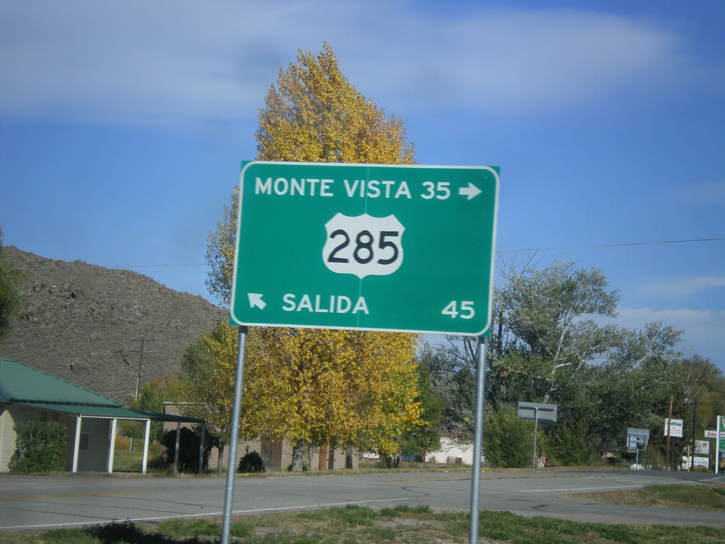
End CO-114 at US-285
End CO-114 at US-285 in Saguache. US-285 north for Salida; US-285 south for Monte Vista.
Taken 10-08-2013
 Saguache
 County
Colorado
United States
Saguache
Saguache County
Colorado
United States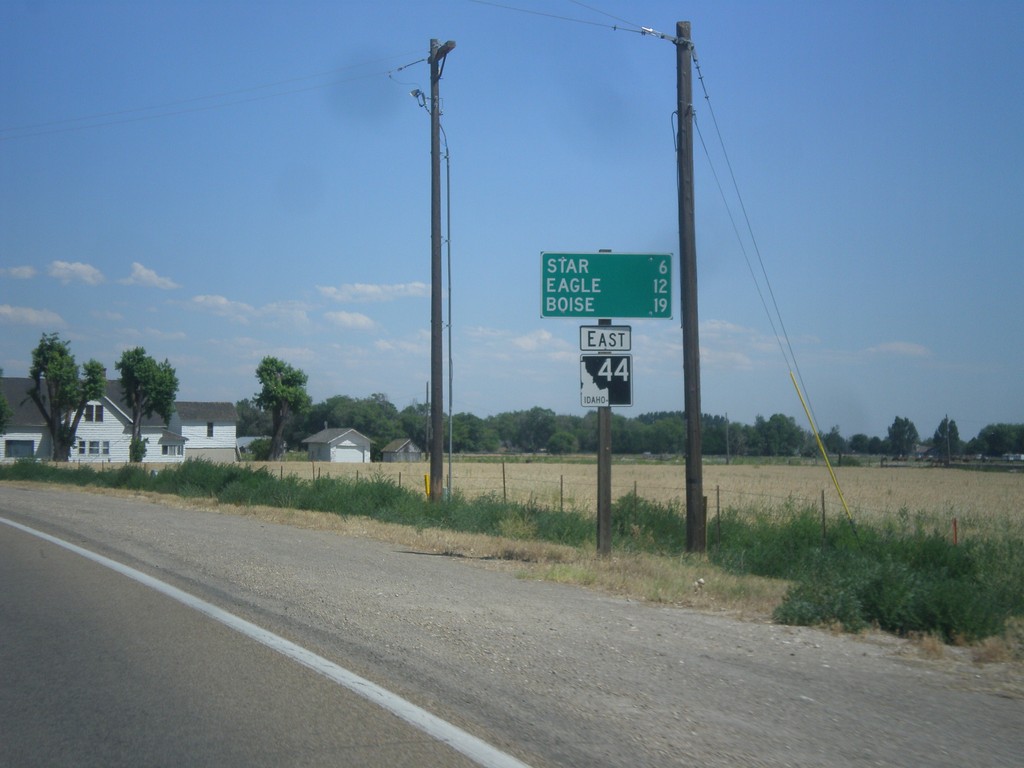
ID-44 East - Distance Marker
Distance marker on ID-44 east. Distance to Star, Eagle, and Boise.
Taken 07-15-2013
 Middleton
Canyon County
Idaho
United States
Middleton
Canyon County
Idaho
United States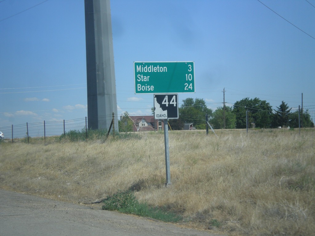
ID-44 East - Distance Marker
Distance marker on ID-44 east. Distance to Middleton, Star, and Boise.
Taken 07-15-2013
Caldwell
Canyon County
Idaho
United States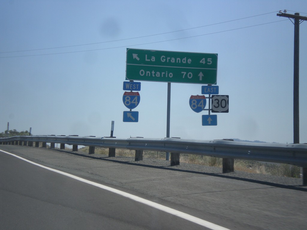
US-30 East at I-84 (Exit 306)
US-30 east at I-84 (Exit 306) onramp. US-30 joins I-84 east to Huntington. This is the eastern entrance to Baker City. Use I-84 East/US-30 East for Ontario. Use I-84 West for La Grande.
Taken 07-15-2013

 Baker City
Baker County
Oregon
United States
Baker City
Baker County
Oregon
United States