Signs Tagged With Distance Marker
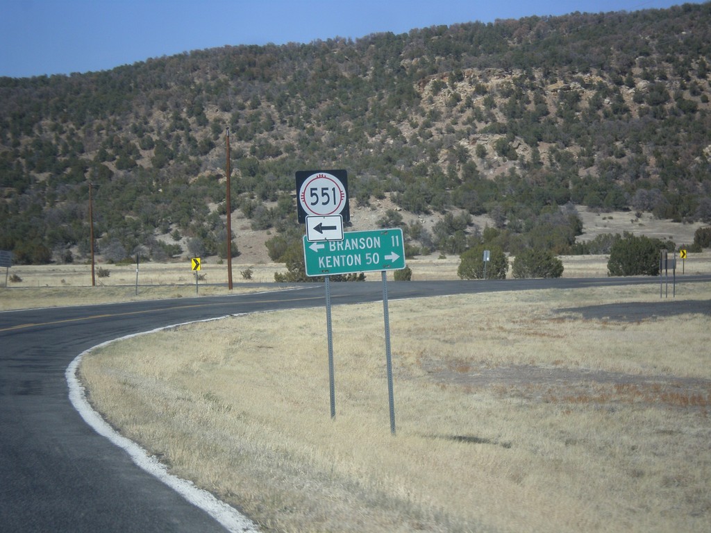
NM-456 East at NM-551 North
NM-456 east at NM-551 north to Branson (Colorado). Continue east on NM-456 for Kenton (Oklahoma).
Taken 03-29-2014

 Folsom
Union County
New Mexico
United States
Folsom
Union County
New Mexico
United States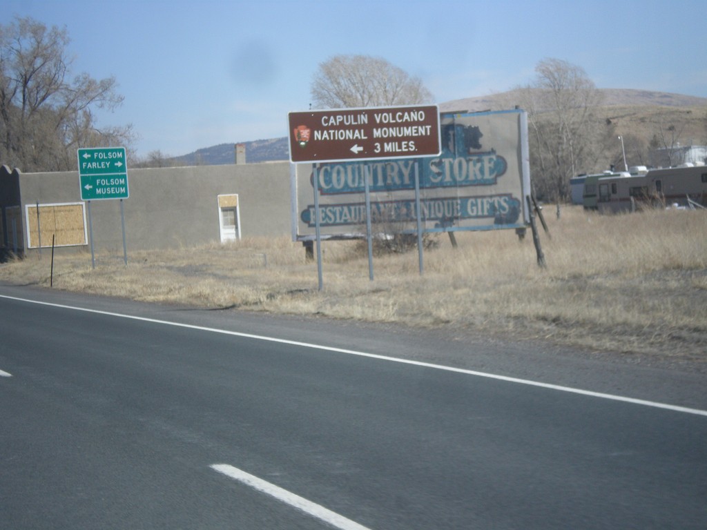
US-64/US-87 East - Capulin National Monument
US-64/US-87 east approaching NM-325. Use NM-325 north for Capulin Volcano National Monument.
Taken 03-29-2014


 Capulin
Union County
New Mexico
United States
Capulin
Union County
New Mexico
United States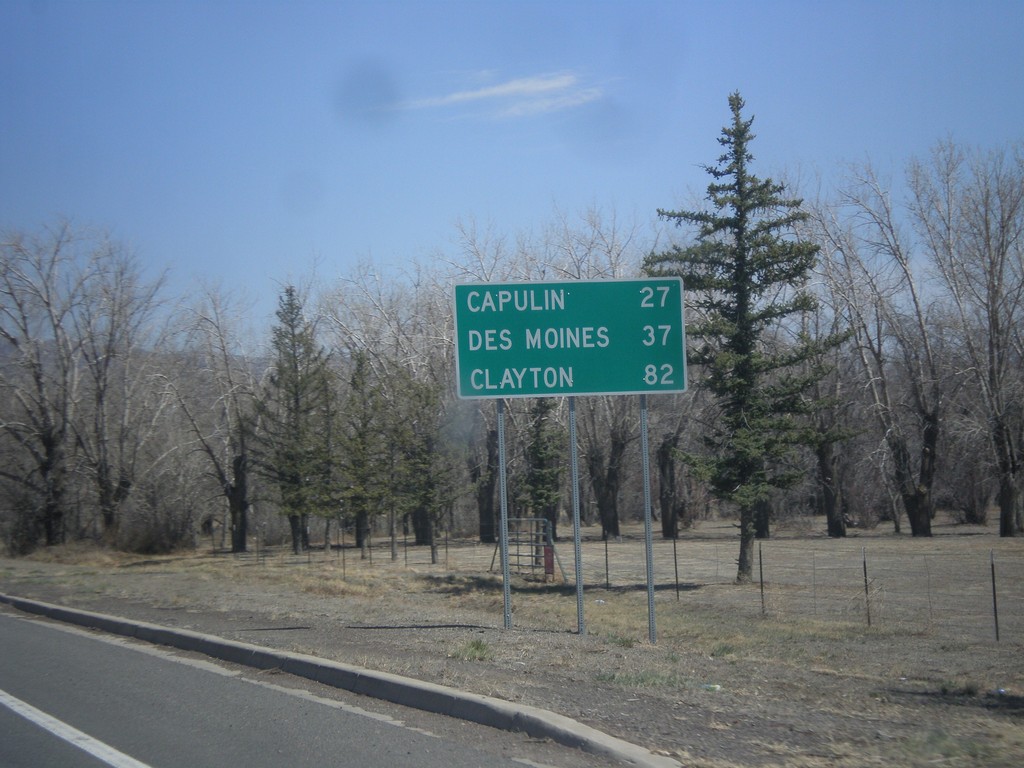
US-64/US-87 East - Distance Marker
Distance marker on US-64/US-87 East to Capulin, Des Moines, and Clayton.
Taken 03-29-2014
Raton
Colfax County
New Mexico
United States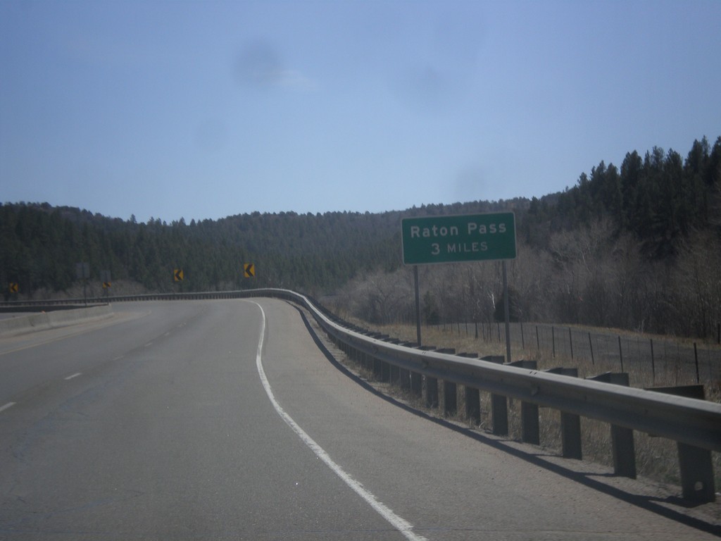
I-25 South - Raton Pass 3 Miles
Distance to top of Raton Pass on I-25 south. Raton Pass - 3 Miles.
Taken 03-29-2014
 Trinidad
Las Animas County
Colorado
United States
Trinidad
Las Animas County
Colorado
United States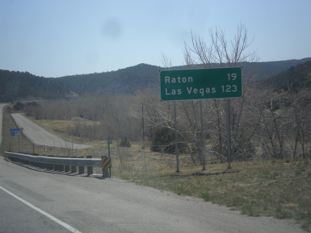
I-25 South - Distance Marker
Distance marker on I-25 south to Raton and Las Vegas. Both destination cities are in New Mexico.
Taken 03-29-2014
Trinidad
Las Animas County
Colorado
United States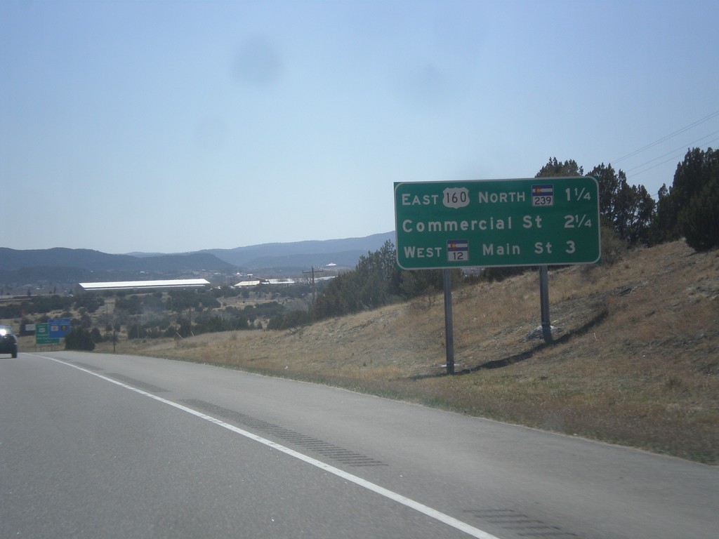
I-25 South - Trinidad Exits
Trinidad Exits on I-25 south. Trinidad Exits: US-160 East/CO-239 North, Commercial St., CO-12 West/Main St.
Taken 03-29-2014
 Trinidad
Las Animas County
Colorado
United States
Trinidad
Las Animas County
Colorado
United States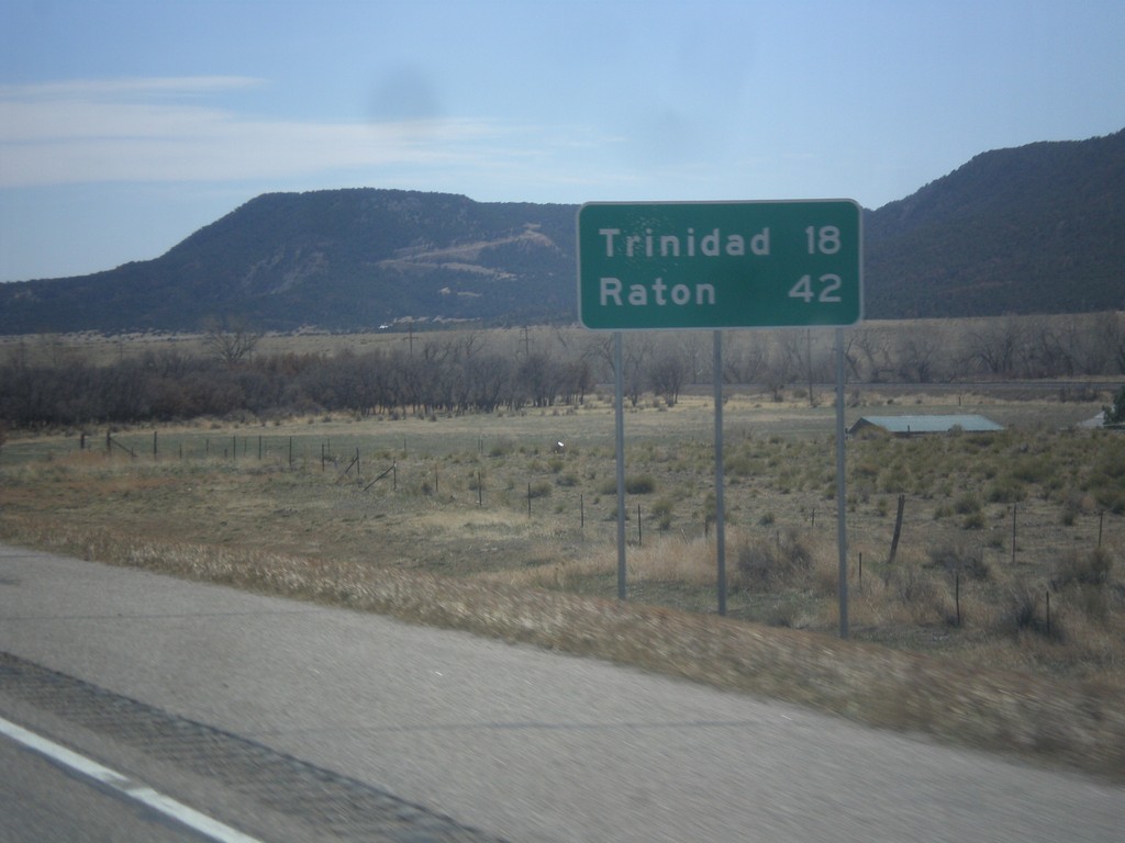
I-25 South - Distance Marker
Distance marker on I-25 south. Distance to Trinidad and Raton (New Mexico).
Taken 03-29-2014
Aguilar
Las Animas County
Colorado
United States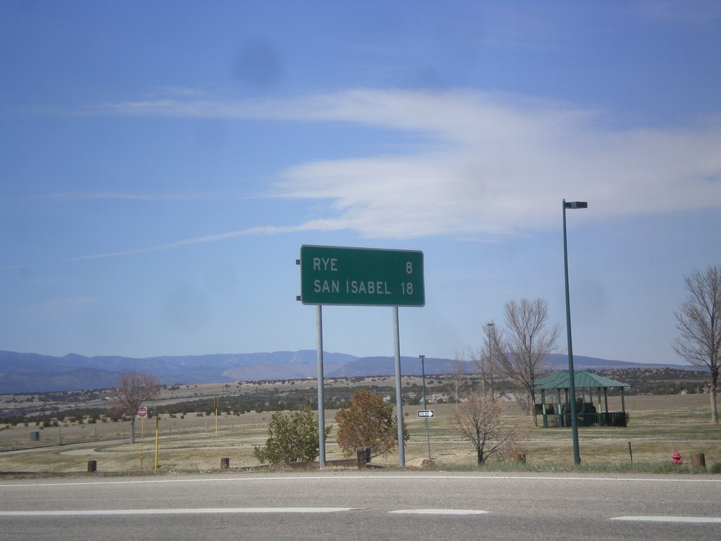
CO-165 West - Distance Marker
Distance marker on CO-165 west. Distance to Rye and San Isabel.
Taken 03-29-2014
 Colorado City
Pueblo County
Colorado
United States
Colorado City
Pueblo County
Colorado
United States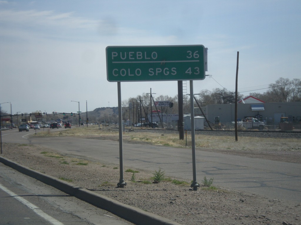
US-50 East - Distance Marker
Distance marker on US-50 east. Distance to Colorado Springs and Pueblo.
Taken 03-29-2014
 Cañon City
Fremont County
Colorado
United States
Cañon City
Fremont County
Colorado
United States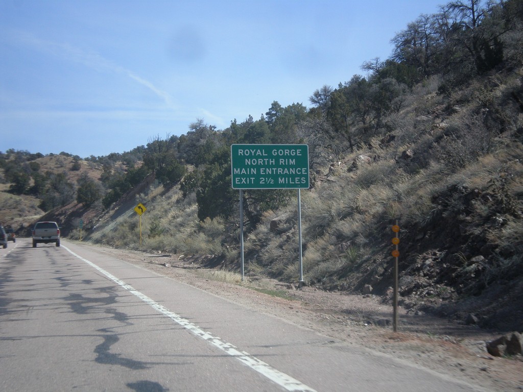
US-50 East - Royal Gorge North Rim
Distance marker on US-50 east for the Royal Gorge North Rim Main Entrance, 2.5 miles. This sign is immediately after the turn off to the South Rim of Royal Gorge.
Taken 03-29-2014
Cañon City
Fremont County
Colorado
United States