Signs Tagged With Distance Marker
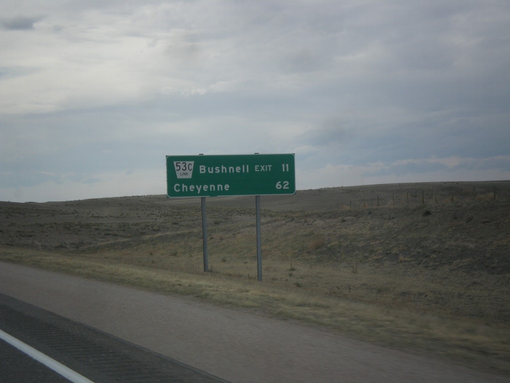
I-80 West - Distance Marker
Distance marker on I-80 west. Distance to NE-53C Link/Bushell Exit and Cheyenne (Wyoming).
Taken 03-30-2014
 Kimball
 County
Nebraska
United States
Kimball
Kimball County
Nebraska
United States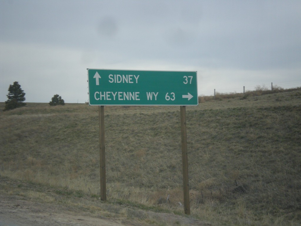
NE-71 South at I-80
NE-71 south at I-80. Use I-80 West/NE-71 South for Cheyenne, WY; I-80 East for Sidney.
Taken 03-30-2014
 Kimball
 County
Nebraska
United States
Kimball
Kimball County
Nebraska
United States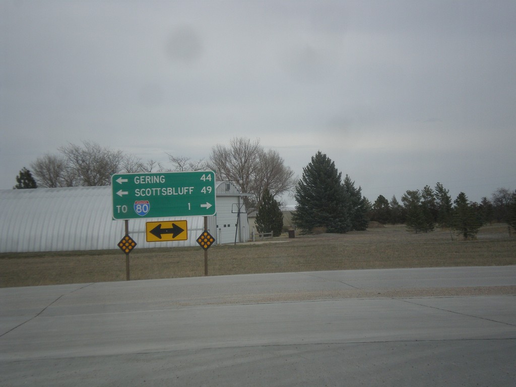
End NE-53E Link at NE-71
End NE-53E Link at NE-71. Use NE-71 north for Gering and Scottsbluff. Use NE-71 south for I-80.
Taken 03-30-2014
 Kimball
 County
Nebraska
United States
Kimball
Kimball County
Nebraska
United States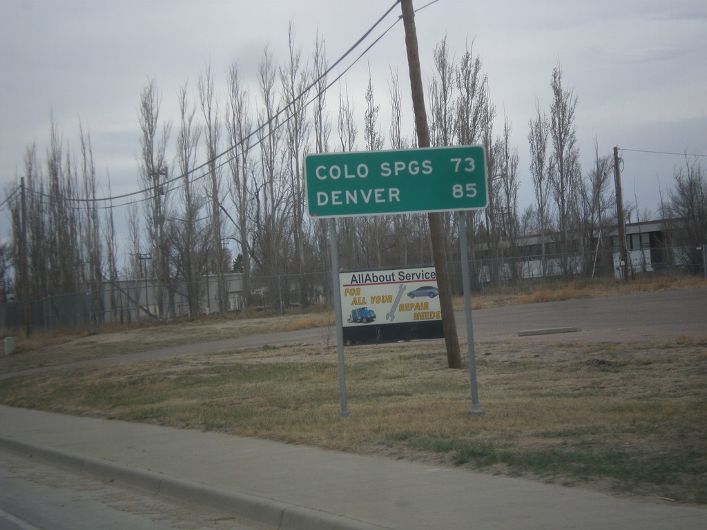
BL-70/US-24/US-40 West/US-287 North - Distance Marker
Distance marker on BL-70/US-24/US-40 West/US-287 North. Distance to Colorado Springs (via US-24) and Denver (via I-70).
Taken 03-30-2014


 Limon
Lincoln County
Colorado
United States
Limon
Lincoln County
Colorado
United States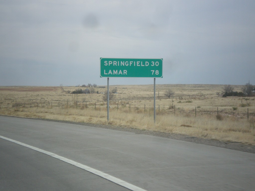
US-287/US-385 North - Distance Marker
Distance marker to Springfield and Lamar on US-287/US-385 north at the Oklahoma-Colorado stateline.
Taken 03-30-2014
 Campo
Baca County
Colorado
United States
Campo
Baca County
Colorado
United States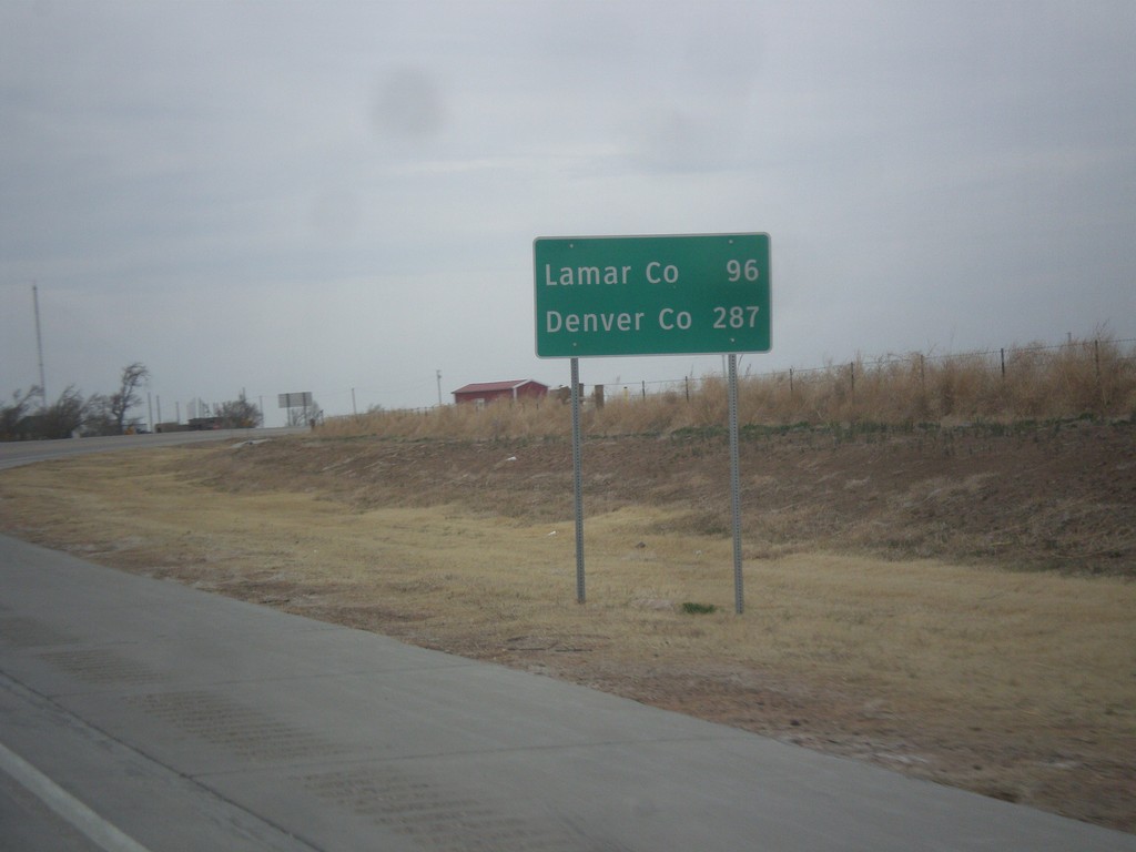
US-287/US-385 North/OK-3 East - Distance Marker
Distance marker on US-287/US-385 North/OK-3 east. Distance to Lamar, CO and Denver, CO.
Taken 03-30-2014
 Boise City
Cimarron County
Oklahoma
United States
Boise City
Cimarron County
Oklahoma
United States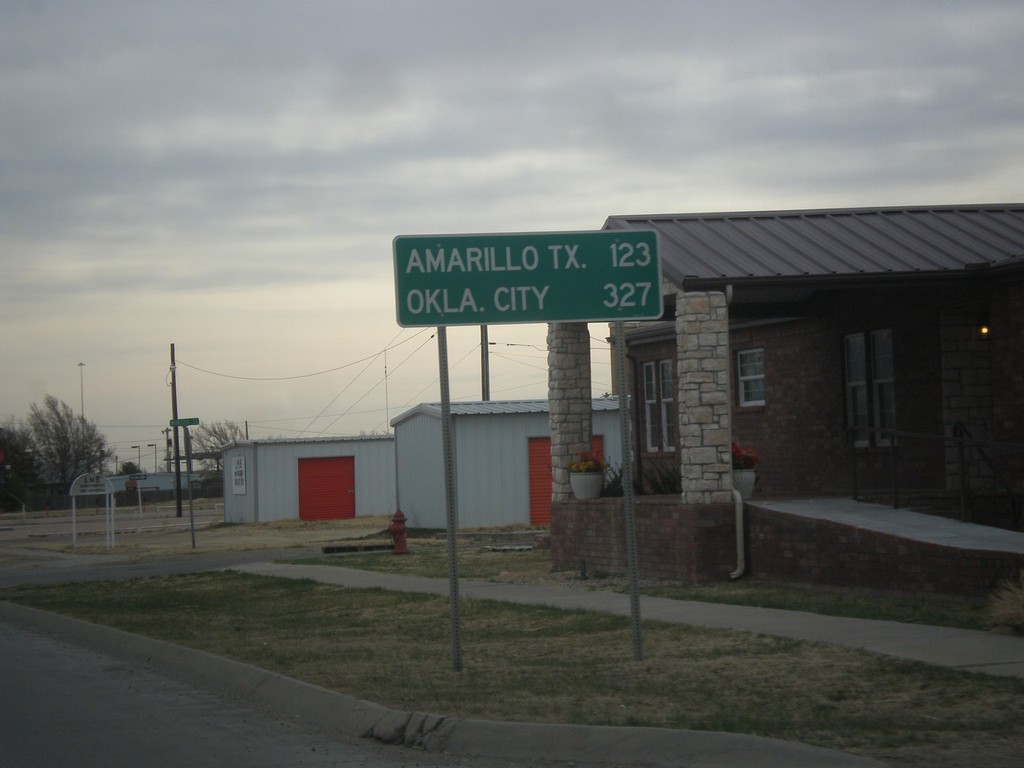
US-56/US-64/US-412/OK-3 East - Distance Marker
Distance marker on US-56/US-64/US-412/OK-3 East. Distance to Amarillo, TX and Oklahoma City.
Taken 03-30-2014


 Boise City
Cimarron County
Oklahoma
United States
Boise City
Cimarron County
Oklahoma
United States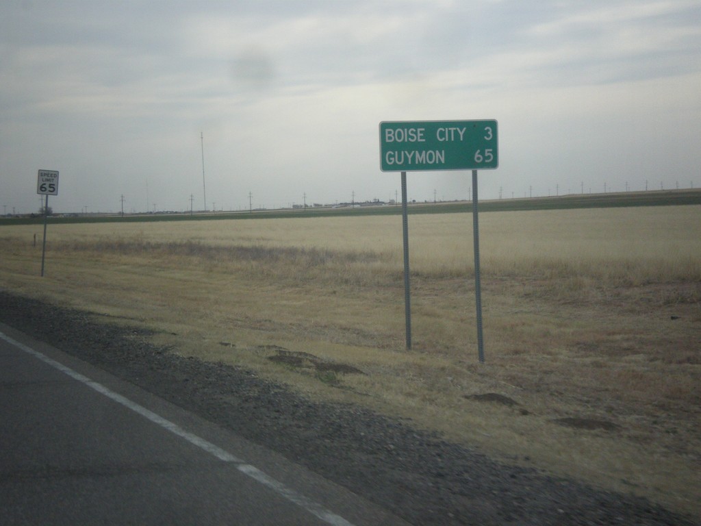
US-56/US-64/US-412 East/US-385 North - Distance Marker
Distance marker on US-56/US-64/US-412 East/US-385 North. Distance to Boise City and Guymon. Speed limit on this stretch of highway is 65 MPH.
Taken 03-30-2014
Boise City
Cimarron County
Oklahoma
United States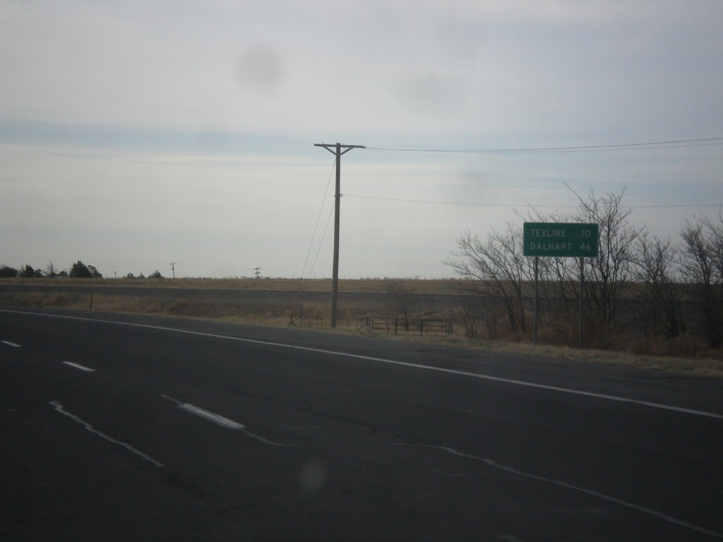
US-87 East - Distance Marker
Distance marker on US-87 east. Distance to Texline and Dalhart, both of which are in Texas. This is the last distance marker along US-87 east in New Mexico.
Taken 03-30-2014
 Clayton
Union County
New Mexico
United States
Clayton
Union County
New Mexico
United States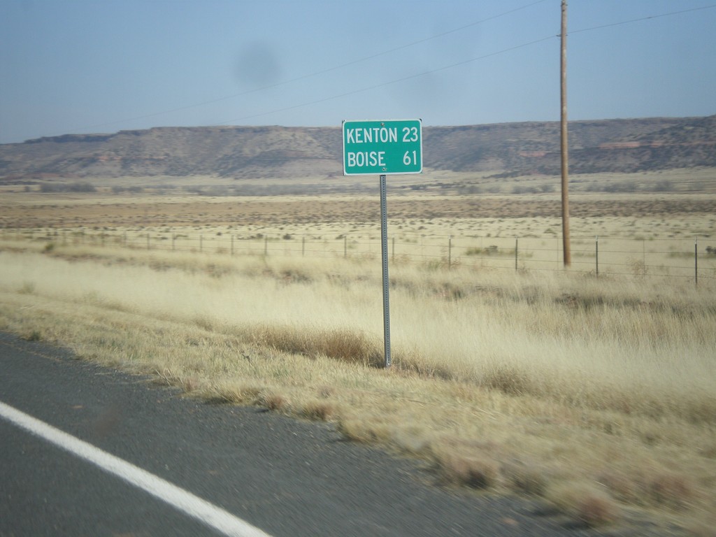
NM-456 East - Distance Marker
Distance marker on NM-456 east. Distance to Kenton, and Boise. Both destinations are in Oklahoma.
Taken 03-29-2014
 Folsom
Union County
New Mexico
United States
Folsom
Union County
New Mexico
United States