Signs Tagged With Distance Marker
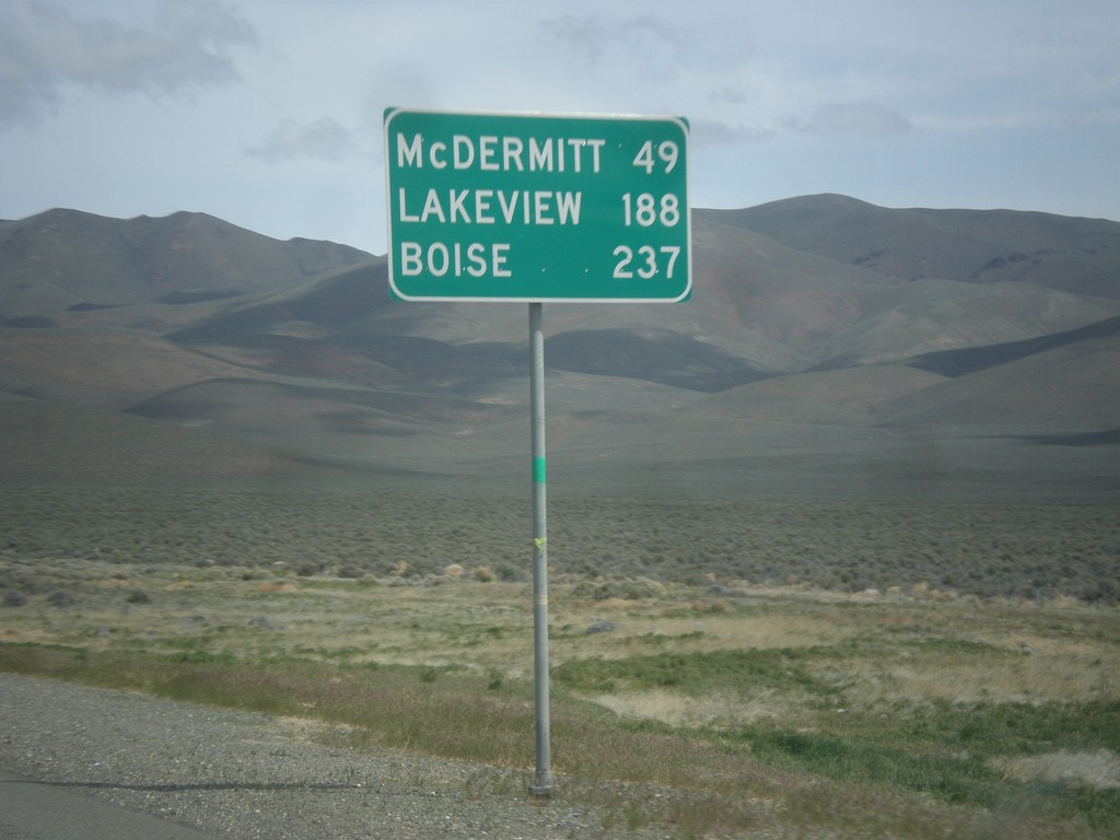
US-95 North - Distance Marker
Distance marker on US-95 north. Distance to McDermit, Lakeview (Oregon - via NV-140), and Boise (Idaho).
Taken 05-06-2014
 Winnemucca
Humboldt County
Nevada
United States
Winnemucca
Humboldt County
Nevada
United States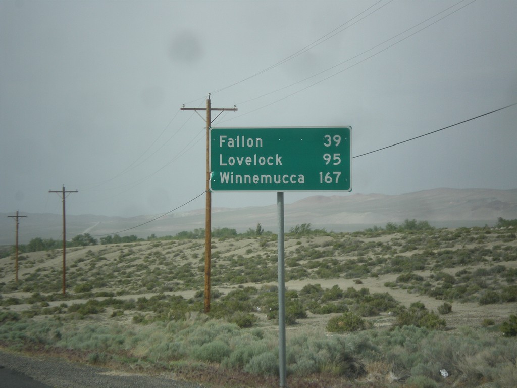
US-95 North - Distance Marker
Distance marker on US-95 north. Distance to Fallon, Lovelock, and Winnemucca. This sign was upgraded to the Clearview font since the last time I photographed it in 2006.
Taken 05-05-2014
Schurz
Mineral County
Nevada
United States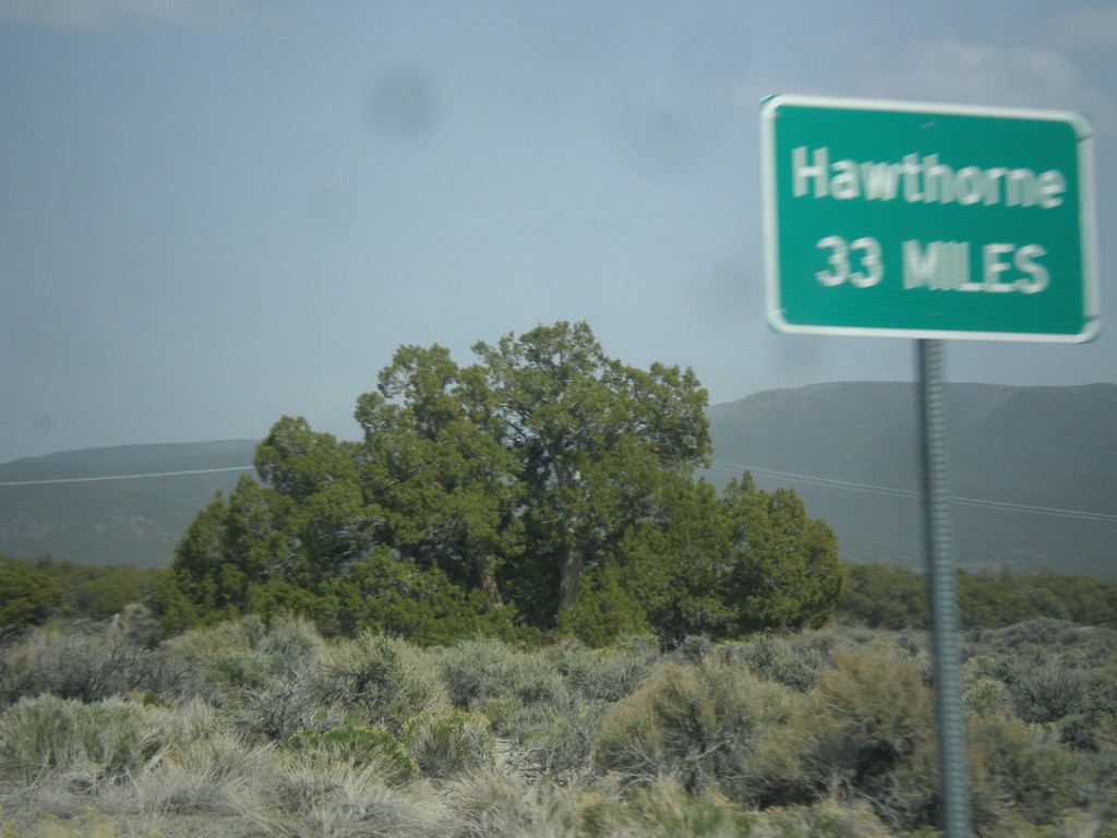
NV-359 North - Distance Marker
Distance marker on NV-359 north. Distance to Hawthorne. This sort of sign is common in Nevada where there is only one city listed as a destination.
Taken 05-05-2014
 Mina
Mineral County
Nevada
United States
Mina
Mineral County
Nevada
United States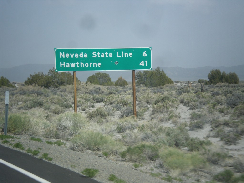
CA-167 East - Distance Marker
Distance marker on CA-167 east. Distance to Nevada State Line and Hawthorne (Nevada).
Taken 05-05-2014
 Lee Vining
Mono County
California
United States
Lee Vining
Mono County
California
United States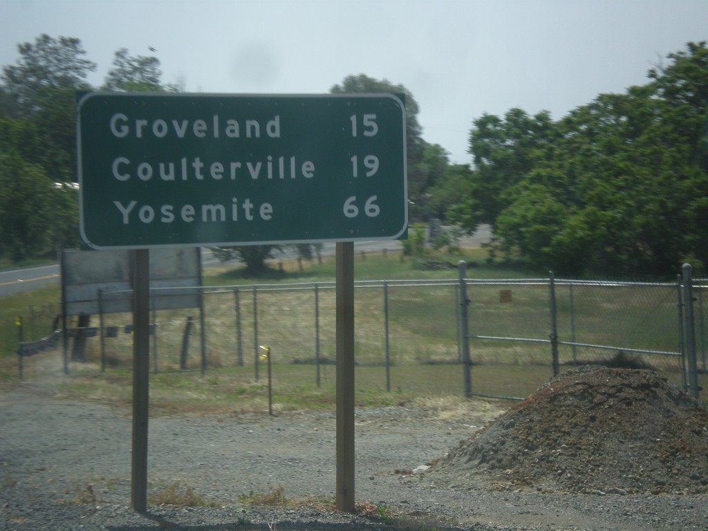
CA-49 South/CA-120 East - Distance Marker
Distance marker on CA-49 South/CA-120 East. Distance to Groveland, Coulterville, and Yosemite.
Taken 05-05-2014

 Chinese Camp
Tuolumne County
California
United States
Chinese Camp
Tuolumne County
California
United States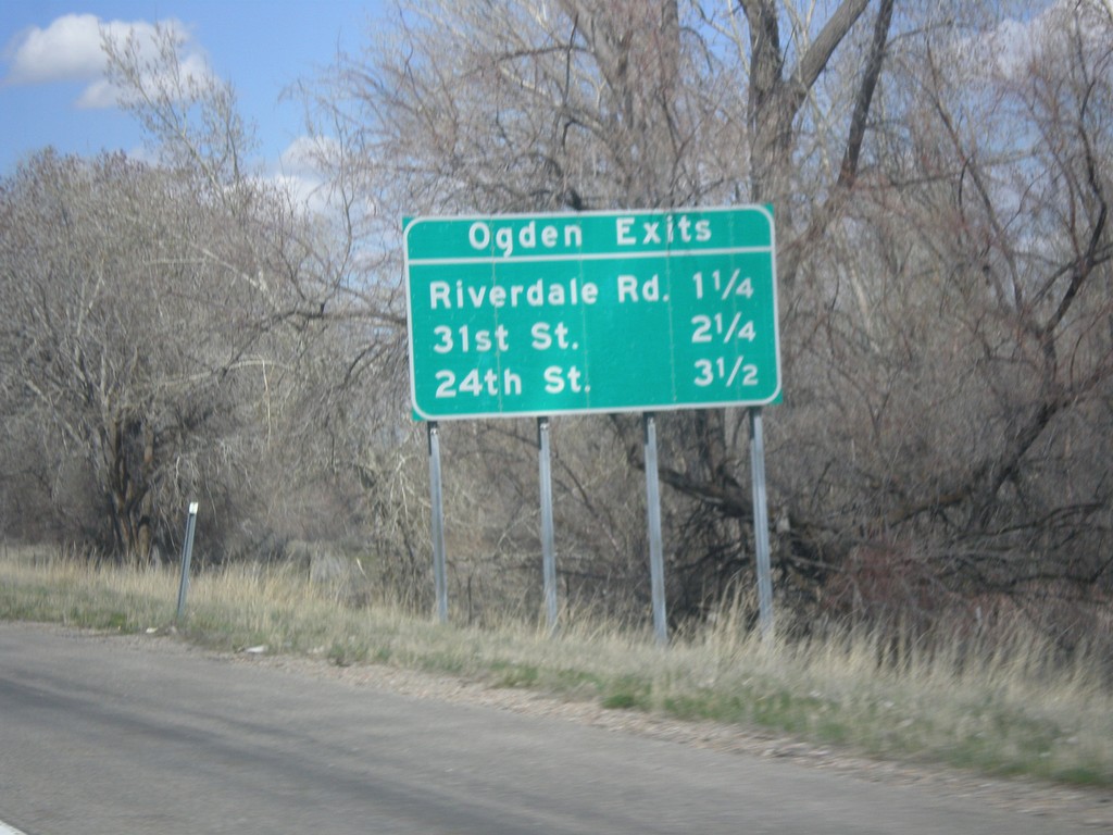
I-84 West - Ogden Exits
Ogden Exits on I-84 west. Next three exits: Riverdale Road, 31st St., and 24th St.
Taken 03-31-2014
 South Weber
Weber County
Utah
United States
South Weber
Weber County
Utah
United States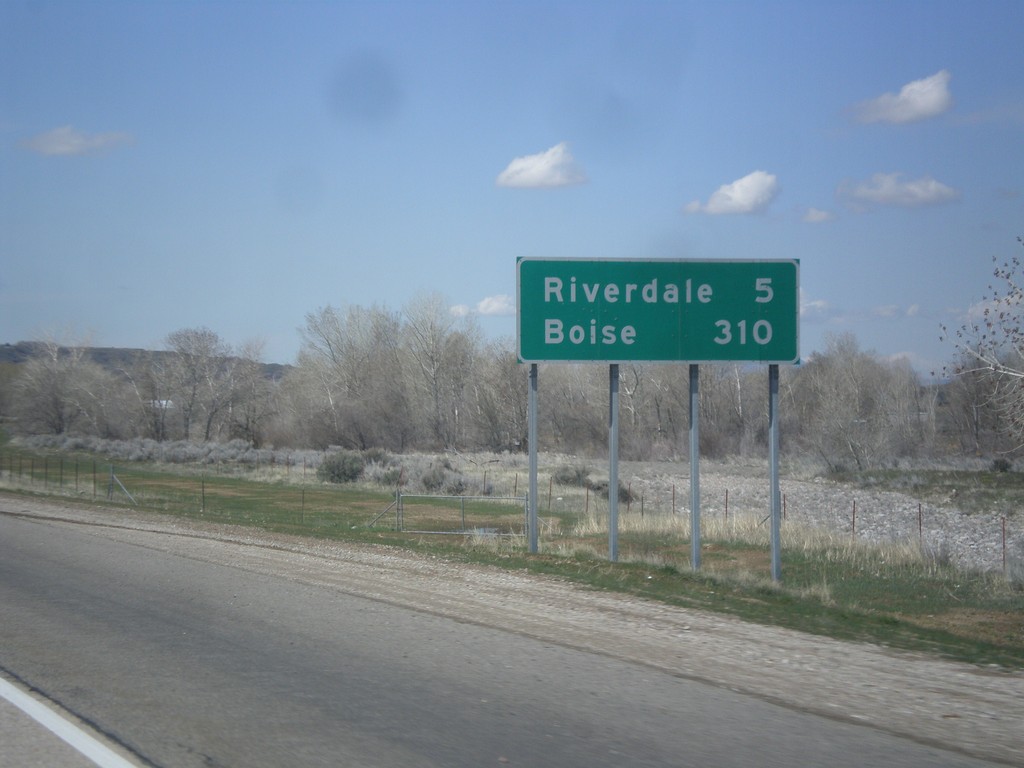
I-84 West - Distance Marker
Distance marker on I-84 west. Distance to Riverdale and Boise. This is the first appearance of Boise on a distance marker on I-84 west.
Taken 03-31-2014
South Weber
Davis County
Utah
United States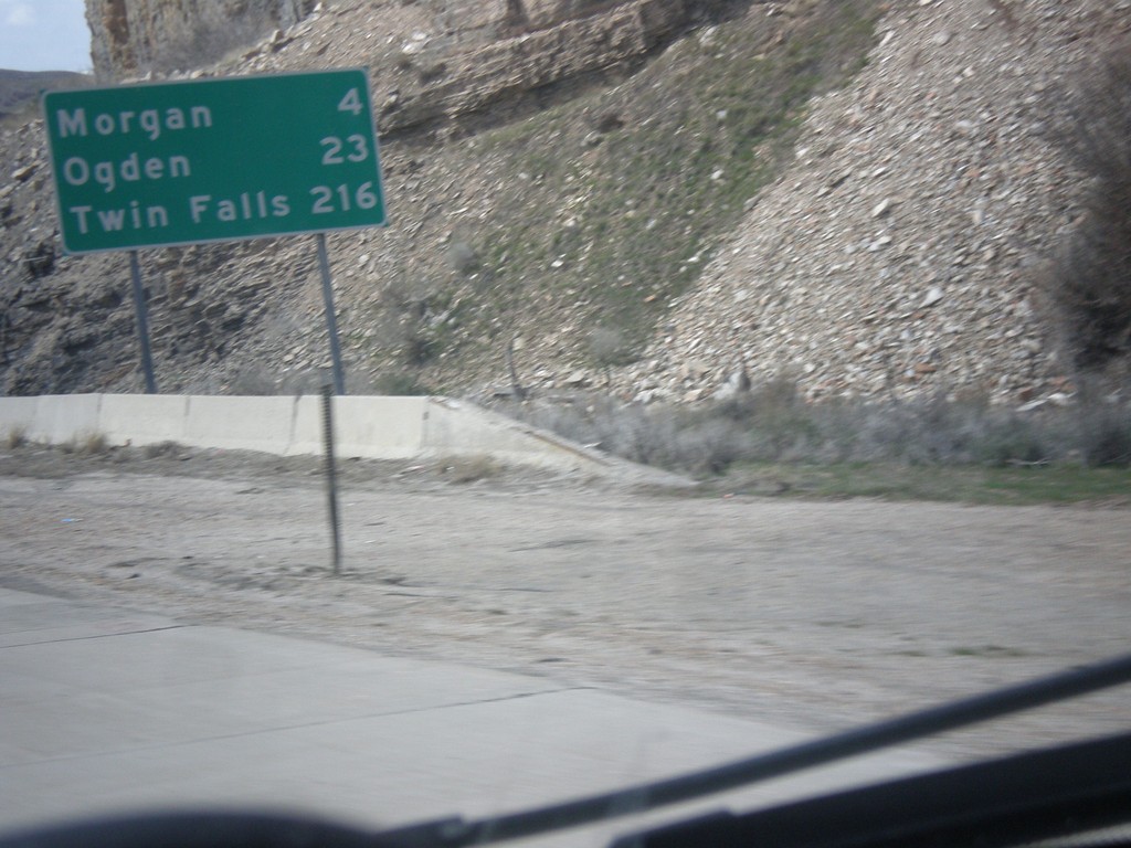
I-84 West - Distance Marker
Distance marker on I-84 west. Distance to Morgan, Ogden, and Twin Falls (Idaho).
Taken 03-31-2014
Morgan
Morgan County
Utah
United States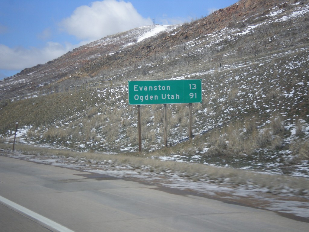
I-80 West - Distance Marker
Distance marker on I-80 west. Distance to Evanston, and Ogden, Utah (via I-84).
Taken 03-31-2014

 Evanston
Uinta County
Wyoming
United States
Evanston
Uinta County
Wyoming
United States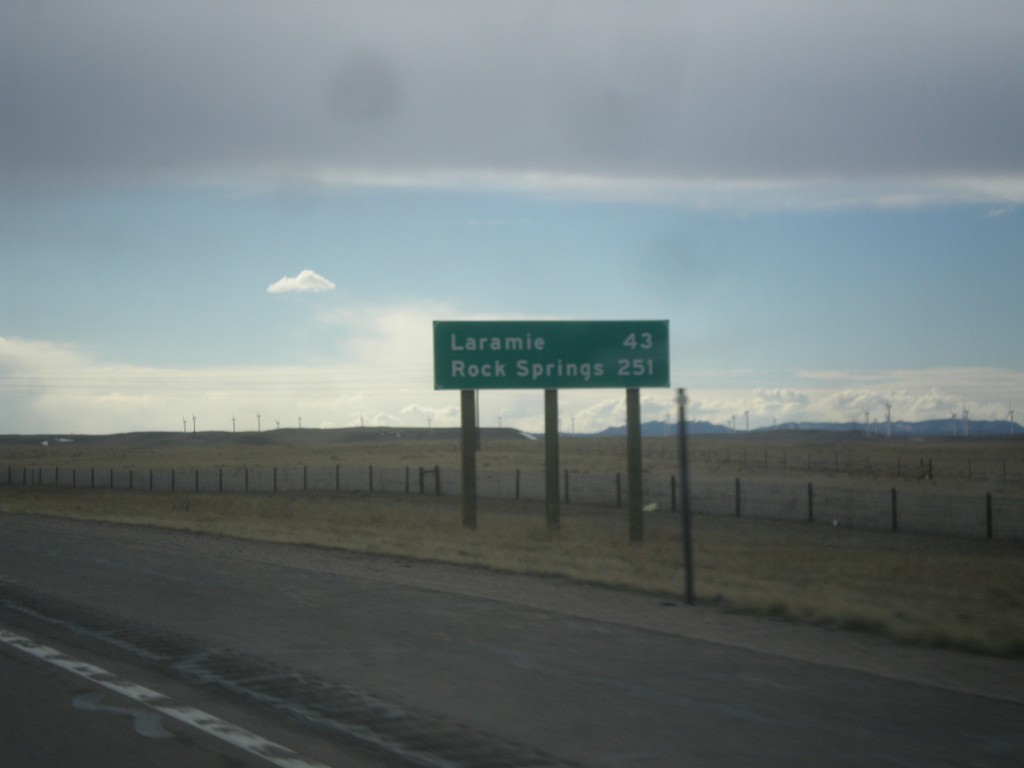
I-80 West - Distance Marker
Distance marker on I-80 west. Distance to Laramie, and Rock Springs.
Taken 03-30-2014
 Cheyenne
Laramie County
Wyoming
United States
Cheyenne
Laramie County
Wyoming
United States