Signs Tagged With Distance Marker
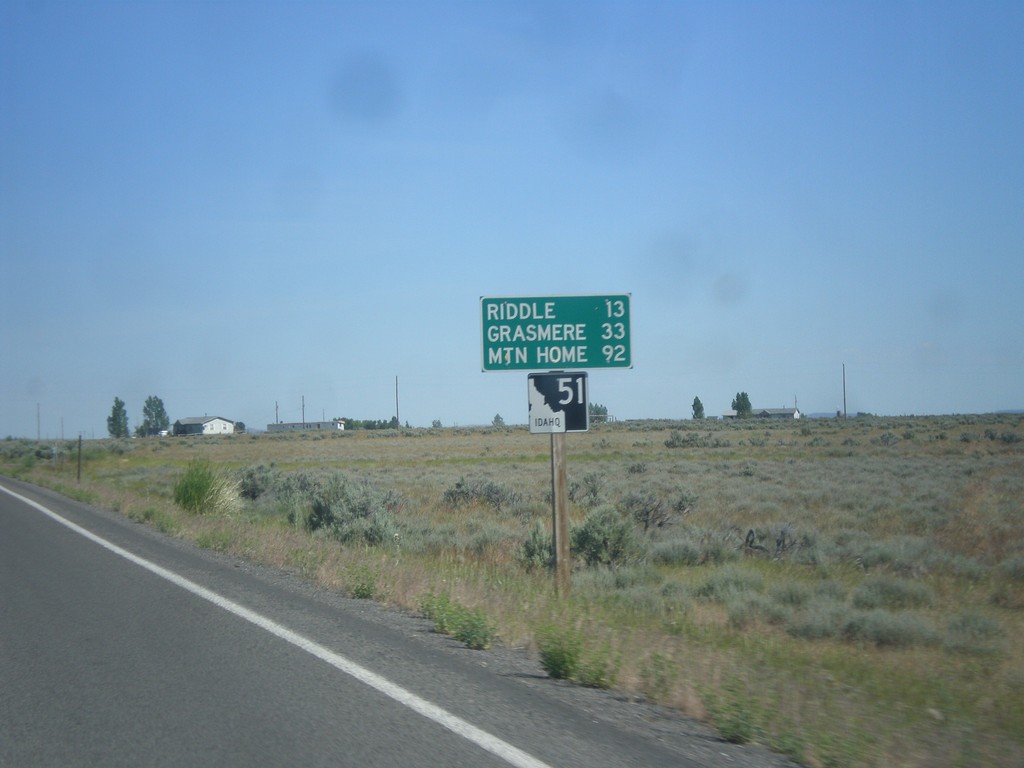
ID-51 North - Distance Marker
Distance marker on ID-51 north. Distance to Riddle, Grasmere, and Mountain Home. This is the first shield and distance marker along ID-51 after the stateline.
Taken 06-21-2014
 Owyhee
 County
Idaho
United States
Owyhee
Owyhee County
Idaho
United States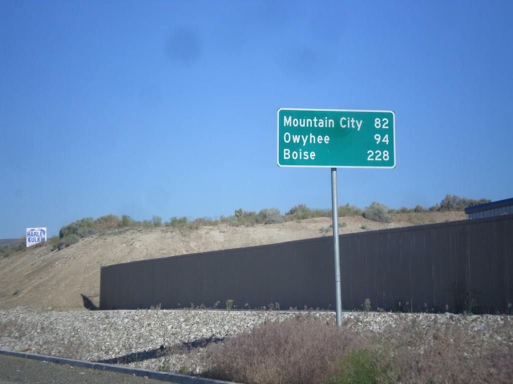
NV-225 North - Distance Marker
Distance Marker on NV-225 North to Mountain City, Owyhee, and Boise (Idaho).
Taken 06-21-2014
 Elko
Elko County
Nevada
United States
Elko
Elko County
Nevada
United States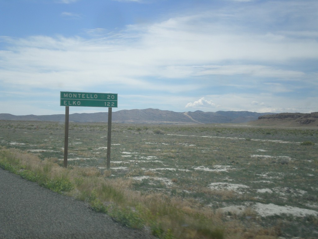
UT-30 West - Distance Marker
Distance marker on UT-30 west. Distance to Montello, and Elko. Both of those places are in Nevada.
Taken 06-21-2014
 Grouse Creek
Box Elder County
Utah
United States
Grouse Creek
Box Elder County
Utah
United States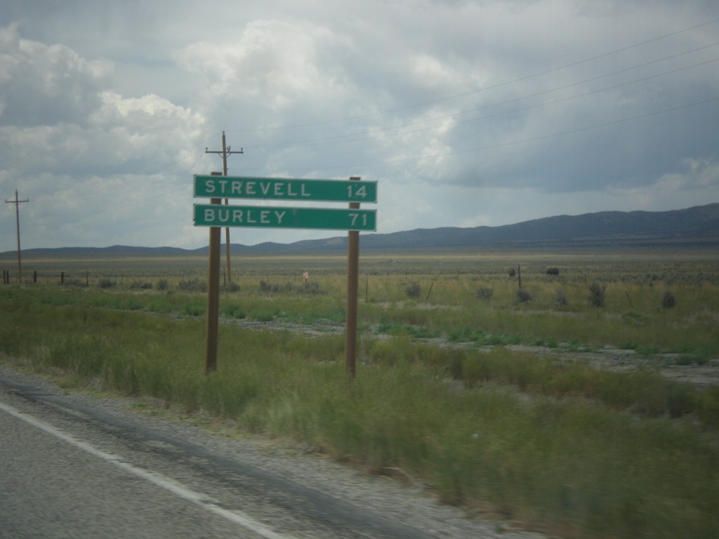
UT-30 West - Distance Marker
Distance marker on UT-30 west. Distance to Strevell, and Burley. Both of these communities are in Idaho, and both are accessed via UT-42.
Taken 06-21-2014
Snowville
Box Elder County
Utah
United States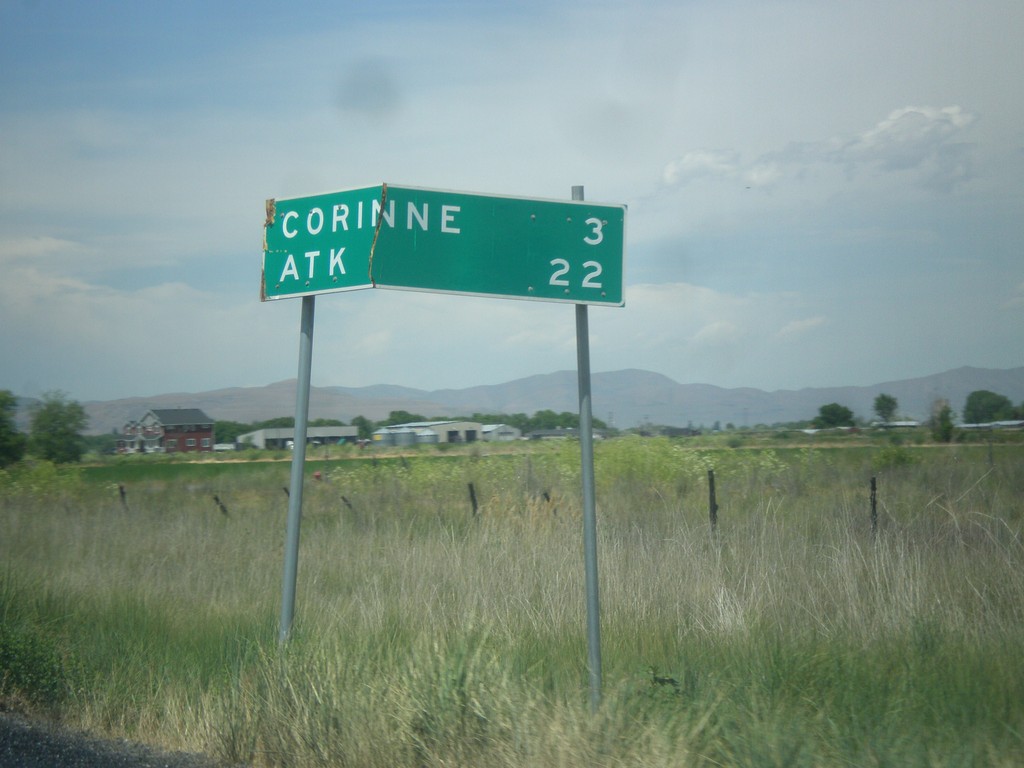
UT-13 North - Distance Marker
Distance marker on UT-13 north. Distance to Corrine, and ATK (an aerospace company).
Taken 06-21-2014
 Brigham City
Box Elder County
Utah
United States
Brigham City
Box Elder County
Utah
United States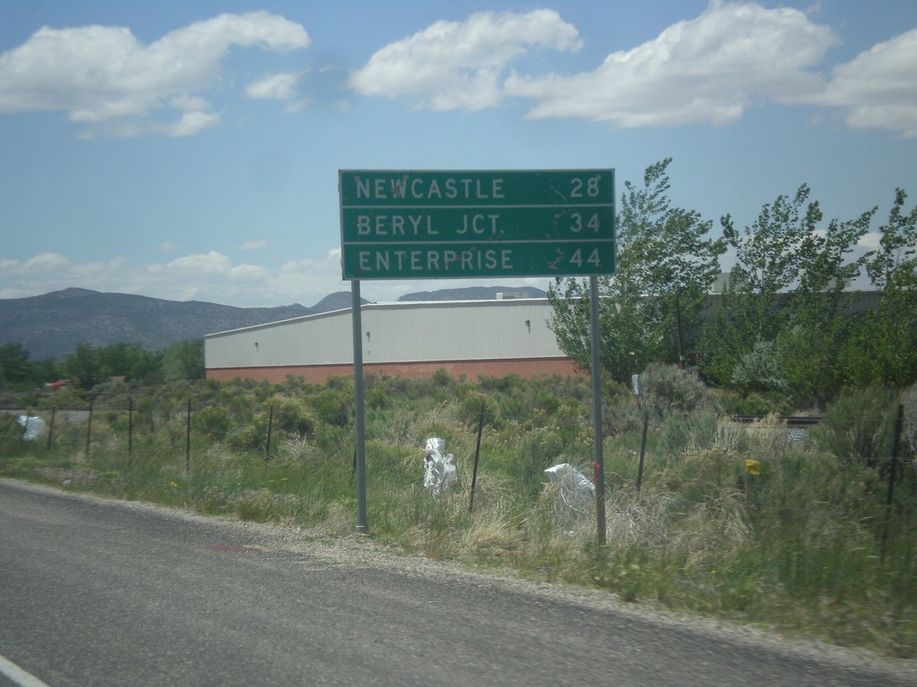
UT-56 West - Distance Marker
Distance marker on UT-56 west. Distance to Newcastle, Beryl Junction, and Enterprise.
Taken 05-21-2014
 Cedar City
Iron County
Utah
United States
Cedar City
Iron County
Utah
United States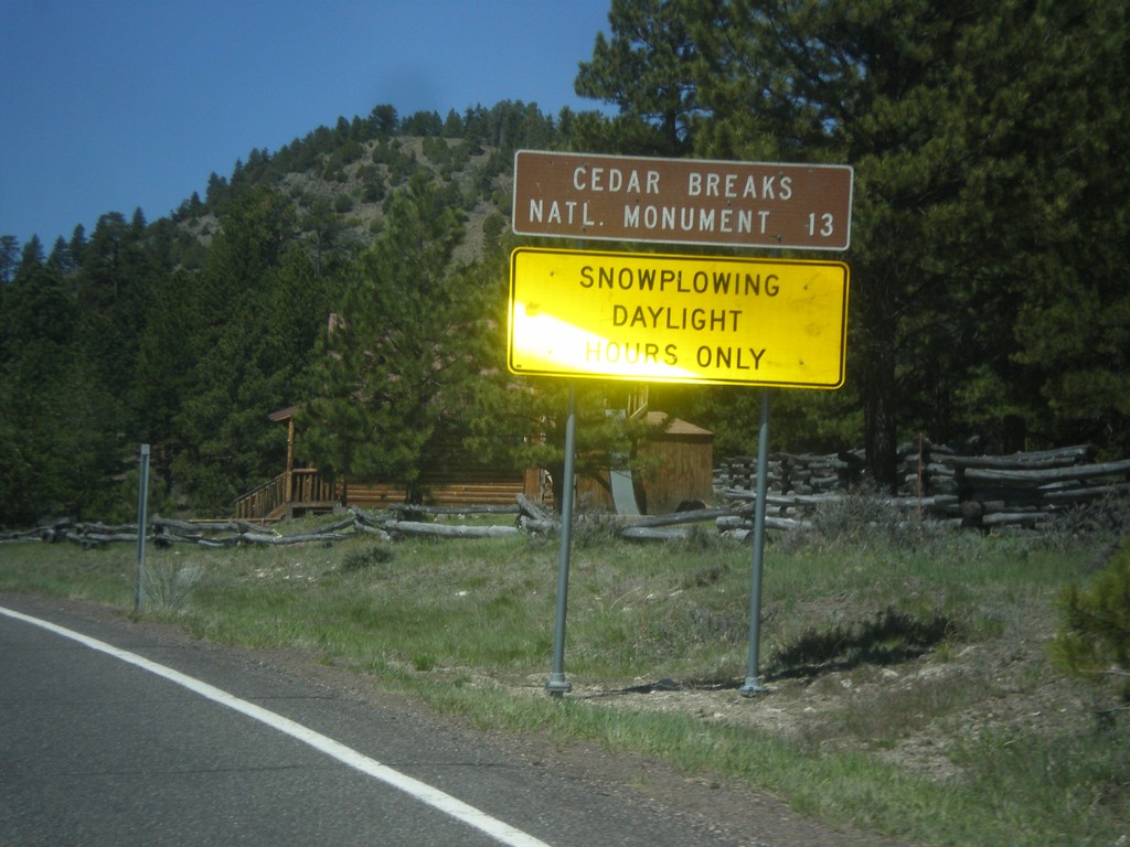
UT-143 - Distance Marker
Distance marker on UT-143 south. Distance to Cedar Breaks National Monument. Below distance marker is another sign reading Snow Plowing Daylight Hours Only.
Taken 05-21-2014
 Panguitch
Garfield County
Utah
United States
Panguitch
Garfield County
Utah
United States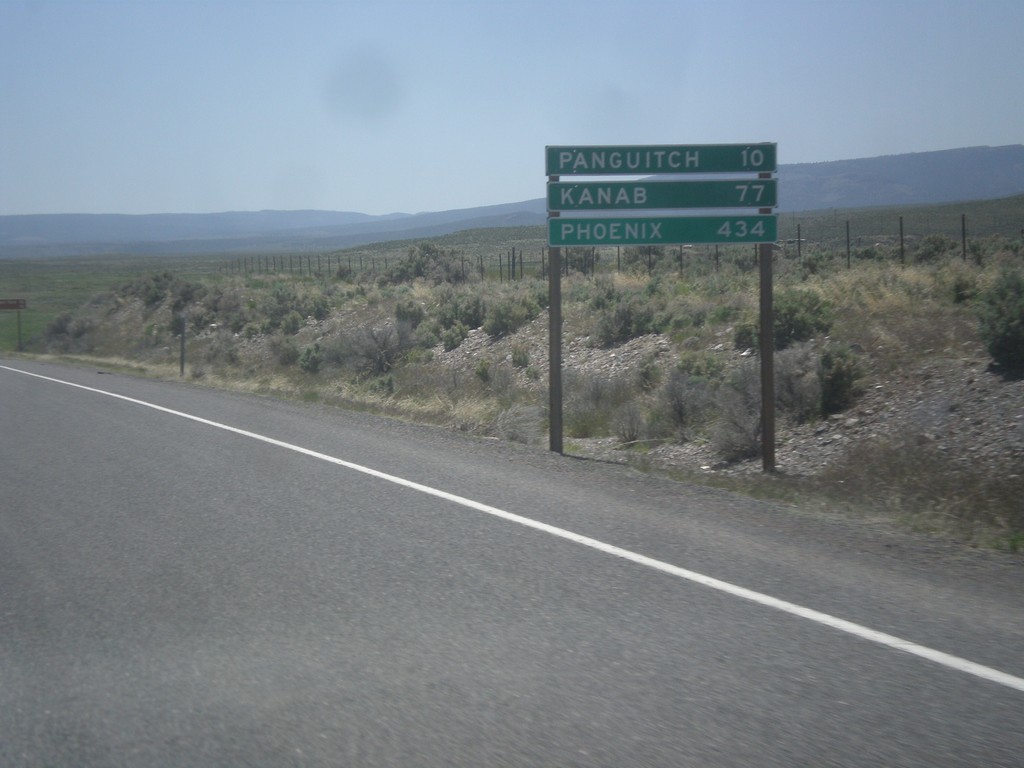
US-89 South - Distance Marker
Distance marker on US-89 south. Distance to Panguitch, Kanab, and Phoenix (Arizona).
Taken 05-19-2014
 Spry
Garfield County
Utah
United States
Spry
Garfield County
Utah
United States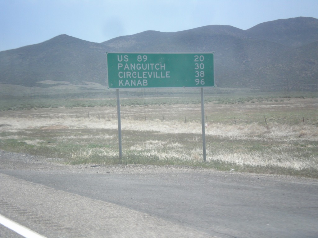
UT-20 East - Distance Marker
Distance marker on UT-20 east. Distance to US-89, Panguitch, Circleville, and Kanab.
Taken 05-19-2014
 Paragonah
Iron County
Utah
United States
Paragonah
Iron County
Utah
United States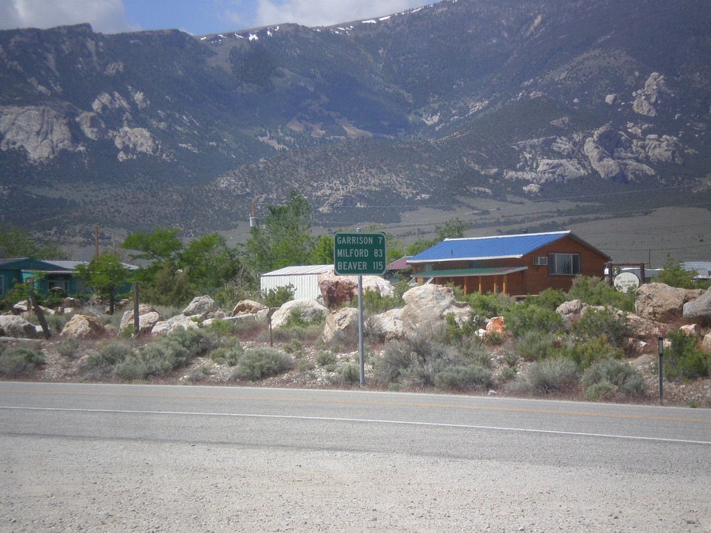
NV-487 South - Distance Marker
Distance marker on NV-487 south. Distance to Gunnison, Milford, and Beaver. All three locations are located in Utah.
Taken 05-19-2014
 Baker
White Pine County
Nevada
United States
Baker
White Pine County
Nevada
United States