Signs Tagged With Distance Marker
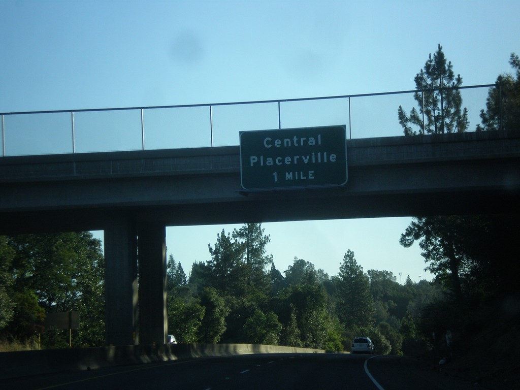
US-50 - Central Placerville
US-50 approaching Central Placerville. The US-50 freeway ends in central Placerville and becomes a city street for a few blocks through central Placerville.
Taken 06-15-2015
 Placerville
El Dorado County
California
United States
Placerville
El Dorado County
California
United States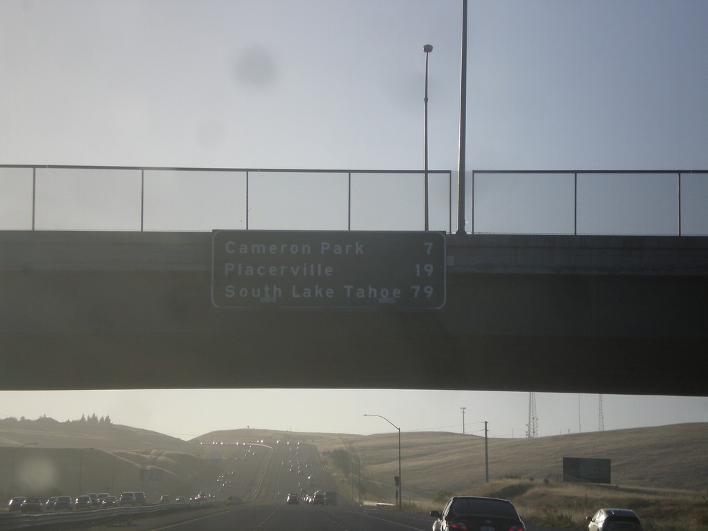
US-50 East - Distance Marker
Distance marker on US-50 east. Distance to Cameron Park, Placerville, and South Lake Tahoe.
Taken 06-15-2015
Folsom
Sacramento County
California
United States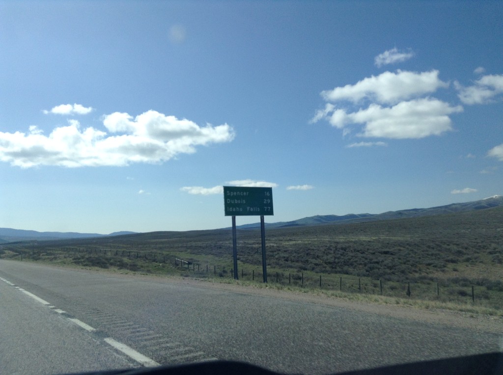
I-15 South - Distance Marker
First distance marker in Idaho along I-15 south. Distance to Spencer, Dubois, and Idaho Falls.
Taken 05-10-2015
 Humphrey
Clark County
Idaho
United States
Humphrey
Clark County
Idaho
United States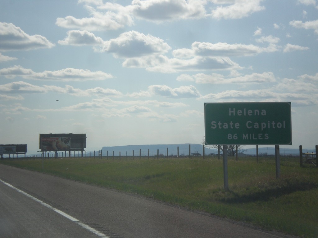
I-15 South - Helena Distance
I-15 South - Helena State Capitol distance. A similar sign is posted on I-15 leaving Butte.
Taken 05-09-2015
Great Falls
Cascade County
Montana
United States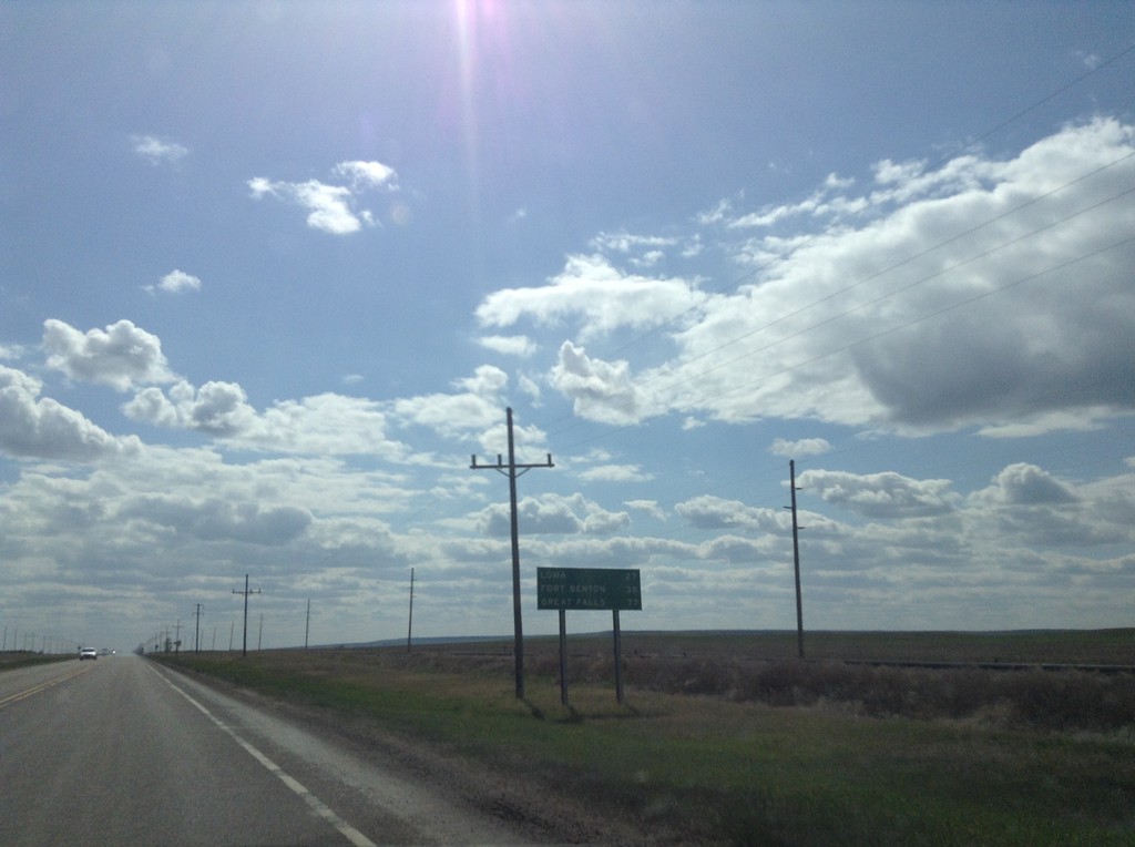
US-87 South - Distance Marker
Distance marker on US-87 south. Distance to Loma, Fort Benton, and Great Falls.
Taken 05-09-2015
 Big Sandy
Chouteau County
Montana
United States
Big Sandy
Chouteau County
Montana
United States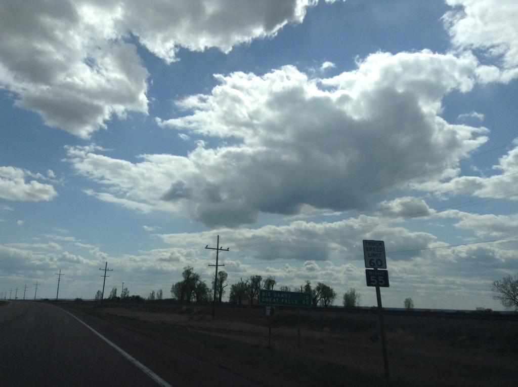
US-87 South - Distance Marker
Distance marker on US-87 south. Distance to Big Sandy and Great Falls. Truck Speed Limit - 60 MPH/Truck Night Speed Limit - 55 MPH.
Taken 05-09-2015
Box Elder
Hill County
Montana
United States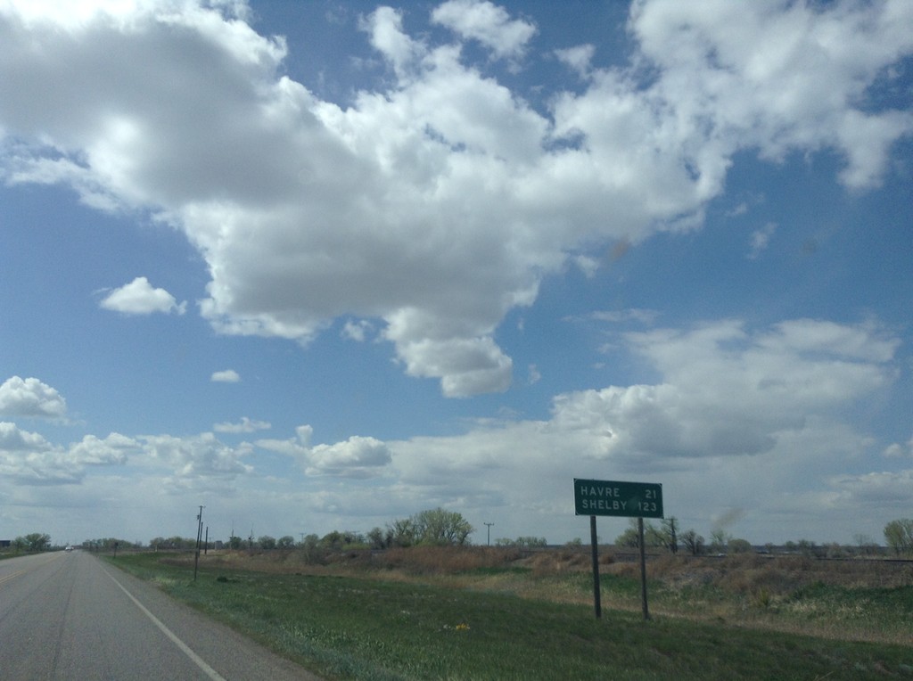
US-2 West - Distance Marker
Distance marker on US-2 west. Distance to Havre, and Shelby.
Taken 05-09-2015
 Chinook
Blaine County
Montana
United States
Chinook
Blaine County
Montana
United States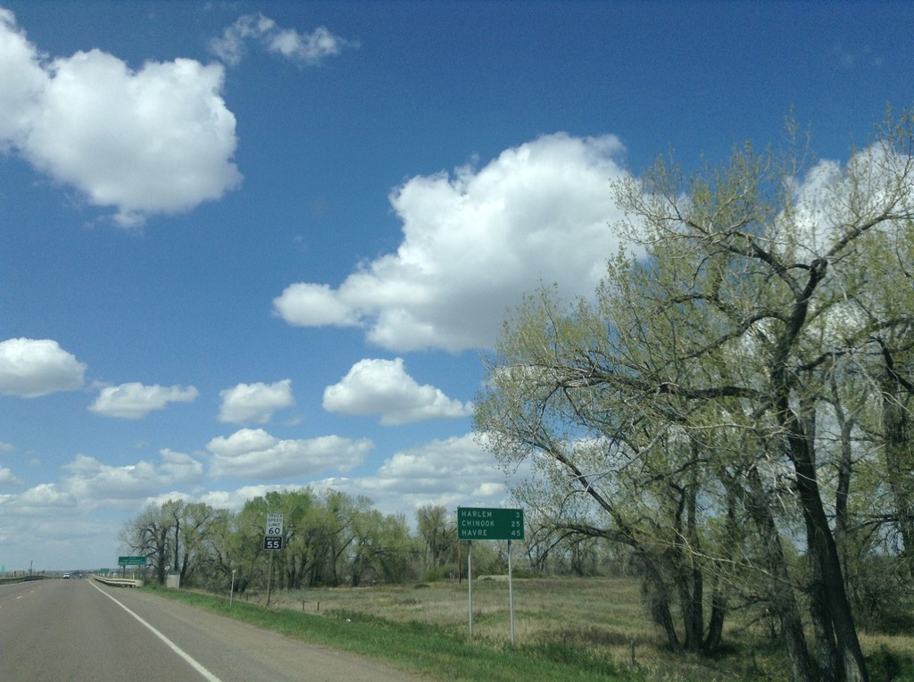
US-2 West - Distance Marker
Distance marker on US-2 west. Distance to Harlem, Chinook, and Havre.
Taken 05-09-2015
Harlem
Blaine County
Montana
United States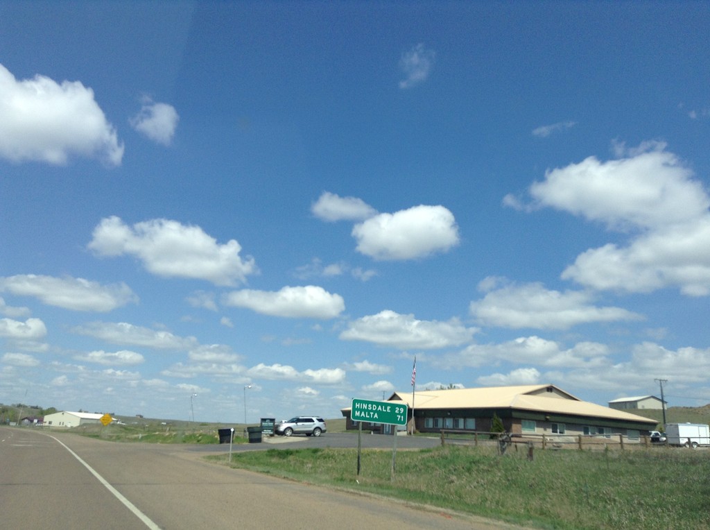
US-2 West - Distance Marker
Distance marker on US-2 west, on the west edge of Glasgow. Distance to Hinsdale and Malta.
Taken 05-09-2015
Glasgow
Valley County
Montana
United States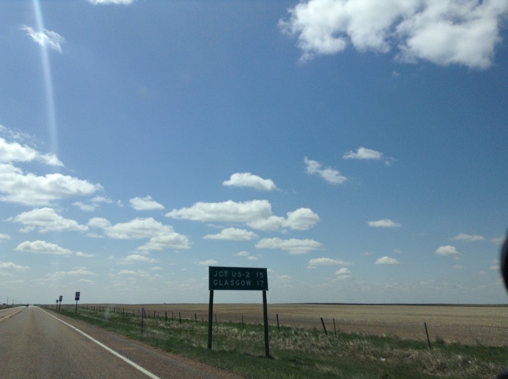
MT-24 South - Distance Marker
Distance marker on MT-24 south. Distance to US-2 and Glasgow.
Taken 05-09-2015
 Saint Marie
Valley County
Montana
United States
Saint Marie
Valley County
Montana
United States