Signs Tagged With Distance Marker
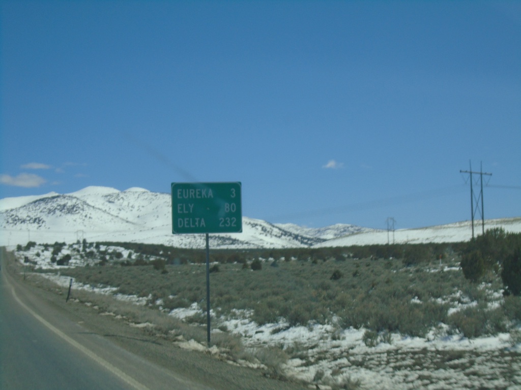
US-50 East - Distance Marker
Distance marker on US-50 East. Distance to Eureka, Ely, and Delta (Utah).
Taken 03-31-2023
 Eureka
 County
Nevada
United States
Eureka
Eureka County
Nevada
United States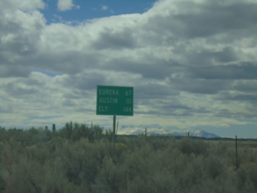
NV-278 South - Distance Marker
Distance marker on NV-278 south. Distance to Eureka, Austin (via US-50 West) and Ely (via US-50 East).
Taken 03-31-2023
 Carlin
Eureka County
Nevada
United States
Carlin
Eureka County
Nevada
United States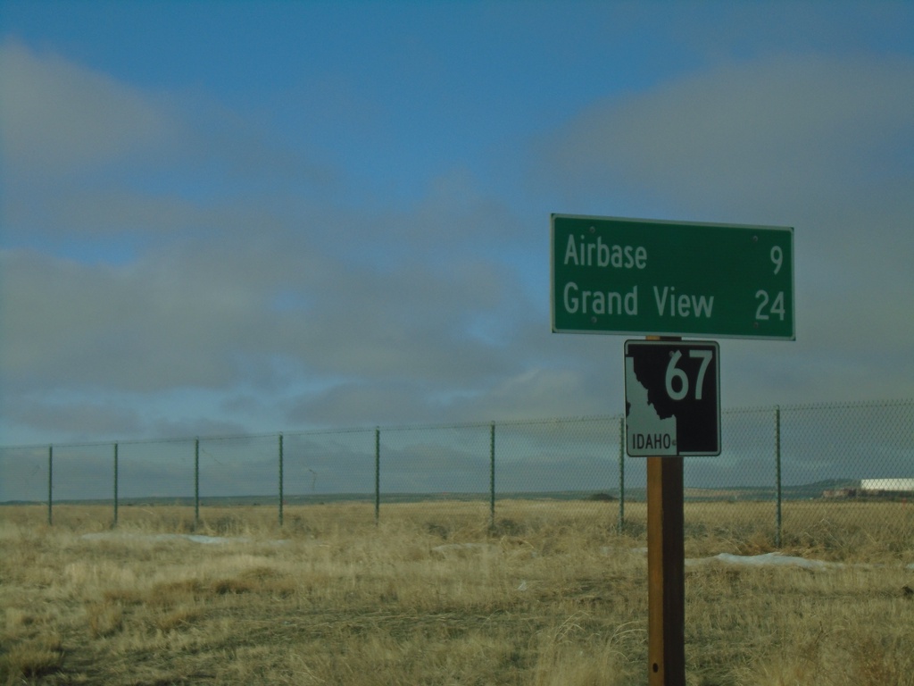
ID-67 West - Distance Marker
Distance marker on ID-67 west. Distance to Airbase (Mountain Home) and Grand View.
Taken 01-01-2023
 Mountain Home
Elmore County
Idaho
United States
Mountain Home
Elmore County
Idaho
United States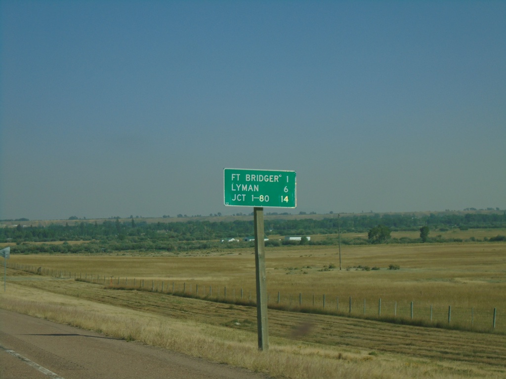
BL-80 East - Distance Marker
Distance marker on BL-80 east. Distance to Fort Bridger, Lyman, and Jct. I-80.
Taken 09-10-2022
 Fort Bridger
Uinta County
Wyoming
United States
Fort Bridger
Uinta County
Wyoming
United States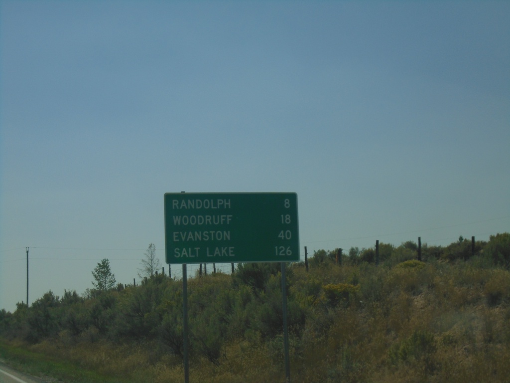
UT-16 South - Distance Marker
Distance marker on UT-16 south in Rich County. Distance to Randolph, Woodruff, Evanston (WY), and Salt Lake. The distance to Salt Lake involves crossing into Wyoming near Evanston.
Taken 09-10-2022
 Randolph
Rich County
Utah
United States
Randolph
Rich County
Utah
United States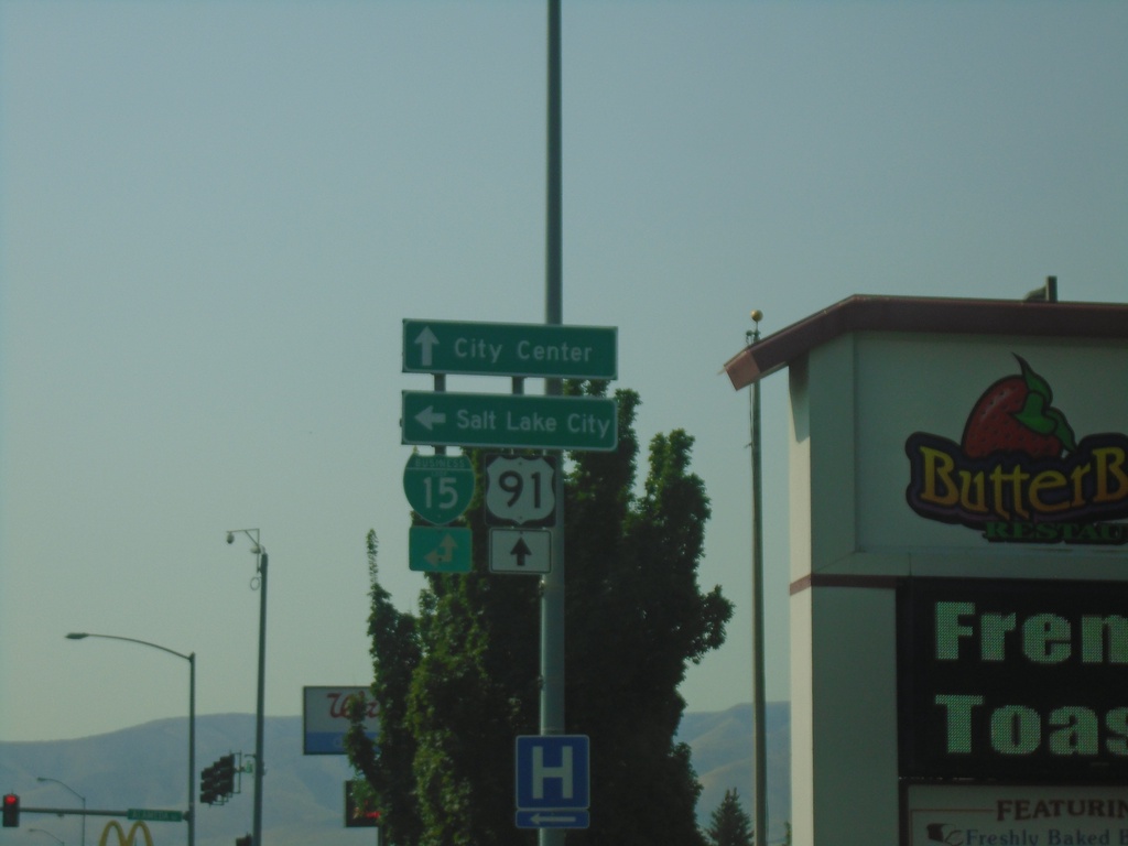
US-91 South at BL-15 - Pocatello
US-91 South (Yellowstone Ave.) at BL-15 (Alameda Road). Turn left on BL-15 North to Salt Lake City; continue straight on BL-15 South/US-91 South to (Pocatello) City Center.
Taken 09-10-2022

 Pocatello
Bannock County
Idaho
United States
Pocatello
Bannock County
Idaho
United States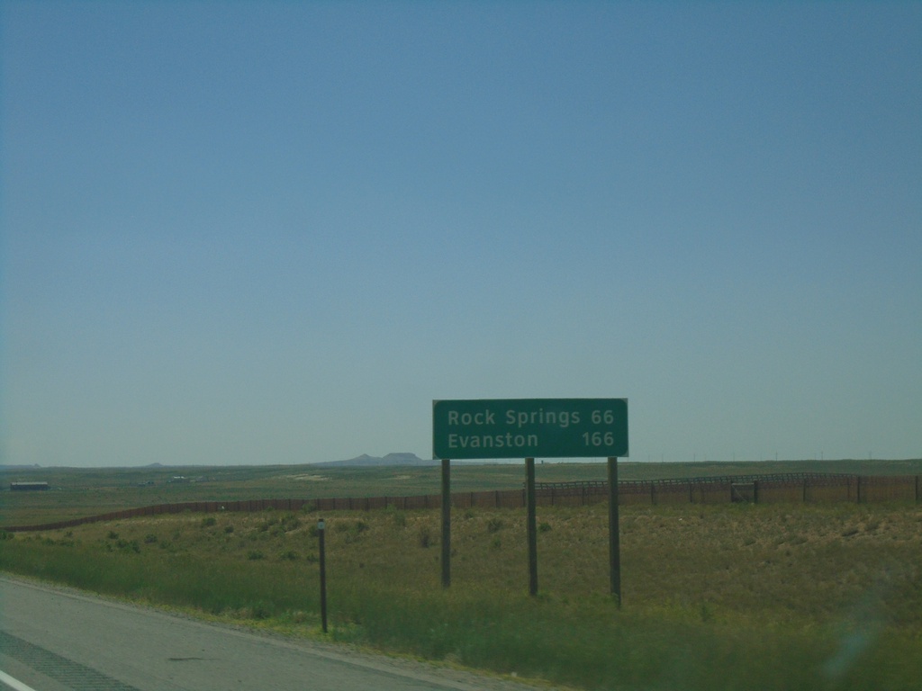
I-80 West - Distance Marker
Distance marker on I-80 west. Distance to Rock Springs and Evanston.
Taken 07-11-2022

 Wamsutter
Sweetwater County
Wyoming
United States
Wamsutter
Sweetwater County
Wyoming
United States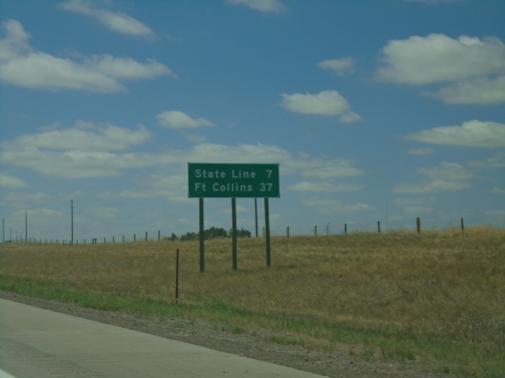
I-25 South - Distance Marker
Distance marker on I-25 south. Distance to State Line (Colorado) and Fort Collins (Colorado).
Taken 07-11-2022

 Cheyenne
Laramie County
Wyoming
United States
Cheyenne
Laramie County
Wyoming
United States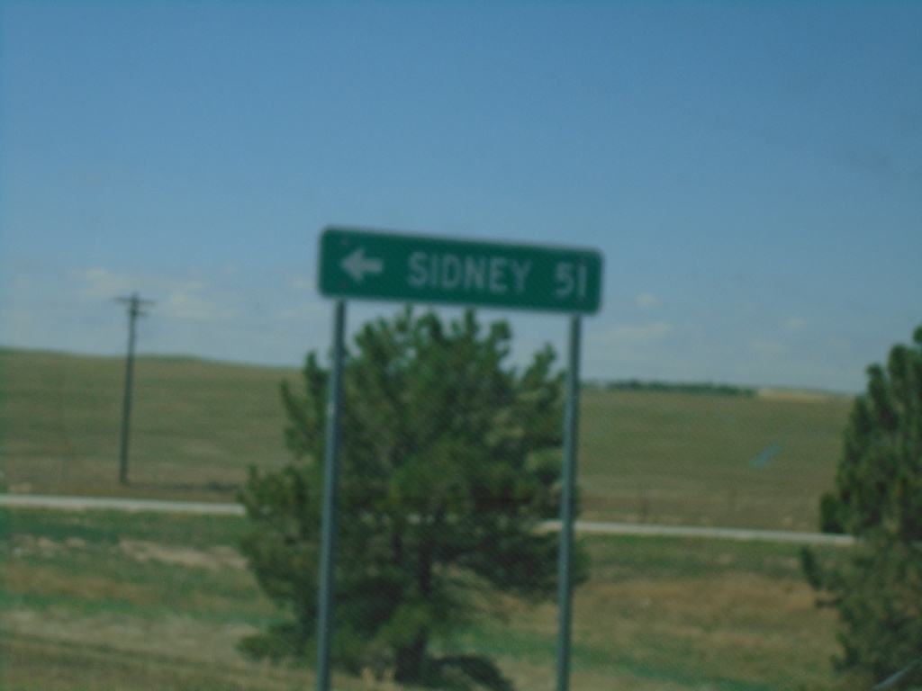
End NE-53C Link South at I-80 East
End NE-53C Link South at I-80 East to Sidney.
Taken 07-11-2022
 Bushnell
Kimball County
Nebraska
United States
Bushnell
Kimball County
Nebraska
United States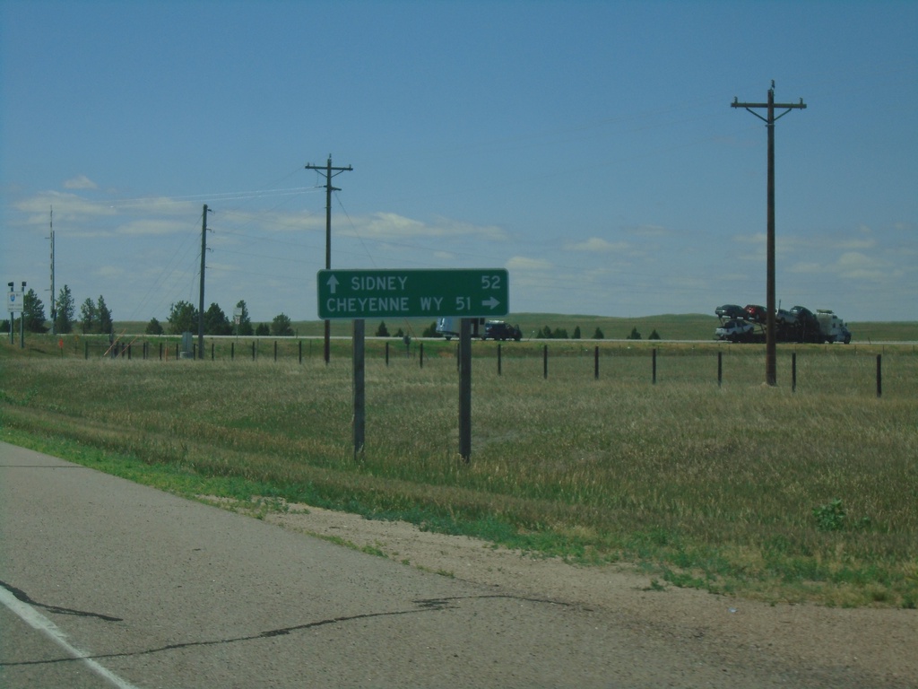
NE-53C Link South Approaching I-80
NE-53C Link South approaching I-80. Use I-80 west to Cheyenne, WY; I-80 east to Sidney.
Taken 07-11-2022
Bushnell
Kimball County
Nebraska
United States