Signs Tagged With Distance Marker
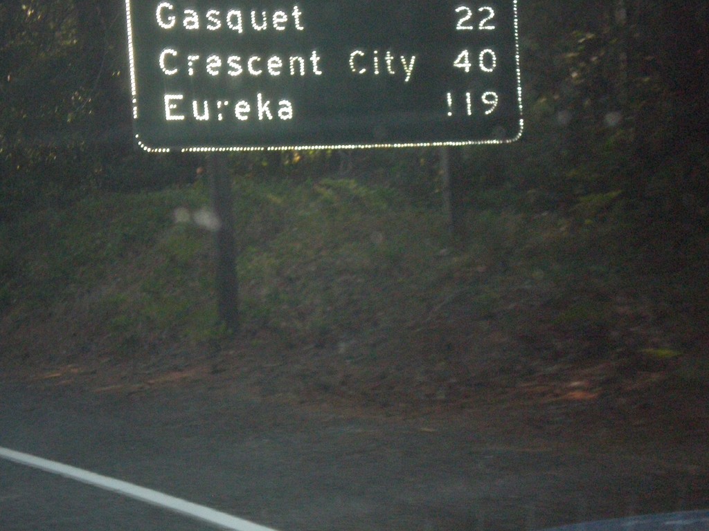
US-199 South - Distance Marker
First distance marker in California along US-199 south. Distance to Gasquet, Crescent City, and Eureka.
Taken 08-17-2015
 Gasquet
Del Norte County
California
United States
Gasquet
Del Norte County
California
United States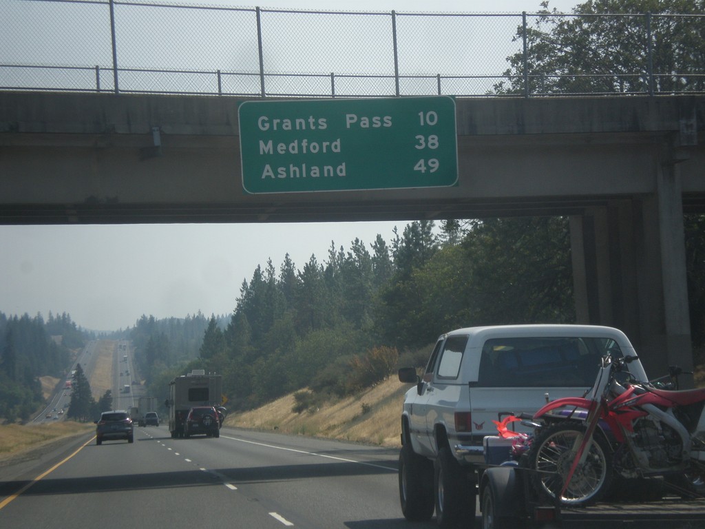
I-5 South - Distance Marker
Distance marker on I-5 south. Distance to Grants Pass, Medford, and Ashland.
Taken 08-17-2015
 Grants Pass
Josephine County
Oregon
United States
Grants Pass
Josephine County
Oregon
United States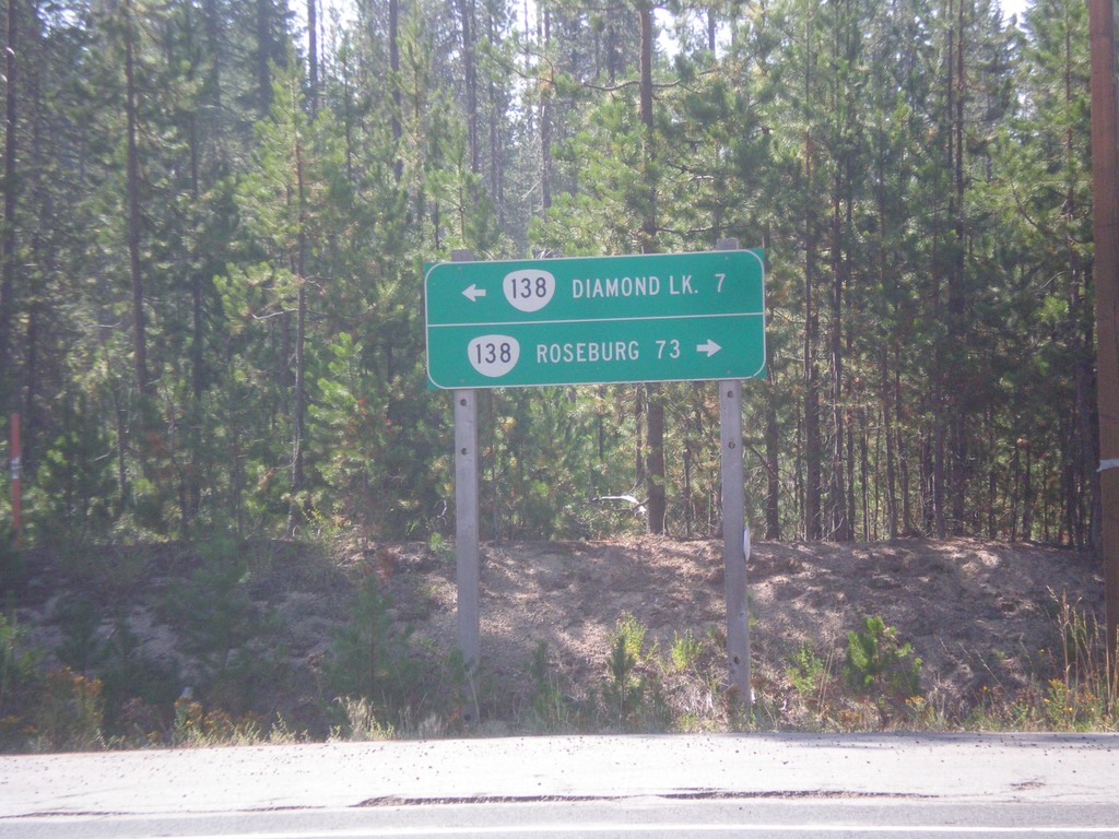
Birds Point Road at OR-138
Birds Point Road at OR-138. Birds Point Road connects the Lemolo Lake area with OR-138. Use OR-138 west to Roseburg; east to Diamond Lake.
Taken 08-17-2015
 Diamond Lake
Douglas County
Oregon
United States
Diamond Lake
Douglas County
Oregon
United States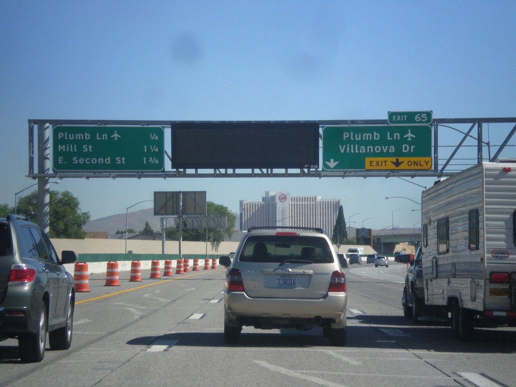
I-580/US-395 North Approaching Exit 65
I-580/US-395 north approaching Exit 65 - Plumb Lane/Villanova Drive. A distance marker showing the next three Reno exits is on the left side of the picture. The next three exits are: Plumb Lane, Mill St., and E. Second St. Use the Plumb Lane exit for the Reno-Tahoe International Airport.
Taken 06-15-2015

 Reno
Washoe County
Nevada
United States
Reno
Washoe County
Nevada
United States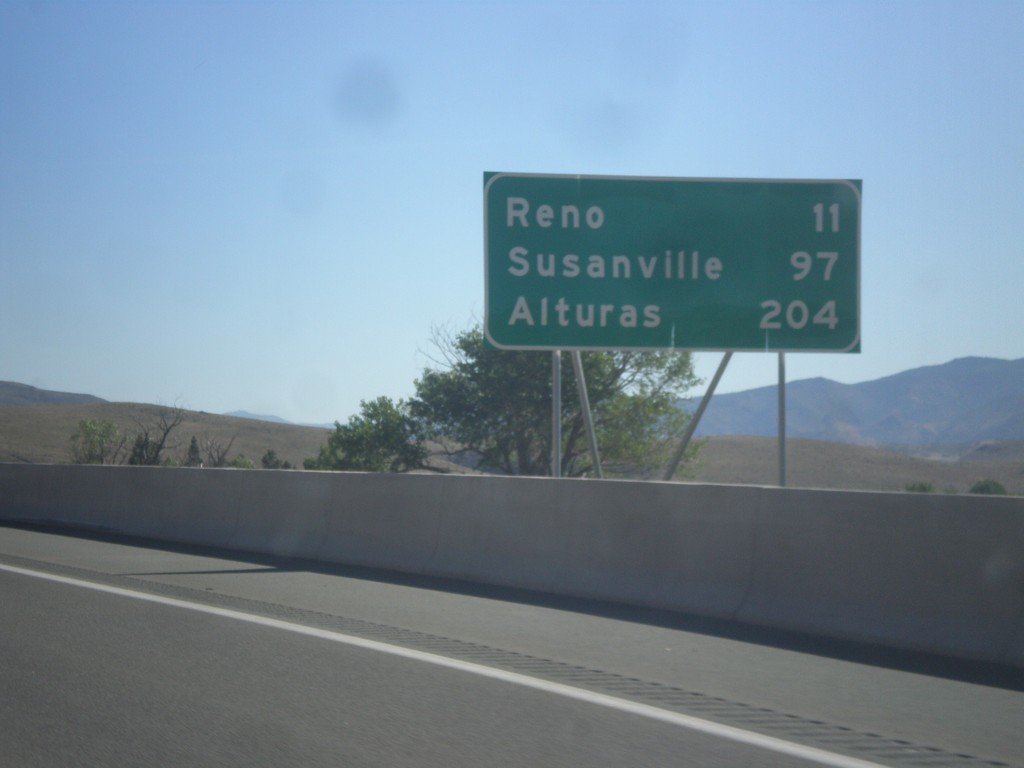
I-580/US-395 North - Distance Marker
Distance marker on I-580/US-395 North. Distance to Reno, Susanville (CA), and Alturas (CA).
Taken 06-15-2015
New Washoe City
Washoe County
Nevada
United States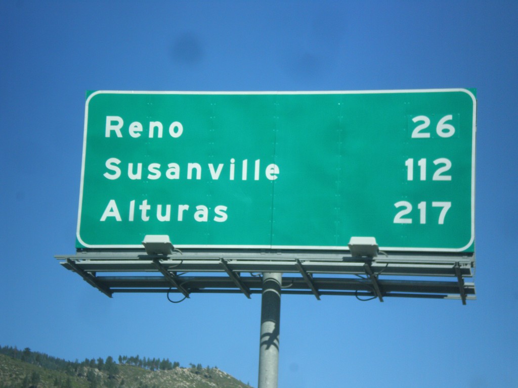
I-580/US-395 North - Distance Marker
Distance marker on I-580/US-395 North. Distance to Reno, Susanville (CA), and Alturas (CA).
Taken 06-15-2015
Carson City
Nevada
United States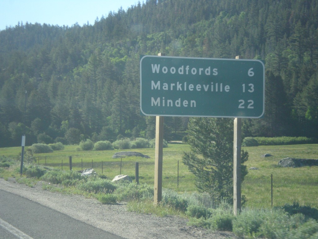
CA-88 East/CA-89 South - Distance Marker
Distance Marker on CA-88 East/CA-89 South. Distance to Woodfords, Markleeville, and Minden (Nevada).
Taken 06-15-2015

 Markleeville
Alpine County
California
United States
Markleeville
Alpine County
California
United States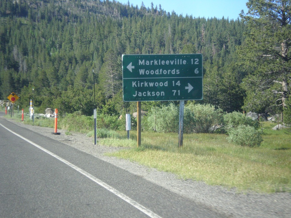
CA-89 South Approaching CA-88
CA-89 South approaching CA-88. Use CA-88 west for Kirkwood and Jackson. Use CA-89 South/CA-89 East for Markleeville and Woodfords. CA-89 south joins CA-88 east to Woodfords.
Taken 06-15-2015
Markleeville
Alpine County
California
United States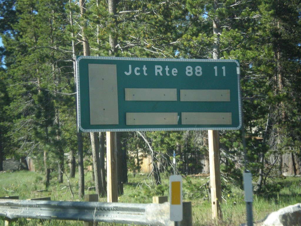
CA-89 South - Distance Marker
Distance marker on CA-89 south. Distance to CA-88 Junction.
Taken 06-15-2015
South Lake Tahoe
El Dorado County
California
United States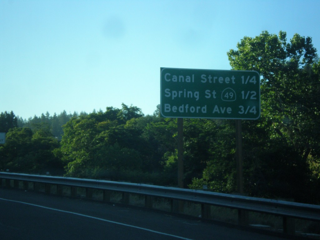
US-50 East - Placerville Intersections
Distance marker showing major cross streets in Placerville.
Taken 06-15-2015
 Placerville
El Dorado County
California
United States
Placerville
El Dorado County
California
United States