Signs Tagged With Distance Marker
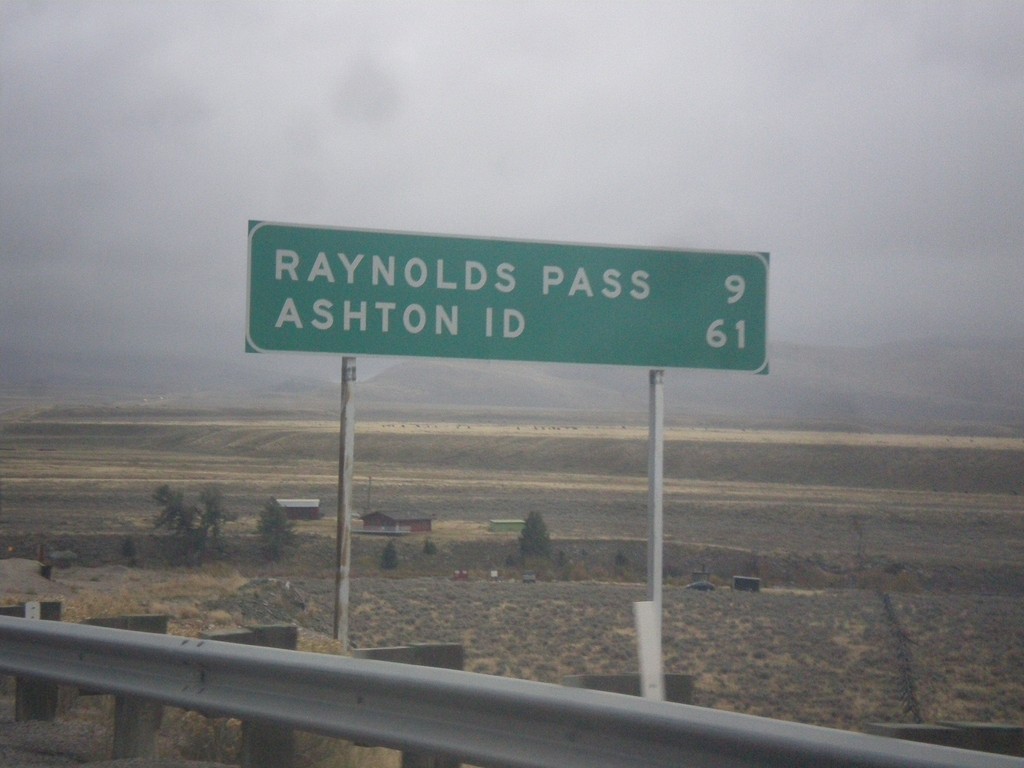
MT-87 South - Distance Marker
Distance marker on MT-87 south. Distance to Raynolds Pass (State Line - Continental Divide) and Ashton, ID.
Taken 10-03-2015
 Schusters Place
Madison County
Montana
United States
Schusters Place
Madison County
Montana
United States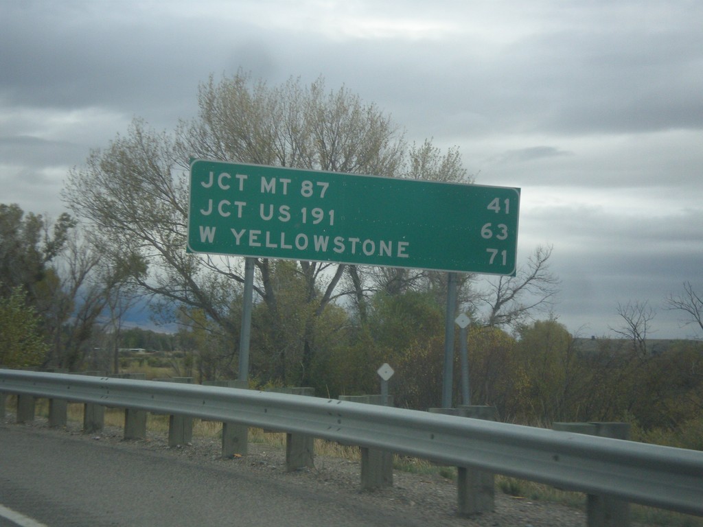
US-287 South - Distance Marker
Distance marker on US-287 south. Distance to Jct. MT-87, Jct. US-191, and West Yellowstone.
Taken 10-03-2015
 Ennis
Madison County
Montana
United States
Ennis
Madison County
Montana
United States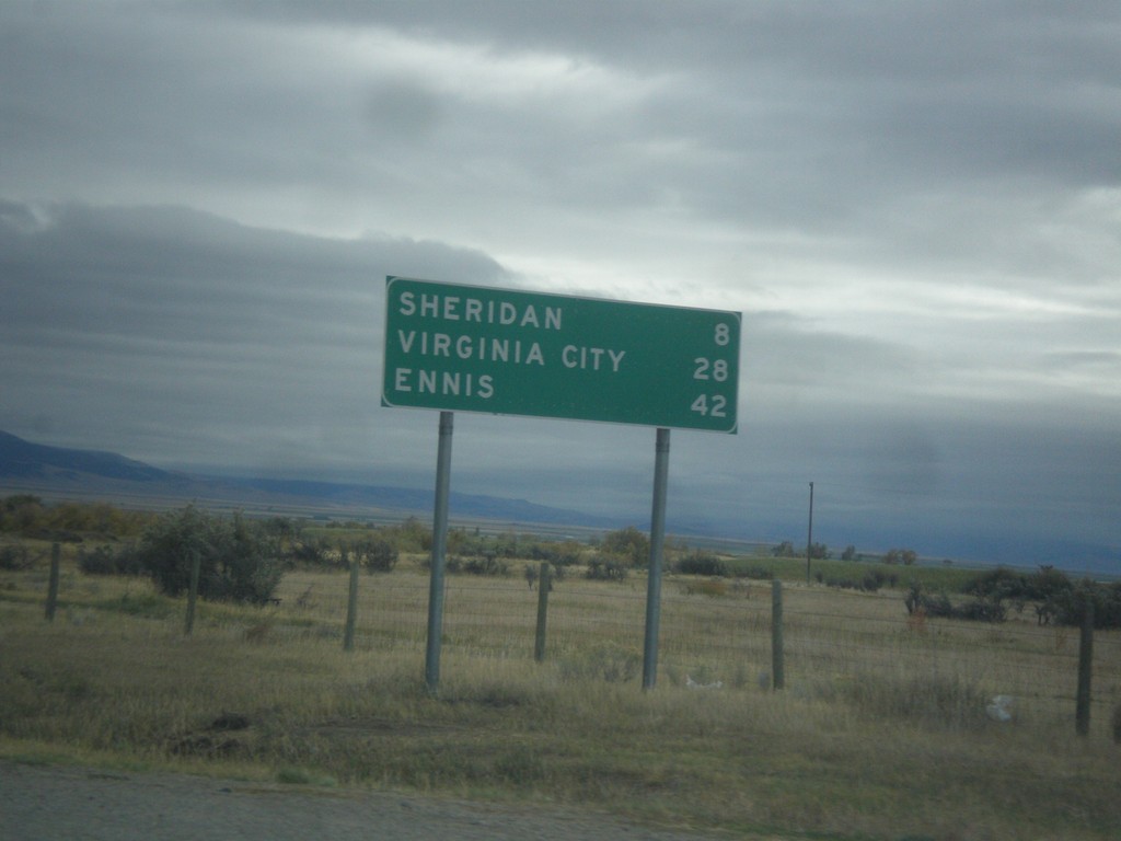
MT-287 South - Distance Marker
Distance marker on MT-287 south. Distance to Sheridan, Virginia City, and Ennis.
Taken 10-03-2015
 Twin Bridges
Madison County
Montana
United States
Twin Bridges
Madison County
Montana
United States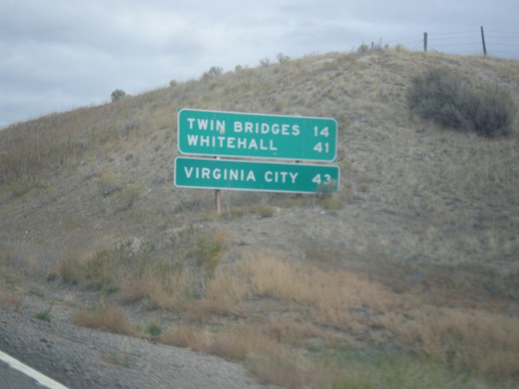
MT-41 North - Distance Marker
Distance marker on MT-41 north. Distance to Twin Bridges, Whitehall, and Virginia City (via MT-287).
Taken 10-03-2015
 Twin Bridges
Madison County
Montana
United States
Twin Bridges
Madison County
Montana
United States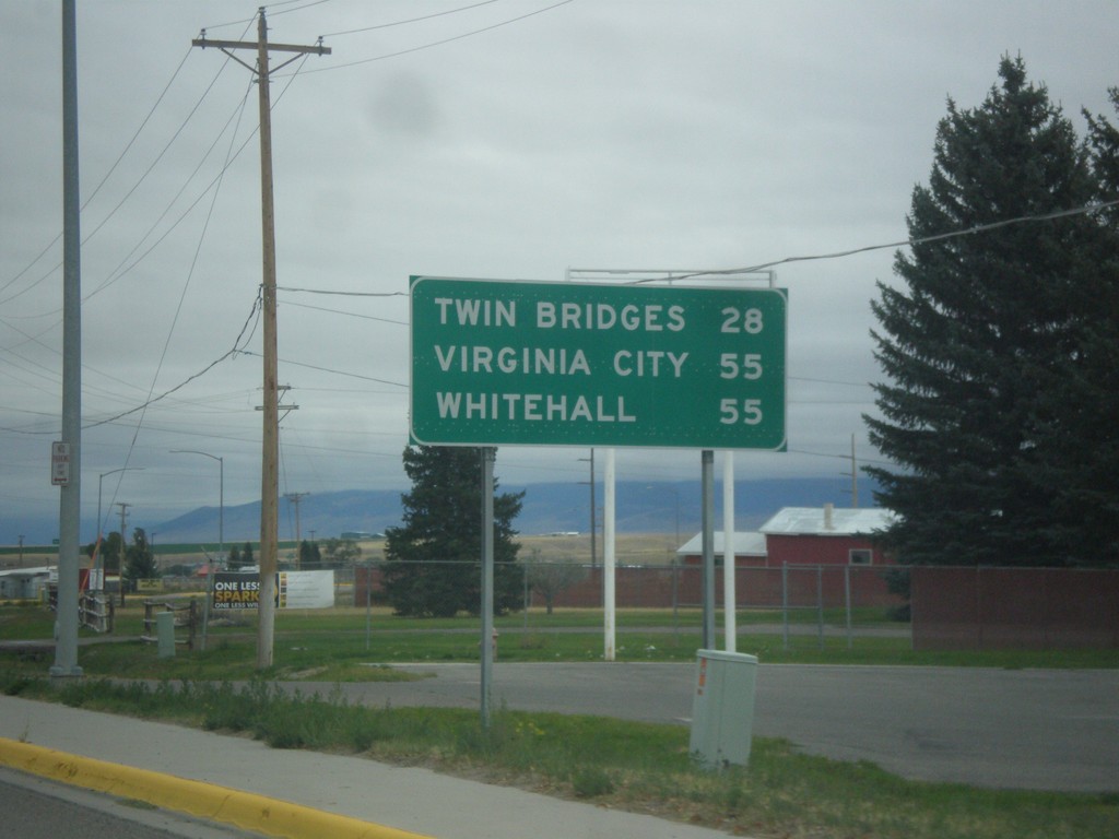
MT-41 North - Distance Marker
Distance marker on MT-41 north. Distance to Twin Bridges, Virginia City (via MT-287) and Whitehall.
Taken 10-03-2015
Dillon
Beaverhead County
Montana
United States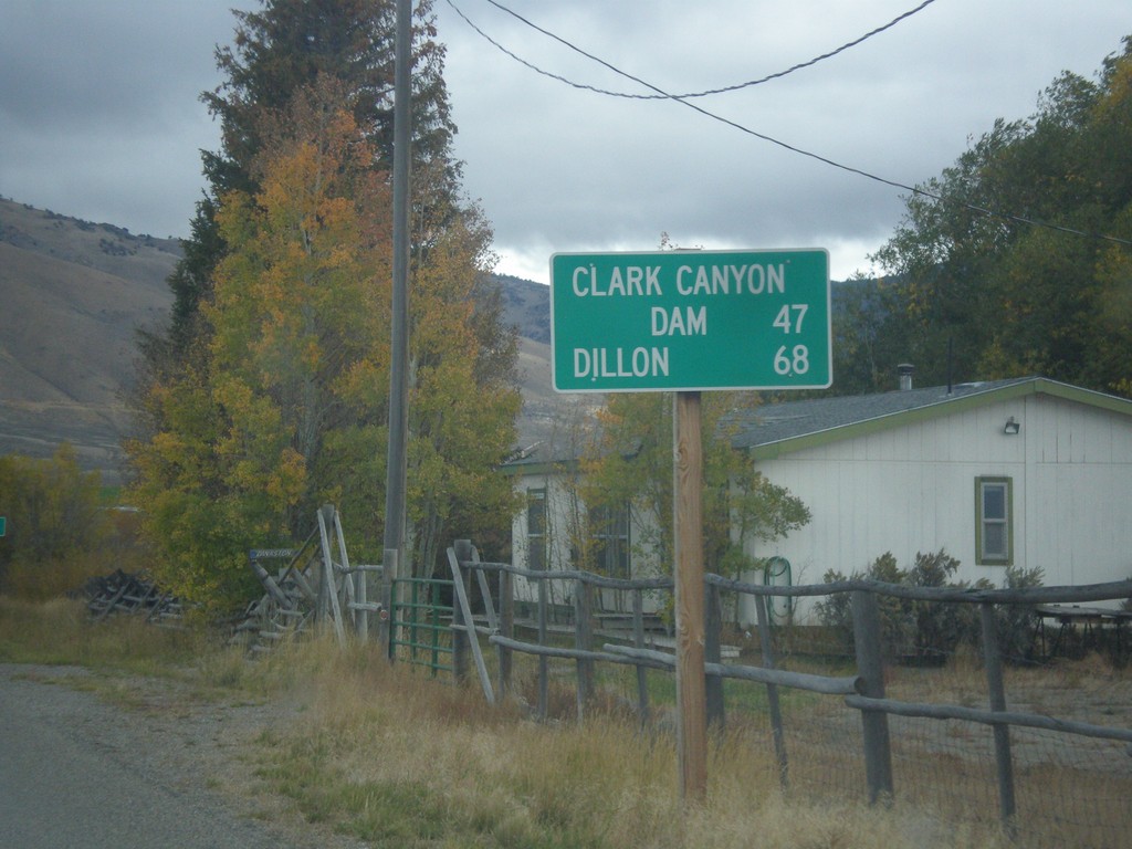
ID-29 East - Distance Marker
Distance marker on ID-29 east. Distance to Clark Canyon Dam (I-15 Jct. in Montana) and Dillon (Montana).
Taken 10-03-2015
 Leadore
Lemhi County
Idaho
United States
Leadore
Lemhi County
Idaho
United States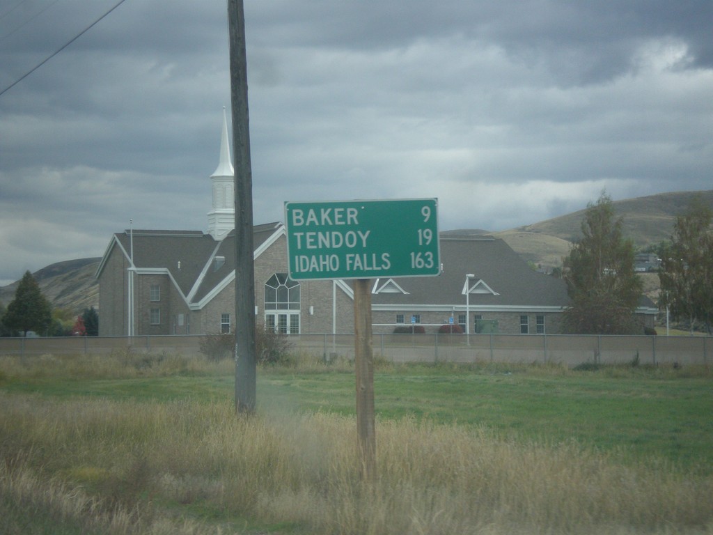
ID-28 South - Distance Marker
Distance marker on ID-28 south in Salmon. Distance to Baker, Tendoy, and Idaho Falls.
Taken 10-03-2015
 Salmon
Lemhi County
Idaho
United States
Salmon
Lemhi County
Idaho
United States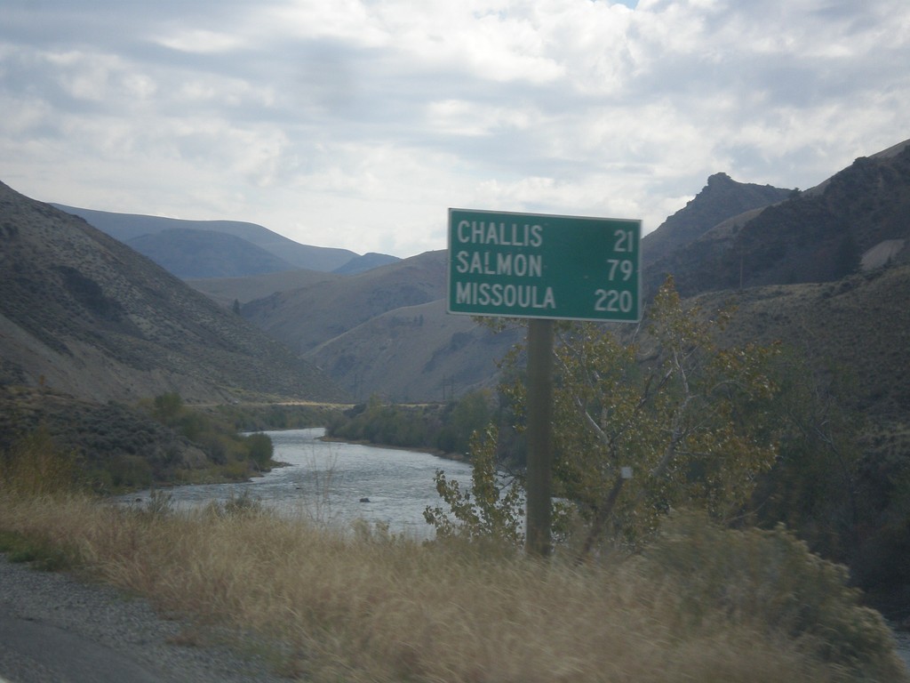
ID-75 North - Distance Marker
Distance marker on ID-75 north. Distance to Challis, Salmon, and Missoula (Montana). The Salmon River is in the background.
Taken 10-03-2015
 Clayton
Custer County
Idaho
United States
Clayton
Custer County
Idaho
United States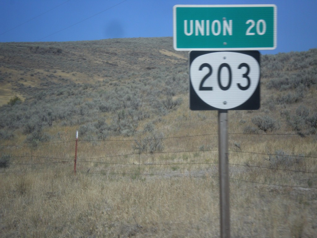
OR-203 North - Distance Marker
Distance marker on OR-203 north. Distance to Union.
Taken 09-13-2015
 Medical Springs
Union County
Oregon
United States
Medical Springs
Union County
Oregon
United States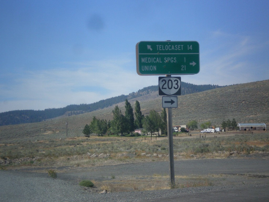
OR-203 North - Telocaset Lane
OR-203 North at Telocaset Lane to Telocaset. Turn right to continue north on OR-203 to Medical Springs and Union.
Taken 09-13-2015
Baker City
Union County
Oregon
United States