Signs Tagged With Distance Marker
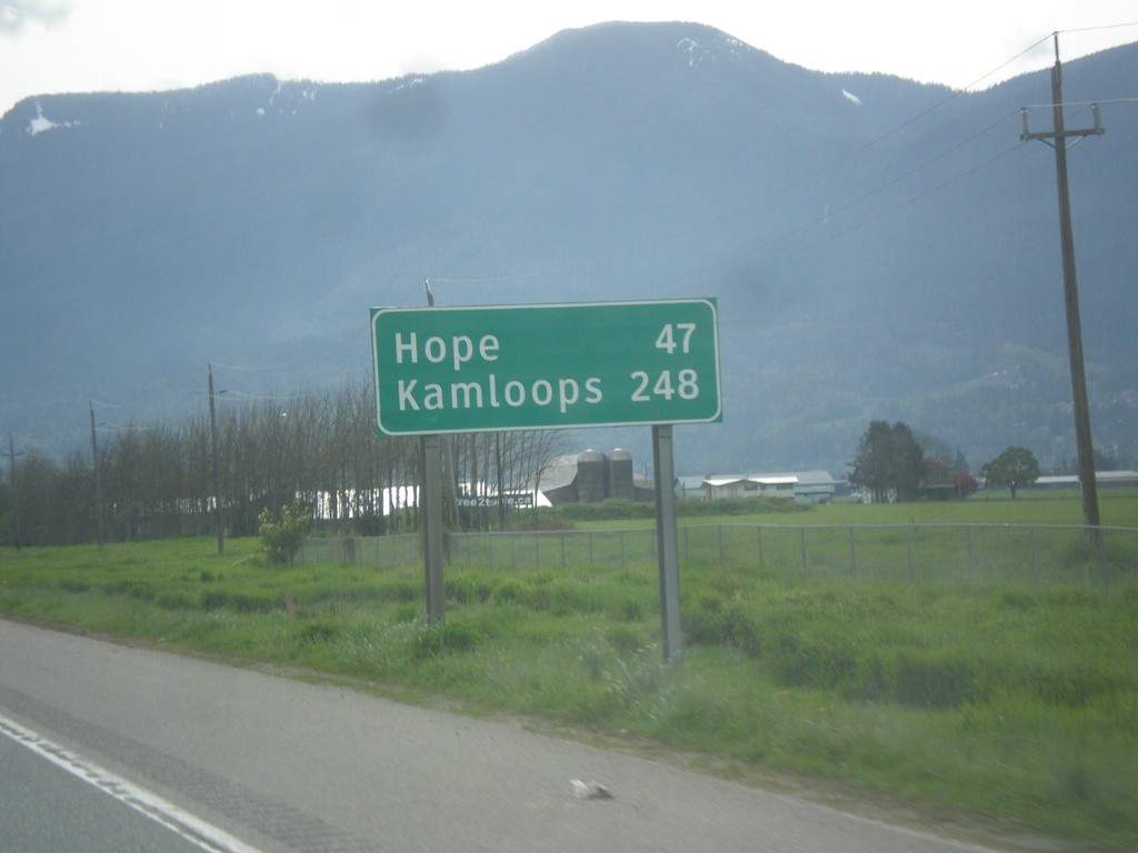
TC-1 East - Distance Marker
Distance marker on TC-1 east. Distance to Hope and Kamloops (via BC-5).
Taken 04-29-2017
 Chilliwack
Fraser Valley
British Columbia
Canada
Chilliwack
Fraser Valley
British Columbia
Canada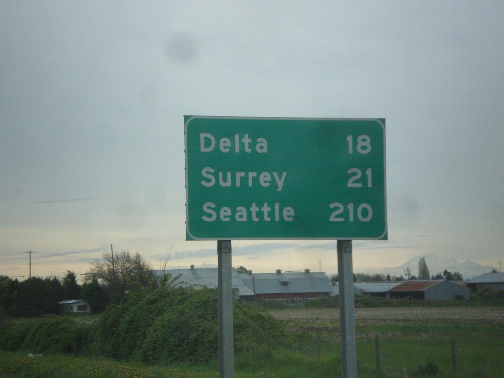
BC-91 South - Distance Marker
Distance marker on BC-91 south. Distance to Delta, Surrey, and Seattle (USA).
Taken 04-29-2017
 Richmond
Metro Vancouver
British Columbia
Canada
Richmond
Metro Vancouver
British Columbia
Canada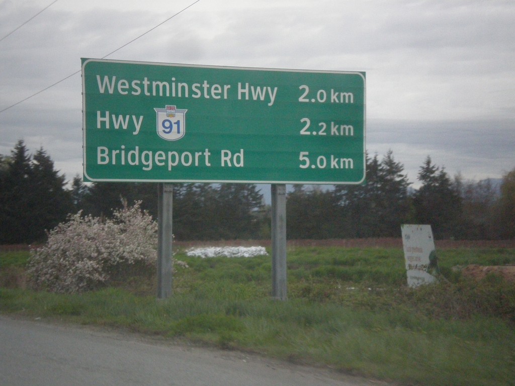
BC-99 North - Next 3 Exits
Next 3 exits on BC-99 north in Richmond: Westminster Highway, Hwy BC-91, and Bridgeport Road.
Taken 04-29-2017
 Richmond
Metro Vancouver
British Columbia
Canada
Richmond
Metro Vancouver
British Columbia
Canada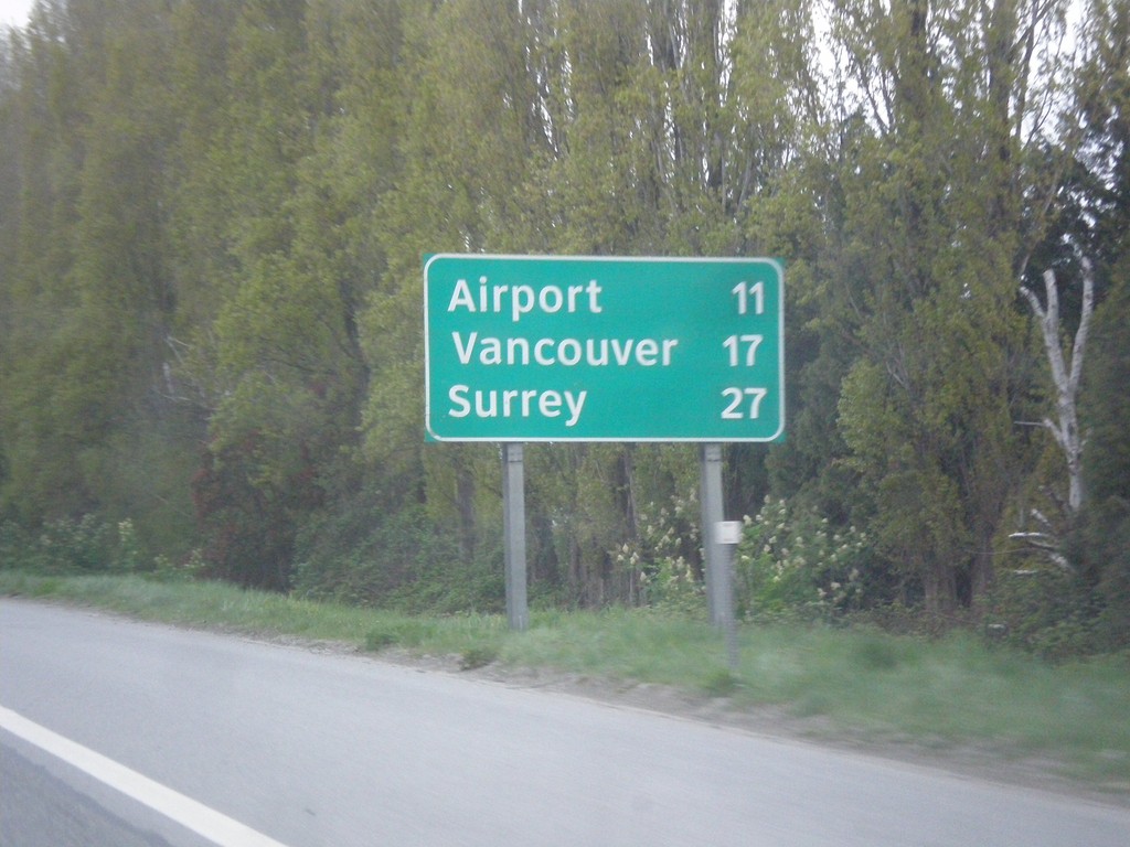
BC-99 North - Distance Marker
Distance marker on BC-99 north. Distance to (Vancouver International) Airport, Vancouver, and Surrey (via BC-91).
Taken 04-29-2017
Richmond
Metro Vancouver
British Columbia
Canada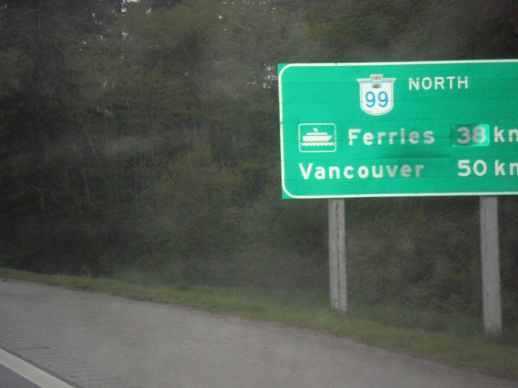
BC-99 North - Distance Marker
Distance marker on BC-99 north. Distance to (Tsawwassen) Ferries - 38km; distance to Vancouver - 50km.
Taken 04-29-2017
Surrey
Metro Vancouver
British Columbia
Canada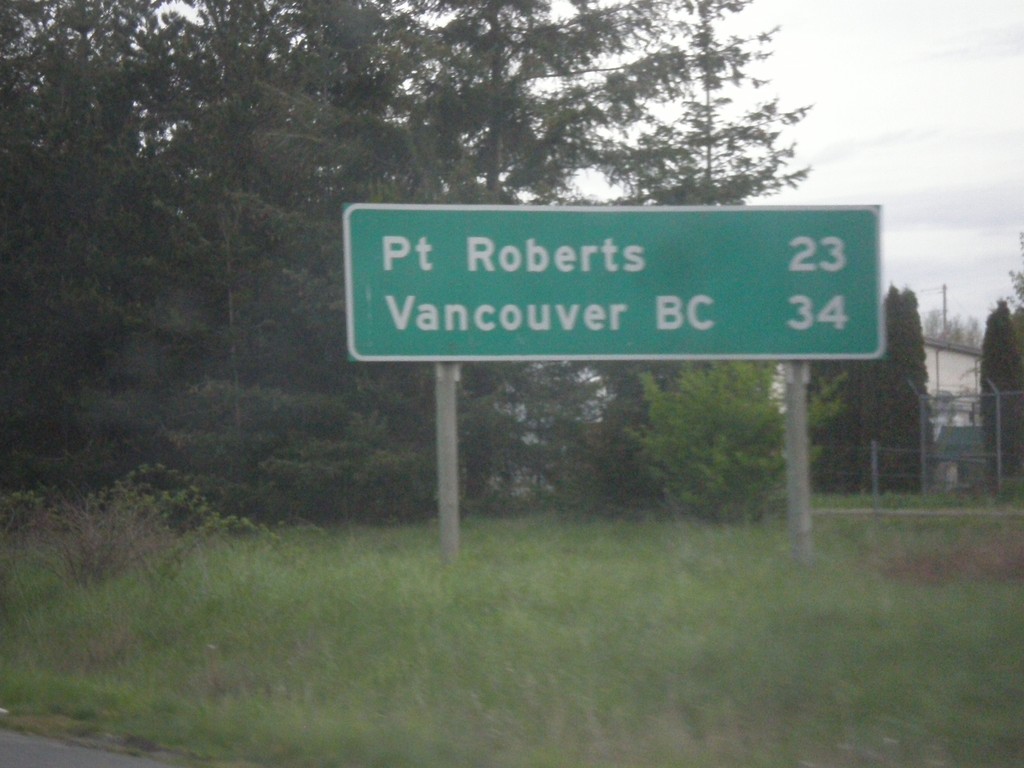
I-5 North - Distance Marker
Distance marker on I-5 north. Distance to Point Roberts and Vancouver, BC. This is the last distance marker on I-5 northbound. Point Roberts is an exclave of the United States. All traffic into Point Roberts has to go through Canada.
Taken 04-29-2017
 Blaine
Whatcom County
Washington
United States
Blaine
Whatcom County
Washington
United States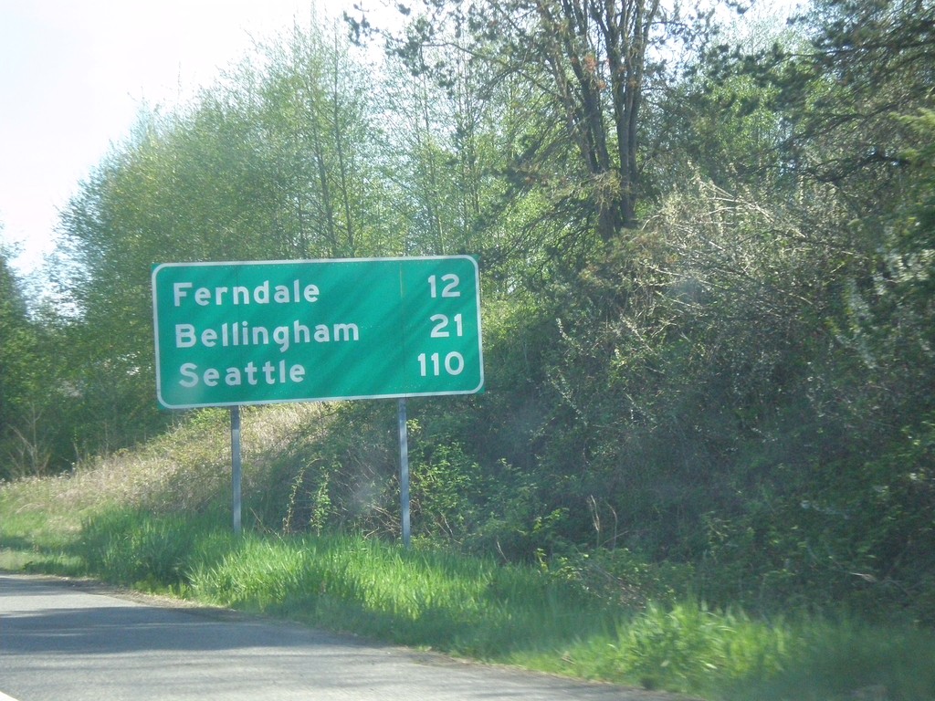
I-5 South - Distance Marker
Distance marker on I-5 south. Distance to Ferndale, Bellingham, and Seattle. This is the first exit on I-5 south of the border crossing.
Taken 04-28-2017
Blaine
Whatcom County
Washington
United States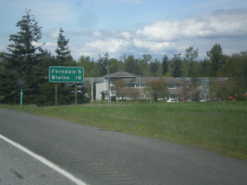
I-5 North - Distance Marker
Distance marker on I-5 north. Distance to Ferndale and Blaine. Blaine is where I-5 ends at the Canadian border.
Taken 04-28-2017
Bellingham
Whatcom County
Washington
United States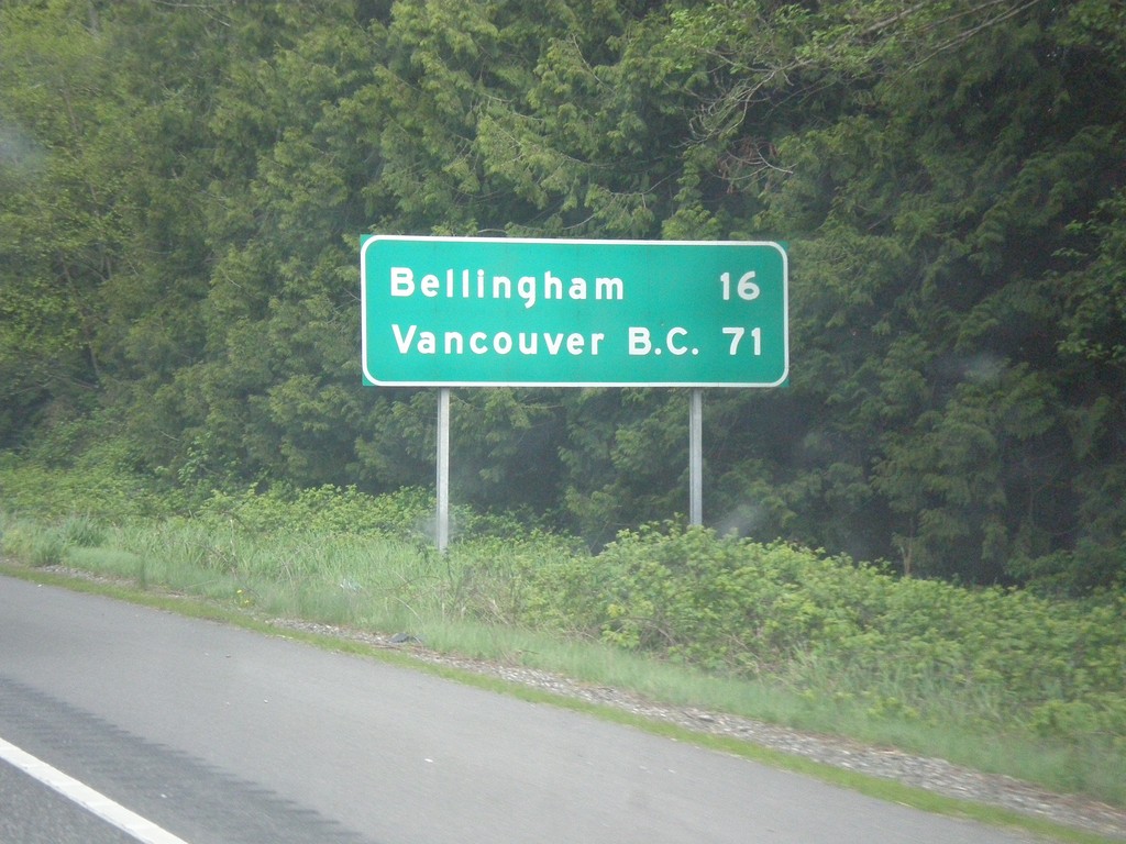
I-5 North - Distance Marker
Distance marker on I-5 north. Distance to Bellingham and Vancouver B.C.
Taken 04-28-2017
Bow
Skagit County
Washington
United States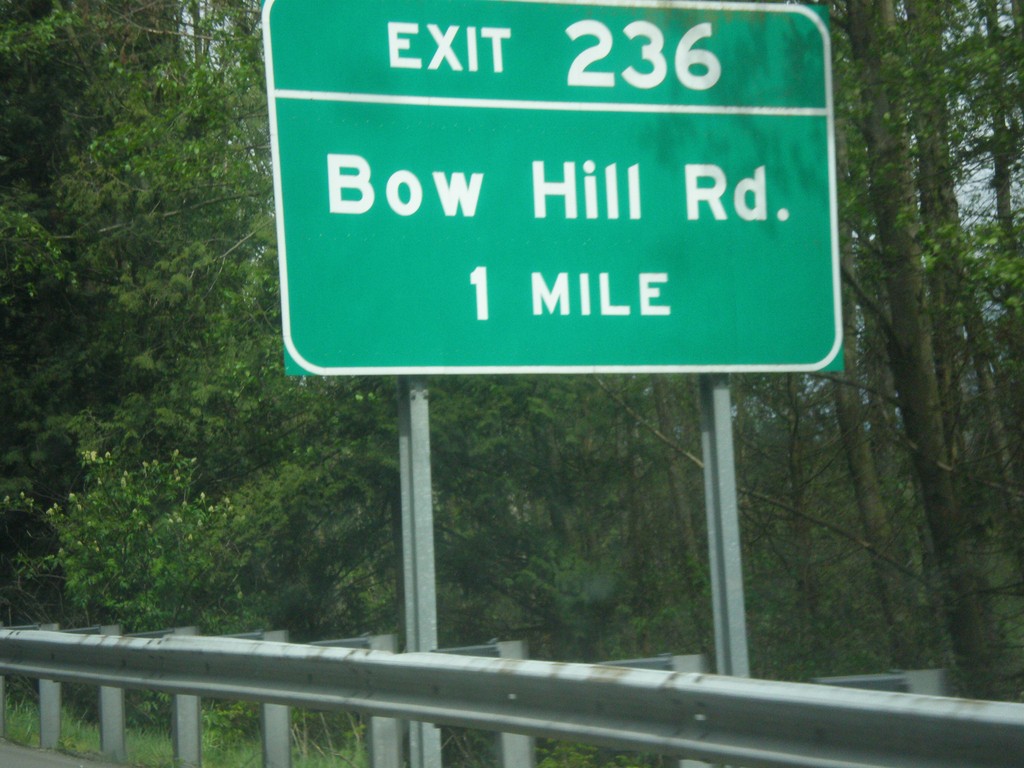
I-5 North - Exit 236
I-5 north approaching Exit 236 - Bow Hill Road.
Taken 04-28-2017
Burlington
Skagit County
Washington
United States