Signs Tagged With Distance Marker
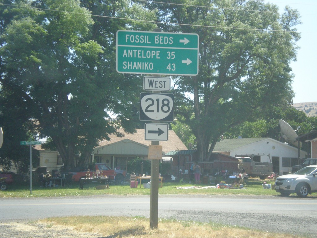
OR-19 South at OR-218 West
OR-19 South at OR-218 West in Fossil. Use OR-218 west for (John Day) Fossil Bends (Clarno Unit), Antelope, and Shaniko.
Taken 07-15-2017

 Fossil
Wheeler County
Oregon
United States
Fossil
Wheeler County
Oregon
United States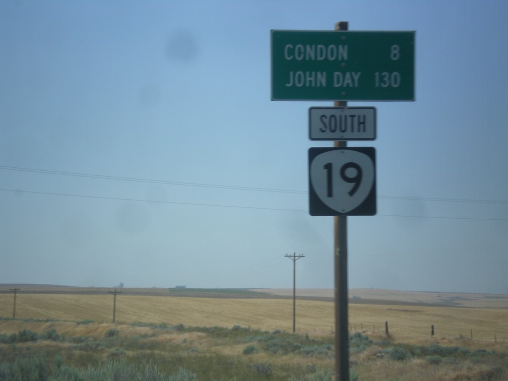
OR-19 South - Distance Marker
Distance marker on OR-19 south. Distance to Condon and John Day.
Taken 07-15-2017
Condon
Gilliam County
Oregon
United States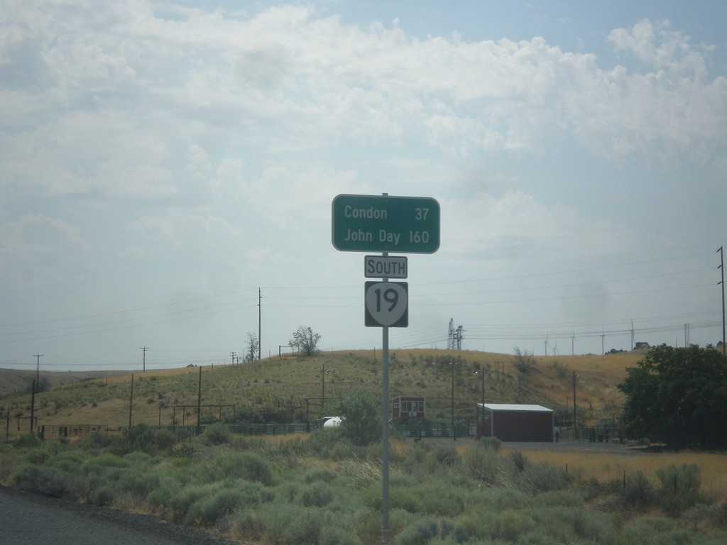
OR-19 South - Distance Marker
Distance marker on OR-19 south. Distance to Condon and John Day.
Taken 07-15-2017
Arlington
Gilliam County
Oregon
United States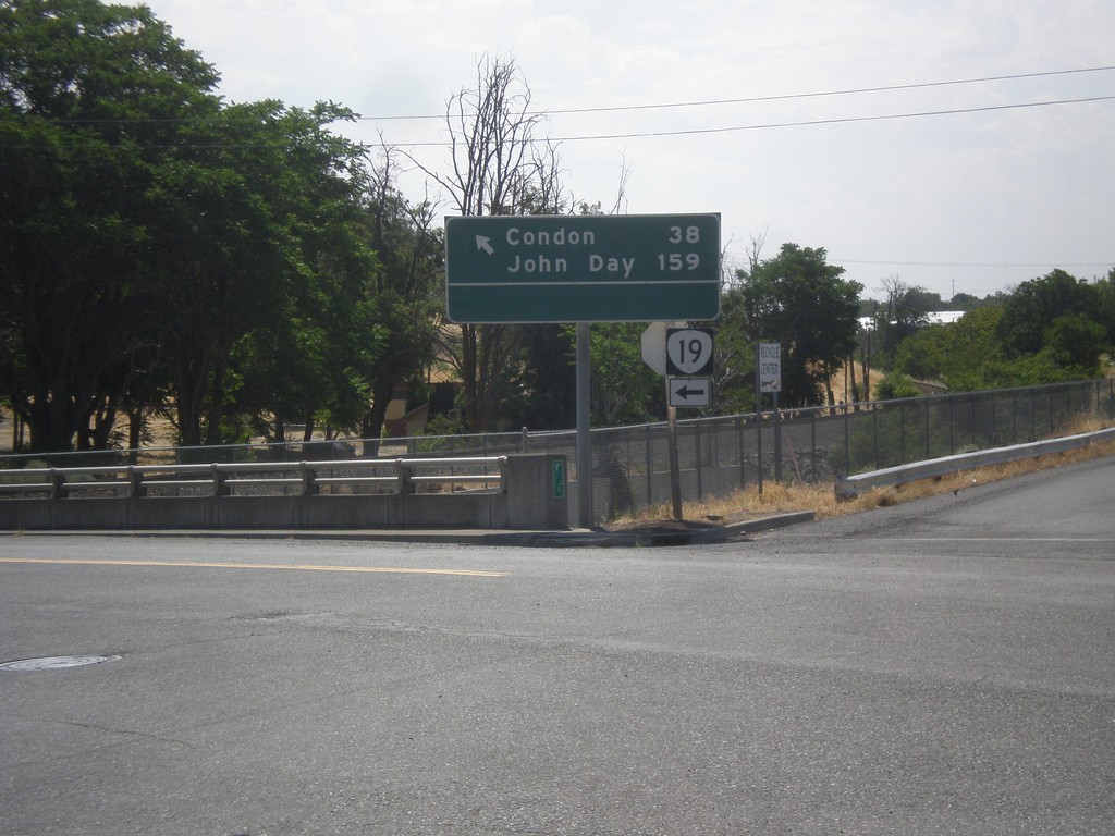
OR-19 South (Cottonwood St.) at Locust St.
OR-19 South (Cottonwood St.) at Locust St. in Arlington. Turn left to continue south on OR-19 for Condon and John Day.
Taken 07-15-2017
Arlington
Gilliam County
Oregon
United States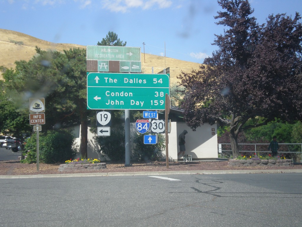
I-84 West Exit 137 Offramp at OR-19
I-84 West Exit 137 offramp at OR-19 in Arlington. Turn left on OR-19 south for Condon and John Day. Continue straight for access to I-84/US-30 West to The Dalles.
Taken 07-15-2017

 Arlington
Gilliam County
Oregon
United States
Arlington
Gilliam County
Oregon
United States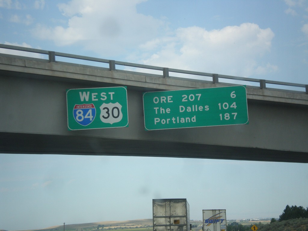
I-84/US-30 West - Distance Marker
Distance Marker on I-84/US-30 West in Stanfield. Distance to OR 207, The Dalles, and Portland.
Taken 07-15-2017
 Echo
Umatilla County
Oregon
United States
Echo
Umatilla County
Oregon
United States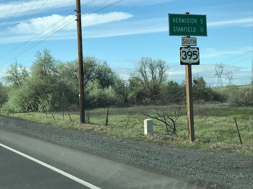
US-395 South - Distance Marker
Distance Marker on US-395 south. Distance to Hermiston and Stanfield.
Taken 04-30-2017
 Umatilla
 County
Oregon
United States
Umatilla
Umatilla County
Oregon
United States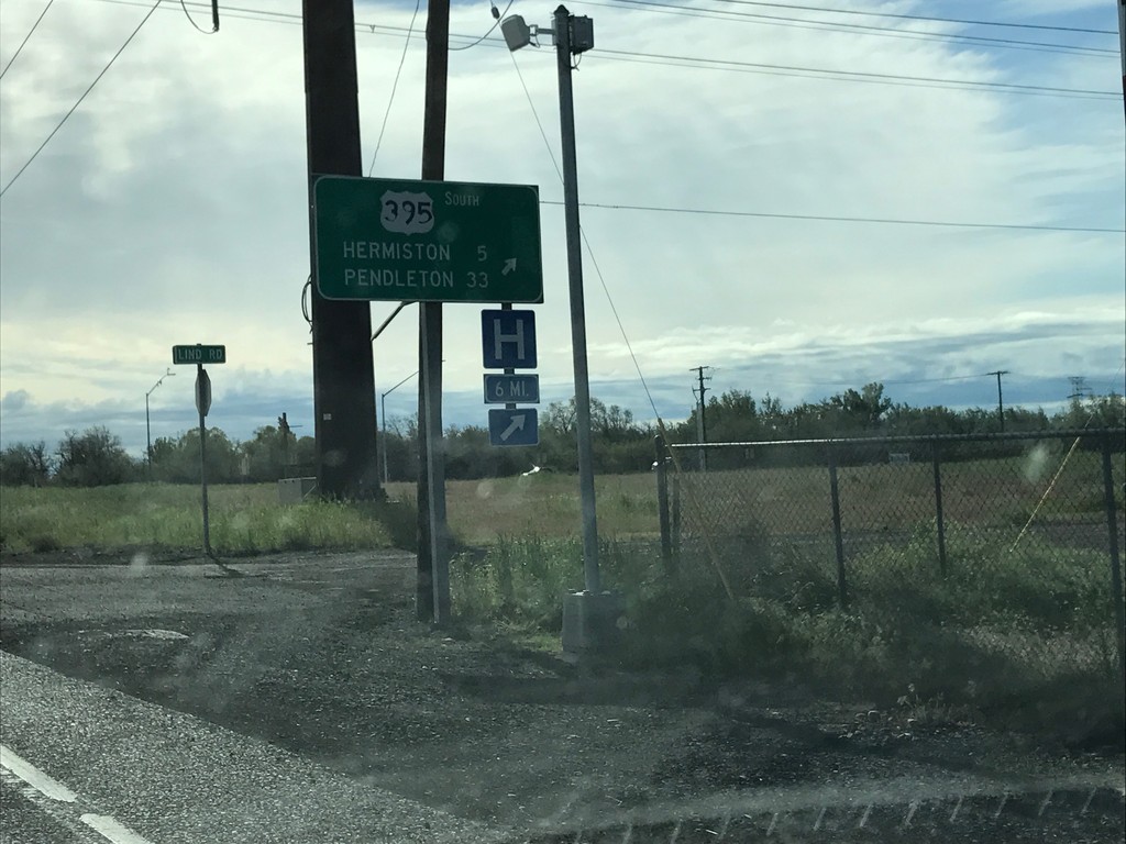
US-730 East/US-395 South at US-730/US-395 Split
US-730 East/US-395 South at US-730/US-395 Split in Umatilla. Merge right to continue south on US-395 to Hermiston and Pendleton.
Taken 04-30-2017
 Umatilla
 County
Oregon
United States
Umatilla
Umatilla County
Oregon
United States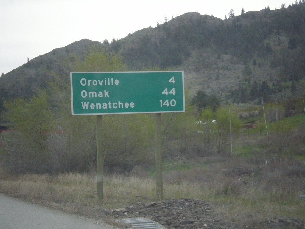
US-97 South - Distance Marker
Distance marker on US-97 south. Distance to Oroville, Omak, and Wenatchee. This is the first distance marker on US-97 in the United States.
Taken 04-29-2017
 Oroville
Okanogan County
Washington
United States
Oroville
Okanogan County
Washington
United States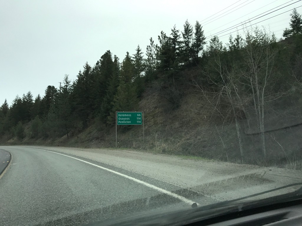
BC-3 East - Distance Marker
Distance marker on BC-3 east. Distance to Keremeos, Osoyoos, and Penticton.
Taken 04-29-2017
 Princeton
Okanagan-Similkameen
British Columbia
Canada
Princeton
Okanagan-Similkameen
British Columbia
Canada