Signs Tagged With Distance Marker
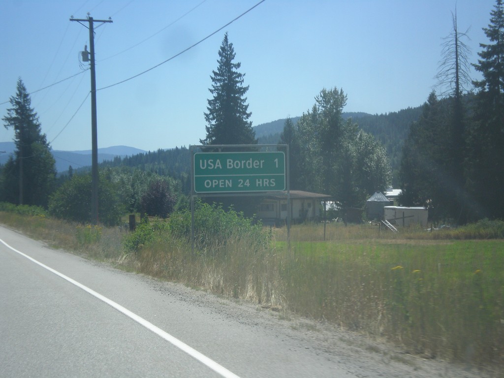
BC-22 South - Distance Marker
Distance Marker on BC-22 South. Distance to USA Border - 1 km. Border crossing at Port of Frontier is open 24 hours.
Taken 07-29-2017
 Rossland
Kootenay Boundary
British Columbia
Canada
Rossland
Kootenay Boundary
British Columbia
Canada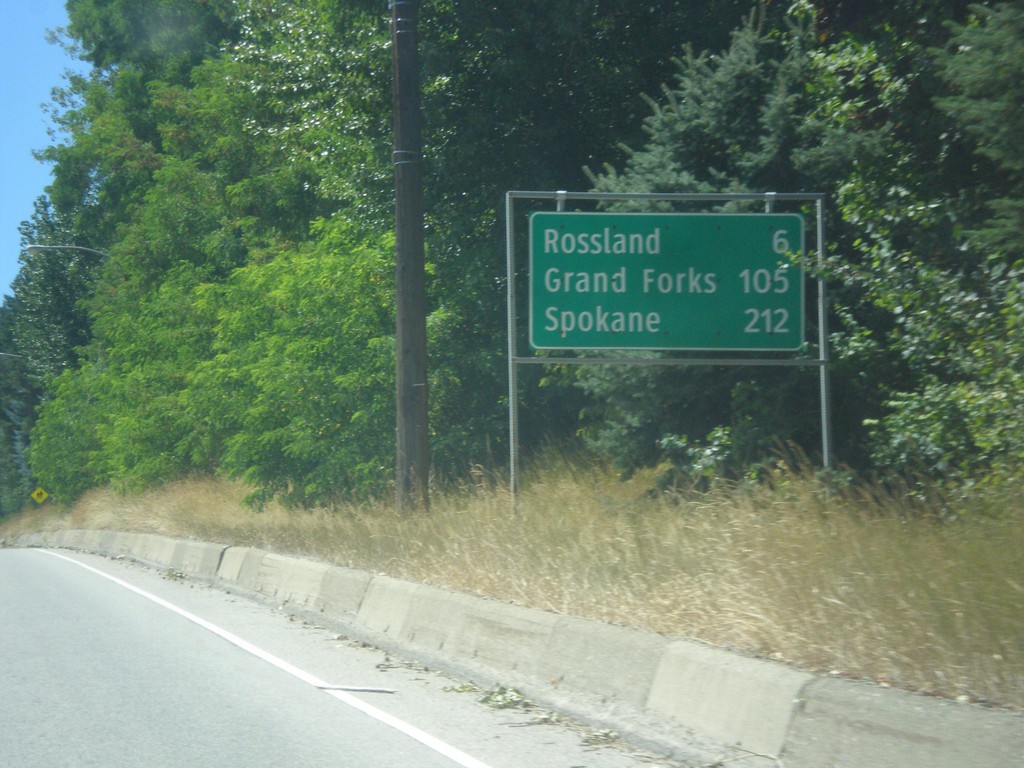
BC-22 South/BC-3B West - Distance Marker
Distance Marker on BC-22 South/BC-3B West. Distance to Rossland, Grand Forks (via BC-3B), and Spokane (Washington, via BC-22).
Taken 07-29-2017
 Trail
Kootenay Boundary
British Columbia
Canada
Trail
Kootenay Boundary
British Columbia
Canada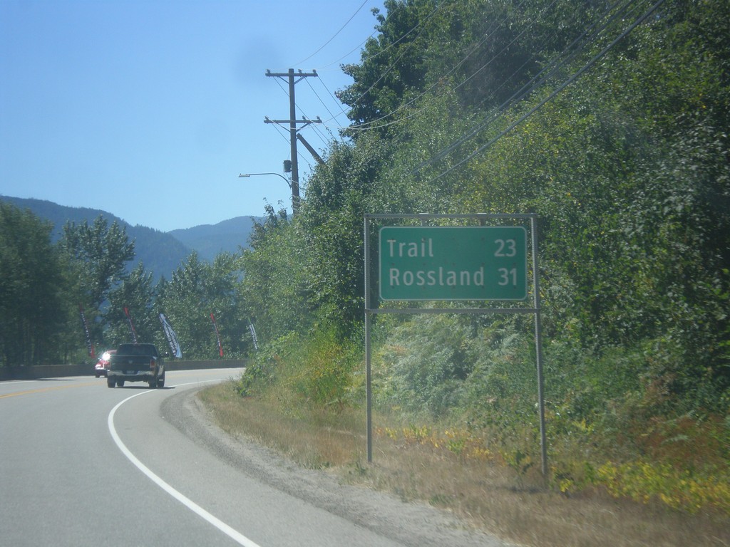
BC-22 South - Distance Marker
Distance marker on BC-22 south. Distance to Trail and Rossland.
Taken 07-29-2017
Castlegar
Central Kootenay
British Columbia
Canada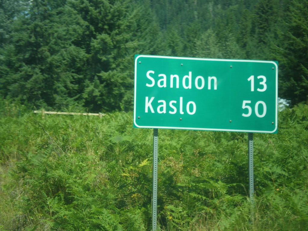
BC-31A East - Distance Marker
Distance Marker on BC-31A East. Distance to Sandon and Kaslo.
Taken 07-27-2017
 New Denver
Central Kootenay
British Columbia
Canada
New Denver
Central Kootenay
British Columbia
Canada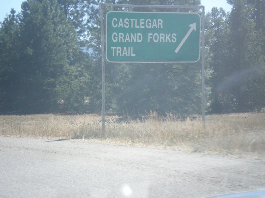
End BC-3A West at BC-3
End BC-3A West at BC-3. Use BC-3 West for Castlegar, Grand Forks, and Trail.
Taken 07-25-2017

 Castlegar
Central Kootenay
British Columbia
Canada
Castlegar
Central Kootenay
British Columbia
Canada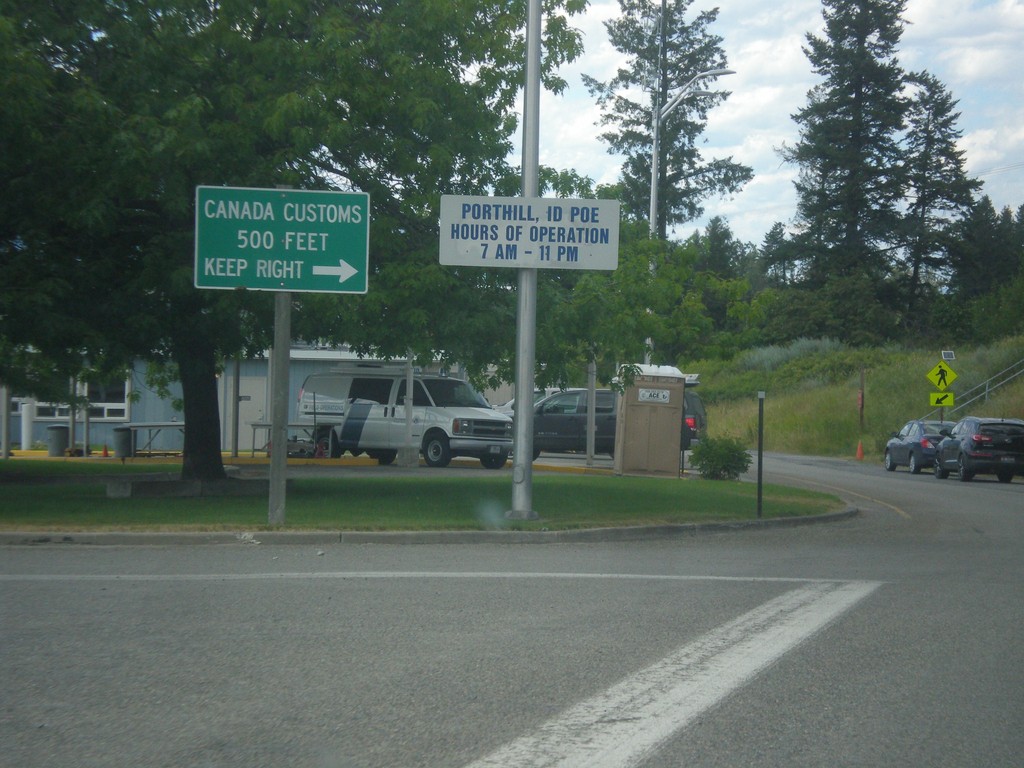
ID-1 North - Porthill Idaho Port of Entry
ID-1 North at Porthill Idaho Port of Entry. Merge right to continue into Canada.
Taken 07-23-2017
 Porthill
Boundary County
Idaho
United States
Porthill
Boundary County
Idaho
United States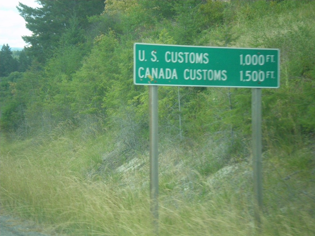
ID-1 North - Distance Marker
Distance Marker on ID-1 north at Porthill. Distance to US Customs and Canada Customs.
Taken 07-23-2017
Bonners Ferry
Boundary County
Idaho
United States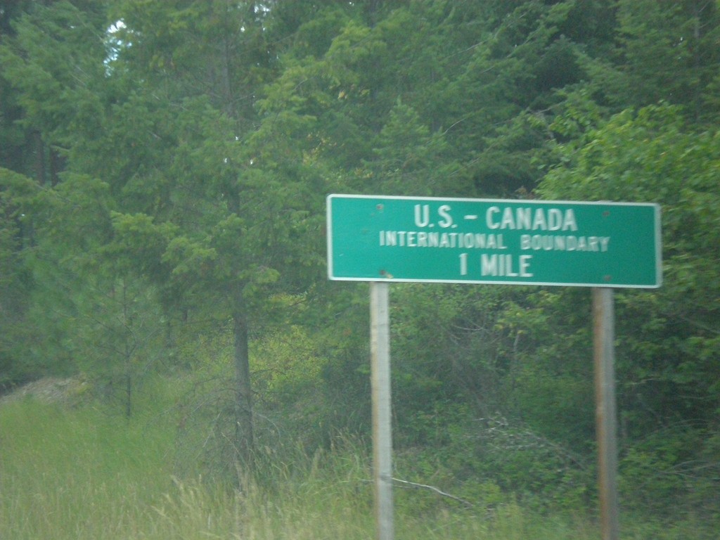
ID-1 North - US-Canada International Boundary
ID-1 North approaching US-Canada International Boundary at Porthill.
Taken 07-23-2017
Bonners Ferry
Boundary County
Idaho
United States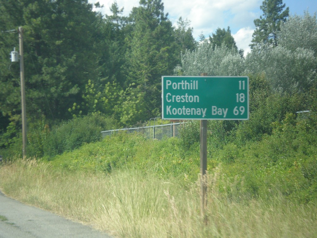
ID-1 North - Distance Marker
Distance marker on ID-1 north. Distance to Porthill, Creston (BC - Canada), and Kootenay Bay (BC- Canada). Kootenay Bay is the Kootenay Lake ferry terminal.
Taken 07-23-2017
Copeland
Boundary County
Idaho
United States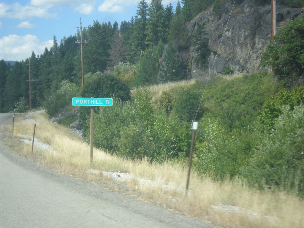
ID-1 North - Distance Marker
Distance marker on ID-1 north. Distance to Porthill. Porthill is located on the Canadian border.
Taken 07-23-2017
Bonners Ferry
Boundary County
Idaho
United States