Signs Tagged With Distance Marker
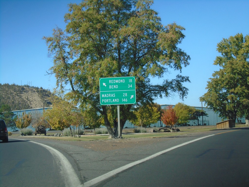
US-26 West at OR-126 - Prineville
US-26 West at OR-126 in Prineville. Turn right for US-26 west to Madras and Portland; turn left for OR-126 west to Redmond and Bend.
Taken 10-13-2018

 Prineville
Crook County
Oregon
United States
Prineville
Crook County
Oregon
United States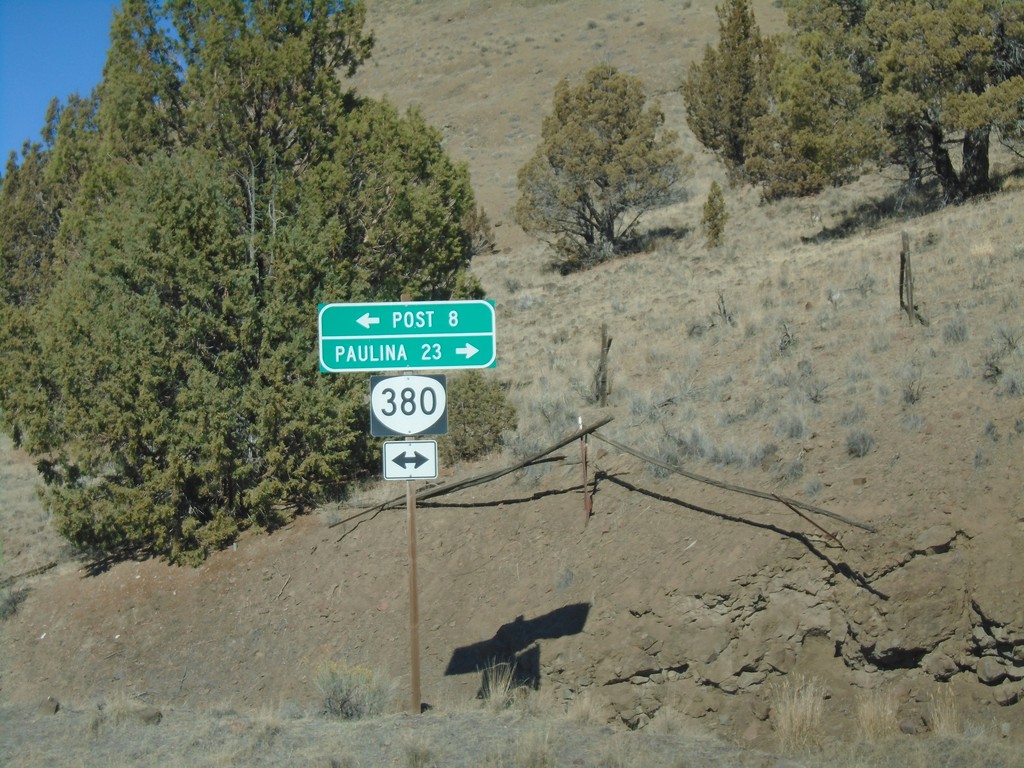
Pine Creek Road at OR-380
Pine Creek Road at OR-380. Turn left for OR-380 west to Post; right for OR-380 east to Paulina.
Taken 10-13-2018
 Prineville
Crook County
Oregon
United States
Prineville
Crook County
Oregon
United States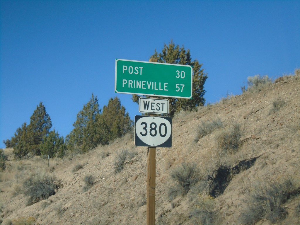
OR-380 West - Distance Marker
Distance marker on OR-380 west. Distance to Post and Prineville. This is the first OR-380 shield on OR-380 westbound.
Taken 10-13-2018
Paulina
Crook County
Oregon
United States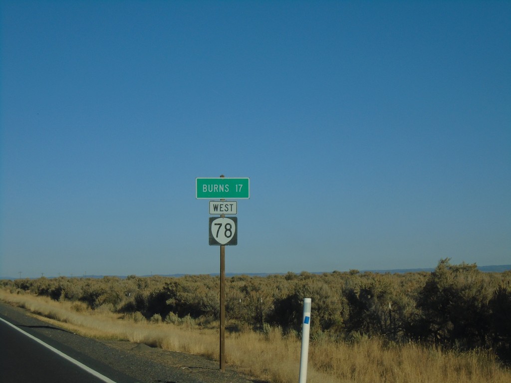
OR-78 West - Distance Marker
Distance marker on OR-78 west. Distance to Burns.
Taken 10-13-2018
 Burns
Harney County
Oregon
United States
Burns
Harney County
Oregon
United States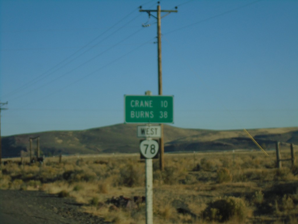
OR-78 West - Distance Marker
Distance marker on OR-78 west. Distance to Crane and Burns.
Taken 10-13-2018
Princeton
Harney County
Oregon
United States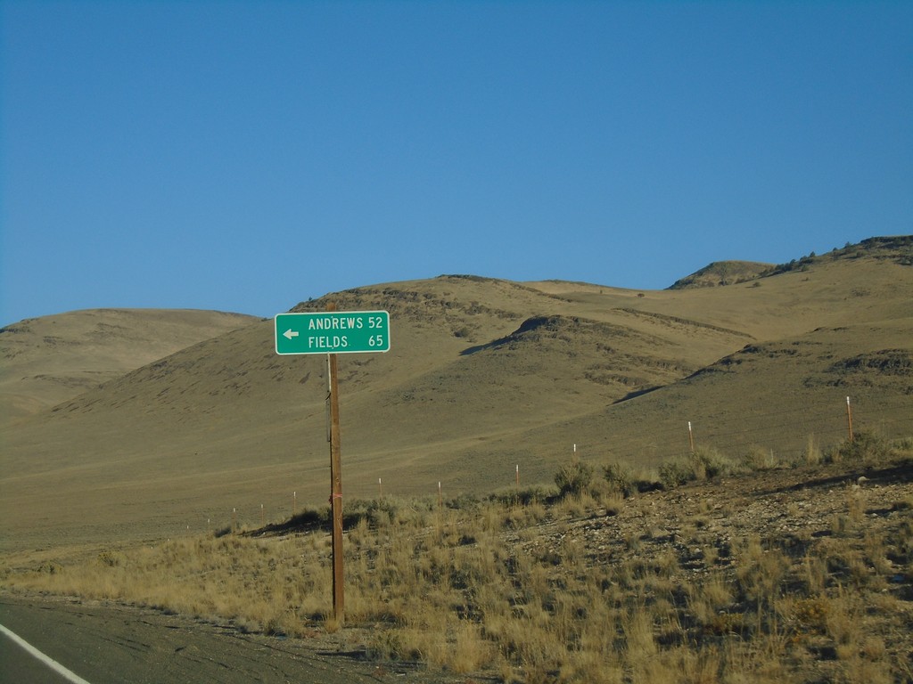
OR-78 West - Fields and Andrews Jct.
OR-78 West at Fields and Andrews Jct. This road travels south to the Nevada border reaching NV-140 at Denio. The road parallels the east side of Steens Mountain and the Alvord Desert.
Taken 10-13-2018
Jordan Valley
Malheur County
Oregon
United States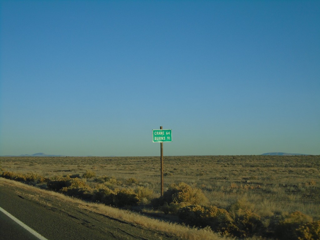
OR-78 West - Distance Marker
Distance marker on OR-78 west. Distance to Crane and Burns.
Taken 10-13-2018
Jordan Valley
Malheur County
Oregon
United States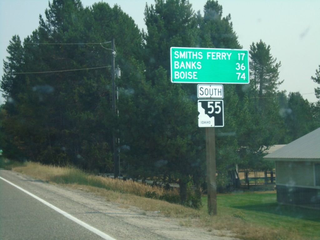
ID-55 South - Distance Marker
Distance marker on ID-55 south. Distance to Smith Ferry, Banks, and Boise.
Taken 08-11-2018
 Cascade
Valley County
Idaho
United States
Cascade
Valley County
Idaho
United States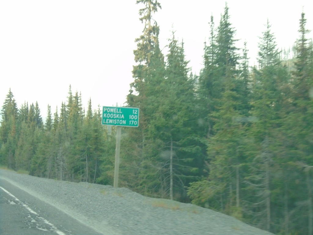
US-12 West - Distance Marker
Distance marker on US-12 west. Distance to Powell, Kooskia, and Lewiston.
Taken 08-11-2018
 Powell Junction
Idaho County
Idaho
United States
Powell Junction
Idaho County
Idaho
United States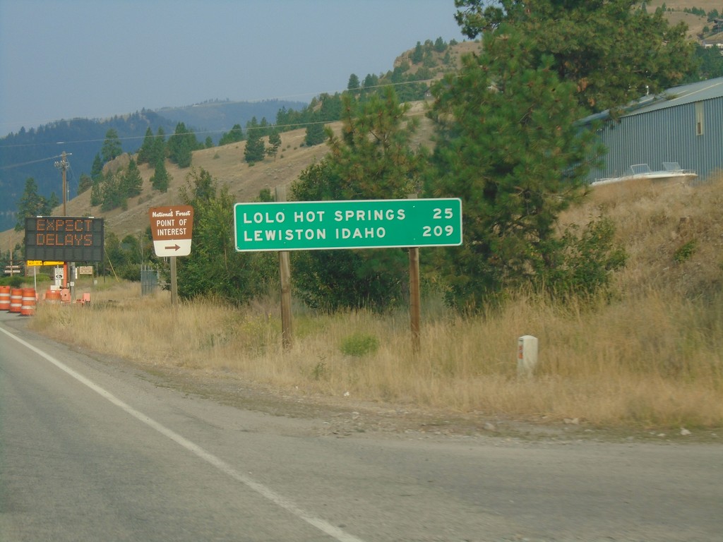
US-12 West - Distance Marker
Distance marker on US-12 west. Distance to Lolo Hot Springs and Lewiston Idaho.
Taken 08-11-2018
Lolo
Missoula County
Montana
United States